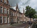
Category:Weeshuispoort (Kampen)
Jump to navigation
Jump to search
| Object location | | View all coordinates using: OpenStreetMap |
|---|
.JPG) | |||||
| Upload media | |||||
| Instance of | |||||
|---|---|---|---|---|---|
| Location | Kampen, Overijssel, Netherlands | ||||
| Heritage designation |
| ||||
 | |||||
Nederlands: Weeshuispoort
|
This is a category about rijksmonument number 23283
|
| Address |
|
Media in category "Weeshuispoort (Kampen)"
The following 11 files are in this category, out of 11 total.
-
 Burgerweeshuis, ingangspoortje - Kampen - 20122839 - RCE.jpg 872 × 1,200; 233 KB
-
 En hoger, overzicht - Kampen - 20123484 - RCE.jpg 1,200 × 804; 214 KB
-
 Kampen DSCF5318.JPG 4,000 × 3,000; 4.66 MB
-
 Kampen rijksmonument (154).JPG 2,592 × 1,944; 1.65 MB
-
 Kampen rijksmonument (155).JPG 1,944 × 2,592; 1.62 MB
-
 Kampen rijksmonument (156).JPG 1,944 × 2,592; 1.82 MB
-
 Kampen, Netherlands - panoramio (112).jpg 4,896 × 3,264; 2.95 MB
-
 Kampen, Netherlands - panoramio (6).jpg 2,048 × 1,375; 440 KB
-
 Overzicht - Kampen - 20350553 - RCE.jpg 1,184 × 1,200; 385 KB
-
 Poortje Vloeddijk - Kampen - 20122838 - RCE.jpg 881 × 1,200; 201 KB
-
 Voorgevels - Kampen - 20123488 - RCE.jpg 1,200 × 814; 202 KB


.JPG)
.JPG)
.jpg)
.jpg)


