Category:Wegekreuz Im Lindenhof (Oberauel)
Jump to navigation
Jump to search
| Object location | | View all coordinates using: OpenStreetMap |
|---|
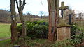
| This category shows a heritage building in Germany, located in the North Rhine-Westphalian city Hennef (Sieg) (no. A 148). |
Media in category "Wegekreuz Im Lindenhof (Oberauel)"
The following 2 files are in this category, out of 2 total.
-
 20170527 07 Oberauel 1.jpg 2,912 × 3,883; 3.28 MB
-
 Hennef Oberauel, Im Lindenhof.JPG 4,032 × 2,272; 6.29 MB

