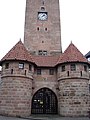
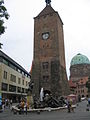
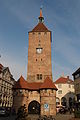
Category:Weißer Turm (Nürnberg)
Jump to navigation
Jump to search
| Object location | | View all coordinates using: OpenStreetMap |
|---|
This is the category of the Bavarian Baudenkmal (cultural heritage monument) with the ID D-5-64-000-1236 (Wikidata)
|
 | |||||
| Upload media | |||||
| Instance of | |||||
|---|---|---|---|---|---|
| Location | Nuremberg, Middle Franconia, Bavaria, Germany | ||||
| Street address |
| ||||
| Heritage designation | |||||
 | |||||
Subcategories
This category has the following 2 subcategories, out of 2 total.
H
U
- U-Bahnhof Weißer Turm (Nürnberg) (12 F)
Media in category "Weißer Turm (Nürnberg)"
The following 56 files are in this category, out of 56 total.
-
 2014 Tatort - Der Himmel ist ein Platz auf Erden - by 2eight - DSC4869.jpg 2,048 × 1,363; 1.55 MB
-
 Altstadt - St. Lorenz, Nürnberg, Germany - panoramio - sanja mm (1).jpg 1,944 × 2,592; 1.79 MB
-
 Bayern Nürnberg 03.jpg 6,016 × 4,016; 7.05 MB
-
 Dezember 2008 - panoramio.jpg 3,056 × 4,592; 4.23 MB
-
 Installation Windrose III und Weißer Turm 01.JPG 3,000 × 4,000; 4.12 MB
-
 Installation Windrose III und Weißer Turm 02.JPG 3,000 × 4,000; 4.15 MB
-
 Installation Windrose III und Weißer Turm 03.JPG 3,000 × 4,000; 4.15 MB
-
 Lorenzer Altstadt Juni 2011 14.JPG 3,240 × 4,320; 6.61 MB
-
 Ludwigsplatz 19, Weißer Turm, Nürnberg 20201106 001.jpg 3,014 × 4,515; 5.47 MB
-
 Malerische Ansichten aus Nürnberg - 0073.jpg 7,620 × 9,852; 6.31 MB
-
 Nuernberg Weisser Turm 2005.jpg 869 × 1,191; 323 KB
-
 Nuernberg Weisser Turm.jpg 1,536 × 2,048; 1 MB
-
 Nuernberg-weisser-turm-v-sw.jpg 600 × 800; 92 KB
-
 Nuremberg 0145.JPG 4,320 × 3,240; 3 MB
-
 Nuremberg 0148.JPG 4,320 × 3,240; 2.89 MB
-
 Nuremberg 0150.JPG 4,320 × 3,240; 2.95 MB
-
 Nuremberg 0154.JPG 4,320 × 3,240; 2.98 MB
-
 Nuremberg panorama.jpg 3,257 × 1,856; 2.39 MB
-
 Nuremberg White Tower f w.jpg 800 × 600; 173 KB
-
 Nürnberg (9532616520) (3).jpg 2,828 × 4,704; 4.38 MB
-
 Nürnberg (9532623040) (3).jpg 3,912 × 3,394; 4.96 MB
-
 Nürnberg (DerHexer) 2011-03-05 085.jpg 2,781 × 4,187; 5.01 MB
-
 Nürnberg - Weißer Turm (44462994182).jpg 5,184 × 3,456; 10.42 MB
-
 Nürnberg 4218.jpg 2,902 × 1,808; 821 KB
-
 Nürnberg DSCF5098.JPG 2,848 × 4,256; 5.24 MB
-
 Nürnberg panorama.jpg 3,257 × 1,856; 2.42 MB
-
 Nürnberg, Stadtbefestigung, Weißer Turm-20160810-001.jpg 5,995 × 4,002; 13.41 MB
-
 Nürnberg, Stadtbefestigung, Weißer Turm-20160810-002.jpg 4,003 × 5,996; 12.48 MB
-
 Nürnberg, Stadtbefestigung, Weißer Turm-20160810-003.jpg 4,003 × 5,996; 14.85 MB
-
 Nürnberg, Stadtbefestigung, Weißer Turm-20160810-004.jpg 4,002 × 5,995; 13.12 MB
-
 Nürnberg, Stadtbefestigung, Weißer Turm-20160810-005.jpg 4,003 × 5,996; 13.68 MB
-
 Nürnberg, Stadtbefestigung, Weißer Turm-20160810-006.jpg 4,002 × 5,995; 12.78 MB
-
 Nürnberg, Stadtbefestigung, Weißer Turm-20160810-007.jpg 4,003 × 5,996; 15.68 MB
-
 Nürnberg, Stadtbefestigung, Weißer Turm-20160810-008.jpg 4,003 × 5,996; 16.13 MB
-
 Nürnberg, Weißer Turm 20170616 001.jpg 4,002 × 5,995; 15.29 MB
-
 Nürnberg, Weißer Turm 20170616 002.jpg 4,003 × 5,996; 13.2 MB
-
 Photo- Nürnberg - Breite Gasse - März 1911.jpg 6,631 × 3,586; 1.95 MB
-
 Sankt-Elisabeth-Kirche, Weißer Turm und Sankt Jakob.JPG 4,000 × 3,000; 4.26 MB
-
 Südliche Altstadt Nürnberg November 2010 33.JPG 2,736 × 3,648; 3.27 MB
-
 Südliche Nürnberger Altstadt im November 2010 16.JPG 3,648 × 2,736; 3.6 MB
-
 Südliche Nürnberger Altstadt im November 2010 18.JPG 2,736 × 3,648; 3.3 MB
-
 U-Bahn Haltestelle Weißer Turm.jpg 2,048 × 1,536; 440 KB
-
 U-Bahnhof Weißer Turm1.jpg 3,648 × 2,736; 2.74 MB
-
 Weißer Turm (Nürnberg-St. Lorenz).fw13.ajb.jpg 2,478 × 2,478; 4.02 MB
-
 Weißer Turm - Nürnberg 001.jpg 4,000 × 6,000; 6 MB
-
 Weißer Turm in Nürnberg.jpg 1,545 × 2,047; 2.38 MB
-
 Weißer Turm mit Barbakane.JPG 3,000 × 4,000; 4.02 MB
-
 Weißer Turm nachts gnu1742.jpg 2,114 × 4,066; 1.36 MB
-
 Weisser Turm Nuernberg Germany.jpg 1,200 × 1,600; 716 KB
-
 Weißer Turm Nürnberg - von Westen.jpg 1,160 × 1,561; 977 KB
-
 Weißer Turm Nürnberg 01.jpg 3,968 × 2,976; 3.96 MB
-
 Weißer Turm Nürnberg 02.jpg 3,370 × 2,890; 3.82 MB
-
 Weißer Turm Nürnberg 03.jpg 3,478 × 2,318; 3.4 MB
-
 Weißer Turm Nürnberg 2023-02-19.jpg 1,744 × 3,066; 1.73 MB
-
 Weißerturm Nurnberg Germany - panoramio.jpg 1,280 × 960; 591 KB
-
 Нюремберг - panoramio (21).jpg 794 × 1,189; 789 KB

.jpg)


_(3).jpg)
_(3).jpg)
_2011-03-05_085.jpg)
.jpg)


.fw13.ajb.jpg)


.jpg)
Categories:
- Ludwigsplatz (Nürnberg)
- Buildings in Nuremberg-St. Lorenz
- Cultural heritage monuments in Sankt Lorenz (borough), Nuremberg
- Towers in Nuremberg
- City gates of Nuremberg
- Vorletzte Stadtmauer (Nuremberg)
- Gate towers in Middle Franconia
- Buildings called White Tower
- Stone towers in Bavaria
- Sandstone buildings in Nuremberg
- Tetragonal towers in Bavaria
- Towers of the older defensive walls of Nuremberg
- Gothic brick buildings in Nuremberg
- Clock towers in Bavaria