Category:West Markham
Jump to navigation
Jump to search
village and civil parish in Nottinghamshire, England  | |||||
| Upload media | |||||
| Instance of | |||||
|---|---|---|---|---|---|
| Location | Bassetlaw, Nottinghamshire, East Midlands, England | ||||
 | |||||
Subcategories
This category has the following 2 subcategories, out of 2 total.
M
- Milton Mausoleum (18 F)
W
Media in category "West Markham"
The following 54 files are in this category, out of 54 total.
-
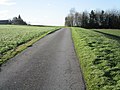
 Alternative route - geograph.org.uk - 4313911.jpg 1,024 × 768; 204 KB
-
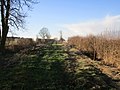
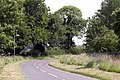
 Back Lane - geograph.org.uk - 4313833.jpg 1,024 × 768; 216 KB
-
 Bridleway to Sibthorpe - geograph.org.uk - 4322144.jpg 1,024 × 768; 195 KB
-
 Bridleway to Sibthorpe - geograph.org.uk - 4322149.jpg 1,024 × 768; 204 KB
-
-
 Bringing home the bacon - geograph.org.uk - 595946.jpg 640 × 480; 95 KB
-
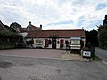
 Butchers and village shop, Milton - geograph.org.uk - 2693812.jpg 640 × 480; 71 KB
-
 Converted chapel, Milton - geograph.org.uk - 2693813.jpg 640 × 480; 77 KB
-
 Cut Mark, West Markham, Hall Farm - geograph.org.uk - 5788771.jpg 1,280 × 960; 459 KB
-
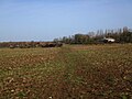
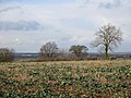
 Farmland near Bevercotes - geograph.org.uk - 2693821.jpg 640 × 480; 57 KB
-
 Farmland near Farleys Wood - geograph.org.uk - 2693823.jpg 640 × 480; 68 KB
-
 Footpath near Bevercotes - geograph.org.uk - 2693817.jpg 640 × 480; 67 KB
-
 Footpath to Milton - geograph.org.uk - 4321987.jpg 1,024 × 768; 198 KB
-
 Former chapel, Milton - geograph.org.uk - 4322617.jpg 1,024 × 768; 196 KB
-
 Isolated tree - geograph.org.uk - 4313862.jpg 1,024 × 768; 186 KB
-
 Leys Lane - geograph.org.uk - 2268853.jpg 640 × 427; 121 KB
-
 Leys Lane - geograph.org.uk - 4313885.jpg 1,024 × 768; 180 KB
-
 Leys Lane - geograph.org.uk - 4313888.jpg 1,024 × 768; 201 KB
-
 Leys Lane - geograph.org.uk - 4313893.jpg 1,024 × 768; 209 KB
-
 Leys Lane - geograph.org.uk - 4313897.jpg 1,024 × 768; 215 KB
-
 Lound Hall - geograph.org.uk - 5174853.jpg 1,341 × 838; 360 KB
-
 Lound Hall Estate - geograph.org.uk - 5174861.jpg 6,000 × 4,000; 6.26 MB
-

-
-
 Milton Mausoleum - geograph.org.uk - 2277168.jpg 640 × 427; 83 KB
-
 Minor road towards Bevercotes - geograph.org.uk - 2693815.jpg 640 × 480; 109 KB
-
 Minor road towards Bevercotes - geograph.org.uk - 2693819.jpg 640 × 480; 47 KB
-
 Minor road towards Walesby - geograph.org.uk - 2693825.jpg 640 × 480; 47 KB
-
 Minor tributary of the River Maun - geograph.org.uk - 4321984.jpg 1,024 × 768; 184 KB
-
 Mussel and Crab restaurant - geograph.org.uk - 1321973.jpg 640 × 427; 51 KB
-
 Mussel and Crab Restaurant - geograph.org.uk - 2691261.jpg 640 × 480; 51 KB
-
 Mussel and crab restaurant - geograph.org.uk - 511696.jpg 640 × 480; 76 KB
-
 Nodding donkeys - geograph.org.uk - 2268851.jpg 640 × 427; 88 KB
-

-
 On the country road from Milton - geograph.org.uk - 848377.jpg 427 × 640; 80 KB
-
 Ordnance Survey Cut Mark - geograph.org.uk - 4968090.jpg 392 × 640; 106 KB
-
 Parson Lane - geograph.org.uk - 2277174.jpg 640 × 427; 88 KB
-
 Roadway to Farleys House - geograph.org.uk - 4313858.jpg 1,024 × 768; 255 KB
-

-
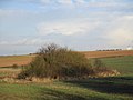 Tangle of bushes - geograph.org.uk - 4313902.jpg 1,024 × 768; 129 KB
-
 The Mussel ^ Crab - geograph.org.uk - 3187777.jpg 640 × 427; 67 KB
-
 The road towards Milton - geograph.org.uk - 848374.jpg 640 × 427; 106 KB
-
 Track to the River Maun - geograph.org.uk - 4322620.jpg 1,024 × 768; 142 KB
-
 Tree on Leys Lane - geograph.org.uk - 4313919.jpg 1,024 × 768; 351 KB
-
 Trees on Leys Lane - geograph.org.uk - 4313848.jpg 1,024 × 768; 211 KB
-

-
 View towards Farleys Wood - geograph.org.uk - 4313854.jpg 1,024 × 768; 234 KB
-
 View towards Leys Lane - geograph.org.uk - 4313842.jpg 1,024 × 768; 227 KB
-
 View towards the Mussel and Crab - geograph.org.uk - 4322153.jpg 1,024 × 768; 208 KB
-
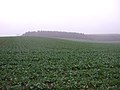
 West Markham farmland - geograph.org.uk - 237868.jpg 640 × 427; 60 KB
-
 West Markham, Hall Farm - geograph.org.uk - 5788782.jpg 1,280 × 960; 299 KB
-
 Wood Lane - geograph.org.uk - 4313838.jpg 1,024 × 768; 224 KB
-
 Wood Lane - geograph.org.uk - 4313879.jpg 1,024 × 768; 191 KB
-
 Wood Lane - geograph.org.uk - 4313881.jpg 1,024 × 768; 140 KB


