Category:Whitchurch-on-Thames
Jump to navigation
Jump to search
village and civil parish in South Oxfordshire district, Oxfordshire, England  | |||||
| Upload media | |||||
| Instance of | |||||
|---|---|---|---|---|---|
| Location | South Oxfordshire, Oxfordshire, South East England, England | ||||
| Located in or next to body of water | |||||
| Area |
| ||||
| official website | |||||
 | |||||
English: Media related to the village and civil parish of Whitchurch-on-Thames, Oxfordshire, England
Subcategories
This category has the following 6 subcategories, out of 6 total.
H
- Hardwick House, Oxfordshire (9 F)
W
- Tollhouse, Whitchurch (5 F)
- Whitchurch Bridge (26 F)
Media in category "Whitchurch-on-Thames"
The following 200 files are in this category, out of 386 total.
(previous page) (next page)-
 A Chiltern Valley - geograph.org.uk - 2553411.jpg 1,024 × 680; 172 KB
-
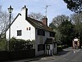
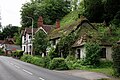
 A cottage in Whitchurch-on-Thames - geograph.org.uk - 642318.jpg 530 × 640; 137 KB
-
 A Crowned Eagle passes Hardwick - geograph.org.uk - 6169750.jpg 3,698 × 1,985; 1.82 MB
-
 A fine village house - geograph.org.uk - 2999582.jpg 640 × 417; 69 KB
-
 A pheasant wooded lane - geograph.org.uk - 2716684.jpg 3,304 × 2,342; 1.87 MB
-
 A quick 'down and up' on the Thames Path - geograph.org.uk - 4442630.jpg 2,592 × 1,944; 1.86 MB
-
 A Rolling Alpaca - geograph.org.uk - 3670858.jpg 2,297 × 1,527; 961 KB
-
 A very steep climb - geograph.org.uk - 2999597.jpg 480 × 640; 118 KB
-
 A329 and River Thames diverge - geograph.org.uk - 2820373.jpg 3,648 × 2,736; 1.49 MB
-
 Access to Coombe Park Farm - geograph.org.uk - 1386229.jpg 640 × 427; 206 KB
-
 Alamanda at Whitchurch. - geograph.org.uk - 4675249.jpg 5,267 × 3,417; 2.32 MB
-
 Alpaca stud, Whitchurch-on-Thames, Oxfordshire - geograph.org.uk - 4811319.jpg 4,033 × 2,230; 5.06 MB
-
 Alpacas on Boze Down - geograph.org.uk - 1234343.jpg 640 × 480; 314 KB
-

-

-

-
 An Emperor passes Hardwick - geograph.org.uk - 6169285.jpg 3,895 × 1,884; 1.65 MB
-
 Approaching Hardwick House estate - geograph.org.uk - 5908248.jpg 3,730 × 1,968; 1.56 MB
-
 Approaching Whitchurch - geograph.org.uk - 1386214.jpg 640 × 427; 196 KB
-
 Approaching Whitchurch Lock - geograph.org.uk - 6169205.jpg 3,453 × 2,126; 2.63 MB
-
 Approaching Whitchurch Toll Bridge - geograph.org.uk - 4442546.jpg 2,592 × 1,944; 1.87 MB
-
 Arches by the river - geograph.org.uk - 1509816.jpg 640 × 427; 92 KB
-
 B471 descents towards Whitchurch - geograph.org.uk - 2719813.jpg 3,648 × 2,736; 2.61 MB
-
 B471 junction with Hardwick Road - geograph.org.uk - 2716629.jpg 3,415 × 2,439; 1.71 MB
-
 Bank Holiday week on the Thames - geograph.org.uk - 6168342.jpg 3,603 × 2,037; 2.09 MB
-
 Benchmark by porch of St Mary's Church - geograph.org.uk - 2712282.jpg 683 × 1,024; 260 KB
-
 Bend on Manor road - geograph.org.uk - 1913950.jpg 1,024 × 683; 154 KB
-

-
 Bluebell wood, Mapledurham, Oxfordshire - geograph.org.uk - 4444814.jpg 800 × 751; 339 KB
-

-

-
 Bluebells at Bottom Wood - geograph.org.uk - 1141966.jpg 640 × 479; 155 KB
-
 Bluebells at Bottom Wood - geograph.org.uk - 1141968.jpg 640 × 479; 146 KB
-

-
 Boat by the willow - geograph.org.uk - 1509825.jpg 640 × 427; 119 KB
-
 Boat jam - geograph.org.uk - 1914123.jpg 640 × 427; 73 KB
-
 Boat over the river - geograph.org.uk - 1505124.jpg 426 × 640; 124 KB
-
 Boathouse on the river - geograph.org.uk - 1505183.jpg 640 × 427; 98 KB
-
 Boathouse on the River Thames - geograph.org.uk - 5422591.jpg 4,457 × 2,507; 6.17 MB
-
 Boathouse over the river - geograph.org.uk - 1505136.jpg 640 × 427; 121 KB
-
 Boating at Whitchurch-on-Thames - geograph.org.uk - 3033.jpg 640 × 480; 82 KB
-
 Boats for hire on the River Thames - geograph.org.uk - 3023545.jpg 1,500 × 993; 161 KB
-
 Boats leaving Whitchurch lock - geograph.org.uk - 6168997.jpg 3,453 × 2,126; 2.9 MB
-
 Boats on the River Thames - geograph.org.uk - 3023547.jpg 1,500 × 992; 187 KB
-
 Bottom Wood - geograph.org.uk - 1141958.jpg 640 × 479; 128 KB
-
 Bottom Wood - geograph.org.uk - 857005.jpg 640 × 427; 119 KB
-
 Boundary of Coombe Park - geograph.org.uk - 923657.jpg 640 × 427; 222 KB
-
 Bozedown Alpacas - geograph.org.uk - 427264.jpg 640 × 480; 146 KB
-
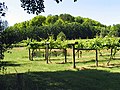 Bozedown Vineyard - geograph.org.uk - 26755.jpg 640 × 480; 200 KB
-
 Bridge over Sulham stream - geograph.org.uk - 924857.jpg 640 × 427; 201 KB
-
 Bridge over Sulham stream - geograph.org.uk - 924863.jpg 640 × 427; 155 KB
-
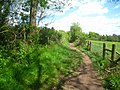
 Bridleway forming part of the Thames Path - geograph.org.uk - 4442612.jpg 2,592 × 1,944; 2.13 MB
-
 Cables by the weir - geograph.org.uk - 1914102.jpg 533 × 800; 86 KB
-
 Canoeists on the River Thames - geograph.org.uk - 1387880.jpg 640 × 477; 69 KB
-
 Canoeists on the River Thames - geograph.org.uk - 1387882.jpg 640 × 354; 64 KB
-
 Caversham King 2 passes Hardwick - geograph.org.uk - 6169277.jpg 3,323 × 2,209; 1.19 MB
-
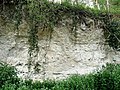 Chalk pit on the Hardwick Estate - geograph.org.uk - 1141984.jpg 640 × 480; 132 KB
-
 Chiltern Edge Scenery near Whitchurch - geograph.org.uk - 4703298.jpg 4,000 × 2,664; 2.37 MB
-
 Christal Haze a long way from home - geograph.org.uk - 6169633.jpg 3,390 × 2,165; 1.45 MB
-
 Circular saw in Bottom Wood - geograph.org.uk - 1149197.jpg 640 × 480; 132 KB
-
 Coppicing in Bottom Wood - geograph.org.uk - 857029.jpg 427 × 640; 116 KB
-

-
 Covered in Ivy - geograph.org.uk - 2182494.jpg 533 × 800; 148 KB
-
 Cut mark on this corner - geograph.org.uk - 2029133.jpg 600 × 800; 169 KB
-
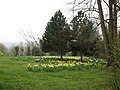 Daffodils at The Baulk - geograph.org.uk - 2311900.jpg 2,272 × 1,704; 2.31 MB
-
 Dandelions in a field off part of the Chiltern Way - geograph.org.uk - 6179266.jpg 4,608 × 3,456; 4.86 MB
-
 Downstream from Whitchurch - geograph.org.uk - 3704646.jpg 2,401 × 1,614; 595 KB
-
 Dragon Boat Final - geograph.org.uk - 3512549.jpg 3,900 × 2,700; 3.63 MB
-
 Dressage arena - geograph.org.uk - 2310720.jpg 2,272 × 1,704; 2.88 MB
-
 Drive to Coombe Park - geograph.org.uk - 923632.jpg 640 × 427; 194 KB
-
 Driveway ^ footpath - geograph.org.uk - 2999594.jpg 640 × 480; 117 KB
-
 Ducks on the weir - geograph.org.uk - 1914122.jpg 1,024 × 683; 220 KB
-
 East Lodge, Hardwick Estate - geograph.org.uk - 5637980.jpg 3,738 × 1,964; 2.19 MB
-
 Eastfield Lane, Whitchurch - geograph.org.uk - 3692468.jpg 1,600 × 1,200; 380 KB
-
 End of the footpath - geograph.org.uk - 1386463.jpg 640 × 426; 204 KB
-
 Entering Whitchurch - geograph.org.uk - 923671.jpg 640 × 427; 187 KB
-
 Entrance near Coombe Park - geograph.org.uk - 923650.jpg 640 × 427; 184 KB
-
 Entrance to Hardwick Estate - geograph.org.uk - 2311901.jpg 2,272 × 1,704; 2.88 MB
-
 Entrance to Hardwick Estate from Hardwick Road - geograph.org.uk - 2716665.jpg 3,648 × 2,538; 2.09 MB
-
 Entrance to Rivendell - geograph.org.uk - 950844.jpg 640 × 480; 111 KB
-
 Entrance to Rivendell Farm - geograph.org.uk - 2999635.jpg 640 × 480; 105 KB
-

-

-
 Farm track south of Whitchurch Hill - geograph.org.uk - 1166787.jpg 427 × 640; 178 KB
-

-
 Farmland below Coombe Court Farm - geograph.org.uk - 4442638.jpg 2,592 × 1,944; 1.41 MB
-

-
 The Ferryboat Inn, Whitchurch-on-Thames - geograph.org.uk - 21250.jpg 634 × 480; 121 KB
-

-
 Fields above Whitchurch - geograph.org.uk - 4442604.jpg 2,592 × 1,944; 1.4 MB
-
 Fields Opposite The Stables - geograph.org.uk - 3704687.jpg 1,600 × 1,257; 659 KB
-

-
 Flush bracket number 5 - geograph.org.uk - 2029148.jpg 600 × 800; 165 KB
-
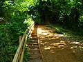
 Footbridge on the Thames Path - geograph.org.uk - 3023863.jpg 1,500 × 1,000; 265 KB
-
 Footpath and alpacas - geograph.org.uk - 2311903.jpg 2,272 × 1,704; 2.09 MB
-
 Forestry equipment in Bottom Wood - geograph.org.uk - 1141993.jpg 640 × 480; 136 KB
-
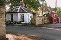
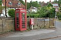
 Former telephone kiosk, Manor Road, Whitchurch-on-Thames, Oxfordshire.jpg 1,832 × 3,054; 1.35 MB
-
 Gates and Blackberries - geograph.org.uk - 3692592.jpg 1,600 × 1,265; 615 KB
-
 Geese on the River Thames - geograph.org.uk - 5422624.jpg 3,720 × 2,480; 7.59 MB
-
 Grand old tree at the top of Path Hill - geograph.org.uk - 2182466.jpg 640 × 480; 111 KB
-
 Grazing by Wheatley's Plantation - geograph.org.uk - 2999601.jpg 640 × 480; 77 KB
-
 Grazing in the Thames valley - geograph.org.uk - 2999608.jpg 640 × 480; 111 KB
-
 Grazing near Coombe Park Farm - geograph.org.uk - 2999603.jpg 640 × 480; 86 KB
-
 Greyhound pub - geograph.org.uk - 5161996.jpg 5,184 × 3,456; 7.13 MB
-
 Hardwick Estate boathouse - geograph.org.uk - 4675110.jpg 5,715 × 3,800; 2.08 MB
-
 Hardwick House - geograph.org.uk - 2555163.jpg 1,024 × 680; 223 KB
-
 Hardwick House - geograph.org.uk - 4442445.jpg 2,592 × 1,944; 2.01 MB
-
 Hardwick House - geograph.org.uk - 4675027.jpg 5,715 × 3,800; 3.09 MB
-
 Hardwick House - geograph.org.uk - 6124460.jpg 3,265 × 1,801; 2.29 MB
-
 Hardwick Road - High Street - geograph.org.uk - 2940984.jpg 800 × 600; 151 KB
-
 Hardwick Road west of Bozedown Farm - geograph.org.uk - 2716638.jpg 3,648 × 2,492; 2.59 MB
-
 Hardwick Stables - geograph.org.uk - 3704679.jpg 1,600 × 1,074; 665 KB
-
 Hardwick Stud Farm - geograph.org.uk - 4018240.jpg 640 × 480; 53 KB
-
 Hardwick Stud Farm - geograph.org.uk - 4442463.jpg 2,592 × 1,944; 2.02 MB
-
 Hardwick Stud Farm - geograph.org.uk - 6179282.jpg 4,608 × 3,456; 4.81 MB
-
 Hardwick Stud Farm - geograph.org.uk - 950914.jpg 640 × 480; 109 KB
-
 Hares Lock Farm, Whitchurch-on-Thames - geograph.org.uk - 26659.jpg 640 × 480; 170 KB
-
 Hartslock Bridleway - geograph.org.uk - 2941008.jpg 800 × 607; 169 KB
-
 Hartslock Bridleway - geograph.org.uk - 2999596.jpg 640 × 480; 101 KB
-
 Hartslock Bridleway - geograph.org.uk - 2999633.jpg 640 × 480; 117 KB
-
 Hedgeline with grey-blue clouds - geograph.org.uk - 4819671.jpg 640 × 419; 93 KB
-
 High hedges beside Pilgrim Cottage - geograph.org.uk - 2716701.jpg 3,648 × 2,642; 2.01 MB
-
 High Street Whitchurch - geograph.org.uk - 1913841.jpg 533 × 800; 106 KB
-
 Hill near Bozedown - geograph.org.uk - 26753.jpg 640 × 480; 448 KB
-
 Hissing Sid - geograph.org.uk - 1505157.jpg 640 × 427; 75 KB
-

-
 Horse steps - geograph.org.uk - 3078610.jpg 1,704 × 2,272; 2.94 MB
-
 House in the High Street - geograph.org.uk - 2999640.jpg 640 × 480; 85 KB
-
 House in Whitchurch - geograph.org.uk - 923684.jpg 640 × 427; 195 KB
-
 House in Whitchurch-on-Thames - geograph.org.uk - 2999649.jpg 640 × 480; 77 KB
-

-
 Houses in Hardwick Road, Whitchurch - geograph.org.uk - 2182416.jpg 640 × 480; 132 KB
-

-
 It's in there somewhere - geograph.org.uk - 2029156.jpg 600 × 800; 201 KB
-
 Junction on Manor road - geograph.org.uk - 1913943.jpg 1,024 × 683; 185 KB
-
 Just a field - geograph.org.uk - 923668.jpg 640 × 427; 167 KB
-

-
 Lazy Days passing Hardwick - geograph.org.uk - 6167920.jpg 3,511 × 2,091; 1.85 MB
-
 Lazy Days passing Hardwick - II - geograph.org.uk - 6167928.jpg 3,511 × 2,091; 1.92 MB
-
 Left out in the rain - geograph.org.uk - 3175827.jpg 640 × 480; 112 KB
-
 Lodge by the entrance - geograph.org.uk - 1913872.jpg 1,024 × 683; 194 KB
-

-
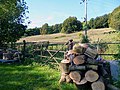 Logs by the Gate - geograph.org.uk - 3692480.jpg 800 × 600; 161 KB
-

-
 Long Acre Farm - geograph.org.uk - 2941011.jpg 640 × 480; 105 KB
-
 Long Acre Farm - geograph.org.uk - 2999637.jpg 640 × 480; 112 KB
-
 Looking towards the hill - geograph.org.uk - 1913850.jpg 533 × 800; 134 KB
-
 Lower Lodge, Manor Farm - geograph.org.uk - 2710565.jpg 1,024 × 683; 226 KB
-
 Maggie May heads West on the Thames - geograph.org.uk - 6169295.jpg 3,389 × 2,166; 2.21 MB
-

-
 Manor gatehouse - geograph.org.uk - 923687.jpg 640 × 422; 175 KB
-
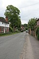
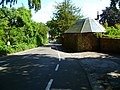
 Manor Road - geograph.org.uk - 2999583.jpg 640 × 480; 110 KB
-
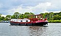
 Millpond Thames with liveaboard boats - geograph.org.uk - 6131990.jpg 3,040 × 1,470; 1.38 MB
-
 Millstream to the Thames - geograph.org.uk - 1480721.jpg 640 × 427; 90 KB
-
 Mooring near Boze Down - geograph.org.uk - 924849.jpg 640 × 427; 184 KB
-
 Muddy Lane, Whitchurch - geograph.org.uk - 3692470.jpg 1,024 × 815; 344 KB
-
 Must be a pub garden - geograph.org.uk - 2999651.jpg 640 × 480; 76 KB
-
 Narrow boat in the pool - geograph.org.uk - 1915752.jpg 1,024 × 683; 206 KB
-
 Narrowboats at Hardwick Estate - 2 - geograph.org.uk - 5637966.jpg 3,323 × 2,209; 2.3 MB
-
 Narrowboats at Hardwick Estate - 3 - geograph.org.uk - 5637972.jpg 3,323 × 2,209; 1.93 MB
-
 Narrowboats at Hardwick Estate - geograph.org.uk - 4747926.jpg 2,827 × 1,879; 1.5 MB
-
 Narrowboats at Hardwick Estate - geograph.org.uk - 4747951.jpg 2,824 × 1,553; 1.09 MB
-
 Narrowboats at Hardwick Estate - geograph.org.uk - 5637962.jpg 3,323 × 2,209; 2.79 MB
-
 Narrowboats turning at Hardwick - geograph.org.uk - 6168372.jpg 3,660 × 2,005; 2.13 MB
-
 Natural process in Bottom Wood - geograph.org.uk - 857063.jpg 427 × 640; 115 KB
-
 Navitas making waves at Hardwick - geograph.org.uk - 6168535.jpg 3,322 × 2,209; 1.9 MB
-
 No boat in the way - geograph.org.uk - 2182479.jpg 1,024 × 683; 261 KB
-
 No practice today - geograph.org.uk - 3175835.jpg 640 × 480; 123 KB
-
 North face of St Mary's Church - geograph.org.uk - 2712301.jpg 1,024 × 683; 158 KB
-
 Northridge 55 Shooters Hill Pangbourne - geograph.org.uk - 3858517.jpg 1,984 × 1,488; 1.05 MB
-
 Notice on the wall - geograph.org.uk - 1910749.jpg 1,024 × 683; 162 KB
-

-

-

-
 Old Man's Beard close up - geograph.org.uk - 4284551.jpg 788 × 800; 130 KB
-
-

-
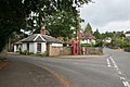
 Old Toll House, Whitchurch-on-Thames - geograph.org.uk - 6114952.jpg 640 × 480; 138 KB
-
 One Woman and her dog pass Hardwick - geograph.org.uk - 6169304.jpg 3,316 × 2,214; 2.59 MB
-
 Orange Way after Wiltshire (295) - geograph.org.uk - 3583391.jpg 800 × 600; 142 KB
-
 Orange Way after Wiltshire (296) - geograph.org.uk - 3583395.jpg 800 × 600; 190 KB
-
 Orange Way after Wiltshire (297) - geograph.org.uk - 3583401.jpg 800 × 600; 173 KB
-
 Orange Way after Wiltshire (298) - geograph.org.uk - 3583403.jpg 800 × 600; 167 KB
-
 Orange Way after Wiltshire (299) - geograph.org.uk - 3583419.jpg 800 × 600; 151 KB
-
 Orange Way after Wiltshire (300) - geograph.org.uk - 3583422.jpg 600 × 800; 117 KB
-
 Orange Way after Wiltshire (301) - geograph.org.uk - 3583426.jpg 800 × 600; 165 KB
-
 Orange Way after Wiltshire (302) - geograph.org.uk - 3583428.jpg 800 × 600; 159 KB
-
 Orange Way after Wiltshire (303) - geograph.org.uk - 3583430.jpg 800 × 600; 185 KB
-
 Orange Way after Wiltshire (306) - geograph.org.uk - 3583510.jpg 800 × 600; 177 KB
-
 Orange Way after Wiltshire (308) - geograph.org.uk - 3583533.jpg 800 × 600; 143 KB
-

-
 Pangbourne - geograph.org.uk - 5422584.jpg 3,360 × 2,240; 7.68 MB
-
 Pangbourne railway geograph-2474691-by-Ben-Brooksbank.jpg 2,390 × 1,411; 942 KB
-
 Pangbourne weir - geograph.org.uk - 1914114.jpg 1,024 × 683; 160 KB
-
 Pangbourne Weir - geograph.org.uk - 5422568.jpg 3,480 × 2,320; 7.54 MB
-
 Path near Hartslock Farm - geograph.org.uk - 2999602.jpg 640 × 480; 125 KB
-
 Peaceful village dwellings - geograph.org.uk - 2999647.jpg 640 × 480; 78 KB
-
 Phone box on Manor Road - geograph.org.uk - 2999579.jpg 639 × 432; 88 KB
-
 Phone box on the corner - geograph.org.uk - 1913969.jpg 1,024 × 683; 216 KB
-
 Plaque on the fence - geograph.org.uk - 1913909.jpg 1,024 × 683; 141 KB


_-_geograph.org.uk_-_3583391.jpg)
_-_geograph.org.uk_-_3583395.jpg)
_-_geograph.org.uk_-_3583401.jpg)
_-_geograph.org.uk_-_3583403.jpg)
_-_geograph.org.uk_-_3583419.jpg)
_-_geograph.org.uk_-_3583422.jpg)
_-_geograph.org.uk_-_3583426.jpg)
_-_geograph.org.uk_-_3583428.jpg)
_-_geograph.org.uk_-_3583430.jpg)
_-_geograph.org.uk_-_3583510.jpg)
_-_geograph.org.uk_-_3583533.jpg)


