Category:Whitegate and Marton
Jump to navigation
Jump to search
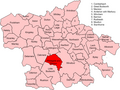
civil parish in Cheshire West and Chester, UK  | |||||
| Upload media | |||||
| Instance of | |||||
|---|---|---|---|---|---|
| Location | Cheshire West and Chester, Cheshire, North West England, England | ||||
 | |||||
Subcategories
This category has the following 3 subcategories, out of 3 total.
V
- Vale Royal Abbey (24 F)
- Vale Royal Locks (22 F)
W
Media in category "Whitegate and Marton"
The following 151 files are in this category, out of 151 total.
-
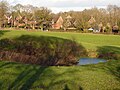
 A boggy pond filled with bulrushes and willow - geograph.org.uk - 2691445.jpg 3,072 × 2,304; 3.84 MB
-
 A flooded sand working popular with anglers - geograph.org.uk - 2688972.jpg 3,072 × 2,304; 3.48 MB
-
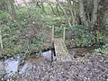 A footbridge over a tributary of Shay's Lane Brook - geograph.org.uk - 2689025.jpg 3,072 × 2,304; 5.2 MB
-
 A modern metal kissing gate beside Clay Lane Farm - geograph.org.uk - 2689033.jpg 3,072 × 2,304; 4.38 MB
-
 A small inlet on the Rookery Pool-Vale Royal Golf Course - geograph.org.uk - 2697037.jpg 3,072 × 2,304; 4.75 MB
-
 A stand of poplars delineate the course of Shays Lane Brook - geograph.org.uk - 2691436.jpg 3,072 × 2,304; 4.89 MB
-
 A tributary of Shays Lane Brook - geograph.org.uk - 2689015.jpg 3,072 × 2,304; 4.29 MB
-
 A49 at Abbots Moss Nursery - geograph.org.uk - 2808494.jpg 640 × 470; 89 KB
-
 A49 at Longstone Lane - geograph.org.uk - 2808507.jpg 640 × 480; 53 KB
-
 A49, Tarporley Road - geograph.org.uk - 2057249.jpg 640 × 480; 212 KB
-
 A54 east of Chester Lane Farm - geograph.org.uk - 4006847.jpg 640 × 408; 51 KB
-
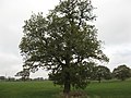
 Ancient roadside oak tree - geograph.org.uk - 1773717.jpg 2,304 × 3,072; 1.55 MB
-
 Arable crop behind Clay Lane Farm - geograph.org.uk - 2689030.jpg 3,072 × 2,304; 3.48 MB
-
 Ash tree (^) in arable field beside Marton Hole - geograph.org.uk - 2689054.jpg 3,072 × 2,304; 4.17 MB
-
 Bark House Farm, Whitegate 01.jpg 4,000 × 3,000; 5.08 MB
-
 Bark House Farm, Whitegate 02.jpg 4,000 × 3,000; 5.32 MB
-
 Beech sculpture - geograph.org.uk - 993880.jpg 429 × 640; 87 KB
-
 Bridge over Dalefords Lane - geograph.org.uk - 5639744.jpg 1,024 × 768; 347 KB
-
 Bridge over the old Weaver - geograph.org.uk - 2750427.jpg 1,024 × 768; 340 KB
-
 Byway at Common Farm - geograph.org.uk - 5639829.jpg 1,024 × 768; 304 KB
-
 Byway to Daleford - geograph.org.uk - 5639823.jpg 1,024 × 768; 379 KB
-
 Byway to Marton Hole - geograph.org.uk - 5639827.jpg 1,024 × 768; 262 KB
-
 Byway to Totties Hall - geograph.org.uk - 5639822.jpg 1,024 × 768; 285 KB
-
 Cattle in Rough Grazing - geograph.org.uk - 2691271.jpg 3,072 × 2,304; 3.26 MB
-
 Cheshire mud - geograph.org.uk - 5639766.jpg 1,024 × 768; 266 KB
-
 Cheshire Polo Club - geograph.org.uk - 6247557.jpg 4,543 × 3,188; 1.86 MB
-
 Chester Lane near Brook Farm - geograph.org.uk - 3361537.jpg 640 × 481; 80 KB
-
 Chester Road Bridge, A556 - geograph.org.uk - 2057179.jpg 640 × 480; 167 KB
-

-
 Common Farm - geograph.org.uk - 5639831.jpg 1,024 × 768; 183 KB
-
 Cows at Common Farm - geograph.org.uk - 5639832.jpg 1,024 × 768; 122 KB
-
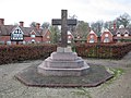
 Cross, St Mary's Drive, Vale Royal - geograph.org.uk - 2752608.jpg 1,024 × 768; 246 KB
-
 Cross, St Mary's Drive, Vale Royal - geograph.org.uk - 2752609.jpg 1,024 × 768; 332 KB
-
 Cyclist on the Whitegate Way - geograph.org.uk - 5639807.jpg 1,024 × 768; 367 KB
-
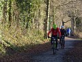 Cyclists on the Whitegate Way - geograph.org.uk - 5639778.jpg 1,024 × 768; 313 KB
-
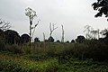 Devastated wood at Foxwist Green - geograph.org.uk - 993909.jpg 640 × 428; 63 KB
-
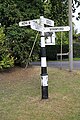 Direction Sign - Signpost in Marton - geograph.org.uk - 6102238.jpg 533 × 800; 118 KB
-
 Earnslow Grange - geograph.org.uk - 1773720.jpg 2,304 × 3,072; 1.35 MB
-
 Earnslow Grange from the air - geograph.org.uk - 3946644.jpg 640 × 480; 108 KB
-
 Embankment footpath - geograph.org.uk - 5639796.jpg 1,024 × 768; 412 KB
-
 Embankment footpath - geograph.org.uk - 5639805.jpg 1,024 × 768; 486 KB
-
 Excalibur^ No, just an old tree trunk in Petty Pool Lake - geograph.org.uk - 1773826.jpg 2,304 × 3,072; 1.87 MB
-
 Falcon Cottage, Martonsands.jpg 1,200 × 896; 296 KB
-
 Field edge boundary at Brook Farm - geograph.org.uk - 2691423.jpg 3,072 × 2,304; 4.16 MB
-
 Field edge boundary at Chesterlane Farm - geograph.org.uk - 2691454.jpg 3,072 × 2,304; 3.29 MB
-
 Field edge boundary behind Blakeden Farm - geograph.org.uk - 2691291.jpg 3,072 × 2,304; 3.62 MB
-
 Field edge boundary near Valeroyal Park - geograph.org.uk - 2689120.jpg 3,072 × 2,304; 3.49 MB
-
 Field near Nova Scotia - geograph.org.uk - 5639794.jpg 1,024 × 768; 155 KB
-
 Fields east of Martonsands - geograph.org.uk - 5639734.jpg 1,024 × 768; 117 KB
-
 Fishing platform with bulrushes - geograph.org.uk - 2688986.jpg 3,072 × 2,304; 4.37 MB
-
 Floating islands of floating pennywort - geograph.org.uk - 5164181.jpg 1,024 × 768; 140 KB
-
 Floating pennywort on the River Weaver - geograph.org.uk - 5164176.jpg 1,024 × 768; 94 KB
-
 Floating pennywort, east bank, River Weaver - geograph.org.uk - 5166775.jpg 1,024 × 768; 99 KB
-
 Flytipped stream - geograph.org.uk - 2753610.jpg 1,024 × 768; 526 KB
-
 Foot bridge and oak tree at Marton Sands - geograph.org.uk - 2689050.jpg 3,072 × 2,304; 4.46 MB
-
 Footbridge in Vale Royal Park - geograph.org.uk - 4115172.jpg 800 × 586; 173 KB
-

-
 Footpath across a lush field - geograph.org.uk - 4115179.jpg 800 × 600; 126 KB
-
 Footpath in Woodland on Vale Royal Golf Course - geograph.org.uk - 2697034.jpg 2,304 × 3,072; 4.69 MB
-
 Footpath to Martonsands - geograph.org.uk - 5639761.jpg 1,024 × 768; 366 KB
-
 Footpath to Nova Scotia - geograph.org.uk - 5639801.jpg 1,024 × 768; 317 KB
-
 Former railway height gauge - geograph.org.uk - 2689046.jpg 3,072 × 2,304; 4.59 MB
-
 Former station sign preserved beside Whitegate Way - geograph.org.uk - 2689034.jpg 3,072 × 2,304; 4.63 MB
-
 Former stationmasters house beside Whitegate Way - geograph.org.uk - 2689039.jpg 2,304 × 3,072; 3.96 MB
-
 Four birches - geograph.org.uk - 5639753.jpg 1,024 × 768; 511 KB
-
 Foxes Bank, Foxwist Green - geograph.org.uk - 993901.jpg 640 × 421; 85 KB
-
 Frozen corner of the mere - geograph.org.uk - 5639817.jpg 1,024 × 768; 270 KB
-
 Golf course tee - geograph.org.uk - 1773737.jpg 3,072 × 2,304; 763 KB
-
 Grange Lane, near Whitegate - geograph.org.uk - 2286706.jpg 640 × 480; 134 KB
-
 Grange Lane, near Whitegate - geograph.org.uk - 2286724.jpg 640 × 480; 129 KB
-
 Grazing pasture beside Clay Lane - geograph.org.uk - 2689016.jpg 3,072 × 2,304; 3.56 MB
-
 Grazing pasture beside the lake - geograph.org.uk - 1773876.jpg 3,072 × 2,304; 1.71 MB
-
 House with a large garden, on The Paddocks - geograph.org.uk - 5639810.jpg 1,024 × 768; 374 KB
-
 Hulses Island - geograph.org.uk - 4064548.jpg 3,648 × 2,736; 4.34 MB
-
 Junction of Nova Scotia Lane and Clay Lane at Marton - geograph.org.uk - 2870422.jpg 1,600 × 1,198; 733 KB
-

-
 Lakeside scene in Petty Pool Wood - geograph.org.uk - 1773822.jpg 3,072 × 2,304; 1.55 MB
-
 Lakeside scene in Petty Pool Wood - geograph.org.uk - 1773883.jpg 3,072 × 2,304; 1.51 MB
-
 Load gauging arch at Whitegate - geograph.org.uk - 5639783.jpg 1,024 × 768; 316 KB
-
 Longstone Lane - geograph.org.uk - 6124259.jpg 1,024 × 768; 476 KB
-
 Longstone.jpg 1,794 × 1,744; 1,010 KB
-
 Marton Hall - geograph.org.uk - 5639742.jpg 1,024 × 767; 172 KB
-

-
 Marton Hole, NW of Winsford - geograph.org.uk - 4351073.jpg 1,024 × 768; 106 KB
-
 Mill Lane - geograph.org.uk - 2753612.jpg 640 × 480; 169 KB
-
 Mill Lane - geograph.org.uk - 6247559.jpg 5,999 × 3,904; 1.87 MB
-
 Mill Lane near Valeroyal Park - geograph.org.uk - 2689117.jpg 3,072 × 2,304; 3.45 MB
-

-
 Mouth of the Pettypool Brook - geograph.org.uk - 2750285.jpg 1,024 × 768; 410 KB
-
 Muddy grazing beside Shay's Lane Brook - geograph.org.uk - 2689027.jpg 3,072 × 2,304; 5.23 MB
-
 New fence and stile at Brook Farm - geograph.org.uk - 2691419.jpg 3,072 × 2,304; 4.17 MB
-
 Oak trees in young Timothy Grass - geograph.org.uk - 2691286.jpg 3,072 × 2,304; 2.43 MB
-

-
 Open deciduous woodland on Newchurch Common - geograph.org.uk - 2688980.jpg 3,072 × 2,304; 5.31 MB
-

-
 Overbridge near Heyesmere - geograph.org.uk - 4440844.jpg 640 × 332; 58 KB
-
 Paddocks at Nova Scotia - geograph.org.uk - 5639799.jpg 1,024 × 768; 300 KB
-
 Parkside Farm - geograph.org.uk - 6246596.jpg 6,000 × 3,248; 1.68 MB
-
 Path at Vale Royal - geograph.org.uk - 2296809.jpg 640 × 480; 105 KB
-
 Path to Sixes Hole - geograph.org.uk - 993895.jpg 429 × 640; 128 KB
-
 Petty Pool Lake - geograph.org.uk - 1773818.jpg 3,072 × 2,304; 1.49 MB
-
 Plague stone.jpg 2,592 × 1,944; 1.04 MB
-
 Pond in farmland - geograph.org.uk - 2688990.jpg 3,072 × 2,304; 3.79 MB
-
 Public footpath beside golf course - geograph.org.uk - 1773727.jpg 2,304 × 3,072; 3.29 MB
-
 Public footpath beside golf course - geograph.org.uk - 1773734.jpg 2,304 × 3,072; 3.31 MB
-
 Railway bridge reflected in the River Weaver - geograph.org.uk - 5160520.jpg 1,024 × 750; 208 KB
-

-
 Road over rail bridge with additional timber supports - geograph.org.uk - 2689014.jpg 3,072 × 2,304; 4.51 MB
-
 Road to Cuddington - geograph.org.uk - 5639730.jpg 1,024 × 768; 178 KB
-
 Rookery Pool - geograph.org.uk - 1773730.jpg 3,072 × 2,304; 605 KB
-
 Sculpture made from an old beech tree - geograph.org.uk - 993876.jpg 429 × 640; 100 KB
-
 Shay's Lane Brook - geograph.org.uk - 2689023.jpg 3,072 × 2,304; 4.84 MB
-
 Shays Lane Brook behind Brook Farm - geograph.org.uk - 2691429.jpg 3,072 × 2,304; 4.21 MB
-
 Silage bales in a field - geograph.org.uk - 5639793.jpg 1,024 × 768; 275 KB
-
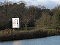 Sluice warning - geograph.org.uk - 2750432.jpg 1,024 × 768; 276 KB
-
 Small mere north of the Whitegate Way - geograph.org.uk - 5639816.jpg 1,024 × 768; 148 KB
-
 Small pond near Cassia Green - geograph.org.uk - 5639765.jpg 1,024 × 768; 259 KB
-
 Solitary oak tree in grass crop - geograph.org.uk - 2691377.jpg 3,072 × 2,304; 3.58 MB
-
 St Mary's Drive, Vale Royal - geograph.org.uk - 2752610.jpg 1,024 × 768; 184 KB
-
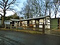 Stables on Common Lane - geograph.org.uk - 5639804.jpg 1,024 × 768; 298 KB
-
 Start of the path to Sixes Hole - geograph.org.uk - 993892.jpg 429 × 640; 116 KB
-
 Steps to a picnic bench - geograph.org.uk - 5639777.jpg 1,024 × 768; 389 KB
-
 The Acorns Caravan Park - geograph.org.uk - 5639834.jpg 1,024 × 768; 302 KB
-
 The Beeches, Foxwist Green - geograph.org.uk - 993873.jpg 640 × 428; 79 KB
-
 The entrance drive to Marton Hall - geograph.org.uk - 2689064.jpg 3,072 × 2,304; 4.03 MB
-
 The old and new post offices - geograph.org.uk - 993937.jpg 640 × 428; 52 KB
-
 The Paddocks Wastewater Treatment Works - geograph.org.uk - 5639812.jpg 1,024 × 768; 414 KB
-
 The Petty Pool Brook at Meadow Home Park bridge - geograph.org.uk - 2689111.jpg 3,072 × 2,304; 4.03 MB
-

-
 The Plough Inn on Beauty Bank near Whitegate - geograph.org.uk - 2870407.jpg 1,600 × 1,198; 410 KB
-
 The road from Newchurch Common to Marton - geograph.org.uk - 2688998.jpg 3,072 × 2,304; 4.12 MB
-
 The sliproad from the A559 joins the A556 at Sandiway - geograph.org.uk - 3673869.jpg 1,600 × 1,200; 303 KB
-
 The upper reaches of Petty Pool Lake - geograph.org.uk - 1773815.jpg 2,304 × 3,072; 2.49 MB
-
 The Whitegate Way - geograph.org.uk - 2689008.jpg 3,072 × 2,304; 5.13 MB
-
 Valeroyal Cut, River Weaver - geograph.org.uk - 4296610.jpg 3,264 × 2,448; 1.74 MB
-
 Valeroyal Cut, Weaver Navigation - geograph.org.uk - 5164124.jpg 1,024 × 768; 133 KB
-
-
 Vr whitegate.png 591 × 443; 63 KB
-
 Whitegate - geograph.org.uk - 6247560.jpg 5,277 × 3,570; 1.68 MB
-
 Whitegate - geograph.org.uk - 6247562.jpg 6,000 × 4,000; 2 MB
-
 Whitegate former station plastform and road bridge - geograph.org.uk - 2689005.jpg 3,072 × 2,304; 4.85 MB
-
 Whitegate Lane south of Earnslow Grange - geograph.org.uk - 5436223.jpg 640 × 481; 104 KB
-
 Whitegate Road crossing the A556 - geograph.org.uk - 5436217.jpg 640 × 481; 83 KB
-
 Whitegate station carpark - geograph.org.uk - 5639781.jpg 1,024 × 768; 265 KB
-
 Whitegate Way - geograph.org.uk - 6247565.jpg 3,614 × 5,824; 1.56 MB
-
 Whitegate Way looking South past the picnic area - geograph.org.uk - 2689043.jpg 3,072 × 2,304; 5.24 MB
-
 Whitegate Way near Nova Scotia - geograph.org.uk - 5639795.jpg 1,024 × 768; 384 KB
-
 Whitegate Way west of Totties Hall - geograph.org.uk - 5639820.jpg 1,024 × 768; 408 KB
-

-
 Woodland track near Whitegate - geograph.org.uk - 2752611.jpg 1,024 × 768; 520 KB
-
 Woodland walk with Silver Birches - geograph.org.uk - 1773821.jpg 2,304 × 3,072; 2.53 MB


_in_arable_field_beside_Marton_Hole_-_geograph.org.uk_-_2689054.jpg)


