Category:Whiteinch
Jump to navigation
Jump to search
district of Glasgow, Scotland, UK  | |||||
| Upload media | |||||
| Instance of | |||||
|---|---|---|---|---|---|
| Location | Glasgow, Scotland | ||||
 | |||||
Subcategories
This category has the following 12 subcategories, out of 12 total.
A
C
- Clyde Tunnel (33 F)
F
G
S
W
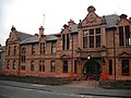
- Whiteinch Burgh Hall (3 F)
- Whiteinch Library (3 F)
- Whiteinch Public School (4 F)
Media in category "Whiteinch"
The following 50 files are in this category, out of 50 total.
-
 21 Westland Drive - geograph.org.uk - 5128575.jpg 1,600 × 1,067; 395 KB
-
 64 Curle Street - geograph.org.uk - 4784264.jpg 360 × 640; 73 KB
-
 64 Curle Street - geograph.org.uk - 4784266.jpg 640 × 360; 95 KB
-
 A739 north of the Clyde Tunnel (geograph 6348368).jpg 1,600 × 1,218; 370 KB
-
 A739 North of the Clyde Tunnel - geograph.org.uk - 1281397.jpg 640 × 480; 75 KB
-
 A814 Clydeside Expressway at Broomhill (geograph 6369692).jpg 800 × 533; 269 KB
-
 Building on Westland Drive - geograph.org.uk - 740893.jpg 640 × 480; 59 KB
-
 Business premises and tenement housing, Whiteinch - geograph.org.uk - 3574325.jpg 4,608 × 3,456; 5.92 MB
-
 Clyde Tunnel - geograph.org.uk - 3574326.jpg 4,608 × 3,456; 6.2 MB
-
 Clyde Tunnel pedestrian entrance - geograph.org.uk - 988575.jpg 640 × 480; 78 KB
-
 Corner of Dumbarton Road ^ Balshagray Crescent, Glasgow - geograph.org.uk - 3972353.jpg 5,184 × 3,456; 7.3 MB
-
 Corner of Dumbarton Road ^ Haldane Street, Glasgow - geograph.org.uk - 3972414.jpg 5,184 × 3,456; 6.84 MB
-
 Corner of Dumbarton Road ^ Haylynn Street, Glasgow - geograph.org.uk - 3972379.jpg 5,184 × 3,456; 6.71 MB
-
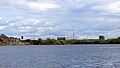
 Cross-river view from Linthouse - geograph.org.uk - 6196620.jpg 1,280 × 960; 334 KB
-
 Curle Street Tower Block, Whiteinch, Glasgow (geograph 4135803).jpg 3,456 × 5,184; 5.7 MB
-
 Cycleway at Whiteinch - geograph.org.uk - 988760.jpg 640 × 480; 83 KB
-
 Dumbarton Road - geograph.org.uk - 1514939.jpg 640 × 480; 80 KB
-

-
 Entrance to Victoria Park Bowling Club - geograph.org.uk - 904027.jpg 640 × 480; 110 KB
-
 Glasgow and the Clyde from the air (geograph 4665706).jpg 640 × 480; 156 KB
-
 Glasgow river scene - geograph.org.uk - 2617105.jpg 640 × 395; 101 KB
-

-

-
 Jordanvale Avenue, Clydeside Industrial Estate.jpg 1,600 × 1,148; 304 KB
-
 Lanarkshire and Dunbartonshire Railway (geograph 2942907).jpg 640 × 480; 262 KB
-

-
 Map of Lanarkshire Sheet 005, Ordnance Survey, 1863-1865.jpg 10,704 × 7,182; 2.38 MB
-
 Map of Lanarkshire Sheet 005, Ordnance Survey, 1863-1865.tiff 10,704 × 7,182; 219.94 MB
-
 Old railway bridge - geograph.org.uk - 2088752.jpg 640 × 421; 159 KB
-
 Old railway bridge - geograph.org.uk - 2088758.jpg 640 × 340; 97 KB
-
 Old railway embankment with Smith Street flats behind - geograph.org.uk - 3993682.jpg 1,200 × 1,600; 324 KB
-
 Old railway line - geograph.org.uk - 2088736.jpg 640 × 427; 140 KB
-
 Old railway line - geograph.org.uk - 2088749.jpg 640 × 480; 143 KB
-
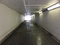
 Pedestrian underpass (geograph 6901164).jpg 1,296 × 1,600; 371 KB
-
 Shipbuilding and Shipping Record (1916) (14783854012).jpg 2,976 × 2,232; 591 KB
-
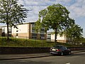 St. Thomas Aquinas Secondary School - geograph.org.uk - 521185.jpg 640 × 480; 115 KB
-
 Subway under the A814 (geograph 3574320).jpg 4,608 × 3,456; 6.26 MB
-
 The Clyde Tunnel - geograph.org.uk - 2088997.jpg 640 × 463; 129 KB
-
 The Upper Clyde - geograph.org.uk - 5765697.jpg 640 × 241; 72 KB
-
 The Upper Clyde - geograph.org.uk - 5765701.jpg 640 × 361; 96 KB
-
 Tower Block UK photo glw1-41 (Whiteinch Curle St 1982).jpg 1,724 × 2,623; 870 KB
-
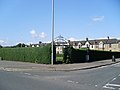
 Victoria Park Drive South, Whiteinch (geograph 6369734).jpg 800 × 534; 240 KB
-
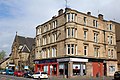
 Whiteinch - geograph.org.uk - 520647.jpg 640 × 480; 81 KB
-
 Whiteinch Cross - geograph.org.uk - 740844.jpg 640 × 480; 45 KB
-
 Whiteinch Cross - panoramio.jpg 3,264 × 2,448; 3.5 MB
-
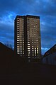
 Whiteinch Highrise - geograph.org.uk - 740847.jpg 480 × 640; 41 KB
-
 Whiteinch Homes, Westland Drive - geograph.org.uk - 1946804.jpg 640 × 480; 83 KB
-
 Whiteinch Public School - geograph.org.uk - 2088980.jpg 640 × 480; 143 KB
-
 Whiteinch Victoria Park railway station (site), Glasgow (geograph 6067793).jpg 1,600 × 1,200; 597 KB
-
 Jem Carpets, Whiteinch - geograph.org.uk - 520644.jpg 640 × 480; 73 KB


.jpg)

.jpg)


.jpg)


.jpg)

_-_geograph.org.uk_-_1033132.jpg)


.jpg)


.jpg)
_(14783854012).jpg)

.jpg)


.jpg)
.jpg)


,_Glasgow_(geograph_6067793).jpg)
