Category:Whitmore, Staffordshire
Jump to navigation
Jump to search
English: Whitmore is a village and small curacy in the county of Staffordshire, England, near Newcastle-under-Lyme.
village and civil parish in Staffordshire, UK  | |||||
| Upload media | |||||
| Instance of | |||||
|---|---|---|---|---|---|
| Location | Newcastle-under-Lyme, Staffordshire, West Midlands, England | ||||
 | |||||
Subcategories
This category has the following 5 subcategories, out of 5 total.
B
- Baldwin's Gate (1 F)
H
- Whitmore Hall (3 F)
Media in category "Whitmore, Staffordshire"
The following 200 files are in this category, out of 210 total.
(previous page) (next page)-
 A Butterton Meadow - geograph.org.uk - 3570130.jpg 640 × 424; 55 KB
-
-
 A line of trees - geograph.org.uk - 3834866.jpg 640 × 430; 36 KB
-
 A linear woodland - geograph.org.uk - 3834868.jpg 640 × 430; 31 KB
-
 A5182 looking west - geograph.org.uk - 5019946.jpg 4,896 × 3,672; 5.26 MB
-
 A53 at Baldwin's Gate - geograph.org.uk - 5109048.jpg 1,600 × 900; 461 KB
-
 A53 bridge over the M6 - geograph.org.uk - 2647038.jpg 640 × 430; 47 KB
-
 A53 Whitmore Road - geograph.org.uk - 6317474.jpg 3,159 × 1,669; 946 KB
-
 Approaching Keele Services, M6 - geograph.org.uk - 2643793.jpg 640 × 430; 46 KB
-

-
 Baldwin's Gate Farm - geograph.org.uk - 6317454.jpg 2,641 × 1,317; 561 KB
-
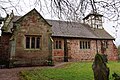
 Baldwin's Gate Methodist Church - geograph.org.uk - 4904519.jpg 1,200 × 799; 403 KB
-
 Baldwin's Gate Primary School - geograph.org.uk - 5109052.jpg 1,600 × 899; 628 KB
-
 Bend in Butterton Lane - geograph.org.uk - 3570277.jpg 640 × 424; 53 KB
-
 Bridge on Three Mile Lane over M6 - geograph.org.uk - 5276586.jpg 4,896 × 3,672; 6.86 MB
-
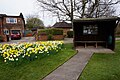 Bus shelter on Newcastle Road, Baldwins Gate. - geograph.org.uk - 4904530.jpg 1,200 × 799; 472 KB
-
 Butterton - geograph.org.uk - 5039825.jpg 3,264 × 2,448; 2.49 MB
-
 Butterton - geograph.org.uk - 5039836.jpg 3,264 × 2,448; 1.57 MB
-
 Butterton - geograph.org.uk - 5039947.jpg 3,264 × 2,448; 2.09 MB
-
 Butterton - geograph.org.uk - 5039950.jpg 3,211 × 2,408; 1.36 MB
-
 Butterton Lane - geograph.org.uk - 3570136.jpg 424 × 640; 86 KB
-
 Butterton Near Keele - geograph.org.uk - 3570271.jpg 640 × 424; 58 KB
-
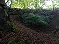 Butterton Sandstone Outcrop - geograph.org.uk - 6022479.jpg 1,024 × 768; 224 KB
-
 Butterton, Butterton Lane - geograph.org.uk - 5039943.jpg 2,448 × 3,264; 2.37 MB
-
 Butterton, church and Church Wood - geograph.org.uk - 5039799.jpg 4,896 × 3,672; 3 MB
-
 Butterton, church of St Thomas - geograph.org.uk - 5038263.jpg 4,896 × 3,672; 4.23 MB
-
 Butterton, entrance to lane to church - geograph.org.uk - 5037058.jpg 4,896 × 3,672; 4.42 MB
-
 Butterton, field near church - geograph.org.uk - 5037061.jpg 4,896 × 3,672; 3.7 MB
-
 Butterton, field near church - geograph.org.uk - 5039805.jpg 4,896 × 3,672; 3.49 MB
-
 Butterton, field near church - geograph.org.uk - 5039810.jpg 4,896 × 3,672; 3.93 MB
-
 Butterton, field path near church - geograph.org.uk - 5037077.jpg 3,672 × 4,896; 2.94 MB
-
 Butterton, field path near church - geograph.org.uk - 5039818.jpg 4,896 × 3,672; 3.72 MB
-
 Butterton, footpath to Seabridge - geograph.org.uk - 5039941.jpg 2,448 × 3,264; 2.16 MB
-
 Butterton, Garden of Remembrance at church - geograph.org.uk - 5038300.jpg 4,896 × 3,672; 5.33 MB
-
 Butterton, old gateposts on Park Road - geograph.org.uk - 5039922.jpg 3,264 × 2,448; 2.67 MB
-
 Butterton, public footpath to Seabridge - geograph.org.uk - 5039932.jpg 4,896 × 3,672; 4.69 MB
-
 Butterton, start of track and public footpath - geograph.org.uk - 5039841.jpg 3,264 × 2,448; 2.33 MB
-
 Butterton, stile to field near church - geograph.org.uk - 5037072.jpg 4,896 × 3,672; 3.94 MB
-
 Butterton, T-junction of Butterton Lane-Park Road - geograph.org.uk - 5039918.jpg 3,264 × 2,448; 3.15 MB
-
 Butterton, track and public footpath - geograph.org.uk - 5039847.jpg 2,448 × 3,264; 2.72 MB
-
 Butterton, Victorian postbox - geograph.org.uk - 5039866.jpg 1,689 × 2,489; 1.28 MB
-
 Cattle grazing, Shelton Under Harley - geograph.org.uk - 2820608.jpg 640 × 315; 40 KB
-
 Church path leading to Three Mile Lane, Whitmore - geograph.org.uk - 4907343.jpg 1,200 × 799; 478 KB
-
 Dab Green Farm - geograph.org.uk - 447678.jpg 640 × 451; 146 KB
-
 Dairy cows near Radwood - geograph.org.uk - 985209.jpg 640 × 457; 174 KB
-
 Dampness Under the M6 - geograph.org.uk - 3570280.jpg 424 × 640; 62 KB
-
 Elizabethan Stables Whitmore Hall - geograph.org.uk - 2478634.jpg 3,072 × 2,304; 2.25 MB
-
 Fallen tree - geograph.org.uk - 593979.jpg 480 × 640; 177 KB
-
 Farm House at Baldwin's Gate Farm - geograph.org.uk - 3881439.jpg 3,564 × 1,964; 2.83 MB
-
 Farmland and woodland - geograph.org.uk - 3680495.jpg 640 × 430; 40 KB
-
 Farmland by the WCML - geograph.org.uk - 3680475.jpg 640 × 326; 38 KB
-
 Farmland by the WCML - geograph.org.uk - 3680490.jpg 640 × 430; 37 KB
-
 Farmland near Madeley Park - geograph.org.uk - 985181.jpg 640 × 457; 166 KB
-
 Farmland north of The Lymes - geograph.org.uk - 2647037.jpg 640 × 430; 33 KB
-
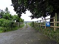
 Field Entrance - geograph.org.uk - 447672.jpg 640 × 480; 127 KB
-
 Field near Stableford - geograph.org.uk - 552996.jpg 640 × 480; 106 KB
-
 Field on Dog Lane - geograph.org.uk - 511805.jpg 640 × 480; 122 KB
-
 Fisheries Sign - geograph.org.uk - 447661.jpg 480 × 640; 115 KB
-
-
 Footbridge over the M6 - geograph.org.uk - 2647041.jpg 640 × 430; 46 KB
-
 Footbridge over the M6 - geograph.org.uk - 2922285.jpg 3,007 × 2,640; 2.84 MB
-
 Footbridge over the M6, Keele - geograph.org.uk - 6080355.jpg 2,000 × 1,500; 2.67 MB
-
 Footbridge to Seabridge - geograph.org.uk - 3570173.jpg 640 × 424; 68 KB
-

-
 Footpath to Seabridge - geograph.org.uk - 3570154.jpg 640 × 424; 63 KB
-
 Footpath To Stoney Low - geograph.org.uk - 3113175.jpg 429 × 640; 53 KB
-
 Footpath ^ M6 - geograph.org.uk - 3570165.jpg 640 × 424; 52 KB
-
 Formal garden at Wilkins Pleck - geograph.org.uk - 4151267.jpg 1,600 × 1,200; 534 KB
-
 Gallops beside the M6 - geograph.org.uk - 2922281.jpg 2,656 × 1,781; 2.39 MB
-
 Gatehouse on Butterton Lane - geograph.org.uk - 3570143.jpg 640 × 424; 67 KB
-
 George VI Postbox - geograph.org.uk - 4907653.jpg 799 × 1,200; 400 KB
-
 Graffiti under M6 bridge - geograph.org.uk - 5050862.jpg 4,896 × 3,672; 4.51 MB
-
 Graffiti under M6 bridge - geograph.org.uk - 5050867.jpg 4,896 × 3,672; 3.21 MB
-
 Graffiti under M6 bridge - geograph.org.uk - 5050878.jpg 4,896 × 3,672; 3.23 MB
-
 Graffiti under M6 bridge - geograph.org.uk - 5050883.jpg 4,896 × 3,672; 3.15 MB
-
 Green and red - geograph.org.uk - 3680478.jpg 640 × 430; 42 KB
-
 Hay Sprink - geograph.org.uk - 3680519.jpg 640 × 430; 46 KB
-
 Heath Road - Whitmore Heath - geograph.org.uk - 6317452.jpg 4,128 × 2,006; 2.68 MB
-
 Herd of cows crossing the M6 Motorway - geograph.org.uk - 3471703.jpg 4,584 × 2,370; 2.18 MB
-
 Hey Sprink - geograph.org.uk - 2820598.jpg 640 × 430; 47 KB
-
 Hill, Hill Chorlton - geograph.org.uk - 4967567.jpg 640 × 374; 39 KB
-
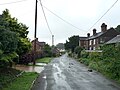
 Houses at Baldwin's Gate - geograph.org.uk - 3881452.jpg 4,608 × 2,243; 3.88 MB
-
 Houses on Bent Lane, Whitmore - geograph.org.uk - 4907314.jpg 1,200 × 799; 462 KB
-
 Junction 15, M6 - geograph.org.uk - 2647045.jpg 640 × 488; 58 KB
-
 Lake at Wilkins Pleck - geograph.org.uk - 4151271.jpg 1,600 × 1,200; 657 KB
-
 Landscape south west of Whitmore - geograph.org.uk - 2820607.jpg 640 × 353; 28 KB
-
 Lane to Stoneylow Farm - geograph.org.uk - 5276696.jpg 4,032 × 3,024; 3.17 MB
-
 Lymes Farm, Butterton - geograph.org.uk - 2470820.jpg 3,147 × 2,147; 1.83 MB
-
 Lymes Road sign, Keele - geograph.org.uk - 3118116.jpg 1,024 × 765; 261 KB
-
 Lymes Road Under the M6, Keele - geograph.org.uk - 6067328.jpg 1,500 × 2,000; 2.1 MB
-
 M6 at Penfields Wood - geograph.org.uk - 3466347.jpg 4,139 × 2,145; 1.69 MB
-
 M6 at Springpool Wood - geograph.org.uk - 3466350.jpg 3,977 × 2,248; 1.77 MB
-
 M6 bridge over Lymes Road - geograph.org.uk - 5050856.jpg 4,896 × 3,672; 4.52 MB
-
 M6 east of Keele Services - geograph.org.uk - 2647036.jpg 640 × 430; 45 KB
-
 M6 looking east from Whitmore Road overbridge - geograph.org.uk - 4759616.jpg 4,512 × 3,000; 1.95 MB
-
 M6 looking west from Whitmore Road overbridge - geograph.org.uk - 4759615.jpg 4,512 × 3,000; 2.24 MB
-
 M6 motorway - 1 mile to Keele services - geograph.org.uk - 1918227.jpg 640 × 480; 144 KB
-
 M6 motorway - A53 overbridge near Keele - geograph.org.uk - 1918224.jpg 640 × 480; 142 KB
-
 M6 motorway - climbing to Keele services - geograph.org.uk - 1918229.jpg 640 × 480; 168 KB
-
-
 M6 Motorway near Butterton - geograph.org.uk - 2244694.jpg 640 × 480; 46 KB
-
 M6 Motorway, Seabridge - geograph.org.uk - 2470837.jpg 3,264 × 2,448; 1.72 MB
-
 M6 near Seabridge - geograph.org.uk - 5021903.jpg 4,877 × 2,848; 2.63 MB
-
 M6 near Seabridge - geograph.org.uk - 5021919.jpg 4,896 × 3,672; 3.16 MB
-
 M6 North climbing to Keele services - geograph.org.uk - 2105629.jpg 640 × 384; 318 KB
-
 M6 North nearing Keele services - geograph.org.uk - 2105631.jpg 640 × 426; 349 KB
-
 M6 Northbound, Welcome Break in One Mile - geograph.org.uk - 3511152.jpg 640 × 480; 316 KB
-
 M6 south near Penfields Wood - geograph.org.uk - 2824379.jpg 640 × 480; 38 KB
-
 M6 South, footbridge near Seabridge - geograph.org.uk - 2934335.jpg 640 × 480; 38 KB
-
 M6 west of Keele Services - geograph.org.uk - 5276617.jpg 4,896 × 3,672; 6.68 MB
-
 Madeley Park - geograph.org.uk - 4967555.jpg 640 × 426; 46 KB
-
 Madeley Park - geograph.org.uk - 4967559.jpg 640 × 426; 52 KB
-
 Madeley Park - geograph.org.uk - 4967560.jpg 640 × 426; 48 KB
-
 Madeley Park - geograph.org.uk - 5349662.jpg 640 × 338; 32 KB
-
 Madeley Park - geograph.org.uk - 5349665.jpg 640 × 425; 54 KB
-
 Madeley Park - geograph.org.uk - 985204.jpg 640 × 457; 165 KB
-
 Madeley Park Farm - geograph.org.uk - 4967563.jpg 640 × 335; 39 KB
-
 Milepost at NGR SJ 7980 4054.jpg 492 × 701; 77 KB
-
 Milepost at NGR SJ 8132 4112.jpg 492 × 701; 68 KB
-
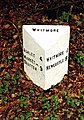
 Milepost at NGR SJ 8242 4217.jpg 492 × 701; 49 KB
-
 Milepost at NGR SJ 8257 4183.jpg 492 × 701; 68 KB
-
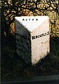
 Milepost at NGR SJ 8400 4186.jpg 258 × 400; 99 KB
-
 Minor Road near Acton - geograph.org.uk - 3880748.jpg 3,491 × 2,497; 3.4 MB
-
 Moathouse Farm - geograph.org.uk - 447664.jpg 640 × 460; 89 KB
-
 New Hayes Farm - geograph.org.uk - 3880737.jpg 2,574 × 1,348; 1 MB
-
 New Hayes Farm - geograph.org.uk - 459080.jpg 613 × 450; 27 KB
-
 New housing - geograph.org.uk - 428218.jpg 640 × 480; 109 KB
-
 Newcastle-under-Lyme , Countryside Scenery - geograph.org.uk - 4934083.jpg 5,855 × 3,903; 6.57 MB
-
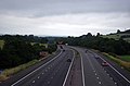
 Newcastle-under-Lyme , The M6 Motorway - geograph.org.uk - 4934072.jpg 6,000 × 4,000; 5.76 MB
-
 Newcastle-under-Lyme , The M6 Motorway - geograph.org.uk - 4934076.jpg 6,000 × 4,000; 6.11 MB
-
 Newcastle-under-Lyme , The M6 Motorway - geograph.org.uk - 4934080.jpg 5,855 × 3,903; 6.67 MB
-
 Newcastle-under-Lyme , The M6 Motorway - geograph.org.uk - 4934085.jpg 6,000 × 4,000; 5.5 MB
-
 Newcastle-under-Lyme , The M6 Motorway - geograph.org.uk - 4934087.jpg 6,000 × 4,000; 5.39 MB
-
 Newcastle-under-Lyme , The M6 Motorway - geograph.org.uk - 4934089.jpg 6,000 × 4,000; 7.9 MB
-
 Newcastle-under-Lyme District , Grassy Field - geograph.org.uk - 3725046.jpg 4,224 × 2,750; 5.37 MB
-
 Newcastle-under-Lyme District , The M6 Motorway - geograph.org.uk - 3725042.jpg 4,288 × 2,848; 4.8 MB
-
 Newcastle-under-Lyme District , The M6 Motorway - geograph.org.uk - 3725050.jpg 4,288 × 2,848; 4.47 MB
-
 Newcastle-under-Lyme District , The M6 Motorway - geograph.org.uk - 3725070.jpg 4,288 × 2,848; 4.35 MB
-
 North Stafford Sports Club - geograph.org.uk - 459082.jpg 640 × 480; 18 KB
-
 Northbound M6 - geograph.org.uk - 3511133.jpg 640 × 480; 369 KB
-
 Northbound M6, Bridge at Whitmore Road - geograph.org.uk - 3511144.jpg 640 × 480; 323 KB
-
 Northbound M6, Footbridge at Seabridge - geograph.org.uk - 3511138.jpg 640 × 480; 373 KB
-
 Orchard Cottage, Three Mile Lane, near Keele - geograph.org.uk - 5276680.jpg 4,032 × 3,024; 3 MB
-
 Park House ^ ruins of Old Hall, Butterton - geograph.org.uk - 5608296.jpg 5,184 × 2,920; 6.86 MB
-
 Path to Shelton under Harley - geograph.org.uk - 593968.jpg 480 × 640; 197 KB
-
 Post Office, Baldwins Gate - geograph.org.uk - 4904549.jpg 1,200 × 799; 299 KB
-
 Pylon by the M6 - geograph.org.uk - 2647040.jpg 640 × 430; 41 KB
-
 Railway line at Stableford - geograph.org.uk - 428205.jpg 640 × 480; 99 KB
-
 Rolling farmland near Whitmore Wood - geograph.org.uk - 3834874.jpg 640 × 430; 28 KB
-
 Rook Hall Farm - geograph.org.uk - 462481.jpg 640 × 507; 37 KB
-
 Rough grassland - geograph.org.uk - 4967554.jpg 640 × 426; 42 KB
-
 Rough Grassland - geograph.org.uk - 5349650.jpg 640 × 426; 50 KB
-
 Rough grazing - geograph.org.uk - 5349657.jpg 640 × 426; 50 KB
-
 Rough pasture - geograph.org.uk - 5349652.jpg 640 × 426; 52 KB
-
 Roundabout near Acton - geograph.org.uk - 3880744.jpg 4,214 × 2,063; 3.74 MB
-
 Rural crossroads at The Lymes on the A53 - geograph.org.uk - 5036656.jpg 3,264 × 2,448; 3.56 MB
-
 Sandy Fields - geograph.org.uk - 4904524.jpg 1,200 × 799; 378 KB
-
 Sheet Anchor, Baldwins Gate - geograph.org.uk - 4904539.jpg 1,200 × 799; 252 KB
-
 Sheet Anchor, Baldwins Gate - geograph.org.uk - 4904542.jpg 1,200 × 1,136; 246 KB
-
 Single tree in a farming landscape - geograph.org.uk - 2820604.jpg 640 × 430; 50 KB
-
 Snapehall Farm - geograph.org.uk - 447683.jpg 640 × 464; 138 KB
-
 Snapehill - geograph.org.uk - 3834878.jpg 640 × 232; 26 KB
-
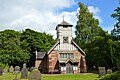
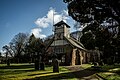 St Mary and All Saints, Whitmore - geograph.org.uk - 5048762.jpg 1,500 × 1,000; 1.34 MB
-
 St Mary's ^ All Saints Church, Whitmore - geograph.org.uk - 4907327.jpg 1,200 × 799; 493 KB
-
 St Mary's ^ All Saints Church, Whitmore - geograph.org.uk - 4907339.jpg 1,200 × 799; 337 KB
-
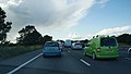 Standing traffic on the M6 - geograph.org.uk - 4140809.jpg 3,872 × 2,192; 993 KB
-
 Swynnerton Old Park - geograph.org.uk - 511790.jpg 640 × 480; 94 KB
-
 The Lake Whitmore Hall - geograph.org.uk - 2478660.jpg 3,072 × 2,304; 2.25 MB
-
 The Lymes Scramble - geograph.org.uk - 5066070.jpg 1,500 × 1,000; 1.33 MB
-
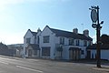
 The Mainwaring Arms, Whitmore - geograph.org.uk - 4907276.jpg 1,200 × 807; 319 KB
-
 The Mianwaring Arms, Whitmore - geograph.org.uk - 4907279.jpg 1,200 × 1,198; 442 KB
-
 The Old Rectory - geograph.org.uk - 3881456.jpg 3,051 × 2,255; 3.04 MB
-
 The Sheet Anchor - Baldwin's Gate - geograph.org.uk - 3881447.jpg 3,443 × 2,283; 2.73 MB
-
 Three Mile Lane at Orchard Cottage - geograph.org.uk - 3113157.jpg 640 × 429; 77 KB
-
 Towards J15 - geograph.org.uk - 3570187.jpg 640 × 424; 41 KB
-
 Towards Stoney Low - geograph.org.uk - 3113199.jpg 640 × 429; 80 KB
-

-
 View towards Bentilee Wood - geograph.org.uk - 3268139.jpg 1,600 × 1,064; 337 KB
-
 View towards Rowley Wood - geograph.org.uk - 2647044.jpg 640 × 430; 47 KB
-

-
 Whitmore - geograph.org.uk - 2259.jpg 640 × 480; 99 KB
-
 Whitmore Church - geograph.org.uk - 4535746.jpg 3,008 × 2,000; 1.61 MB
-
 Whitmore Hall , Whitmore - geograph.org.uk - 5430848.jpg 1,500 × 1,000; 1.54 MB
-
 Whitmore Hall, Whitmore - geograph.org.uk - 4907334.jpg 1,200 × 799; 389 KB
-
 Whitmore Tea Rooms - geograph.org.uk - 4535792.jpg 3,008 × 2,000; 1.83 MB
-
 Whitmore Tea Rooms - geograph.org.uk - 4907265.jpg 1,200 × 799; 441 KB
-
 Whitmore Wood - geograph.org.uk - 2820605.jpg 640 × 353; 35 KB
-
 Whitmore Wood - geograph.org.uk - 3680487.jpg 640 × 430; 40 KB
-
 Whitmore Wood - geograph.org.uk - 3715067.jpg 640 × 395; 21 KB
-
 Whitmore Wood - geograph.org.uk - 3834876.jpg 640 × 430; 32 KB
-
 Whitmore, avenue to Whitmore Hall - geograph.org.uk - 4535760.jpg 3,008 × 2,000; 1.5 MB
-
 Whitmore, car park - geograph.org.uk - 4535727.jpg 3,264 × 2,448; 2.97 MB
-
 Whitmore, churchyard - geograph.org.uk - 4535770.jpg 3,008 × 2,000; 1.71 MB
-
 Whitmore, lane to Acton - geograph.org.uk - 4535718.jpg 2,448 × 3,264; 3.12 MB
-
 Whitmore, lychgate on corner - geograph.org.uk - 4535779.jpg 3,008 × 2,000; 1.57 MB
-
 Whitmore, Mainwaring Arms (rear) - geograph.org.uk - 5091522.jpg 3,264 × 2,448; 1.98 MB
-
 Whitmore, Mainwaring Arms - geograph.org.uk - 4536335.jpg 3,264 × 2,448; 3.6 MB
-
 Whitmore, path from byway - geograph.org.uk - 4535821.jpg 3,264 × 2,448; 2.73 MB
-
 Whitmore, top of track leading to cricket club - geograph.org.uk - 4535711.jpg 3,264 × 2,448; 1.74 MB
-
 Wilkins Pleck and its formal garden - geograph.org.uk - 4151264.jpg 1,600 × 1,200; 704 KB


_-_geograph.org.uk_-_5091522.jpg)


