Category:Whitwell-on-the-Hill
Jump to navigation
Jump to search
village and civil parish in North Yorkshire, England, UK  | |||||
| Upload media | |||||
| Instance of | |||||
|---|---|---|---|---|---|
| Location |
| ||||
 | |||||
Subcategories
This category has the following 2 subcategories, out of 2 total.
Media in category "Whitwell-on-the-Hill"
The following 192 files are in this category, out of 192 total.
-
 A minor road to the north of Crambe - geograph.org.uk - 2262308.jpg 800 × 600; 288 KB
-
 A minor road towards Castle Howard - geograph.org.uk - 2326000.jpg 800 × 600; 214 KB
-
 A64 behind me Cliff Lane in front - geograph.org.uk - 2810257.jpg 3,264 × 2,448; 2.1 MB
-
 A64 from Scarborough - geograph.org.uk - 753210.jpg 640 × 478; 218 KB
-
 A64 towards York - geograph.org.uk - 753206.jpg 640 × 478; 224 KB
-
 Across the fields to the monument - geograph.org.uk - 1745294.jpg 640 × 427; 339 KB
-
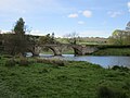
 Ancient bridge at Kirkham - geograph.org.uk - 2116388.jpg 1,600 × 1,200; 473 KB
-
 Approaching Whitwell Grange - geograph.org.uk - 3481562.jpg 640 × 427; 81 KB
-
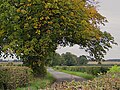
 Autumn colour on the road to Foston - geograph.org.uk - 3721736.jpg 1,024 × 768; 226 KB
-
 Bellmire Hill Farm - geograph.org.uk - 2012421.jpg 640 × 480; 63 KB
-
 Below Fulsty Head, near Kirkham - geograph.org.uk - 5548331.jpg 640 × 480; 689 KB
-
 Beside Oak Cliff Wood - geograph.org.uk - 5493761.jpg 5,184 × 3,456; 6.32 MB
-
 Beside the Derwent - geograph.org.uk - 2917180.jpg 1,024 × 768; 234 KB
-
 Bridge Arch over the River Derwent at Kirkham Abbey - geograph.org.uk - 1938403.jpg 2,652 × 3,150; 2.58 MB
-
 Bridge Near Kirkham Priory - geograph.org.uk - 2023551.jpg 3,800 × 2,533; 3.03 MB
-
 Bridge Over River Derwent - geograph.org.uk - 2078123.jpg 1,744 × 1,308; 1.71 MB
-
 Bridge over the River Derwent - geograph.org.uk - 3405689.jpg 640 × 480; 154 KB
-
 Building and trees - geograph.org.uk - 789934.jpg 640 × 478; 220 KB
-
 Centenary Way - geograph.org.uk - 2078203.jpg 1,744 × 1,308; 1.66 MB
-
 Cereal cropfield - geograph.org.uk - 2916211.jpg 1,024 × 768; 308 KB
-
 Cliff Lane - geograph.org.uk - 5373583.jpg 1,024 × 768; 190 KB
-
 Corner of a greening field - geograph.org.uk - 2838535.jpg 1,024 × 768; 151 KB
-
 Crossroads near Foston - geograph.org.uk - 5547255.jpg 640 × 496; 192 KB
-
 Derwentside priory - Kirkham, North Yorkshire - geograph.org.uk - 5991200.jpg 1,024 × 672; 174 KB
-
 Down the Derwent - geograph.org.uk - 2917170.jpg 1,024 × 768; 155 KB
-
 Drain along a field boundary - geograph.org.uk - 2838540.jpg 1,024 × 768; 165 KB
-
 Entering Kirkham from the west - geograph.org.uk - 2916226.jpg 1,024 × 660; 287 KB
-
 Entrance to Castle Howard estate - geograph.org.uk - 4353503.jpg 4,272 × 3,174; 2.86 MB
-
 Evidence of the Point to Point - geograph.org.uk - 789920.jpg 640 × 478; 227 KB
-
 Fallen tree and wood anemones - geograph.org.uk - 2917309.jpg 1,024 × 685; 383 KB
-
 Farmland east of the Intakes crossroads - geograph.org.uk - 3721740.jpg 1,024 × 768; 201 KB
-
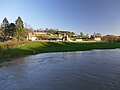
 Farmland near Whitwell-on-the-Hill - geograph.org.uk - 5547245.jpg 640 × 480; 163 KB
-
 Farmland north of the Intakes crossroads - geograph.org.uk - 3721728.jpg 1,024 × 615; 132 KB
-
 Field off Shepherdfield Lane - geograph.org.uk - 5372732.jpg 1,024 × 768; 183 KB
-
 Fields near Crambe - geograph.org.uk - 6137957.jpg 1,024 × 768; 167 KB
-
 Fields near monument to Earl of Carlisle - geograph.org.uk - 2993593.jpg 4,000 × 3,000; 3.1 MB
-
 Fixing the potholes - geograph.org.uk - 3373657.jpg 1,024 × 669; 241 KB
-
 Floating debris lodged on the weir - geograph.org.uk - 2917205.jpg 1,024 × 768; 292 KB
-
 Footbridge over ditch - geograph.org.uk - 6265778.jpg 640 × 427; 151 KB
-
 Footpath and Fulsty Head - geograph.org.uk - 5372743.jpg 1,024 × 768; 168 KB
-
 Footpath at Bellmire Hill - geograph.org.uk - 5372737.jpg 1,024 × 768; 208 KB
-
 Footpath below Bellmire Hill - geograph.org.uk - 4353510.jpg 4,320 × 3,240; 3.7 MB
-
 Footpath off Tout Hill - geograph.org.uk - 4079175.jpg 1,600 × 1,200; 829 KB
-
 Footpath through Oak Cliff Wood - geograph.org.uk - 5381096.jpg 1,024 × 768; 383 KB
-
 Footpath to Kirkham Bridge - geograph.org.uk - 5379273.jpg 1,024 × 768; 356 KB
-
 Footpath to Whitwell-on-the-Hill - geograph.org.uk - 2012424.jpg 640 × 480; 51 KB
-
 Footpath to Whitwell-on-the-Hill - geograph.org.uk - 2838531.jpg 1,024 × 768; 137 KB
-
 Foston Bridge - geograph.org.uk - 1330140.jpg 640 × 480; 87 KB
-
 From Barton Hill - geograph.org.uk - 788191.jpg 640 × 478; 233 KB
-
 Gate and incomplete stile - geograph.org.uk - 5379296.jpg 1,024 × 768; 364 KB
-
 Gated path into Oak Cliff Wood - geograph.org.uk - 2917304.jpg 1,024 × 768; 413 KB
-
 High Moor near Whitwell-on-the-Hill - geograph.org.uk - 5549658.jpg 640 × 480; 187 KB
-
 Hill to Castle Howard - geograph.org.uk - 3481492.jpg 640 × 427; 87 KB
-
 Hillside, near Ben Wood - geograph.org.uk - 6265772.jpg 640 × 427; 80 KB
-

-

-
 Kirkham Abbey Bridge - geograph.org.uk - 2078246.jpg 1,744 × 1,308; 1.95 MB
-
 Kirkham Abbey Weir - geograph.org.uk - 2078260.jpg 1,744 × 1,308; 1.6 MB
-
 Kirkham Bridge - geograph.org.uk - 2917282.jpg 1,024 × 768; 245 KB
-
 Kirkham bridge - geograph.org.uk - 2969496.jpg 3,736 × 1,814; 1.38 MB
-
 Kirkham Bridge - geograph.org.uk - 3868941.jpg 1,600 × 1,200; 776 KB
-
 Kirkham Bridge - geograph.org.uk - 5138633.jpg 1,800 × 1,012; 1.95 MB
-
 Kirkham Bridge - geograph.org.uk - 5379379.jpg 1,024 × 768; 253 KB
-
 Kirkham Bridge - geograph.org.uk - 5381075.jpg 1,024 × 768; 153 KB
-
 Kirkham Bridge - geograph.org.uk - 5493747.jpg 5,184 × 3,456; 6.29 MB
-
 Kirkham Bridge - geograph.org.uk - 5547966.jpg 640 × 491; 196 KB
-
 Kirkham Bridge - geograph.org.uk - 6137951.jpg 1,024 × 768; 184 KB
-
 Kirkham Bridge over the River Derwent - geograph.org.uk - 2916249.jpg 1,024 × 728; 311 KB
-
 Kirkham Bridge, Kirkham - geograph.org.uk - 5762423.jpg 640 × 480; 96 KB
-
 Kirkham Priory - geograph.org.uk - 2078107.jpg 1,744 × 1,308; 1.75 MB
-
 Kirkham Priory - geograph.org.uk - 2078136.jpg 1,744 × 1,308; 1.44 MB
-
 Kirkham Priory - geograph.org.uk - 2078147.jpg 1,744 × 1,308; 1.49 MB
-
 Kirkham Priory - geograph.org.uk - 3405656.jpg 640 × 480; 92 KB
-
 Kirkham Priory - geograph.org.uk - 4778128.jpg 800 × 600; 86 KB
-
 Kirkham Priory from Kirkham Bridge - geograph.org.uk - 5379408.jpg 1,024 × 768; 137 KB
-
 Lane near Whitwell-on-the-Hill - geograph.org.uk - 5547240.jpg 640 × 480; 674 KB
-
 Looking down to the point to point course - geograph.org.uk - 789928.jpg 640 × 478; 232 KB
-
 Looking over the point to point course - geograph.org.uk - 789933.jpg 640 × 478; 233 KB
-
 Looking towards Crambe - geograph.org.uk - 789913.jpg 640 × 478; 248 KB
-
 Looking up the hill - geograph.org.uk - 753004.jpg 640 × 478; 230 KB
-
 Lychgate at St John's the Evangelist - geograph.org.uk - 5417422.jpg 1,200 × 799; 444 KB
-
 Manor Farm, Kirkham reflected in the River Derwent - geograph.org.uk - 2697305.jpg 2,398 × 1,799; 915 KB
-
 Men at work - geograph.org.uk - 4353535.jpg 4,320 × 3,240; 4.15 MB
-
 Near Whitwell Grange - geograph.org.uk - 3481570.jpg 640 × 427; 87 KB
-
 Oak Cliff Wood - geograph.org.uk - 2012417.jpg 640 × 480; 101 KB
-
 Onhams Lane - geograph.org.uk - 5493877.jpg 5,184 × 3,456; 4.13 MB
-
 Ordnance Survey Cut Mark - geograph.org.uk - 2861700.jpg 4,000 × 3,000; 3.24 MB
-
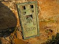 Ordnance Survey Flush Bracket 2330 - geograph.org.uk - 2862161.jpg 4,000 × 3,000; 3.33 MB
-
 Outside the Signal Box at Kirkham Abbey - geograph.org.uk - 5493757.jpg 5,184 × 3,456; 6.85 MB
-
 Over the jump - geograph.org.uk - 753014.jpg 640 × 478; 213 KB
-
 Park House - geograph.org.uk - 3721733.jpg 1,024 × 768; 178 KB
-
 Part of the old road east of Barton Hill - geograph.org.uk - 4079168.jpg 1,600 × 1,200; 751 KB
-
 Pasture House Farm - geograph.org.uk - 753118.jpg 640 × 478; 248 KB
-
 Path and Bellmire Hill Farm - geograph.org.uk - 5379289.jpg 1,024 × 768; 359 KB
-
 Path down to Kirkham Bridge - geograph.org.uk - 5379351.jpg 1,024 × 768; 169 KB
-
 Path Gate to Road, Kirkham - geograph.org.uk - 3197244.jpg 4,608 × 3,072; 2.17 MB
-
 Path to Whitwell - geograph.org.uk - 6137966.jpg 1,024 × 768; 132 KB
-
 Path up to Bellmire Hill - geograph.org.uk - 5379300.jpg 1,024 × 768; 288 KB
-
 Poppies in a field - geograph.org.uk - 1053211.jpg 480 × 640; 79 KB
-
 Public footpath to Bulmer - geograph.org.uk - 3721730.jpg 1,024 × 768; 112 KB
-
 Rail and river near Kirkham Bridge - geograph.org.uk - 4353515.jpg 4,320 × 2,540; 1.92 MB
-
 Ready for a Cruise - geograph.org.uk - 2670188.jpg 3,648 × 2,736; 4.27 MB
-
 Remains of Kirkham Priory - geograph.org.uk - 3222120.jpg 1,024 × 768; 331 KB
-
 River Derwent - geograph.org.uk - 2078273.jpg 1,744 × 1,308; 1.82 MB
-
 River Derwent - geograph.org.uk - 3405671.jpg 640 × 480; 102 KB
-
 River Derwent and Kirkham Bridge - geograph.org.uk - 6227362.jpg 2,000 × 1,246; 3.28 MB
-
 River Derwent and Kirkham Priory - geograph.org.uk - 5488287.jpg 640 × 427; 191 KB
-
 River Derwent at Kirkham - geograph.org.uk - 5548120.jpg 640 × 559; 190 KB
-
 River Derwent at Kirkham Abbey - geograph.org.uk - 2078162.jpg 1,744 × 1,308; 1.38 MB
-
 River Derwent at Kirkham Abbey - geograph.org.uk - 3405644.jpg 640 × 480; 107 KB
-
 River Derwent flowing through Kirkham - geograph.org.uk - 3222119.jpg 1,024 × 768; 382 KB
-
 River Derwent from Kirkham Bridge (1) - geograph.org.uk - 5493751.jpg 5,184 × 3,456; 7.2 MB
-
 River Derwent from Kirkham Bridge (2) - geograph.org.uk - 5493753.jpg 5,184 × 3,456; 5.74 MB
-
 River Derwent, Kirkham - geograph.org.uk - 1882794.jpg 640 × 480; 110 KB
-
 River Derwent, looking upstream - geograph.org.uk - 6265769.jpg 640 × 427; 84 KB
-
 Road into the Village. Whitwell on the Hill - geograph.org.uk - 2810239.jpg 3,264 × 2,448; 2.18 MB
-
 Road towards Castle Howard - geograph.org.uk - 3481489.jpg 640 × 427; 92 KB
-
 Ruins reflected - geograph.org.uk - 2917297.jpg 1,024 × 768; 275 KB
-
 Scarborough Spa Express - geograph.org.uk - 2524534.jpg 3,008 × 2,000; 2.28 MB
-
 Scarborough to York Line - geograph.org.uk - 2094775.jpg 4,000 × 3,000; 3.05 MB
-
 Second Jump - geograph.org.uk - 753130.jpg 640 × 478; 240 KB
-
 Sheep in field - geograph.org.uk - 753121.jpg 640 × 478; 237 KB
-
 Sheep on a hillside near Kirkham - geograph.org.uk - 5548121.jpg 640 × 485; 193 KB
-
 Shepherdfields Lane at Onhams Lane - geograph.org.uk - 5417408.jpg 1,200 × 799; 440 KB
-

-
 Sheriff Hutton Castle - geograph.org.uk - 3481575.jpg 640 × 427; 67 KB
-
 Signal box in the mirror - geograph.org.uk - 6265397.jpg 640 × 480; 141 KB
-
 Sluices on the Derwent - geograph.org.uk - 2917184.jpg 1,024 × 751; 319 KB
-
 Sluices, River Derwent - geograph.org.uk - 2917288.jpg 1,024 × 711; 208 KB
-
 Snow covered course - geograph.org.uk - 753192.jpg 640 × 478; 202 KB
-
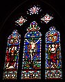
 St John the Evangelist - geograph.org.uk - 5417424.jpg 1,200 × 799; 384 KB
-
 St John the Evangelist - geograph.org.uk - 5417562.jpg 1,030 × 1,200; 455 KB
-
 St John the Evangelist - geograph.org.uk - 5417566.jpg 799 × 1,200; 256 KB
-
 St John the Evangelist - geograph.org.uk - 5417573.jpg 1,200 × 799; 286 KB
-
 St John the Evangelist - geograph.org.uk - 5417581.jpg 715 × 1,200; 422 KB
-
 St John the Evangelist - geograph.org.uk - 5417587.jpg 948 × 1,200; 580 KB
-
 St John the Evangelist - geograph.org.uk - 5417589.jpg 684 × 1,200; 356 KB
-
 St John the Evangelist - geograph.org.uk - 5417592.jpg 1,200 × 799; 282 KB
-
 St John the Evangelist - geograph.org.uk - 5417600.jpg 796 × 1,200; 338 KB
-
 St John the Evangelist - geograph.org.uk - 5417610.jpg 1,155 × 1,200; 553 KB
-
 St John the Evangelist - geograph.org.uk - 5417616.jpg 1,031 × 1,200; 539 KB
-
 St John the Evangelist - geograph.org.uk - 5417622.jpg 799 × 1,200; 242 KB
-
 St John the Evangelist - geograph.org.uk - 5418752.jpg 1,200 × 799; 503 KB
-
 Stoking up the fires - geograph.org.uk - 3227195.jpg 800 × 545; 270 KB
-
 Stone Stile at Kirkham Abbey - geograph.org.uk - 2078169.jpg 1,744 × 1,308; 1.83 MB
-
 Stranded on the weir - geograph.org.uk - 2917196.jpg 1,024 × 711; 265 KB
-
 Telephone exchange, Whitwell-on-the-Hill - geograph.org.uk - 2761964.jpg 1,024 × 768; 325 KB
-
 The A64 passing Whitwell on the Hill - geograph.org.uk - 2810245.jpg 3,264 × 2,448; 2.15 MB
-
 The Bridge at Kirkham Abbey - geograph.org.uk - 1938399.jpg 3,052 × 2,247; 3.02 MB
-
 The Bridge at Kirkham Abbey - geograph.org.uk - 2556803.jpg 2,800 × 1,800; 831 KB
-
 The crossroads at the Intakes - geograph.org.uk - 3721737.jpg 1,024 × 768; 195 KB
-
 The field with Whitwell Grange trig point - geograph.org.uk - 4079191.jpg 1,600 × 1,200; 583 KB
-
 The Hall Kirkham - geograph.org.uk - 2078218.jpg 1,744 × 1,308; 1.89 MB
-
 The Hall Kirkham Abbey - geograph.org.uk - 2078223.jpg 1,744 × 1,308; 1.69 MB
-
 The River Derwent above Kirkham Bridge - geograph.org.uk - 5379396.jpg 1,024 × 768; 207 KB
-
 The River Derwent at Kirkham Abbey - geograph.org.uk - 1938407.jpg 3,200 × 2,400; 2.68 MB
-
 The River Derwent below Kirkham Bridge - geograph.org.uk - 5379416.jpg 1,024 × 768; 159 KB
-
 The weir at Kirkham - geograph.org.uk - 5372769.jpg 1,024 × 768; 261 KB
-
 Top of car park - geograph.org.uk - 753200.jpg 640 × 478; 170 KB
-
 Top of Whitwell Hill - geograph.org.uk - 1295021.jpg 640 × 478; 153 KB
-
 Tout Hill, Whitwell on the Hill - geograph.org.uk - 5417415.jpg 1,200 × 799; 411 KB
-
 Towards the monument - geograph.org.uk - 3482095.jpg 640 × 427; 103 KB
-
 Track to A64 on Whitwell Hill - geograph.org.uk - 789902.jpg 640 × 478; 238 KB
-

-
 Train Crossing Centenary Way - geograph.org.uk - 2078183.jpg 1,744 × 1,308; 1.43 MB
-
 Trans Pennine Express - geograph.org.uk - 2524528.jpg 3,008 × 2,000; 2.47 MB
-
 Upstream from Kirkham Bridge - geograph.org.uk - 5488286.jpg 640 × 427; 209 KB
-
 View across the Derwent - geograph.org.uk - 4353522.jpg 3,240 × 4,320; 3.49 MB
-
 View across the River Derwent, Kirkham - geograph.org.uk - 2917190.jpg 1,024 × 768; 278 KB
-
 View down to the railway - geograph.org.uk - 5379340.jpg 1,024 × 768; 196 KB
-

-
 View over the valley - geograph.org.uk - 3227132.jpg 1,024 × 768; 291 KB
-
 View towards Sheriff Hutton - geograph.org.uk - 3481498.jpg 640 × 427; 95 KB
-
 View towards Whitwell on the Hill - geograph.org.uk - 5379281.jpg 1,024 × 768; 190 KB
-
 Village Water Pump, Whitwell on the Hill - geograph.org.uk - 5417418.jpg 799 × 1,200; 547 KB
-
 Village Water Pump, Whitwell on the Hill - geograph.org.uk - 5417419.jpg 799 × 1,200; 616 KB
-
 Warning, Blue Hill ahead - geograph.org.uk - 2838534.jpg 1,024 × 768; 147 KB
-

-
 Weir at Kirkham Abbey - geograph.org.uk - 2094743.jpg 4,000 × 3,000; 2.97 MB
-
 What's going on^ - geograph.org.uk - 4353526.jpg 3,240 × 4,320; 3.35 MB
-
 Whitwell Grange - geograph.org.uk - 4079181.jpg 1,600 × 1,200; 801 KB
-
 Whitwell Grange Trig pillar - geograph.org.uk - 5880514.jpg 1,024 × 768; 253 KB
-
 Whitwell Grange Trig Point - geograph.org.uk - 447482.jpg 640 × 480; 63 KB
-
 Whitwell on the Hill War Memorial Plaque - geograph.org.uk - 5417429.jpg 956 × 1,200; 297 KB
-

-
 Whitwell-on-the-Hill - geograph.org.uk - 5549664.jpg 640 × 480; 370 KB
-
 Woodland at the top of Trout Hill - geograph.org.uk - 2761947.jpg 1,024 × 768; 330 KB
-
 Woodland on Blue Hill - geograph.org.uk - 2916219.jpg 1,024 × 768; 478 KB
-
 Fence 2 from 3 - geograph.org.uk - 753187.jpg 640 × 478; 209 KB
-

-
 Horses on second jump - geograph.org.uk - 753128.jpg 640 × 478; 239 KB
-
 Just before the second jump - geograph.org.uk - 753008.jpg 640 × 478; 218 KB


_road,_north_of_Whitwell-on-the-Hill_-_geograph.org.uk_-_2262315.jpg)


_-_geograph.org.uk_-_5493751.jpg)
_-_geograph.org.uk_-_5493753.jpg)


