Category:Whitwood
Jump to navigation
Jump to search
area of Castleford and former civil parish in Wakefield, West Yorkshire, England | |||||
| Upload media | |||||
| Instance of |
| ||||
|---|---|---|---|---|---|
| Location | Wakefield, West Yorkshire, Yorkshire and the Humber, England | ||||
 | |||||
Whitwood is an area of Castleford, West Yorkshire.
Subcategories
This category has the following 6 subcategories, out of 6 total.
C
- California Drive (3 F)
N
- The New Wheatsheaf, Whitwood (3 F)
R
- Rising Sun, Whitwood (4 F)
W
- Whitwood cemetery (2 F)
- Whitwood College (6 F)
- Whitwood Golf Club (5 F)
Media in category "Whitwood"
The following 77 files are in this category, out of 77 total.
-
 'Fairies Hill', Whitwood. - geograph.org.uk - 523033.jpg 640 × 381; 46 KB
-
 A brace of bridges - geograph.org.uk - 5651831.jpg 4,608 × 3,456; 4.02 MB
-

-
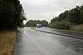
 A655 towards the M62 - geograph.org.uk - 2627957.jpg 1,600 × 1,200; 515 KB
-
 Altofts Lane towards Express Way - geograph.org.uk - 3856438.jpg 1,200 × 798; 303 KB
-
 B6421 Cutsyke Road - geograph.org.uk - 225569.jpg 640 × 390; 39 KB
-
 Beech House on Whitwood Lane, Whitwood - geograph.org.uk - 3856375.jpg 1,200 × 798; 317 KB
-
 Bend in the Calder - geograph.org.uk - 2014299.jpg 1,024 × 768; 176 KB
-
 Boats moored alongside the Calder. - geograph.org.uk - 5988272.jpg 1,024 × 683; 157 KB
-
 Bramham Road - Stamford Avenue - geograph.org.uk - 5125857.jpg 640 × 433; 46 KB
-
 Carr Beck Road - Carr Beck Drive - geograph.org.uk - 5126054.jpg 640 × 480; 72 KB
-
 Carr Beck View - Carr Beck Drive - geograph.org.uk - 5126051.jpg 640 × 480; 60 KB
-
 Castleford Premier Inn - geograph.org.uk - 4037623.jpg 2,048 × 1,536; 520 KB
-
 Chequerfield Close - Stamford Close - geograph.org.uk - 5125860.jpg 640 × 480; 68 KB
-
 College Grove - Willowbridge Lane - geograph.org.uk - 5125850.jpg 640 × 480; 78 KB
-
 Cutsyke allotments - geograph.org.uk - 119746.jpg 640 × 479; 144 KB
-

-

-

-
 Fairies Hill Cut, east end - geograph.org.uk - 867680.jpg 640 × 451; 68 KB
-
 Fairies Hill Wharf - geograph.org.uk - 867646.jpg 640 × 450; 55 KB
-
 Fairies Hill wharf, Whitwood - geograph.org.uk - 3277945.jpg 3,993 × 2,551; 1.93 MB
-
 Fairies Wharf on the River Calder - geograph.org.uk - 3856496.jpg 1,200 × 798; 285 KB
-
 Floodwater at Whitwood Mere Castleford - geograph.org.uk - 2784401.jpg 3,420 × 2,022; 992 KB
-
 Glenn Court - Pasture Drive - geograph.org.uk - 5126034.jpg 640 × 440; 63 KB
-
 Green Lane, Whitwood - geograph.org.uk - 3856301.jpg 1,200 × 798; 415 KB
-
 Greenbank Close - Pasture Drive - geograph.org.uk - 5126035.jpg 640 × 480; 71 KB
-
 Imex at Willowbridge Industrial Estate Castleford - geograph.org.uk - 2757190.jpg 3,673 × 2,335; 990 KB
-

-
 Looking towards Whitwood Junction - geograph.org.uk - 5702119.jpg 4,608 × 3,072; 2.82 MB
-
 Low Laithe Farm - geograph.org.uk - 225572.jpg 640 × 432; 48 KB
-
 M62 westbound - geograph.org.uk - 1323989.jpg 640 × 480; 43 KB
-
 M62 westbound - geograph.org.uk - 1323991.jpg 640 × 480; 42 KB
-

-
 Marston Court - College Grove - geograph.org.uk - 5125869.jpg 640 × 468; 50 KB
-

-
 Mexboro' Arms Hotel, Whitwood - geograph.org.uk - 3856351.jpg 1,200 × 798; 282 KB
-
 Mooring bollards on the River Calder - geograph.org.uk - 2163211.jpg 1,024 × 768; 171 KB
-
 Northern railcars at Whitwood Junction - geograph.org.uk - 4912803.jpg 800 × 600; 105 KB
-
-
 Pasture Drive - Pasture Way - geograph.org.uk - 5126029.jpg 640 × 460; 68 KB
-
 Pasture Way - Willowbridge Lane - geograph.org.uk - 5125877.jpg 640 × 480; 52 KB
-
 Path along the River Calder - geograph.org.uk - 3856506.jpg 1,200 × 798; 607 KB
-
 Path leading to Fairies Wharf - geograph.org.uk - 3856493.jpg 1,200 × 798; 519 KB
-

-
 Private road to a Lafarge Plant - geograph.org.uk - 3856459.jpg 1,200 × 798; 446 KB
-
 Public footpath off Express Way - geograph.org.uk - 3856441.jpg 1,200 × 798; 669 KB
-
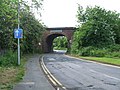 Railway Bridge - geograph.org.uk - 1312587.jpg 640 × 480; 112 KB
-
 Railway bridge on Whitwood Lane, Whitwood - geograph.org.uk - 3856391.jpg 1,200 × 798; 434 KB
-

-
 River Calder west of Methley Bridge - geograph.org.uk - 2974132.jpg 2,048 × 1,536; 600 KB
-
 Riverside path north of Fairies Hill - geograph.org.uk - 2974141.jpg 2,048 × 1,536; 518 KB
-
 Roundabout on the A639 - geograph.org.uk - 2627951.jpg 1,600 × 1,200; 429 KB
-
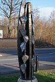 Sculpture on Green Lane, Whitwood - geograph.org.uk - 3856328.jpg 798 × 1,200; 402 KB
-
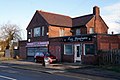 Shops on Wood Lane, Whitwood - geograph.org.uk - 3856309.jpg 1,200 × 798; 346 KB
-
 Stamford Avenue - College Grove - geograph.org.uk - 5125853.jpg 640 × 438; 51 KB
-
 The 'King Billy' - geograph.org.uk - 369304.jpg 640 × 471; 66 KB
-
 The Bridge Inn, Whitwood - geograph.org.uk - 3856405.jpg 1,200 × 798; 337 KB
-
 The Bridge Inn, Whitwood - geograph.org.uk - 3856408.jpg 798 × 1,200; 245 KB
-

-
 The former Briggs Memorial Hall, Whitwood - geograph.org.uk - 3856370.jpg 1,200 × 798; 343 KB
-
 The Mexboro' Arms Hotel - geograph.org.uk - 1995536.jpg 640 × 394; 52 KB
-
 The New Bistro Cafe - geograph.org.uk - 1312621.jpg 640 × 480; 73 KB
-
 The path up the railway embankment - geograph.org.uk - 3857083.jpg 1,200 × 798; 601 KB
-
 The River Calder at Whitwood Mere - geograph.org.uk - 4912819.jpg 800 × 600; 153 KB
-
 Toll Bar Road - Leeds Road - geograph.org.uk - 5158107.jpg 640 × 401; 64 KB
-
 Towton Drive - College Grove - geograph.org.uk - 5125863.jpg 640 × 459; 51 KB
-
 Trees on Whitwood Golf Course - geograph.org.uk - 4912796.jpg 800 × 600; 164 KB
-
 Valley Court - Pasture Drive - geograph.org.uk - 5126039.jpg 640 × 480; 118 KB
-

-
 Whitwood Common Lane - geograph.org.uk - 5856631.jpg 1,024 × 683; 165 KB
-

-

-
 Whitwood Lane - geograph.org.uk - 3410795.jpg 1,024 × 660; 212 KB
-
 Whitwood Lodge on Whitwood Lane, Whitwood - geograph.org.uk - 3856382.jpg 1,200 × 798; 358 KB
-
 Winter floods, Whitwood Mere - geograph.org.uk - 663126.jpg 640 × 439; 80 KB
-
 Wood Green off Wood Lane, Whitwood - geograph.org.uk - 3856304.jpg 1,200 × 798; 243 KB


