Category:Wick St Lawrence
Jump to navigation
Jump to search
English: Wick St. Lawrence is a civil parish and village in Somerset, England. It falls within the unitary authority of North Somerset. Its population in the 2001 census was 1,296.
village and civil parish in Somerset, United Kingdom  | |||||
| Upload media | |||||
| Instance of | |||||
|---|---|---|---|---|---|
| Location | North Somerset, Somerset, South West England, England | ||||
 | |||||
Subcategories
This category has only the following subcategory.
Media in category "Wick St Lawrence"
The following 45 files are in this category, out of 45 total.
-
 Access track, Environment Agency works site - geograph.org.uk - 4540931.jpg 1,024 × 737; 141 KB
-
 Boats on the River Banwell - geograph.org.uk - 4540860.jpg 1,024 × 768; 187 KB
-
 Bridge on Ebdon Road - geograph.org.uk - 4540368.jpg 1,024 × 768; 228 KB
-
 Clevedon from the air - geograph.org.uk - 3737042.jpg 3,264 × 2,448; 5.66 MB
-
 Coastal defences at the mouth of River Yeo - geograph.org.uk - 4540876.jpg 1,024 × 768; 221 KB
-
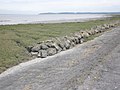 Coastal defences, Wick Warth - geograph.org.uk - 4540867.jpg 1,024 × 768; 198 KB
-
 Concrete blockhouse, Wick Warth - geograph.org.uk - 4540872.jpg 1,024 × 768; 227 KB
-
 Cottage in Wick St Lawrence - geograph.org.uk - 4540445.jpg 1,024 × 768; 195 KB
-
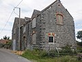 Dilapidated house on Wick Road - geograph.org.uk - 4540391.jpg 1,024 × 768; 184 KB
-
 Direction Sign - Signpost in Ebdon - geograph.org.uk - 6102255.jpg 1,170 × 1,795; 156 KB
-
 Dolecroft Lane - geograph.org.uk - 4540970.jpg 1,024 × 768; 162 KB
-
 Earthworks, Congresbury Yeo River banks scheme - geograph.org.uk - 4540892.jpg 1,024 × 768; 208 KB
-
 Ebdon Bow Farm - geograph.org.uk - 4540359.jpg 1,024 × 803; 140 KB
-
 Ebdon Lane - geograph.org.uk - 4540986.jpg 1,024 × 768; 205 KB
-
 Entrance Woodspring School - geograph.org.uk - 4541059.jpg 1,024 × 801; 136 KB
-
 Farm building, Bourton - geograph.org.uk - 4540960.jpg 1,024 × 768; 169 KB
-
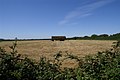
 Field, east of Bourton Lane - geograph.org.uk - 4540978.jpg 1,024 × 768; 211 KB
-
 Fishing boat, River Banwell estuary - geograph.org.uk - 4540851.jpg 1,024 × 768; 162 KB
-
 Hay meadow, Lower Wick - geograph.org.uk - 4540855.jpg 1,024 × 768; 256 KB
-
 Houses on Hodder's Lane - geograph.org.uk - 4540943.jpg 1,024 × 768; 161 KB
-
 Maize crop, Lower Wick Farm - geograph.org.uk - 4540544.jpg 1,024 × 768; 242 KB
-
 Mulberry Farm - geograph.org.uk - 4540923.jpg 1,024 × 768; 120 KB
-
 Myrtle Cottage, Icelton - geograph.org.uk - 4540917.jpg 1,024 × 768; 168 KB
-
 North Somerset , The River Banwell - geograph.org.uk - 3162948.jpg 4,288 × 2,848; 6.17 MB
-

-

-

-
 River Banwell - geograph.org.uk - 4540858.jpg 1,024 × 768; 198 KB
-
 River Yeo - geograph.org.uk - 4540882.jpg 1,024 × 768; 147 KB
-
 River Yeo - geograph.org.uk - 4540897.jpg 1,024 × 768; 208 KB
-

-
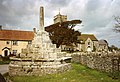
 Stone Cross, Wick St Lawrence - geograph.org.uk - 4540481.jpg 1,024 × 768; 218 KB
-
 The Congresbury Yeo - geograph.org.uk - 4540911.jpg 1,024 × 768; 173 KB
-
 Turning for Hodders Lane - geograph.org.uk - 4540948.jpg 1,024 × 768; 226 KB
-
 View across estuary from sea wall - geograph.org.uk - 1542889.jpg 640 × 480; 64 KB
-
 Warth Lane - geograph.org.uk - 4540507.jpg 1,024 × 768; 177 KB
-
 Wheatfield Drive, Ebdon - geograph.org.uk - 4540341.jpg 1,024 × 803; 140 KB
-
 Wick St Lawrence , M5 Motorway - geograph.org.uk - 6283768.jpg 6,000 × 4,000; 4.52 MB
-
 Wick St Lawrence sewage treatment works - geograph.org.uk - 536741.jpg 640 × 426; 106 KB
-
 Wick St Lawrence Wharf - geograph.org.uk - 73638.jpg 640 × 397; 104 KB
-
 Wick St Lawrence.jpg 640 × 438; 141 KB
-

-
 Works building, Ebdon Lane - geograph.org.uk - 4541052.jpg 1,024 × 768; 131 KB
-
 Hay Harvest - geograph.org.uk - 536725.jpg 640 × 426; 123 KB
-
 View ENE across bay towards Clevedon - geograph.org.uk - 357298.jpg 640 × 480; 114 KB


