Category:Wicken Bonhunt
Jump to navigation
Jump to search
English: Wicken Bonhunt is a small village in Essex population of about 50.

village and civil parish in Essex, England, UK  | |||||
| Upload media | |||||
| Instance of | |||||
|---|---|---|---|---|---|
| Location | Uttlesford, Essex, East of England, England | ||||
 | |||||
Subcategories
This category has the following 2 subcategories, out of 2 total.
C
S
Media in category "Wicken Bonhunt"
The following 45 files are in this category, out of 45 total.
-
 B1038 at Wickham Bonhunt - geograph.org.uk - 4060631.jpg 1,600 × 1,106; 602 KB
-
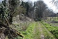
 Bridleway - with horse riders - geograph.org.uk - 6104114.jpg 1,600 × 1,067; 213 KB
-
 Bridleway and open barn - geograph.org.uk - 6104102.jpg 1,600 × 1,067; 313 KB
-
 Bridleway out of Wicken Bonhunt - geograph.org.uk - 6104097.jpg 1,600 × 1,067; 808 KB
-
 Canopied Ricking Road Wicken Bonhunt Essex England.jpg 3,420 × 5,328; 24.81 MB
-

-
 Cottage at Wicken Bonhunt Essex England.jpg 5,472 × 3,648; 22.37 MB
-
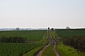
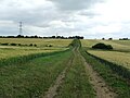
 Electric Pylons - geograph.org.uk - 6122388.jpg 768 × 1,024; 203 KB
-

-
 Erne Cottage and Mill House - geograph.org.uk - 5947651.jpg 1,200 × 942; 243 KB
-
 Field east of Rickling Road - geograph.org.uk - 6053031.jpg 1,024 × 768; 308 KB
-
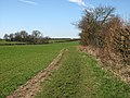
 Footpath - geograph.org.uk - 5236599.jpg 1,024 × 768; 237 KB
-
 Footpath Junction - geograph.org.uk - 5236590.jpg 1,024 × 768; 373 KB
-
 Footpath Pylons And Fields - geograph.org.uk - 5523814.jpg 1,024 × 768; 183 KB
-
 Former Telephone Box and Public House - geograph.org.uk - 5523804.jpg 1,024 × 768; 277 KB
-
 Gate And Old Barn - geograph.org.uk - 5523809.jpg 1,024 × 768; 205 KB
-
 Harcamlow Way - geograph.org.uk - 6123929.jpg 1,024 × 768; 115 KB
-
 Harcamlow Way north of Wicken Bonhunt - geograph.org.uk - 6104130.jpg 1,600 × 1,067; 746 KB
-
 Houses on B1038 - geograph.org.uk - 3494256.jpg 4,320 × 3,240; 3.46 MB
-
 M11 bridge over Wicken Road - geograph.org.uk - 4063880.jpg 1,600 × 1,200; 606 KB
-
 M11 northbound - geograph.org.uk - 3455252.jpg 1,578 × 946; 892 KB
-
 M11, southbound - geograph.org.uk - 3765592.jpg 640 × 472; 52 KB
-
 New steel-framed construction, Wicken Bonhunt - geograph.org.uk - 6052985.jpg 1,024 × 768; 345 KB
-
 On the way to Arkesden (geograph 3890838).jpg 1,200 × 900; 1.53 MB
-
 Open Road - geograph.org.uk - 5236618.jpg 1,024 × 768; 244 KB
-
 Path through trees - geograph.org.uk - 3890832.jpg 1,200 × 900; 1.59 MB
-
 Paths part at the crest of the hill - geograph.org.uk - 3890846.jpg 1,200 × 900; 1.28 MB
-
 Pilgrims Cottage - geograph.org.uk - 5947968.jpg 1,200 × 900; 183 KB
-
 Pylons - geograph.org.uk - 5523827.jpg 768 × 1,024; 118 KB
-
 Rickling Road - geograph.org.uk - 4061929.jpg 3,312 × 2,272; 3.4 MB
-
 Rickling Road descends to Wicken Bonhunt - geograph.org.uk - 6052965.jpg 1,024 × 768; 261 KB
-
 St Helen's Chapel - geograph.org.uk - 6123931.jpg 1,024 × 768; 109 KB
-
 Sugar beet by Wicken Road - geograph.org.uk - 4063888.jpg 1,600 × 1,200; 759 KB
-
 Thatched cottage in Wicken Bonhunt - geograph.org.uk - 124840.jpg 640 × 427; 74 KB
-
 Thatched cottage in Wicken Bonhunt - geograph.org.uk - 124842.jpg 640 × 427; 84 KB
-
 The B1038, Wicken Bonhunt - geograph.org.uk - 5585625.jpg 2,048 × 1,536; 1.01 MB
-
 The path to Arkesden - geograph.org.uk - 3890841.jpg 1,200 × 900; 1.6 MB
-
 To Newport - geograph.org.uk - 5236606.jpg 763 × 1,024; 295 KB
-
 Tree by Rickling Road - geograph.org.uk - 6053018.jpg 1,024 × 768; 336 KB
-
 View east from farm track south of Wicken Bonhunt - geograph.org.uk - 6104088.jpg 1,600 × 1,067; 405 KB
-
 View NNW from Rickling Road - geograph.org.uk - 3889680.jpg 640 × 480; 158 KB
-
 White houses, Wicken Bonhunt - geograph.org.uk - 3889690.jpg 640 × 428; 110 KB
-
 Wicken Bonhunt - St Helen's Chapel - geograph.org.uk - 5250221.jpg 1,600 × 1,067; 413 KB
-
 Wicken Road - geograph.org.uk - 4063883.jpg 1,600 × 1,200; 594 KB
-
 Works entrance, M11 - geograph.org.uk - 2587288.jpg 640 × 430; 56 KB


.jpg)


