Category:Widford, Oxfordshire
Jump to navigation
Jump to search
village in Oxfordshire, United Kingdom  | |||||
| Upload media | |||||
| Instance of | |||||
|---|---|---|---|---|---|
| Location | Swinbrook and Widford, West Oxfordshire, Oxfordshire, South East England, England | ||||
 | |||||
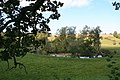
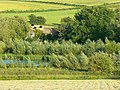
English: Widford is a hamlet on the River Windrush about east of Burford in West Oxfordshire. The village was an exclave of Gloucestershire until 1844.
Subcategories
This category has only the following subcategory.
S
- St Oswald's Church, Widford (22 F)
Media in category "Widford, Oxfordshire"
The following 17 files are in this category, out of 17 total.
-
 Bend in the Windrush - geograph.org.uk - 1516275.jpg 640 × 427; 89 KB
-
-
 Footpath to Widford - geograph.org.uk - 1238747.jpg 640 × 480; 101 KB
-
 Meadow north of Widford - geograph.org.uk - 860868.jpg 640 × 480; 171 KB
-
 P1040517 - Flickr - gailhampshire.jpg 1,101 × 1,107; 240 KB
-
 P1040518 - Flickr - gailhampshire.jpg 1,272 × 1,326; 218 KB
-
 P1040521 - Flickr - gailhampshire.jpg 1,176 × 1,104; 197 KB
-
 River Windrush at Widford - geograph.org.uk - 130770.jpg 480 × 640; 337 KB
-
 River Windrush from White Hill, Widford - geograph.org.uk - 130766.jpg 640 × 480; 208 KB
-
 River Windrush(es) - geograph.org.uk - 327317.jpg 640 × 480; 127 KB
-
 Snow near Widford - geograph.org.uk - 1155123.jpg 640 × 429; 80 KB
-
-
 Widford VRwallbox.jpg 1,740 × 2,900; 2.16 MB
-
 Bridleway and disused quarries - geograph.org.uk - 293483.jpg 640 × 427; 94 KB
-
 Snow on the A40 at Swinbrook - geograph.org.uk - 349319.jpg 640 × 444; 61 KB
-
 Sunset on the Path to St Oswald's Chapel - geograph.org.uk - 300775.jpg 480 × 640; 111 KB
-
 The Windrush in flood - geograph.org.uk - 293481.jpg 640 × 427; 68 KB

._-_Flickr_-_gailhampshire.jpg)


_-_geograph.org.uk_-_327317.jpg)


