Category:Wikivoyage maps
Jump to navigation
Jump to search
Subcategories
This category has the following 9 subcategories, out of 9 total.
- Wikivoyage maps of India (60 F)
?
D
- Wikivoyage map data (7 P)
- Wikivoyage DE maps (13 F)
I
- Wikivoyage map icons (46 F)
T
- Wikivoyage map templates (15 F)
- Wikivoyage Travel Maps (8 F)
W
- Wikivoyage maps of the world (5 F)
Media in category "Wikivoyage maps"
The following 200 files are in this category, out of 212 total.
(previous page) (next page)-
 Achterhoek Wikivoyage Map rev.png 4,250 × 3,192; 1.6 MB
-
 Achterhoek Wikivoyage Map.png 6,000 × 4,687; 2.34 MB
-
 Alentejo Map.png 625 × 413; 153 KB
-
 Algarve Map.png 550 × 141; 52 KB
-
 Amstelland Wikivoyage Map.png 2,000 × 1,413; 580 KB
-
 Amstelland Wikivoyage Map.svg 866 × 612; 105 KB
-
 Argentina regions map (es).png 1,731 × 3,008; 865 KB
-
 Arizona Wikivoyage static map.png 1,000 × 1,230; 198 KB
-
 Arizona Wikivoyage static map.svg 893 × 1,099; 414 KB
-
 Bahrain map WV.png 2,500 × 2,752; 1,024 KB
-
 Beiras Static Map.png 625 × 387; 164 KB
-
 Brooklyn districts map.png 2,000 × 2,162; 3.44 MB
-
 Cape Breton Island map.png 3,073 × 3,255; 1.71 MB
-
 Cape Breton Island map.svg 750 × 625; 2.51 MB
-
 Central Canberra static map.png 1,624 × 1,352; 717 KB
-
 Central Canberra static map.svg 750 × 625; 93 KB
-
 Chile Regions map.png 3,000 × 4,770; 1.55 MB
-
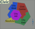
 Civic regions map.png 1,684 × 1,070; 943 KB
-
 Civic regions map.svg 750 × 625; 6.09 MB
-
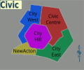
 Civic static map.png 1,148 × 956; 497 KB
-
 Civic static map.svg 750 × 625; 39 KB
-
 Coastal diving regions of SA.png 3,000 × 2,640; 308 KB
-
 Dakar map osm.png 861 × 831; 376 KB
-
 Dallas Map - Wikivoyage.svg 2,800 × 3,000; 72 KB
-
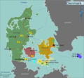 Denmark regions map102.png 2,371 × 2,191; 780 KB
-
 Devon Wikivoyage static map.png 1,500 × 1,378; 468 KB
-
 Devon Wikivoyage static map.svg 1,292 × 1,187; 2.35 MB
-
 Downtown Shanghai districts map.png 406 × 476; 251 KB
-
 Drenthe Wikivoyage Map.png 6,000 × 6,081; 2.35 MB
-
 East African islands.png 1,249 × 1,749; 182 KB
-
 East Coast regions map.png 2,344 × 1,953; 879 KB
-
 East Coast regions map.svg 750 × 625; 1.94 MB
-
 Eastern Europe Wikivoyage map.png 1,990 × 2,373; 565 KB
-
 Ermittlung Koordinaten GeoMap.png 357 × 200; 25 KB
-
 Europe regions minimal cities--mod Latin Europe.png 3,000 × 2,610; 1.2 MB
-
 Europe regions minimal cities--mod Latin Europe.svg 1,600 × 1,394; 1.53 MB
-
 Finnish Lapland regions map.png 4,392 × 4,593; 2.46 MB
-
 Finnish Lapland regions map.svg 750 × 625; 2.69 MB
-
 Flevoland Wikivoyage Map.png 4,804 × 5,393; 2.11 MB
-
 Flevoland Wikivoyage Map.svg 1,537 × 1,726; 175 KB
-
 Germany Regions 02.png 503 × 600; 221 KB
-
 Gold Creek Village.png 1,899 × 1,582; 354 KB
-
 Gold Creek Village.svg 750 × 625; 4.3 MB
-
 Greater Brisbane regions map.png 1,544 × 1,286; 982 KB
-
 Greater Brisbane regions map.svg 750 × 625; 2.2 MB
-
 Greater Geelong static map.png 768 × 1,024; 387 KB
-
 Greater Sydney regions map.png 1,732 × 1,442; 1.26 MB
-
 Greater Sydney regions.svg 750 × 625; 3.51 MB
-
 Groningen (province) Wikivoyage Map.png 2,000 × 2,277; 951 KB
-
 Groningen (province) Wikivoyage Map.svg 1,484 × 1,689; 5.78 MB
-
 GTA regions map.png 2,344 × 1,953; 795 KB
-
 GTA regions map.svg 750 × 625; 2.86 MB
-
 Hall map.png 1,185 × 983; 361 KB
-
 Hall map.svg 750 × 625; 4.65 MB
-
 Haute-Savoie région wikivoyage.png 2,000 × 1,711; 158 KB
-
 Heard Island and McDonald Islands map.png 1,563 × 1,302; 511 KB
-
 Heard Island and McDonald Islands map.svg 750 × 625; 1.92 MB
-
 Helsinki Wikivoyage district map 2022.png 1,300 × 1,015; 621 KB
-
 Helsinki Wikivoyage district map 2022.svg 744 × 1,052; 1.1 MB
-
 Hungary static map.png 1,931 × 1,267; 371 KB
-
 Hunter, NSW map.png 2,344 × 1,953; 452 KB
-
 Hunter, NSW map.svg 750 × 625; 13.71 MB
-
 Illawarra region map.png 6,136 × 11,774; 3.04 MB
-
 Illawarra region map.svg 750 × 625; 3.18 MB
-
 KwaZulu-Natal regions map.png 4,688 × 3,906; 1.86 MB
-
 KwaZulu-Natal regions map.svg 750 × 625; 1.7 MB
-
 Lantau WV locator map.svg 1,454 × 1,083; 145 KB
-
 Latin Europe Wikivoyage Map.png 3,000 × 2,100; 818 KB
-
 Latin Europe Wikivoyage Map.svg 802 × 562; 256 KB
-
 Latvia regions map (3).pdf 1,752 × 1,033; 321 KB
-
 Latvia regions map for wikivoyage.svg 1,052 × 620; 1.42 MB
-
 Leeds map.png 1,563 × 1,302; 423 KB
-
 Leeds map.svg 750 × 625; 15.55 MB
-
 Limburg Wikivoyage Map -SecRoads.png 2,562 × 6,000; 1.33 MB
-
 Limburg Wikivoyage Map.png 2,562 × 6,000; 2.45 MB
-
 Litorale adriatico abruzzese.png 529 × 667; 143 KB
-
 LocDBMap.PNG 919 × 588; 67 KB
-
 Lofoten Island Wikivoyage map.png 2,657 × 2,301; 419 KB
-
 Louisiana static map.png 2,001 × 1,781; 273 KB
-
 Louisiana static map.svg 103 × 91; 374 KB
-
 Luxembourg Wikivoyage Map 2017.png 2,500 × 3,700; 1.31 MB
-
 Luxembourg Wikivoyage Map 2017.svg 1,506 × 2,229; 182 KB
-
 Manchester WV map.png 1,200 × 1,151; 1.04 MB
-
 Map of Banten region Wikivoyage.png 622 × 588; 60 KB
-
 Map of Bogor Raya region Wikivoyage.png 614 × 588; 59 KB
-
 Map of East Parahyangan region Wikivoyage.png 628 × 537; 56 KB
-
 Map of George Town, Penang, Malaysia.png 485 × 600; 144 KB
-
 Map of Greater Jakarta region Wikivoyage.png 497 × 461; 46 KB
-
 Map of Luzon.png 1,380 × 2,450; 112 KB
-
 Map of North Coast West Java region Wikivoyage.png 792 × 486; 68 KB
-
 Map of Parahyangan region Wikivoyage.png 588 × 588; 61 KB
-
 Map of South America.png 493 × 600; 163 KB
-
 Map of Southern Russia-en.png 4,185 × 3,409; 2.69 MB
-
 Map of Western Java regions.png 1,085 × 663; 122 KB
-
 Map-Africa-Regions-Islands-tr.png 991 × 1,030; 377 KB
-
 Map-Africa-Regions-Islands.png 991 × 1,030; 337 KB
-
 Map-cairo-wikivoyage.svg 1,240 × 1,000; 2.16 MB
-
 Map-USA-Pacific Northwest01.png 848 × 1,037; 149 KB
-
 Map-USA-Regions02.png 2,506 × 2,600; 1.65 MB
-
 Mauricie regions map.png 1,524 × 1,268; 639 KB
-
 Mauricie regions map.svg 750 × 625; 3.41 MB
-
 Minas Gerais regions map.png 5,469 × 4,557; 1.52 MB
-
 Minas Gerais regions map.svg 750 × 625; 1.92 MB
-
 Mount Buller Village Map.png 3,000 × 2,422; 621 KB
-
 New Buffalo districts reference map.png 1,500 × 2,299; 1.94 MB
-
 New England NSW regions map.png 1,262 × 1,048; 1.01 MB
-
 New England NSW regions map.svg 750 × 625; 1.9 MB
-
 New England regions map.png 1,648 × 1,374; 860 KB
-
 New England regions map.svg 750 × 625; 632 KB
-
 New South Wales regions map.png 1,592 × 1,386; 1.26 MB
-
 New South Wales regions map.svg 744 × 1,052; 1.66 MB
-
 Normandy regions map (it).png 3,125 × 2,467; 772 KB
-
 Normandy regions map (it).svg 750 × 625; 1.91 MB
-
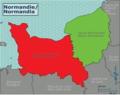
 Normandy regions map.png 3,125 × 2,458; 746 KB
-
 Normandy regions map.svg 750 × 625; 1.91 MB
-
 North Dakota Wikivoyage Map.png 4,992 × 3,050; 1.11 MB
-
 North Dakota Wikivoyage Map.svg 5,616 × 3,432; 253 KB
-
 Northern Ontario Static Map.svg 703 × 641; 203 KB
-
 Northern Portugal Static Map.png 625 × 240; 109 KB
-
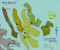 Norðoyar regions map.png 3,909 × 3,262; 1.73 MB
-
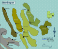 Norðoyar regions map.svg 750 × 625; 3.29 MB
-
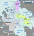
 Nunavut Static Map.png 431 × 459; 163 KB
-
 Nunavut Static Map.svg 460 × 490; 352 KB
-
 Oklahoma City Wikivoyage Map.png 3,000 × 2,797; 766 KB
-
 Oklahoma City Wikivoyage Map.svg 975 × 909; 181 KB
-
 Oklahoma Static Map.png 1,001 × 533; 105 KB
-
 Oklahoma Static Map.svg 8,469 × 4,511; 105 KB
-
 Oregon Trail wikivoyage map svg.svg 314 × 178; 192 KB
-
 Oregon Trail wikivoyage map.png 3,008 × 1,705; 454 KB
-
 Outback NSW map.png 924 × 770; 208 KB
-
 Outback NSW map.svg 750 × 625; 6.97 MB
-
 Outback NSW regions map.png 3,917 × 3,266; 1.21 MB
-
 Outback NSW regions map.svg 750 × 625; 3.02 MB
-
 Paraná regions map.png 3,906 × 3,255; 822 KB
-
 Paraná regions map.svg 750 × 625; 3.59 MB
-
 Parliamentary Triangle.png 1,899 × 1,553; 797 KB
-
 Parliamentary Triangle.svg 750 × 625; 4.19 MB
-
 Places visited by LucasJV January 2014.png 834 × 642; 196 KB
-
 Pleasanton Map.png 1,276 × 930; 198 KB
-
 Pleasanton Open Street Map.png 2,000 × 2,829; 226 KB
-
 Portugal Static Map.png 625 × 915; 336 KB
-
 Praguedistrctstravel.png 700 × 525; 34 KB
-
 Pulu Keeling NP map.png 1,899 × 1,582; 564 KB
-
 Pulu Keeling NP map.svg 750 × 625; 935 KB
-
 Punjab (Pakistan) Divisions n.jpg 640 × 762; 83 KB
-
 Queensland Wikivoyage map.png 5,906 × 5,906; 1.51 MB
-
 Reg Rusia Wikitravel diseño 2.jpg 800 × 600; 62 KB
-
 Rivierenland Wikivoyage Map.png 6,000 × 4,062; 1.9 MB
-
 Région wikivoyage Troms.png 6,091 × 5,007; 2.23 MB
-
 Saskatchewan Updated Static Map.png 1,500 × 1,925; 946 KB
-
 Savoie arrondissement wikivoyage png.png 2,000 × 1,575; 161 KB
-
 Savoie arrondissement wikivoyage.svg 512 × 402; 11 KB
-
 SE Queensland regions map.png 2,488 × 3,539; 1.39 MB
-
 SE Queensland regions map.svg 744 × 1,052; 2.38 MB
-
 Shanghai districts map inner.svg 835 × 730; 3.02 MB
-
 Singapore Harbourfront and Sentosa map 01.svg 1,855 × 809; 1.71 MB
-
 Singapore Harbourfront and Sentosa map 02.png 3,008 × 3,418; 1.93 MB
-
 Singapore MRT LRT system map Wikivoyage.png 2,000 × 1,513; 628 KB
-
 South Australia regions map.png 5,628 × 6,500; 2.42 MB
-
 South Australia regions map.svg 750 × 625; 9.37 MB
-
 Southeastern New South Wales regions map.png 1,330 × 1,399; 374 KB
-
 Southeastern New South Wales regions map.svg 750 × 625; 1.98 MB
-
 Southern Tasmania regions map.png 1,694 × 1,416; 1.47 MB
-
 Southern Tasmania regions map.svg 750 × 625; 2.69 MB
-
 Southern Tasmania regions.png 1,564 × 1,304; 1.27 MB
-
 Southern Tasmania regions.svg 750 × 625; 8.21 MB
-
 Southwestern Counties Ontario Map Wikivoyage.png 1,405 × 2,000; 324 KB
-
 Southwestern Ontario Static Map.svg 394 × 342; 29 KB
-
 Spain map.png 1,996 × 1,471; 742 KB
-
 Sydfynske Øhav Wikivoyage Map.png 3,000 × 2,704; 1.02 MB
-
 Sydfynske Øhav Wikivoyage Map.svg 2,767 × 2,494; 260 KB
-
 Tagus Valley Map.png 625 × 438; 165 KB
-
 Tasmania map.png 2,339 × 1,950; 1.02 MB
-
 Tasmania map.svg 750 × 625; 2.01 MB
-
 Tuvalu map.png 1,017 × 1,266; 227 KB
-
 Veluwerand Wikivoyage Map.png 3,675 × 1,800; 904 KB
-
 Vesteralen wikivoyage map.png 2,405 × 2,117; 541 KB
-
 Vienna Wikivoyage Map.png 3,000 × 2,812; 2.08 MB
-
 Vienna Wikivoyage Map.svg 2,822 × 2,645; 335 KB
-
 Volusia County static map.svg 953 × 805; 85 KB
-
 Vágar static map.png 3,909 × 3,258; 1.37 MB
-
 Vágar static map.svg 750 × 625; 2.89 MB
-
 West Frisian Islands Wikivoyage Map.png 5,000 × 2,680; 1.35 MB
-
 West Frisian Islands Wikivoyage Map.svg 2,380 × 1,276; 201 KB
-
 Wikivoyage Aude region map.png 3,000 × 2,167; 818 KB
-
 Wikivoyage Las Vegas district map.png 967 × 864; 217 KB
-
 Wikivoyage Las Vegas district map.svg 744 × 1,052; 483 KB
-
 Wikivoyage map Namur.png 501 × 584; 173 KB
-
 Wikivoyage Map of Zeeland.svg 2,405 × 2,307; 178 KB
-
 Wikivoyage Melbourne district map.png 925 × 695; 173 KB
-
 Wikivoyage Melbourne district map.svg 744 × 1,052; 449 KB
-
 Wikivoyage Montreal district map.png 1,591 × 1,199; 452 KB
-
 Wikivoyage Montreal district map.svg 744 × 1,052; 681 KB
-
 Wikivoyage Nordland subdivision.png 5,839 × 8,058; 3.26 MB
-
 Wikivoyage paris map.svg 512 × 333; 1.45 MB
-
 Wikivoyage région map of Reunion fr.png 1,429 × 1,266; 218 KB
-
 Wikivoyage Taipei Districts.png 1,200 × 1,476; 521 KB
-
 Wikivoyage Taipei Districts.svg 1,000 × 1,000; 636 KB
-
 Wikivoyage US regions - American Southwest states.jpg 572 × 371; 107 KB
-
 Wikivoyage US regions - Mid-Atlantic states.jpg 572 × 371; 106 KB


.png)


_Wikivoyage_Map.png)
_Wikivoyage_Map.svg)


.png)
.svg)


_Divisions_n.jpg)


