Category:Willem II Straat, Tilburg
Jump to navigation
Jump to search
| Object location | | View all coordinates using: OpenStreetMap |
|---|
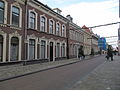
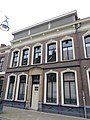
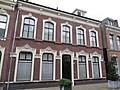
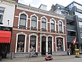
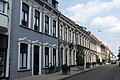
Nederlands: Afbeeldingen van de Willem II Straat in het Dwaalgebied in het stadsdeel Tilburg Centrum in de gemeente Tilburg in de provincie Noord-Brabant in het zuiden van Nederland. Nabij het Pieter Vreedeplein Onder meer bereikbaar vanaf de Spoorlaan
street in Tilburg, the Netherlands  | |||||
| Upload media | |||||
| Instance of | |||||
|---|---|---|---|---|---|
| Location | Tilburg, North Brabant, Netherlands | ||||
| Street address |
| ||||
 | |||||
Subcategories
This category has the following 10 subcategories, out of 10 total.
6
C
H
S
T
- Theater De Vorst (57 F)
W
- Willem II Straat 40-42, Tilburg (23 F)
- Willem II Straat 45, Tilburg (14 F)
Media in category "Willem II Straat, Tilburg"
The following 97 files are in this category, out of 97 total.
-
 Hoek Willem II Straat Heuvelstraat Tilburg P1170095.jpg 4,000 × 2,672; 5.68 MB
-
 Hoek Willem II Straat Heuvelstraat Tilburg P1170096.jpg 4,000 × 2,672; 5.64 MB
-
 Overzicht - Tilburg - 20209485 - RCE.jpg 1,200 × 785; 211 KB
-
 Overzicht - Tilburg - 20209486 - RCE.jpg 1,200 × 780; 208 KB
-
 Overzicht - Tilburg - 20209487 - RCE.jpg 1,200 × 788; 207 KB
-
 Overzicht - Tilburg - 20209488 - RCE.jpg 1,200 × 781; 214 KB
-
 Overzicht - Tilburg - 20209489 - RCE.jpg 788 × 1,200; 231 KB
-
 Overzicht - Tilburg - 20209491 - RCE.jpg 1,200 × 788; 226 KB
-
 Overzicht - Tilburg - 20209498 - RCE.jpg 1,200 × 788; 229 KB
-
 Overzicht - Tilburg - 20209500 - RCE.jpg 788 × 1,200; 200 KB
-
 Overzicht - Tilburg - 20209501 - RCE.jpg 1,200 × 788; 228 KB
-
 Overzicht - Tilburg - 20209502 - RCE.jpg 788 × 1,200; 211 KB
-
 Overzicht - Tilburg - 20209503 - RCE.jpg 788 × 1,200; 221 KB
-
 Overzicht - Tilburg - 20209504 - RCE.jpg 1,200 × 788; 230 KB
-
 Overzicht - Tilburg - 20209505 - RCE.jpg 1,200 × 788; 215 KB
-
 Overzicht - Tilburg - 20209507 - RCE.jpg 788 × 1,200; 205 KB
-
 Overzicht - Tilburg - 20209508 - RCE.jpg 1,200 × 788; 210 KB
-
 Overzicht - Tilburg - 20209509 - RCE.jpg 1,200 × 788; 201 KB
-
 Overzicht - Tilburg - 20209510 - RCE.jpg 1,200 × 788; 205 KB
-
 Overzicht - Tilburg - 20209516 - RCE.jpg 1,200 × 788; 237 KB
-
 Overzicht - Tilburg - 20209518 - RCE.jpg 1,200 × 788; 211 KB
-
 Overzicht voorgevel - Tilburg - 20344336 - RCE.jpg 783 × 1,200; 216 KB
-
 Overzicht voorgevel - Tilburg - 20344349 - RCE.jpg 783 × 1,200; 234 KB
-
 Overzicht voorgevel - Tilburg - 20344350 - RCE.jpg 783 × 1,200; 225 KB
-
 Overzicht voorgevel kantoor - Tilburg - 20344338 - RCE.jpg 1,200 × 783; 205 KB
-
 Overzicht voorgevel kantoor - Tilburg - 20344339 - RCE.jpg 783 × 1,200; 216 KB
-
 Reshare Store Tilburg P1360327.jpg 4,000 × 2,672; 5.64 MB
-
 Reshare Store Tilburg P1360328.jpg 4,000 × 2,672; 5.61 MB
-
 RM521224 Tilburg - Willem II Straat 31.jpg 2,592 × 1,944; 1.38 MB
-
 RM521225 Tilburg - Willem II Straat 39.jpg 2,592 × 1,944; 1.3 MB
-
 RM521230 Tilburg - Willem II Straat 55-57.jpg 2,592 × 1,944; 1.43 MB
-
 Slagerij LeJeune P1360323.jpg 4,000 × 2,672; 5.55 MB
-
 Slagerij LeJeune P1360324.jpg 2,672 × 4,000; 5.61 MB
-
 Tilburg - Willem II Straat.jpg 2,592 × 1,944; 1.16 MB
-
 Voorgevel - Tilburg - 20209499 - RCE.jpg 788 × 1,200; 219 KB
-
 Willem II Straat 1, Tilburg.jpg 3,000 × 4,000; 3.17 MB
-
 Willem II Straat 11, Tilburg.jpg 3,000 × 4,000; 3.35 MB
-
 Willem II Straat 13, Tilburg.jpg 3,000 × 4,000; 3.39 MB
-
 Willem II Straat 14, Tilburg (2).jpg 3,000 × 4,000; 2.94 MB
-
 Willem II Straat 14, Tilburg.jpg 3,000 × 4,000; 3.01 MB
-
 Willem II Straat 15, Tilburg.jpg 3,000 × 4,000; 3.52 MB
-
 Willem II Straat 15a, Tilburg.jpg 3,000 × 4,000; 3.19 MB
-
 Willem II Straat 15a-17, Tilburg.jpg 4,000 × 3,000; 3.56 MB
-
 Willem II Straat 16, Tilburg.jpg 3,000 × 4,000; 2.4 MB
-
 Willem II Straat 17, Tilburg.jpg 3,000 × 4,000; 3.32 MB
-
 Willem II Straat 18, Tilburg.jpg 3,000 × 4,000; 2.83 MB
-
 Willem II Straat 19, Tilburg.jpg 4,000 × 3,000; 3.26 MB
-
 Willem II Straat 21, Tilburg.jpg 4,000 × 3,000; 3.51 MB
-
 Willem II Straat 23, Tilburg.jpg 3,000 × 4,000; 3.15 MB
-
 Willem II Straat 25, Tilburg.jpg 3,000 × 4,000; 3.41 MB
-
 Willem II Straat 25-27, Tilburg.jpg 4,000 × 3,000; 3.68 MB
-
 Willem II Straat 27, Tilburg.jpg 3,000 × 4,000; 3.69 MB
-
 Willem II Straat 28, Tilburg.jpg 4,000 × 3,000; 2.42 MB
-
 Willem II Straat 3, Tilburg.jpg 3,000 × 4,000; 3.6 MB
-
 Willem II Straat 30, Tilburg.jpg 3,000 × 4,000; 2.59 MB
-
 Willem II Straat 30-32, Tilburg.jpg 3,000 × 4,000; 2.63 MB
-
 Willem II Straat 31, Tilburg.jpg 4,000 × 3,000; 3.69 MB
-
 Willem II Straat 32, Tilburg.jpg 3,000 × 4,000; 2.89 MB
-
 Willem II Straat 33, Tilburg.jpg 3,000 × 4,000; 3.22 MB
-
 Willem II Straat 33-35, Tilburg.jpg 4,000 × 3,000; 3.49 MB
-
 Willem II Straat 34, Tilburg.jpg 3,000 × 4,000; 3.13 MB
-
 Willem II Straat 34-36, Tilburg.jpg 4,000 × 3,000; 3.8 MB
-
 Willem II Straat 36, Tilburg.jpg 3,000 × 4,000; 3.2 MB
-
 Willem II Straat 37, Tilburg - detail.jpg 4,000 × 3,000; 2.79 MB
-
 Willem II Straat 37, Tilburg.jpg 4,000 × 3,000; 3.37 MB
-
 Willem II Straat 38, Tilburg - detail (2).jpg 4,000 × 3,000; 3.13 MB
-
 Willem II Straat 38, Tilburg - detail.jpg 4,000 × 3,000; 2.27 MB
-
 Willem II Straat 38, Tilburg.jpg 4,000 × 3,000; 3.15 MB
-
 Willem II Straat 39, Tilburg - detail (2).jpg 4,000 × 3,000; 2.53 MB
-
 Willem II Straat 39, Tilburg - detail.jpg 4,000 × 3,000; 3.12 MB
-
 Willem II Straat 39, Tilburg.jpg 3,000 × 4,000; 3.43 MB
-
 Willem II Straat 45a, Tilburg.jpg 4,000 × 3,000; 3.22 MB
-
 Willem II Straat 5, Tilburg.jpg 4,000 × 3,000; 3.3 MB
-
 Willem II Straat 56, Tilburg.jpg 3,000 × 4,000; 2.83 MB
-
 Willem II Straat 58, Tilburg.jpg 3,000 × 4,000; 3.22 MB
-
 Willem II Straat 58-60, Tilburg.jpg 4,000 × 3,000; 4.08 MB
-
 Willem II Straat 60, Tilburg.jpg 3,000 × 4,000; 3.45 MB
-
 Willem II Straat 62, Tilburg - gevelsteen.jpg 3,000 × 4,000; 3.85 MB
-
 Willem II Straat 62, Tilburg.jpg 3,000 × 4,000; 3.43 MB
-
 Willem II Straat 70, Tilburg.jpg 3,000 × 4,000; 3.51 MB
-
 Willem II Straat 82abc, Tilburg.jpg 4,000 × 3,000; 2.89 MB
-
 Willem II Straat 88-90ab, Tilburg.jpg 4,000 × 3,000; 3.41 MB
-
 Willem II Straat 9, Tilburg.jpg 3,000 × 4,000; 3.32 MB
-
 Willem II Straat Tilburg P1170078.jpg 4,000 × 2,672; 5.75 MB
-
 Willem II Straat Tilburg P1170079.jpg 4,000 × 2,672; 5.46 MB
-
 Willem II Straat Tilburg P1170087.jpg 4,000 × 2,672; 5.65 MB
-
 Willem II Straat, Tilburg P1360302.jpg 4,000 × 2,672; 5.71 MB
-
 Willem II Straat, Tilburg P1360305 copy.jpg 2,344 × 2,079; 867 KB
-
 Willem II Straat, Tilburg P1360305.jpg 4,000 × 2,672; 5.23 MB
-
 Willem II Straat, Tilburg P1360306.jpg 2,672 × 4,000; 5.54 MB
-
 Willem II Straat, Tilburg P1360307.jpg 4,000 × 2,672; 5.5 MB
-
 Willem II Straat, Tilburg P1360318.jpg 4,000 × 2,672; 5.51 MB
-
 Willem II Straat, Tilburg P1360319.jpg 4,000 × 2,672; 5.76 MB
-
 Willem II Straat, Tilburg P1360325.jpg 2,672 × 4,000; 5.61 MB
-
 Willem II Straat, Tilburg P1360326.jpg 4,000 × 2,672; 5.6 MB
-
 Zara Tilburg P1170098.jpg 4,000 × 2,672; 5.45 MB
-
 Zara Tilburg P1170099.jpg 4,000 × 2,672; 5.58 MB


.jpg)


.jpg)


.jpg)


