Category:Willemstraat, Breda
Jump to navigation
Jump to search
| Camera location | | View all coordinates using: OpenStreetMap |
|---|
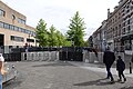
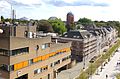
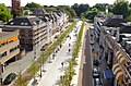
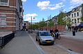
Nederlands: Afbeeldingen van de Willemstraat, een voetgangersstraat bij het Station Breda aan de centrumkant nabij Breda Centrum in Breda in de provincie Noord-Brabant in het zuiden van Nederland. De Willemstraat vormt een verbinding tussen het Station Breda en het Park Valkenberg naar het centrum van Breda dat lopend binnen circa 10 minuten te bereiken is. De hoofdvestiging van de VVV Breda was tot 25 maart 2019 onder meer gevestigd in de Willemstraat. (https://erfgoed.breda.nl/erfgoed/archief/willemstraat-centrum)
street in Breda, the Netherlands | |||||
| Upload media | |||||
| Instance of | |||||
|---|---|---|---|---|---|
| Location | Breda, North Brabant, Netherlands | ||||
| Street address |
| ||||
 | |||||
Subcategories
This category has the following 3 subcategories, out of 3 total.
Media in category "Willemstraat, Breda"
The following 59 files are in this category, out of 59 total.
-
 Brasserie NUL76 Willemstraat DSCF0160.JPG 2,816 × 2,112; 2.65 MB
-
 Breda koningsdag 2024 01.jpg 5,472 × 3,648; 8.02 MB
-
 Breda koningsdag 2024 02.jpg 5,472 × 3,648; 9.35 MB
-
 Breda Photo 2016 DSCF7131.jpg 2,816 × 1,864; 2.48 MB
-
 Breda Photo 2016 DSCF7132.jpg 2,816 × 1,864; 2.55 MB
-
 Fototentoonstelling Willemstraat DSCF0020.jpg 2,048 × 1,536; 1.54 MB
-
 Informatiecentrum en spar DSCF7254.jpg 2,816 × 1,864; 2.47 MB
-
 Informatiecentrum Willemstraat, Breda DSCF7255.jpg 2,816 × 1,864; 2.48 MB
-
 Pand Willemstraat, Breda DSCF7261.jpg 1,864 × 2,816; 2.56 MB
-
 Post.nl DSCF7151.jpg 2,816 × 1,864; 2.55 MB
-
 Uitzicht op Post.nl en de Willemstraat Breda DSCF7149.jpg 2,816 × 1,864; 2.51 MB
-
 Willemstraat , Breda DSCF5669.jpg 2,816 × 1,864; 2.45 MB
-
 Willemstraat , Breda DSCF5707.jpg 2,816 × 1,864; 2.49 MB
-
 Willemstraat Breda DSCF3019.JPG 2,816 × 2,112; 2.62 MB
-
 Willemstraat Breda DSCF5227.jpg 2,048 × 1,536; 1.62 MB
-
 Willemstraat Breda DSCF8801.jpg 2,816 × 1,864; 2.49 MB
-
 Willemstraat Breda P1320223copy.jpg 4,000 × 2,672; 3.47 MB
-
 Willemstraat Breda.jpg 4,928 × 3,264; 7.02 MB
-
 Willemstraat, Breda DSCF5670.jpg 2,816 × 1,864; 2.45 MB
-
 Willemstraat, Breda DSCF5671.jpg 2,816 × 1,864; 2.51 MB
-
 Willemstraat, Breda DSCF5672.jpg 2,816 × 1,864; 2.51 MB
-
 Willemstraat, Breda DSCF5673.jpg 2,816 × 1,864; 2.53 MB
-
 Willemstraat, Breda DSCF5674.jpg 1,864 × 2,816; 2.54 MB
-
 Willemstraat, Breda DSCF5675.jpg 2,816 × 1,864; 2.49 MB
-
 Willemstraat, Breda DSCF5676.jpg 2,816 × 1,864; 2.42 MB
-
 Willemstraat, Breda DSCF5677.jpg 2,816 × 1,864; 2.51 MB
-
 Willemstraat, Breda DSCF5678.jpg 2,816 × 1,864; 2.45 MB
-
 Willemstraat, Breda DSCF5679.jpg 2,816 × 1,864; 2.43 MB
-
 Willemstraat, Breda DSCF5680.jpg 2,816 × 1,864; 2.46 MB
-
 Willemstraat, Breda DSCF5681.jpg 2,816 × 1,864; 2.46 MB
-
 Willemstraat, Breda DSCF5682.jpg 2,816 × 1,864; 2.53 MB
-
 Willemstraat, Breda DSCF5683.jpg 2,816 × 1,864; 2.52 MB
-
 Willemstraat, Breda DSCF5684.jpg 2,816 × 1,864; 2.51 MB
-
 Willemstraat, Breda DSCF5689.jpg 2,816 × 1,864; 2.54 MB
-
 Willemstraat, Breda DSCF5704.jpg 2,816 × 1,864; 2.52 MB
-
 Willemstraat, Breda DSCF5705.jpg 2,816 × 1,864; 2.47 MB
-
 Willemstraat, Breda DSCF7121.jpg 2,816 × 1,864; 2.56 MB
-
 Willemstraat, Breda DSCF7150.jpg 2,816 × 1,864; 2.56 MB
-
 Willemstraat, Breda DSCF7152.jpg 2,816 × 1,864; 2.57 MB
-
 Willemstraat, Breda DSCF7245.jpg 2,816 × 1,864; 2.49 MB
-
 Willemstraat, Breda DSCF7256.jpg 2,816 × 1,864; 2.46 MB
-
 Willemstraat, Breda DSCF7257.jpg 2,816 × 1,864; 2.52 MB
-
 Willemstraat, Breda DSCF7258.jpg 2,816 × 1,864; 2.47 MB
-
 Willemstraat, Breda DSCF7259.jpg 2,816 × 1,864; 2.54 MB
-
 Willemstraat, Breda DSCF7262.jpg 2,816 × 1,864; 2.47 MB
-
 Willemstraat, Breda DSCF8783.jpg 2,816 × 1,864; 2.48 MB
-
 Willemstraat, Breda DSCF8784.jpg 2,816 × 1,864; 2.49 MB
-
 Willemstraat, Breda DSCF8785.jpg 2,816 × 1,864; 2.48 MB
-
 Willemstraat, Breda DSCF8786.jpg 2,816 × 1,864; 2.47 MB
-
 Willemstraat, Breda DSCF8787.jpg 2,816 × 1,864; 2.5 MB
-
 Willemstraat, Breda DSCF8788.jpg 2,816 × 1,864; 2.44 MB
-
 Willemstraat, Breda DSCF8789.jpg 2,816 × 1,864; 2.55 MB
-
 Willemstraat, Breda DSCF8791.jpg 2,816 × 1,864; 2.49 MB
-
 Willemstraat, Breda DSCF8798.jpg 2,816 × 1,864; 2.54 MB
-
 Willemstraat, Breda DSCF9043.jpg 2,816 × 1,864; 2.63 MB
-
 Willemstraat, Breda DSCF9044.jpg 2,816 × 1,864; 2.52 MB
-
 Willemstraat, Breda DSCF9045.jpg 2,816 × 1,864; 2.47 MB
-
 Willemstraat, Breda DSCF9046.jpg 2,816 × 1,864; 2.56 MB
-
 Willemstraat, Breda DSCF9047.jpg 2,816 × 1,864; 2.52 MB


