Category:Willibrorduskerk (Vleuten)
Jump to navigation
Jump to search
| Object location | | View all coordinates using: OpenStreetMap |
|---|
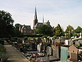
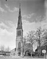
church building in Utrecht, Netherlands  | |||||
| Upload media | |||||
| Instance of | |||||
|---|---|---|---|---|---|
| Part of | |||||
| Location | Vleuten, Vleuten-De Meern, Q2524844, Utrecht, Netherlands | ||||
| Street address |
| ||||
| Located on street |
| ||||
| Architect | |||||
| Heritage designation |
| ||||
| Inception |
| ||||
| Religion or worldview | |||||
 | |||||
Nederlands: Willibrorduskerk Vleuten - anno 1885
Kerk:
|
This is a category about rijksmonument number 520228
|
Pastorie:
|
This is a category about rijksmonument number 520227
|
| Address |
|
Subcategories
This category has only the following subcategory.
Media in category "Willibrorduskerk (Vleuten)"
The following 34 files are in this category, out of 34 total.
-
 520227 Detail RK pastorie Vleuten.JPG 2,272 × 1,704; 2.93 MB
-
 520227 Oostelijk gevel pastorie Vleuten.JPG 1,980 × 1,485; 2.37 MB
-
 520227 Pastorie Willibrordkerk Vleuten.JPG 2,272 × 1,704; 2.31 MB
-
 520228 Daken kerk en pastorie vleuten.JPG 2,272 × 1,704; 1.62 MB
-
 520228 Willibrordkerk te Vleuten besneeuwde torens.JPG 2,000 × 3,008; 2.41 MB
-
 520228 Willibrordkerk te Vleuten Noordzijde.JPG 2,272 × 1,704; 865 KB
-
 520228 Willibrordkerk te Vleuten Oostzijde met narcissen.JPG 2,272 × 1,704; 1.48 MB
-
 Exterieur - Vleuten - 20243074 - RCE.jpg 943 × 1,200; 231 KB
-
 Exterieur - Vleuten - 20243075 - RCE.jpg 961 × 1,200; 224 KB
-
 Interieur - Vleuten - 20243076 - RCE.jpg 957 × 1,200; 256 KB
-
 Interieur - Vleuten - 20243077 - RCE.jpg 958 × 1,200; 233 KB
-
 Interieur naar het koor - Vleuten - 20243080 - RCE.jpg 955 × 1,200; 248 KB
-
 Interieur naar het orgel - Vleuten - 20243081 - RCE.jpg 957 × 1,200; 243 KB
-

-

-

-
 Interieur, aanzicht hoofdaltaar - Vleuten - 20360309 - RCE.jpg 1,188 × 1,200; 359 KB
-
 Interieur, aanzicht Maria-altaar - Vleuten - 20360311 - RCE.jpg 1,185 × 1,200; 425 KB
-
 Interieur, ciborie - Vleuten - 20360317 - RCE.jpg 1,190 × 1,200; 212 KB
-
 Interieur, kandelaar - Vleuten - 20360319 - RCE.jpg 1,200 × 1,200; 239 KB
-
 Interieur, kelk - Vleuten - 20360316 - RCE.jpg 1,190 × 1,200; 196 KB
-
 Interieur, Maria-altaar, aanzicht Maria met kind - Vleuten - 20360310 - RCE.jpg 1,185 × 1,200; 375 KB
-
 Interieur, monstrans - Vleuten - 20360318 - RCE.jpg 1,190 × 1,200; 244 KB
-
 Noord-oost gevel - Vleuten - 20243079 - RCE.jpg 957 × 1,200; 210 KB
-

-
 VLEUTEN ST. WILLIBRORDKERK 01.jpg 3,456 × 4,608; 4.75 MB
-
 VLEUTEN ST. WILLIBRORDKERK 02.jpg 4,608 × 3,456; 3.21 MB
-
 Westgevel toren - Vleuten - 20243078 - RCE.jpg 954 × 1,200; 240 KB
-
 Willibrorduskerk (Vleuten) 06.jpg 3,456 × 5,184; 7.92 MB
-
 Willibrorduskerk (Vleuten) 07.jpg 5,184 × 3,456; 9.48 MB
-
 Willibrorduskerk Vleuten elevation.jpg 1,133 × 1,348; 197 KB
-
 Willibrorduskerk Vleuten plan 1.jpg 1,068 × 1,121; 135 KB
-
 Willibrorduskerk Vleuten section 0.jpg 1,134 × 1,703; 207 KB
-
 Willibrorduskerk Vleuten section 1.jpg 1,111 × 1,150; 174 KB


_06.jpg)
_07.jpg)


