Category:Windrush (village)
Jump to navigation
Jump to search
village and civil parish in Gloucestershire, United Kingdom  | |||||
| Upload media | |||||
| Instance of | |||||
|---|---|---|---|---|---|
| Location | Cotswold, Gloucestershire, South West England, England | ||||
 | |||||
Subcategories
This category has the following 2 subcategories, out of 2 total.
S
W
- Windrush Mill (5 F)
Media in category "Windrush (village)"
The following 105 files are in this category, out of 105 total.
-
 A lower green at Windrush - geograph.org.uk - 5553934.jpg 640 × 360; 88 KB
-

-
 A40 at the footpath to Windrush Camp - geograph.org.uk - 2512816.jpg 640 × 480; 55 KB
-

-
 A40 south of Windrush - geograph.org.uk - 2512826.jpg 640 × 480; 72 KB
-
 Approaching Windrush - geograph.org.uk - 6274409.jpg 2,048 × 1,536; 924 KB
-
 Approaching Windrush from the south-west - geograph.org.uk - 2658901.jpg 2,592 × 1,944; 2.36 MB
-
 Arable land near Windrush - geograph.org.uk - 3781336.jpg 1,024 × 680; 257 KB
-
 Autumn leaves at Windrush - geograph.org.uk - 5553946.jpg 640 × 360; 106 KB
-
 Bridleway south of B4425 - geograph.org.uk - 3782314.jpg 1,024 × 680; 246 KB
-
 Building at Dean Farm - geograph.org.uk - 387538.jpg 640 × 480; 136 KB
-
 Cattle - geograph.org.uk - 384900.jpg 640 × 480; 118 KB
-
 Cereals growing near Windrush - geograph.org.uk - 802659.jpg 640 × 426; 100 KB
-
 Cotswold , Grassy Field - geograph.org.uk - 6113409.jpg 6,000 × 4,000; 6.8 MB
-
 Cotswold , Little Windrush - geograph.org.uk - 6113423.jpg 6,000 × 4,000; 7.48 MB
-
 Cotswold , The A40 - geograph.org.uk - 6113420.jpg 6,000 × 4,000; 7.5 MB
-
 Cotswold , The A40 - geograph.org.uk - 6113424.jpg 6,000 × 4,000; 3.64 MB
-
 Cottages in Windrush - geograph.org.uk - 3781348.jpg 1,024 × 680; 289 KB
-
 Country south-west of Windrush - geograph.org.uk - 2658897.jpg 2,592 × 1,944; 1.03 MB
-

-

-
 Down from the green in Windrush - geograph.org.uk - 5553943.jpg 640 × 360; 99 KB
-
 Driveways to Barrington Downs Farm - geograph.org.uk - 382388.jpg 618 × 640; 118 KB
-
 Entering Windrush - geograph.org.uk - 4418971.jpg 640 × 480; 147 KB
-
 Farm buildings and bales - geograph.org.uk - 384899.jpg 640 × 480; 91 KB
-
 Farm road approaching the A40 at Windrush - geograph.org.uk - 3782503.jpg 1,024 × 680; 233 KB
-
 Farm track and bridleway - geograph.org.uk - 3780137.jpg 1,024 × 680; 204 KB
-
 Field Barn near Windrush - geograph.org.uk - 2072467.jpg 640 × 407; 61 KB
-
 Fields above the Windrush valley - geograph.org.uk - 2742709.jpg 2,592 × 1,944; 1.75 MB
-
 Fine stone houses in Windrush village - geograph.org.uk - 304474.jpg 640 × 480; 80 KB
-
 Fletcher Watsons View of Oak Tree Nr Windrush Mill - geograph.org.uk - 2252469.jpg 2,592 × 1,944; 824 KB
-
 Fletcher Watsons View of Windrush Mill - geograph.org.uk - 2252175.jpg 2,592 × 1,944; 953 KB
-
 Footbridge and seat - geograph.org.uk - 2071384.jpg 640 × 427; 106 KB
-
 Large Oak Tree Near Windrush Mill ^1 - geograph.org.uk - 2252461.jpg 2,592 × 1,944; 714 KB
-
 Ley Mary Farmhouse, Windrush - geograph.org.uk - 5553958.jpg 640 × 360; 77 KB
-
 Meandering through the Cotswolds - geograph.org.uk - 376036.jpg 640 × 480; 126 KB
-
 Mill race at windrush mill - geograph.org.uk - 1513001.jpg 417 × 640; 134 KB
-
 New bridge over the River Windrush - geograph.org.uk - 2072511.jpg 640 × 442; 96 KB
-

-

-
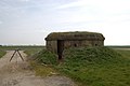
 Pillar by the roadside (2) - geograph.org.uk - 3696518.jpg 640 × 480; 113 KB
-
 Pillar in the hedge (1) - geograph.org.uk - 3696502.jpg 480 × 640; 120 KB
-
 Poplars by the Windrush - geograph.org.uk - 376040.jpg 640 × 480; 136 KB
-
 Road junction, Little Barrington - geograph.org.uk - 3716742.jpg 1,024 × 680; 311 KB
-
 Roadside cottages in Windrush - geograph.org.uk - 1485235.jpg 640 × 427; 64 KB
-
 Rough grassland - geograph.org.uk - 3718615.jpg 1,024 × 680; 251 KB
-
 Site of RAF Windrush - geograph.org.uk - 3780127.jpg 1,024 × 680; 151 KB
-
 Stile near Windrush - geograph.org.uk - 37089.jpg 640 × 427; 70 KB
-
-
 The A40, Windrush - geograph.org.uk - 3577062.jpg 1,600 × 1,183; 734 KB
-
 The Fox, Little Barrington - geograph.org.uk - 3716677.jpg 1,024 × 680; 183 KB
-
 The green at Windrush - geograph.org.uk - 5553950.jpg 640 × 360; 103 KB
-

-
 The wandering Windrush - geograph.org.uk - 376051.jpg 640 × 480; 129 KB
-

-
 Turn right for Windrush, A40 westbound - geograph.org.uk - 3576134.jpg 1,600 × 1,200; 511 KB
-

-
 View from A40 - geograph.org.uk - 384860.jpg 640 × 480; 98 KB
-
 Village Hall, Windrush - geograph.org.uk - 4979510.jpg 4,000 × 3,000; 2.46 MB
-
 Willows by the Windrush - geograph.org.uk - 376045.jpg 480 × 640; 119 KB
-
 Windrush Camp (geograph 6520002).jpg 2,500 × 1,875; 1.93 MB
-
 Windrush Church - geograph.org.uk - 6274384.jpg 2,048 × 1,536; 1.17 MB
-
 Windrush hillfort - geograph.org.uk - 3782495.jpg 1,024 × 680; 200 KB
-
 Windrush Mill garden flooded. - geograph.org.uk - 1546503.jpg 640 × 419; 93 KB
-
 Windrush Quarry - geograph.org.uk - 327021.jpg 640 × 435; 48 KB
-
 Windrush village - geograph.org.uk - 1485208.jpg 640 × 427; 106 KB
-
 Windrush village - geograph.org.uk - 5553937.jpg 640 × 360; 60 KB
-
 Windrush village green - geograph.org.uk - 1485225.jpg 640 × 427; 93 KB
-
 Windrush, Hydrant and Pillion Stone - geograph.org.uk - 5435092.jpg 3,679 × 2,456; 6.31 MB
-
 Arable land near Aldsworth - geograph.org.uk - 750411.jpg 640 × 426; 66 KB
-
 Barn near Windrush - geograph.org.uk - 802644.jpg 640 × 426; 84 KB
-
 Bridleway - geograph.org.uk - 384901.jpg 640 × 480; 128 KB
-
 Bridleway - geograph.org.uk - 387544.jpg 640 × 480; 104 KB
-
 Bridleway from Budgehill Wood - geograph.org.uk - 384864.jpg 640 × 480; 129 KB
-
 Bridleway towards the Windrush - geograph.org.uk - 376078.jpg 640 × 480; 83 KB
-
 Budgehill Wood and Budgehill Belt - geograph.org.uk - 384865.jpg 640 × 480; 141 KB
-
 Control Tower - geograph.org.uk - 384875.jpg 640 × 480; 86 KB
-
 Crossroads - geograph.org.uk - 588336.jpg 640 × 480; 94 KB
-
 Farm track towards Asp Copse - geograph.org.uk - 376075.jpg 640 × 480; 87 KB
-
 Fieldscape - geograph.org.uk - 387561.jpg 640 × 480; 63 KB
-

-
 Hangars at Windrush Airfield - geograph.org.uk - 384890.jpg 640 × 485; 115 KB
-
 In Budgehill Wood - geograph.org.uk - 384882.jpg 640 × 480; 175 KB
-
 In Budgehill Wood - geograph.org.uk - 384887.jpg 640 × 480; 179 KB
-
 Ivy-clad tree - geograph.org.uk - 304544.jpg 640 × 480; 85 KB
-
 Ladbarrow Farm - geograph.org.uk - 387568.jpg 640 × 480; 133 KB
-
 Ladbarrow Farm, a wider view - geograph.org.uk - 387572.jpg 640 × 483; 115 KB
-
 Landing Strip, Windrush Airfield - geograph.org.uk - 384896.jpg 640 × 426; 114 KB
-
 Looking towards Lappingwell Wood - geograph.org.uk - 387534.jpg 640 × 480; 109 KB
-
 Macaroni Downs Farm - geograph.org.uk - 387549.jpg 640 × 480; 129 KB
-
 New trees in Tyning Wood - geograph.org.uk - 387533.jpg 640 × 480; 155 KB
-
 Pig Unit - geograph.org.uk - 636590.jpg 640 × 480; 96 KB
-
 R.A.F. Windrush - geograph.org.uk - 384894.jpg 640 × 480; 129 KB
-
 Restricted Byway - geograph.org.uk - 392357.jpg 640 × 480; 146 KB
-
 River Windrush - geograph.org.uk - 325210.jpg 640 × 480; 98 KB
-
 SE from Budgehill Wood - geograph.org.uk - 384870.jpg 640 × 480; 135 KB
-
 South-Eastern side of Tyning Wood - geograph.org.uk - 387531.jpg 640 × 480; 110 KB
-
 Spinney - geograph.org.uk - 387543.jpg 640 × 480; 130 KB
-
 Spinney - geograph.org.uk - 387558.jpg 640 × 480; 100 KB
-
 Spinney and Copse - geograph.org.uk - 387541.jpg 640 × 480; 105 KB
-
 The valley of the River Leach - geograph.org.uk - 387539.jpg 640 × 480; 97 KB
-
 The Western edge of Tyning Wood - geograph.org.uk - 387530.jpg 640 × 480; 123 KB
-
 Tree belt and runway - geograph.org.uk - 384898.jpg 640 × 480; 111 KB
-
 Windrush Camp - geograph.org.uk - 384893.jpg 640 × 480; 99 KB
-
 Windrush Heights - geograph.org.uk - 293462.jpg 640 × 427; 80 KB


_-_geograph.org.uk_-_3696518.jpg)
_-_geograph.org.uk_-_3696502.jpg)


.jpg)


