Category:Winterbourne Stoke
Jump to navigation
Jump to search
village and civil parish in Wiltshire, UK  | |||||
| Upload media | |||||
| Instance of | |||||
|---|---|---|---|---|---|
| Location | Wiltshire, South West England, England | ||||
| Population |
| ||||
 | |||||
English: Winterbourne Stoke is a village in Wiltshire, England, located around 5 km west of Stonehenge. It is sited on the A303 road, close to its junction with the B3083.
Nederlands: Winterbourne Stoke is een dorp (village) en civil parish in de unitary authority Wiltshire, in het Engelse graafschap Wiltshire. De civil parish telt
Subcategories
This category has the following 3 subcategories, out of 3 total.
A
- Airman's Cross, Stonehenge (7 F)
B
- The Bell, Winterbourne Stoke (5 F)
Media in category "Winterbourne Stoke"
The following 200 files are in this category, out of 232 total.
(previous page) (next page)-
 A new sort of pilgrimage - geograph.org.uk - 6156368.jpg 1,024 × 768; 109 KB
-
 A303 - B3083 junction - geograph.org.uk - 3330184.jpg 640 × 385; 40 KB
-
 A303 atop Winterbourne Stoke Hill - geograph.org.uk - 3824660.jpg 3,648 × 2,736; 1.5 MB
-
 A303 entering Winterbourne Stoke - geograph.org.uk - 4110117.jpg 1,600 × 1,050; 514 KB
-
 A303 heading west - geograph.org.uk - 6259386.jpg 1,024 × 684; 209 KB
-
 A303 heading west - geograph.org.uk - 6259397.jpg 1,024 × 684; 187 KB
-
 A303 heading west - geograph.org.uk - 6259415.jpg 1,024 × 684; 205 KB
-
 A303 heading west - geograph.org.uk - 6259431.jpg 1,024 × 684; 264 KB
-
 A303 heading west, Winterbourne Stoke - geograph.org.uk - 6259407.jpg 1,024 × 684; 221 KB
-
 A303 road junction - geograph.org.uk - 5092097.jpg 1,600 × 1,067; 520 KB
-
 A303 towards Longbarrow Cross Roads - geograph.org.uk - 4110241.jpg 1,600 × 1,017; 420 KB
-
 A303 towards Longbarrow Roundabout - geograph.org.uk - 4110251.jpg 1,600 × 1,067; 366 KB
-
 A303 towards Winterbourne Stoke - geograph.org.uk - 4110110.jpg 1,600 × 1,060; 425 KB
-
-
 A303 west of Winterbourne Stoke - geograph.org.uk - 3330185.jpg 640 × 430; 37 KB
-
 A303, approaching Winterbourne Stoke - geograph.org.uk - 3330179.jpg 640 × 430; 60 KB
-

-
 A303, eastbound - geograph.org.uk - 4781033.jpg 640 × 426; 57 KB
-
 A303, westbound - geograph.org.uk - 3330173.jpg 640 × 430; 40 KB
-
 A303, westbound - geograph.org.uk - 5287451.jpg 640 × 466; 39 KB
-
 A303, westbound - geograph.org.uk - 5287455.jpg 640 × 426; 47 KB
-
 A303, westbound - geograph.org.uk - 5287461.jpg 640 × 393; 48 KB
-
 A303, westbound - geograph.org.uk - 5291902.jpg 640 × 426; 62 KB
-
 A303, westbound - geograph.org.uk - 5291912.jpg 640 × 426; 75 KB
-
 A303, Winterbourne Stoke - geograph.org.uk - 4784650.jpg 640 × 404; 51 KB
-

-
 A360 northbound - geograph.org.uk - 4577787.jpg 640 × 480; 48 KB
-
 A360, southbound - geograph.org.uk - 5287435.jpg 640 × 394; 36 KB
-
 Airman's Corner - geograph.org.uk - 6153463.jpg 4,285 × 2,410; 1.5 MB
-
 Airman's Cross (geograph 6153465).jpg 2,614 × 3,485; 2.27 MB
-
 Airman's Cross - geograph.org.uk - 5837871.jpg 640 × 452; 70 KB
-

-
 B3083 north of Winterbourne Stoke - geograph.org.uk - 3461190.jpg 3,648 × 2,736; 1.55 MB
-
 B3083 south of Scotland Lodge Farm - geograph.org.uk - 3461195.jpg 3,514 × 2,502; 1.22 MB
-
 Barn near Greenland Farm - geograph.org.uk - 4307631.jpg 1,024 × 768; 119 KB
-
 Barrow, Winterbourne Stoke group - geograph.org.uk - 491345.jpg 640 × 480; 154 KB
-
 Bell Barrow at Winterbourne Stoke Cemetery.jpg 3,716 × 1,180; 1 MB
-
 Berwick Rd off A303 - geograph.org.uk - 5291898.jpg 640 × 389; 54 KB
-

-
 Bowl and Pond Barrows, Winterbourne Stoke.jpg 1,270 × 760; 400 KB
-
 Building works near Stonehenge - geograph.org.uk - 3444267.jpg 800 × 443; 77 KB
-
 Burial Mound on Route to Stonehenge - geograph.org.uk - 5477558.jpg 4,896 × 3,672; 6.57 MB
-

-
 Chocolate Box England - geograph.org.uk - 365945.jpg 640 × 480; 133 KB
-
 Cows and the Stonehenge Visitor Centre - geograph.org.uk - 4124249.jpg 1,024 × 768; 125 KB
-
 Crossroads Long Barrow 1.jpg 1,295 × 589; 252 KB
-
 Crossroads Long Barrow 2.jpg 3,928 × 1,124; 772 KB
-

-
 Descending Winterbourne Stoke Hill - geograph.org.uk - 5287464.jpg 640 × 412; 54 KB
-
 Disc Barrows, Winterbourne Stoke.jpg 1,196 × 548; 159 KB
-
 Driveway from Airman's Corner to car park, Stonehenge - geograph.org.uk - 6590504.jpg 5,184 × 3,456; 7.49 MB
-
 English Countryside Shrewton United Kingdom Landscape Photography (168525949).jpeg 2,000 × 1,125; 968 KB
-
 Entering Winterbourne Stoke, A303 - geograph.org.uk - 5287468.jpg 640 × 426; 66 KB
-
 Fargo Plantation - geograph.org.uk - 2819491.jpg 2,000 × 1,487; 386 KB
-
-
 Farmland near Winterbourne Stoke - geograph.org.uk - 489491.jpg 640 × 480; 117 KB
-
 Farmland, Winterbourne Stoke - geograph.org.uk - 489445.jpg 640 × 480; 161 KB
-
 Fields and track at Greenland Farm - geograph.org.uk - 5615532.jpg 640 × 480; 111 KB
-
 Fields by Longbarrow - geograph.org.uk - 5871418.jpg 2,441 × 1,150; 214 KB
-
 Fields west of Stonehenge - geograph.org.uk - 6258010.jpg 1,600 × 1,067; 677 KB
-
 Gate and field boundary - geograph.org.uk - 5057831.jpg 3,264 × 2,448; 3 MB
-

-
 Gathering in the straw - geograph.org.uk - 6256660.jpg 2,592 × 1,944; 1.67 MB
-
 Golden field with birds - geograph.org.uk - 5861837.jpg 1,024 × 683; 199 KB
-
 Hares in a field near Winterbourne Stoke - geograph.org.uk - 874030.jpg 640 × 480; 179 KB
-
 Hidden away - geograph.org.uk - 6156398.jpg 1,024 × 768; 196 KB
-
 High Street, Winterbourne Stoke - geograph.org.uk - 4110231.jpg 1,600 × 1,064; 362 KB
-
 High Street, Winterbourne Stoke - geograph.org.uk - 5707301.jpg 1,990 × 1,454; 1.79 MB
-
 Hill Farm - geograph.org.uk - 4871344.jpg 640 × 481; 91 KB
-
 Houses in Winterbourne Stoke - geograph.org.uk - 4870586.jpg 640 × 480; 60 KB
-
 Houses on High Street, Winterbourne Stoke - geograph.org.uk - 5707300.jpg 2,048 × 1,536; 1.86 MB
-

-
 Lay by near Scotland Lodge Farm - geograph.org.uk - 4047631.jpg 640 × 460; 66 KB
-
 Long barrow at Winterbourne Stoke - geograph.org.uk - 4307574.jpg 1,024 × 768; 125 KB
-
 Longhorn cows, Cherry Lodge Farm - geograph.org.uk - 797591.jpg 640 × 457; 180 KB
-
 Manor Farm - geograph.org.uk - 5287477.jpg 640 × 426; 39 KB
-
 Manor House - geograph.org.uk - 5377121.jpg 640 × 426; 101 KB
-
 Milestone near Stonehenge - geograph.org.uk - 2221661.jpg 640 × 480; 72 KB
-
 Milestone near Stonehenge - geograph.org.uk - 2221671.jpg 480 × 640; 106 KB
-
 Monument to fatal air crash, Airman's Corner - geograph.org.uk - 4123342.jpg 1,600 × 1,200; 1.34 MB
-
 Neolithic houses under construction - geograph.org.uk - 3933807.jpg 3,648 × 2,434; 3.61 MB
-
 Neolithic replica houses, Stonehenge Visitor Centre - geograph.org.uk - 6590542.jpg 5,184 × 3,456; 6.34 MB
-
 Neolithic village, Stonehenge - geograph.org.uk - 4520187.jpg 2,736 × 1,824; 3.48 MB
-
 Neolithic village, Stonehenge - geograph.org.uk - 4520192.jpg 2,736 × 1,824; 2.91 MB
-
 New car park at Stonehenge - geograph.org.uk - 4307562.jpg 800 × 600; 124 KB
-
 New coach park at Stonehenge - geograph.org.uk - 4307559.jpg 1,024 × 768; 71 KB
-
 New pedestrian route towards stone circle - geograph.org.uk - 6590629.jpg 5,179 × 3,451; 6.22 MB
-
 New Stonehenge Visitor Centre - geograph.org.uk - 3683193.jpg 1,024 × 768; 163 KB
-
 One of many tumuli in the Winterbourne Stoke group - geograph.org.uk - 3427003.jpg 3,648 × 2,736; 2.62 MB
-
 Paths at Stonehenge Visitor Centre - geograph.org.uk - 6607091.jpg 5,184 × 3,456; 5.64 MB
-
 Petrol station on High Street, Winterbourne Stoke - geograph.org.uk - 5764027.jpg 2,182 × 1,552; 1.54 MB
-
 Plaque at Airman's Cross - geograph.org.uk - 5837876.jpg 640 × 640; 78 KB
-
 Plaque on bridge over River Till, Winterbourne Stoke - geograph.org.uk - 5182737.jpg 1,600 × 1,064; 424 KB
-
 Plaque outside Stonehenge Visitor Centre - geograph.org.uk - 4735325.jpg 1,024 × 1,024; 233 KB
-
 Pond Barrow on west end of Winterbourne Stoke Cemetery.jpg 1,098 × 595; 229 KB
-

-
 Poultry Farm - geograph.org.uk - 811132.jpg 640 × 480; 85 KB
-
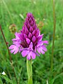 Pyramidal orchid - geograph.org.uk - 477304.jpg 480 × 640; 94 KB
-

-

-
 Replica of Neolithic house, Stonehenge Visitor Centre - geograph.org.uk - 4735301.jpg 1,024 × 1,024; 285 KB
-
 Replica of Neolithic houses, Stonehenge Visitor Centres - geograph.org.uk - 4735322.jpg 1,024 × 1,024; 231 KB
-
 Replicas of Neolithic houses, Stonehenge Visitor Centre - geograph.org.uk - 4735309.jpg 1,024 × 1,024; 251 KB
-
 River Till at Winterbourne Stoke - geograph.org.uk - 372347.jpg 640 × 480; 177 KB
-
 River Till, Winterbourne Stoke - geograph.org.uk - 364962.jpg 640 × 480; 100 KB
-
 Road to Hill Farm - geograph.org.uk - 5377125.jpg 640 × 426; 46 KB
-
 Round Barrow and Woodland - geograph.org.uk - 5057836.jpg 3,264 × 2,448; 3.18 MB
-
 Roundabout near the Stonehenge Visitor Centre - geograph.org.uk - 6266955.jpg 1,600 × 1,067; 577 KB
-
 Shuttle buses at Stonehenge Visitor Centre - geograph.org.uk - 4307581.jpg 1,024 × 768; 88 KB
-

-
 Sonehenge Visitor Centre - geograph.org.uk - 6153472.jpg 4,263 × 2,397; 1.62 MB
-

-

-

-

-

-

-
 Stonehenge (35396782583).jpg 3,648 × 5,472; 8.18 MB
-
 Stonehenge (36159830446).jpg 3,648 × 5,472; 8.57 MB
-
 Stonehenge - entrance to National Trust land - geograph.org.uk - 4307610.jpg 1,024 × 768; 148 KB
-
 Stonehenge - neolithic village - geograph.org.uk - 4307598.jpg 1,024 × 768; 101 KB
-
 Stonehenge - pull on that^ - geograph.org.uk - 4307600.jpg 1,024 × 768; 92 KB
-
 Stonehenge Visitor Centre - geograph.org.uk - 4307589.jpg 1,024 × 768; 122 KB
-
 Stonehenge Visitor Centre - geograph.org.uk - 4339480.jpg 3,872 × 2,592; 4.31 MB
-
 Stonehenge visitor centre - geograph.org.uk - 4520175.jpg 2,736 × 1,824; 3.54 MB
-
 Stonehenge visitor centre - geograph.org.uk - 4520181.jpg 2,736 × 1,824; 3.44 MB
-
 Stonehenge Visitor Centre - geograph.org.uk - 5406549.jpg 1,500 × 1,000; 1.31 MB
-
 Stonehenge Visitor Centre - geograph.org.uk - 5477556.jpg 4,896 × 3,672; 6.01 MB
-
 Stonehenge Visitor Centre - geograph.org.uk - 6258009.jpg 1,600 × 1,067; 679 KB
-
 Stonehenge Visitor Centre car park - geograph.org.uk - 4123964.jpg 1,600 × 1,066; 897 KB
-
 Stonehenge Visitor Centre main entrance - geograph.org.uk - 4735295.jpg 1,024 × 1,024; 251 KB
-
 Straight line to St. Peter's - geograph.org.uk - 811129.jpg 640 × 359; 68 KB
-

-
 The A303 at Winterbourne Stoke - geograph.org.uk - 3444263.jpg 800 × 505; 87 KB
-
 The A303, Winterbourne Stoke - geograph.org.uk - 5779978.jpg 2,304 × 1,728; 1.75 MB
-

-
 The Longbarrow crossroads - geograph.org.uk - 5707302.jpg 2,000 × 1,470; 1.58 MB
-
 The new Stonehenge Visitor Centre - geograph.org.uk - 4916301.jpg 640 × 480; 74 KB
-

-
 The road from Stonehenge from the visitor centre - geograph.org.uk - 6267105.jpg 1,600 × 1,067; 612 KB
-
 Tour bus at Stonehenge - geograph.org.uk - 4307556.jpg 1,024 × 768; 84 KB
-
 Track to barn - geograph.org.uk - 5083442.jpg 640 × 480; 87 KB
-
 Two tumuli of many with woodland beyond - geograph.org.uk - 3426999.jpg 3,648 × 2,736; 2.07 MB
-

-
 View towards Winterbourne Stoke Down - geograph.org.uk - 5057825.jpg 2,179 × 1,632; 729 KB
-
 Visitors on new path to Stonehenge - geograph.org.uk - 6590591.jpg 5,184 × 3,456; 7.12 MB
-

-
 Water tower near Greenland Farm - geograph.org.uk - 4307626.jpg 1,024 × 768; 120 KB
-

-
 Wiltshire , Small Road - geograph.org.uk - 5739461.jpg 6,000 × 4,000; 5.7 MB
-
 Winterbourne Stoke , A303 - geograph.org.uk - 6623870.jpg 4,608 × 3,456; 7.1 MB
-
 Winterbourne Stoke , A303 - geograph.org.uk - 6623872.jpg 4,608 × 3,456; 6.67 MB
-
 Winterbourne Stoke , A303 - geograph.org.uk - 6624850.jpg 4,608 × 3,456; 6.76 MB
-
 Winterbourne Stoke , A303 - geograph.org.uk - 6624853.jpg 4,608 × 3,456; 6.62 MB
-
 Winterbourne Stoke , A303 - geograph.org.uk - 6624855.jpg 4,608 × 3,456; 7.16 MB
-
 Winterbourne Stoke , Joseph's Burger Van - geograph.org.uk - 6623871.jpg 4,608 × 3,456; 7.33 MB
-
 Winterbourne Stoke , Longbarrow Roundabout - geograph.org.uk - 6620969.jpg 4,133 × 3,100; 2.69 MB
-
 Winterbourne Stoke , Longbarrow Roundabout - geograph.org.uk - 6620971.jpg 4,487 × 3,365; 3.47 MB
-
 Winterbourne Stoke - Airman's Cross - geograph.org.uk - 1718088.jpg 1,024 × 768; 300 KB
-
 Winterbourne Stoke - Airmans Cross - geograph.org.uk - 1718093.jpg 1,024 × 768; 200 KB
-
 Winterbourne Stoke - Airmans Cross - geograph.org.uk - 1718099.jpg 1,024 × 768; 177 KB
-
 Winterbourne Stoke - Airmans Cross - geograph.org.uk - 1718100.jpg 1,024 × 768; 207 KB
-
 Winterbourne Stoke - Airmans Cross - geograph.org.uk - 1718103.jpg 1,024 × 768; 161 KB
-
 Winterbourne Stoke - Airmans Cross - geograph.org.uk - 1718107.jpg 1,024 × 768; 202 KB
-
 Winterbourne Stoke - geograph.org.uk - 2904483.jpg 800 × 600; 392 KB
-
 Winterbourne Stoke Barrow Cemetery as seen from the A303.jpg 4,145 × 2,277; 4.65 MB
-
 Winterbourne Stoke bell barrow.jpg 1,270 × 760; 293 KB
-
 Winterbourne Stoke, Airman's Corner - geograph.org.uk - 3683276.jpg 1,024 × 768; 122 KB
-
 Winterbourne Stoke, Airmen's Cross - geograph.org.uk - 3683213.jpg 1,024 × 754; 214 KB
-
 Winterbourne Stoke, car park - geograph.org.uk - 3683324.jpg 1,024 × 768; 125 KB
-

-

-

-
 Winterbourne Stoke, site office - geograph.org.uk - 3683268.jpg 1,024 × 768; 116 KB
-
 Winterbourne Stoke, UK - panoramio (1).jpg 3,264 × 2,448; 2.27 MB
-
 Winterbourne Stoke, UK - panoramio (10).jpg 3,264 × 2,448; 2.26 MB
-
 Winterbourne Stoke, UK - panoramio (11).jpg 3,264 × 2,448; 2.42 MB
-
 Winterbourne Stoke, UK - panoramio (12).jpg 3,264 × 2,448; 1.68 MB
-
 Winterbourne Stoke, UK - panoramio (13).jpg 3,264 × 2,448; 2.35 MB
-
 Winterbourne Stoke, UK - panoramio (14).jpg 3,264 × 2,448; 2.05 MB
-
 Winterbourne Stoke, UK - panoramio (15).jpg 3,264 × 2,448; 2.25 MB
-
 Winterbourne Stoke, UK - panoramio (16).jpg 3,264 × 2,448; 2.21 MB
-
 Winterbourne Stoke, UK - panoramio (17).jpg 3,264 × 2,448; 2.64 MB
-
 Winterbourne Stoke, UK - panoramio (18).jpg 3,264 × 2,448; 2.01 MB
-
 Winterbourne Stoke, UK - panoramio (19).jpg 3,264 × 2,448; 1.77 MB
-
 Winterbourne Stoke, UK - panoramio (2).jpg 3,264 × 2,448; 2.56 MB
-
 Winterbourne Stoke, UK - panoramio (20).jpg 3,264 × 2,448; 1.72 MB
-
 Winterbourne Stoke, UK - panoramio (21).jpg 3,264 × 2,448; 1.9 MB
-
 Winterbourne Stoke, UK - panoramio (3).jpg 3,264 × 2,448; 3.25 MB
-
 Winterbourne Stoke, UK - panoramio (4).jpg 3,264 × 2,448; 2.59 MB
-
 Winterbourne Stoke, UK - panoramio (5).jpg 3,264 × 2,448; 1.85 MB
-
 Winterbourne Stoke, UK - panoramio (6).jpg 3,264 × 2,448; 2.65 MB
-
 Winterbourne Stoke, UK - panoramio (7).jpg 3,264 × 2,448; 3.81 MB
-
 Winterbourne Stoke, UK - panoramio (8).jpg 3,264 × 2,448; 2.59 MB
-
 Winterbourne Stoke, UK - panoramio (9).jpg 3,264 × 2,448; 2.4 MB
-
 Winterbourne Stoke, UK - panoramio.jpg 2,448 × 3,264; 3.22 MB
-

-
 Cows on Horse Down - geograph.org.uk - 490553.jpg 640 × 480; 148 KB
-
 Farm road, Winterbourne Stoke - geograph.org.uk - 490552.jpg 640 × 480; 125 KB
-
 Farm track, Shrewton - geograph.org.uk - 705595.jpg 480 × 640; 141 KB


.jpg)


.jpeg)


_-_geograph.org.uk_-_5081862.jpg)
_-_geograph.org.uk_-_5081864.jpg)
_-_geograph.org.uk_-_5081866.jpg)
_-_geograph.org.uk_-_5081867.jpg)
_-_geograph.org.uk_-_5081868.jpg)

.jpg)
.jpg)


.jpg)
.jpg)
.jpg)
.jpg)
.jpg)
.jpg)
.jpg)
.jpg)
.jpg)
.jpg)
.jpg)
.jpg)
.jpg)
.jpg)
.jpg)
.jpg)
.jpg)
.jpg)
.jpg)
.jpg)
.jpg)


