Category:Woodbury, East Devon
Jump to navigation
Jump to search
English: Woodbury is a village and civil parish in East Devon in the English county of Devon, The parish, which has a population of 3,466 and lies on the east bank of the Exe Estuary, has borders – clockwise from the estuary – with the district of Exeter (near to Topsham) and then the parishes of Clyst St George, Clyst St Mary, Farringdon, Colaton Raleigh, Bicton and Lympstone.
Nederlands: Woodbury is een plaats en civil parish in het bestuurlijke gebied East Devon, in het Engelse graafschap Devon met 3.466 inwoners.
Polski: Woodbury – wieś w Anglii, w hrabstwie Devon, w dystrykcie East Devon. Leży 11 km na południowy wschód od miasta Exeter i 247 km na zachód od Londynu. W 2001 miejscowość liczyła 3466 mieszkańców.
Svenska: Woodbury är en civil parish i East Devon i Devon i England. Orten har 3466 invånare (2001). Byn nämndes i Domedagsboken (Domesday Book) år 1086, och kallades då Wodeberie.

village and civil parish in East Devon, Devon, England  | |||||
| Upload media | |||||
| Instance of | |||||
|---|---|---|---|---|---|
| Location | East Devon, Devon, South West England, England | ||||
| Population |
| ||||
| Area |
| ||||
 | |||||
Subcategories
This category has the following 15 subcategories, out of 15 total.
E
G
- Gilbrook House, Woodbury (4 F)
- Gulliford Farm, Lympstone (3 F)
M
- The Maltsters Arms, Woodbury (1 F)
N
R
- Rydon Farmhouse (5 F)
S
T
W
- The White Hart, Woodbury (2 F)
- Woodbury Castle (25 F)
- Woodbury Primary School (2 F)
- Woodbury War Memorial (4 F)
- Woodmanton (4 F)
Media in category "Woodbury, East Devon"
The following 200 files are in this category, out of 762 total.
(previous page) (next page)-
 1,2,3, Flower Street.jpg 5,212 × 3,475; 9.73 MB
-
 1,2,3, Mirey Lane.jpg 5,568 × 3,712; 11.44 MB
-
 2 And 3, The Green.jpg 5,568 × 3,712; 9.83 MB
-
 A Devon lane - geograph.org.uk - 5710422.jpg 640 × 426; 44 KB
-
 A difficult view - geograph.org.uk - 1601273.jpg 640 × 480; 276 KB
-
 A glimpse of the East Devon countryside - geograph.org.uk - 1451327.jpg 640 × 480; 107 KB
-
 A grey day on the Exe Estuary - geograph.org.uk - 5699656.jpg 640 × 426; 23 KB
-
 A wooden foot bridge - geograph.org.uk - 4706946.jpg 1,024 × 768; 262 KB
-
 A3052, westbound - geograph.org.uk - 5254010.jpg 640 × 426; 76 KB
-
 A376 approaching Ebford - geograph.org.uk - 1090362.jpg 640 × 480; 106 KB
-
 A376 at Gulliford - geograph.org.uk - 4035487.jpg 640 × 460; 68 KB
-
 A376 at Nutwell Cottages - geograph.org.uk - 2196835.jpg 640 × 480; 95 KB
-
 A376 at the Nutwell Lodge - geograph.org.uk - 4035475.jpg 640 × 331; 130 KB
-
 A376 Footbridge at Exton - geograph.org.uk - 6110359.jpg 800 × 533; 602 KB
-
 A376, Exmouth Road, approaching Exton - geograph.org.uk - 6110357.jpg 800 × 534; 730 KB
-
 A376, Exton - geograph.org.uk - 6110363.jpg 800 × 600; 606 KB
-
 A376, Exton Park - geograph.org.uk - 6110361.jpg 800 × 533; 602 KB
-
 Admiring the view - geograph.org.uk - 3242589.jpg 1,024 × 768; 185 KB
-
 AMS Murtaya Angle.jpg 640 × 480; 91 KB
-
 AMS Murtaya Front.jpg 640 × 480; 90 KB
-
 Anglo Saxon stirrup mount (FindID 63765).jpg 740 × 963; 63 KB
-
-
 Approaching Higher Venmore farm from the West - geograph.org.uk - 5270986.jpg 1,024 × 768; 174 KB
-
 Arable field east of Exton - geograph.org.uk - 2018964.jpg 640 × 480; 74 KB
-

-
 Arable land, Woodbury - geograph.org.uk - 2461500.jpg 640 × 480; 119 KB
-
 Autumn leaves on Black Hill, Bicton Common - geograph.org.uk - 4181961.jpg 1,600 × 1,200; 1.79 MB
-
 Avocet Drive, Exton - geograph.org.uk - 1090258.jpg 480 × 640; 103 KB
-
 Avocet line at Exton - geograph.org.uk - 5699659.jpg 640 × 426; 56 KB
-
 Avocet on the Exe - geograph.org.uk - 1182249.jpg 640 × 427; 54 KB
-
 Avocet over Greenland - geograph.org.uk - 1182239.jpg 640 × 427; 63 KB
-
 B3179 approaching Woodbury - geograph.org.uk - 2271799.jpg 640 × 480; 66 KB
-
 B3179 approaching Woodbury - geograph.org.uk - 5499747.jpg 2,023 × 2,494; 1.03 MB
-
 B3179 at Woodbury Wood - geograph.org.uk - 5499763.jpg 2,048 × 3,072; 1.24 MB
-
 B3179 at Woodbury Wood - geograph.org.uk - 5499772.jpg 3,072 × 2,048; 1.33 MB
-

-
 B3179 near Postlake Farm - geograph.org.uk - 2271797.jpg 640 × 480; 68 KB
-
 B3180 by Black Hill Quarry - geograph.org.uk - 1959588.jpg 480 × 640; 109 KB
-
 B3180 by Black Hill Quarry - geograph.org.uk - 1959603.jpg 640 × 470; 122 KB
-
 B3180 on Woodbury Common - geograph.org.uk - 1959533.jpg 640 × 480; 122 KB
-

-
 Barbecue area on the foreshore at Exton - geograph.org.uk - 1270786.jpg 640 × 480; 124 KB
-
 Barn at Ford Farm, Woodbury - geograph.org.uk - 136501.jpg 640 × 427; 237 KB
-
 Barn, near Rydon Hill Farm - geograph.org.uk - 1450976.jpg 640 × 480; 86 KB
-
 Barn, Postlake Farm - geograph.org.uk - 5710418.jpg 640 × 425; 40 KB
-
 Barrier between railway and cycle track - geograph.org.uk - 5771184.jpg 1,600 × 1,200; 1,003 KB
-
 Barton Close - geograph.org.uk - 5699677.jpg 640 × 426; 62 KB
-
 Bedside Manor - geograph.org.uk - 1153822.jpg 640 × 512; 99 KB
-
 Beeches Close - geograph.org.uk - 2760828.jpg 1,024 × 768; 206 KB
-
 Beeches Close - geograph.org.uk - 5703652.jpg 640 × 425; 65 KB
-
 Bend in the cycle track at Exton - geograph.org.uk - 5771191.jpg 1,600 × 1,200; 777 KB
-
 Big field - geograph.org.uk - 5710379.jpg 640 × 426; 36 KB
-
 Bixley Haven.jpg 5,038 × 3,359; 10.69 MB
-
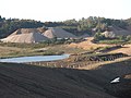
 Black Hill quarries - geograph.org.uk - 66845.jpg 640 × 383; 111 KB
-
 Black Hill Quarry - geograph.org.uk - 1020130.jpg 640 × 480; 63 KB
-
 Black Hill Quarry - geograph.org.uk - 977672.jpg 640 × 299; 39 KB
-
 Black swan in River Clyst - geograph.org.uk - 2597667.jpg 800 × 600; 347 KB
-
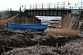 Blue boat by the railway bridge at Exton - geograph.org.uk - 5720061.jpg 640 × 427; 109 KB
-

-
 Bond's Lane - geograph.org.uk - 5707700.jpg 640 × 426; 90 KB
-
 Bond's Lane - geograph.org.uk - 5707701.jpg 640 × 426; 92 KB
-
 Bond's Lane - geograph.org.uk - 5707702.jpg 640 × 426; 90 KB
-
 Bond's Lane - geograph.org.uk - 5707704.jpg 640 × 426; 94 KB
-
 Bond's Lane - geograph.org.uk - 5707705.jpg 640 × 426; 90 KB
-
 Bond's Lane - geograph.org.uk - 5710372.jpg 640 × 426; 75 KB
-

-
 Bond's Lane, Woodbury Salterton - geograph.org.uk - 143280.jpg 640 × 480; 130 KB
-
 Bonds Lane heading west - geograph.org.uk - 1601042.jpg 640 × 480; 217 KB
-
 Bridge House - geograph.org.uk - 5703647.jpg 640 × 425; 48 KB
-
 Bridge on cycle track between Topsham and Exton - geograph.org.uk - 5771139.jpg 1,600 × 1,198; 816 KB
-
 Bridge Pitt - geograph.org.uk - 2344415.jpg 800 × 600; 481 KB
-
-
 Bridge Pitt from the south - geograph.org.uk - 2344457.jpg 800 × 600; 489 KB
-
 Bridleway off the B3180 - geograph.org.uk - 1881663.jpg 640 × 480; 329 KB
-
 Bridleway, to Lympstone Common - geograph.org.uk - 1451268.jpg 640 × 480; 140 KB
-
 Bridleway, to Woodbury Common - geograph.org.uk - 1392842.jpg 640 × 480; 111 KB
-
 Broadway - geograph.org.uk - 5703666.jpg 640 × 426; 69 KB
-
 Broadway House (1).jpg 4,470 × 2,979; 2.25 MB
-
 Brookfield - geograph.org.uk - 5707651.jpg 640 × 426; 77 KB
-
 Bus at Greendale - geograph.org.uk - 1661350.jpg 640 × 470; 101 KB
-
 Bus stop, Woodbury - geograph.org.uk - 5703673.jpg 640 × 426; 72 KB
-
 By Bond's Lane - geograph.org.uk - 5710346.jpg 640 × 426; 45 KB
-
 By Lympstone Commando Station - geograph.org.uk - 5090887.jpg 640 × 480; 99 KB
-
 Car park at Woodbury Castle - geograph.org.uk - 4712965.jpg 1,600 × 1,200; 1.64 MB
-
 Caravan site, Woodbury - geograph.org.uk - 5492184.jpg 3,072 × 2,048; 1.4 MB
-
 Caravans, at Castle Brake - geograph.org.uk - 1451335.jpg 640 × 480; 95 KB
-
 Castle Brake, camping and caravan site - geograph.org.uk - 1451332.jpg 640 × 480; 106 KB
-

-

-
 Christ Church, Parsonage Way - geograph.org.uk - 2764882.jpg 1,024 × 768; 152 KB
-
 Church Cottage (1).jpg 4,769 × 3,179; 8.44 MB
-
 Church Cottage - geograph.org.uk - 5707515.jpg 640 × 426; 64 KB
-
 Church Cottage - geograph.org.uk - 5707517.jpg 640 × 426; 52 KB
-
 Church Masons.jpg 1,639 × 2,460; 1.93 MB
-
 Church of St Andrew - geograph.org.uk - 5699683.jpg 640 × 426; 63 KB
-
 Church of St Andrew - geograph.org.uk - 5699685.jpg 640 × 426; 64 KB
-
 Church of St Andrew - geograph.org.uk - 5699688.jpg 640 × 426; 59 KB
-
 Church of St Swithun - geograph.org.uk - 5707526.jpg 640 × 426; 53 KB
-
 Church of St Swithun - geograph.org.uk - 5707546.jpg 426 × 640; 48 KB
-
 Church of St Swithun - geograph.org.uk - 5707547.jpg 640 × 426; 57 KB
-
 Church of St Swithun - geograph.org.uk - 5707549.jpg 640 × 426; 58 KB
-
 Church of St Swithun - geograph.org.uk - 5707553.jpg 640 × 425; 53 KB
-
 Church of St Swithun - geograph.org.uk - 5707557.jpg 640 × 426; 50 KB
-
 Church of St Swithun - geograph.org.uk - 5707559.jpg 640 × 426; 58 KB
-
 Church of St Swithun - geograph.org.uk - 5707563.jpg 640 × 426; 36 KB
-
 Church of St Swithun - geograph.org.uk - 5707564.jpg 425 × 640; 79 KB
-
 Church Rooms Woodbury - geograph.org.uk - 2768033.jpg 1,024 × 768; 141 KB
-
 Church Steps Cottages - geograph.org.uk - 5707555.jpg 640 × 426; 63 KB
-
 Church Steps Cottages.jpg 5,568 × 3,712; 9.3 MB
-
 Church Stile Cottages - geograph.org.uk - 5707561.jpg 640 × 426; 62 KB
-
 Church Town House - geograph.org.uk - 5707572.jpg 640 × 426; 50 KB
-
 Close up of Blackhill Quarry workings - geograph.org.uk - 136508.jpg 640 × 427; 249 KB
-
 Closed for the winter - geograph.org.uk - 3412798.jpg 1,024 × 768; 253 KB
-
 Closed lane from Greendale Cross - geograph.org.uk - 1660267.jpg 480 × 640; 128 KB
-
 Coastal Marsh at Exton - geograph.org.uk - 5108828.jpg 3,819 × 1,815; 1.1 MB
-
 Cob and brick barns - geograph.org.uk - 1407876.jpg 640 × 480; 162 KB
-
 Colaton Raleigh Common - geograph.org.uk - 2464781.jpg 640 × 480; 134 KB
-
 Colaton Raleigh Parish Boundary - geograph.org.uk - 2343381.jpg 800 × 600; 545 KB
-
 Colaton Raleigh Parish Boundary - geograph.org.uk - 2343382.jpg 800 × 600; 410 KB
-
 Commercial woodland near Woodbury - geograph.org.uk - 117972.jpg 640 × 480; 147 KB
-

-
-
 Coniger Cross - geograph.org.uk - 3742425.jpg 2,028 × 1,437; 617 KB
-
 Coniger Cross - geograph.org.uk - 3880359.jpg 1,024 × 768; 216 KB
-
 Coombe Farm - geograph.org.uk - 957864.jpg 640 × 480; 54 KB
-
 Coombe Farm, near Woodmanton - geograph.org.uk - 134714.jpg 640 × 480; 145 KB
-
 Corner house on Stony Lane - geograph.org.uk - 3412869.jpg 640 × 480; 68 KB
-
 Cottages, Church Stile Lane - geograph.org.uk - 5707551.jpg 640 × 426; 57 KB
-
 Cottages, Gillbrook - geograph.org.uk - 5703644.jpg 640 × 425; 60 KB
-
 Cottages, Gillbrook, Woodbury - geograph.org.uk - 1084558.jpg 640 × 480; 96 KB
-
 Cottles Lane - geograph.org.uk - 2344375.jpg 800 × 600; 403 KB
-
 Country Lane, north of The Brake - geograph.org.uk - 1450990.jpg 640 × 480; 122 KB
-
 Countryside at Coniger Cross - geograph.org.uk - 3742435.jpg 1,916 × 1,197; 473 KB
-

-
 Cross roads on the Exmouth road at Exton - geograph.org.uk - 5271032.jpg 1,024 × 768; 179 KB
-
 Crossroads near Oakhayes - geograph.org.uk - 5707578.jpg 640 × 426; 68 KB
-
 Cycle track between Exton and Topsham - geograph.org.uk - 2485250.jpg 800 × 600; 442 KB
-
 Cycle track between Topsham and Exton (3) - geograph.org.uk - 5771091.jpg 1,600 × 1,200; 801 KB
-
 Cycle track north of Exton, passing railway cutting - geograph.org.uk - 5771156.jpg 1,600 × 1,199; 866 KB
-
 Cycle track on boardwalk and bridge at Nutwell Court - geograph.org.uk - 5771270.jpg 1,600 × 1,067; 609 KB
-
 Cycle track south of Exton - geograph.org.uk - 5771247.jpg 1,600 × 1,067; 786 KB
-
 Cycle track south of Exton by the Avocet Line - geograph.org.uk - 5771238.jpg 1,600 × 1,200; 822 KB
-
 Cycle track south of Exton in shallow valley - geograph.org.uk - 5771229.jpg 1,600 × 1,200; 754 KB
-
 Cycle track south of Exton, railway and estuary - geograph.org.uk - 5771258.jpg 1,600 × 1,200; 799 KB
-
 Dairy cattle, near Woodbury Common - geograph.org.uk - 1392836.jpg 640 × 452; 117 KB
-
 Darby's Cottages (1).jpg 2,381 × 3,572; 4.26 MB
-
 Darby's Cottages.jpg 4,914 × 3,276; 8.42 MB
-
 Decked cycle path next to the river Exe - geograph.org.uk - 2933546.jpg 640 × 480; 143 KB
-
 Defensive earthworks, Woodbury Castle - geograph.org.uk - 1364698.jpg 640 × 480; 138 KB
-
 Derelict building in Rushmoor Wood - geograph.org.uk - 163086.jpg 640 × 480; 111 KB
-
 Devon country lane - geograph.org.uk - 1086309.jpg 640 × 480; 154 KB
-
 DHL depot Greendale Barton - geograph.org.uk - 5398611.jpg 640 × 480; 62 KB
-
 Distant view to the Exe Estuary - geograph.org.uk - 5707645.jpg 640 × 426; 61 KB
-
 Dog Lane - geograph.org.uk - 4958497.jpg 2,715 × 1,883; 1.1 MB
-
 Dog Lane - geograph.org.uk - 4958503.jpg 1,920 × 1,280; 759 KB
-
 Dog walking near Woodbury Salterton - geograph.org.uk - 1601058.jpg 640 × 480; 158 KB
-
 Downhill to Woodbury Salterton - geograph.org.uk - 1601266.jpg 640 × 480; 191 KB
-
 Downs Corner - geograph.org.uk - 2344476.jpg 800 × 600; 392 KB
-
 Drake's Cottage (1).jpg 5,206 × 3,470; 10.55 MB
-
 Driveway at the end of Green Lane - geograph.org.uk - 1619638.jpg 640 × 480; 221 KB
-
 East Devon , Car Park - geograph.org.uk - 5388791.jpg 6,000 × 4,000; 7.22 MB
-
 East Devon , Castle Plantation - geograph.org.uk - 5388756.jpg 6,000 × 4,000; 6.16 MB
-
 East Devon , Castle Plantation - geograph.org.uk - 5388757.jpg 6,000 × 4,000; 6.13 MB
-
 East Devon , Castle Plantation - geograph.org.uk - 5388758.jpg 6,000 × 4,000; 6.57 MB
-
 East Devon , Castle Plantation - geograph.org.uk - 5388760.jpg 4,000 × 6,000; 5.78 MB
-
 East Devon , Castle Plantation - geograph.org.uk - 5388762.jpg 4,000 × 6,000; 5.98 MB
-
 East Devon , Castle Plantation - geograph.org.uk - 5388763.jpg 4,000 × 6,000; 7.37 MB
-
 East Devon , Castle Plantation - geograph.org.uk - 5388764.jpg 6,000 × 4,000; 7 MB
-
 East Devon , Castle Plantation - geograph.org.uk - 5388766.jpg 6,000 × 4,000; 5.71 MB
-
 East Devon , Castle Plantation - geograph.org.uk - 5388767.jpg 6,000 × 4,000; 7.41 MB
-
 East Devon , Castle Plantation - geograph.org.uk - 5388770.jpg 6,000 × 4,000; 5.85 MB
-
 East Devon , Colaton Raleigh Common Footpath - geograph.org.uk - 5388797.jpg 6,000 × 4,000; 6.59 MB
-
 East Devon , Colaton Raleigh Common Footpath - geograph.org.uk - 5388798.jpg 6,000 × 4,000; 7.67 MB
-
 East Devon , Colaton Raleigh Common Footpath - geograph.org.uk - 5390332.jpg 6,000 × 4,000; 7.83 MB
-
 East Devon , Country Lane - geograph.org.uk - 3711030.jpg 3,483 × 2,312; 4.67 MB
-
 East Devon , Countryside Scenery - geograph.org.uk - 4165147.jpg 4,288 × 2,848; 6.03 MB
-
 East Devon , Countryside Scenery - geograph.org.uk - 5039894.jpg 6,000 × 4,000; 6.64 MB
-
 East Devon , Countryside Scenery - geograph.org.uk - 5039896.jpg 6,000 × 4,000; 6.06 MB
-
 East Devon , Exeter Raceworld - geograph.org.uk - 3307091.jpg 4,288 × 2,848; 4.92 MB
-
 East Devon , Exmouth Road - geograph.org.uk - 3731010.jpg 4,288 × 2,848; 5.4 MB
-
 East Devon , Exmouth Road A376 - geograph.org.uk - 3711027.jpg 4,288 × 2,848; 5.34 MB
-
 East Devon , Exmouth Road A376 - geograph.org.uk - 3711028.jpg 4,218 × 2,740; 5.81 MB
-
 East Devon , Exmouth Road A376 - geograph.org.uk - 3711034.jpg 4,236 × 2,768; 5.59 MB
-
 East Devon , Farm Track - geograph.org.uk - 4165097.jpg 4,288 × 2,848; 4.01 MB
-
 East Devon , Farm Track - geograph.org.uk - 4165137.jpg 4,288 × 2,848; 5.28 MB
-
 East Devon , Farm Track - geograph.org.uk - 5039883.jpg 6,000 × 4,000; 7.15 MB
-
 East Devon , Farm Track - geograph.org.uk - 5039884.jpg 6,000 × 4,000; 7.19 MB
-
 East Devon , Farm Track ^ Gate - geograph.org.uk - 5039890.jpg 6,000 × 4,000; 6.46 MB
-
 East Devon , Grassy Field - geograph.org.uk - 4165000.jpg 4,068 × 2,702; 6.75 MB
-
 East Devon , Grassy Field - geograph.org.uk - 4165017.jpg 4,288 × 2,848; 6.81 MB
-
 East Devon , Grassy Field ^ Gate - geograph.org.uk - 4165005.jpg 4,288 × 2,848; 4.81 MB
-
 East Devon , Grassy Field ^ Tractor - geograph.org.uk - 4165078.jpg 4,288 × 2,848; 6.73 MB
-
 East Devon , Greendale Business Park - geograph.org.uk - 3299776.jpg 3,264 × 1,840; 1.87 MB
-
 East Devon , Information Signs - geograph.org.uk - 5388793.jpg 6,000 × 4,000; 7.81 MB
-
 East Devon , Postlake Farm - geograph.org.uk - 4165008.jpg 4,288 × 2,848; 5.12 MB
-
 East Devon , Postlake Farm - geograph.org.uk - 4165011.jpg 4,288 × 2,848; 5.6 MB
-
 East Devon , Postlake Farm - geograph.org.uk - 4165015.jpg 4,288 × 2,848; 5.03 MB
-
 East Devon , Postlake Farm - geograph.org.uk - 4165080.jpg 4,288 × 2,848; 4.77 MB
-
 East Devon , Postlake Farm - geograph.org.uk - 4165082.jpg 4,288 × 2,848; 4.5 MB
-
 East Devon , Postlake Farm - geograph.org.uk - 4165094.jpg 4,288 × 2,848; 4.73 MB


.jpg)


.jpg)


.jpg)


_-_geograph.org.uk_-_5771091.jpg)


.jpg)


.jpg)


