Category:Wooler
Vai alla navigazione
Vai alla ricerca
town in Northumberland, England  | |||||
| Carica un file multimediale | |||||
| Istanza di | |||||
|---|---|---|---|---|---|
| Luogo | Northumberland, Nord Est dell'Inghilterra, Inghilterra | ||||
 | |||||
English: Wooler is a small town in Northumberland, England. It lies on the edge of the Northumberland National Park, by the Cheviot Hills and so is a popular base for walkers and is referred to as the "Gateway to the Cheviots". As well as many shops and pubs, the town boasts a youth hostel, many hotels and campsites.
Nederlands: Wooler is een plaats en civil parish in het Engelse graafschap Northumberland. De plaats telt 1857 inwoners.
Polski: Wooler - miasto w Wielkiej Brytanii, w Anglii, w hrabstwie Northumberland. W 2001r. miasto to zamieszkiwało 1 857 osób.
Română: Wooler este un oraş în comitatul Northumberland, regiunea North East England, Anglia. Oraşul se află în districtul Alnwick.
Sottocategorie
Questa categoria contiene le 12 sottocategorie indicate di seguito, su un totale di 12.
B
- Borders Gliding Club (13 F)
G
- Glendale Hall, Wooler (5 F)
H
P
- Pubs in Wooler (24 F)
S
- Shops in Wooler (11 F)
- St Mary's Church, Wooler (18 F)
W
- Weetwood Moor (25 F)
- White Law, Northumberland (3 F)
- St Ninian's church, Wooler (14 F)
- Wooler War Memorial (3 F)
File nella categoria "Wooler"
Questa categoria contiene 200 file, indicati di seguito, su un totale di 457.
(pagina precedente) (pagina successiva)-
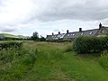
 'Ground nesting birds' below Fredden Hill - geograph.org.uk - 4015804.jpg 768 × 1 024; 313 KB
-
 A 'Lozenge' Pillbox Near Wooler Common - geograph.org.uk - 4314250.jpg 4 592 × 3 448; 3,39 MB
-

-
 A pile of stones - geograph.org.uk - 6246005.jpg 1 600 × 1 200; 430 KB
-
 A rough field near Wooler - geograph.org.uk - 5257214.jpg 1 024 × 768; 397 KB
-
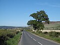
 A697 heading west - geograph.org.uk - 5062241.jpg 1 500 × 1 125; 1,19 MB
-
 A697 northbound - geograph.org.uk - 3393265.jpg 640 × 404; 65 KB
-
 A697 northbound - geograph.org.uk - 3393272.jpg 640 × 480; 36 KB
-
 A697 northbound, Wooler - geograph.org.uk - 3187950.jpg 640 × 480; 50 KB
-
 A697 northbound, Wooler - geograph.org.uk - 3187959.jpg 640 × 463; 55 KB
-

-
 Above Carey Burn - geograph.org.uk - 6201206.jpg 1 024 × 768; 273 KB
-
 Along the foot of the bank - geograph.org.uk - 3632000.jpg 1 024 × 768; 639 KB
-
 Ambulance Station - geograph.org.uk - 261006.jpg 640 × 475; 99 KB
-
 Another old pillbox - geograph.org.uk - 1420595.jpg 640 × 480; 150 KB
-
 Antiques Warehouse, Wooler - geograph.org.uk - 3641236.jpg 1 024 × 768; 222 KB
-
 Approaching Wooler - geograph.org.uk - 4564302.jpg 1 600 × 1 123; 184 KB
-
 Approaching Wooler on the B6348 - geograph.org.uk - 3442993.jpg 2 933 × 2 028; 1,7 MB
-
 Arable land, Milfield Plain - geograph.org.uk - 4858032.jpg 1 024 × 768; 397 KB
-
 ArmstrongMapHomildon1769.JPG 476 × 399; 47 KB
-
 B6348 through West Weetwood - geograph.org.uk - 3442602.jpg 3 786 × 2 764; 3,53 MB
-
 B6525 - geograph.org.uk - 4858025.jpg 1 024 × 768; 289 KB
-
 B6525 - geograph.org.uk - 4858040.jpg 1 024 × 768; 339 KB
-
 Bell's Valley - geograph.org.uk - 4015846.jpg 1 024 × 768; 324 KB
-
 Bell's Valley - geograph.org.uk - 4857222.jpg 1 024 × 768; 322 KB
-
 Bell's Valley - geograph.org.uk - 4857226.jpg 1 024 × 768; 354 KB
-
 Bench, Cheviot Road - geograph.org.uk - 3439308.jpg 640 × 480; 345 KB
-
 Bend in road near Horsdon Farm - geograph.org.uk - 3641415.jpg 1 763 × 1 203; 721 KB
-
 Bicycle storage lockers, Wooler - geograph.org.uk - 1816628.jpg 640 × 399; 71 KB
-

-
 Brake van and shunter - geograph.org.uk - 3641228.jpg 953 × 715; 252 KB
-
 Brake van and signals - geograph.org.uk - 3641216.jpg 1 024 × 768; 228 KB
-
 Bridge over the Humbleton Burn - geograph.org.uk - 4857966.jpg 1 024 × 768; 452 KB
-
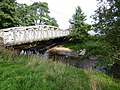
 Bridge over Wooler Water - geograph.org.uk - 1416183.jpg 640 × 480; 149 KB
-
 Bridge over Wooler Water - geograph.org.uk - 261003.jpg 640 × 475; 105 KB
-
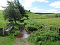
 Bridleway near youth hostel, Wooler - geograph.org.uk - 3450507.jpg 3 200 × 2 360; 4,22 MB
-
 Bridleway on the southern edge of Wooler - geograph.org.uk - 3450522.jpg 3 011 × 2 296; 4,11 MB
-
 Bridleway to Bell's Valley Cottage - geograph.org.uk - 4015832.jpg 1 024 × 768; 256 KB
-
 Bridleway to Broadstruther - geograph.org.uk - 6245820.jpg 1 600 × 1 200; 441 KB
-
 Bridleway to Broadstruther - geograph.org.uk - 6245836.jpg 1 600 × 1 200; 361 KB
-
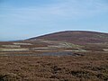
 Brown's Law - geograph.org.uk - 4857952.jpg 1 024 × 768; 468 KB
-
 Building in valley below Coldberry Hill - geograph.org.uk - 6264264.jpg 1 600 × 1 200; 805 KB
-
 Burnhouse Road, Wooler - geograph.org.uk - 4858006.jpg 1 024 × 768; 498 KB
-
 Carey Burn - geograph.org.uk - 6201239.jpg 1 024 × 768; 375 KB
-
 Carey Burn below Hart Heugh - geograph.org.uk - 6201214.jpg 1 024 × 768; 308 KB
-
 Carey Burn Bridge - geograph.org.uk - 1003534.jpg 640 × 428; 52 KB
-
 Cheviot Road, Wooler - geograph.org.uk - 3439305.jpg 640 × 480; 294 KB
-
 Cheviot Street, Wooler - geograph.org.uk - 6175609.jpg 1 024 × 768; 246 KB
-
 Church Street - geograph.org.uk - 6236187.jpg 1 944 × 2 592; 1,12 MB
-
 Church Street in Wooler - geograph.org.uk - 5995999.jpg 4 000 × 3 000; 2,64 MB
-
 Church Street rising to meet Market Place - geograph.org.uk - 5062236.jpg 1 500 × 1 017; 1,23 MB
-
 Common Burn and Broadstruthers Burn merging - geograph.org.uk - 4245300.jpg 1 600 × 1 200; 886 KB
-
 Common Road - geograph.org.uk - 4857950.jpg 1 024 × 768; 480 KB
-
 Commonburn road - geograph.org.uk - 4857188.jpg 1 024 × 768; 341 KB
-
 Commonedge road - geograph.org.uk - 4857229.jpg 1 024 × 768; 352 KB
-
 Cornfields at Way to Wooler - geograph.org.uk - 1997802.jpg 640 × 480; 52 KB
-
 Corrugated container, Commonburn Road - geograph.org.uk - 6286599.jpg 1 600 × 1 200; 557 KB
-
 Cottages near Turvelaws Farm - geograph.org.uk - 4564297.jpg 1 600 × 1 200; 251 KB
-
 Country lane near Wooler - geograph.org.uk - 1454510.jpg 640 × 480; 141 KB
-
 Country Lane towards Coldmartin Loughs - geograph.org.uk - 5511797.jpg 1 066 × 800; 429 KB
-
 Crags on Watch Hill - geograph.org.uk - 3733866.jpg 1 600 × 1 200; 623 KB
-
 Crags on Watch Hill - geograph.org.uk - 5666892.jpg 1 600 × 1 200; 648 KB
-
 Derelict building - geograph.org.uk - 6245843.jpg 1 600 × 1 200; 411 KB
-
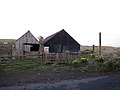
 Derelict farm building - geograph.org.uk - 3035987.jpg 1 600 × 1 200; 291 KB
-
 Descending to Wooler - geograph.org.uk - 4119374.jpg 1 024 × 678; 237 KB
-
 Doddington Bridge - geograph.org.uk - 3641173.jpg 1 024 × 768; 247 KB
-
 Drainage, Turvelaws - geograph.org.uk - 4858022.jpg 1 024 × 768; 334 KB
-
 Dry valley west of Earle Whin - geograph.org.uk - 6180017.jpg 1 024 × 768; 285 KB
-
 Early summer under Coldberry Hill - geograph.org.uk - 4015777.jpg 1 024 × 768; 272 KB
-
 Electricity towers in Glendale - geograph.org.uk - 1416161.jpg 640 × 480; 41 KB
-
 End of a day's play at Wooler - geograph.org.uk - 1419998.jpg 640 × 480; 154 KB
-
 End of public road to Commonburn House - geograph.org.uk - 4015347.jpg 1 024 × 768; 198 KB
-
 End of the main^ - geograph.org.uk - 1420321.jpg 640 × 480; 218 KB
-
 Entrance to Highburn House Campsite - geograph.org.uk - 6175596.jpg 1 024 × 768; 294 KB
-
 Entrance to Wooler - geograph.org.uk - 3187940.jpg 640 × 431; 58 KB
-
 Entrance to Wooler - geograph.org.uk - 3393260.jpg 640 × 480; 59 KB
-
 Essence and Beauty, Wooler - geograph.org.uk - 5627311.jpg 1 024 × 619; 130 KB
-
 Wooler Evangelical Church - geograph.org.uk - 260991.jpg 640 × 475; 71 KB
-
 Evening light on the cornfield - geograph.org.uk - 2003877.jpg 640 × 480; 64 KB
-
 Farm Buildings - geograph.org.uk - 260999.jpg 640 × 475; 84 KB
-
 Farm Cottage, Turvelaws Farm - geograph.org.uk - 5512058.jpg 1 066 × 800; 328 KB
-
 Farm road, Turvelaws - geograph.org.uk - 4858033.jpg 1 024 × 768; 340 KB
-
 Farm track, Milfield Plain - geograph.org.uk - 4858029.jpg 1 024 × 768; 360 KB
-
 Farmland (crops all harvested) - geograph.org.uk - 5512049.jpg 1 066 × 800; 233 KB
-
 Farmland, Turvelaws - geograph.org.uk - 3449096.jpg 4 608 × 3 456; 5,35 MB
-
 Felled woodland on Kenterdale Hill - geograph.org.uk - 6180799.jpg 1 024 × 768; 297 KB
-
 Field above Wooler - geograph.org.uk - 4857943.jpg 1 024 × 768; 453 KB
-
 Field above Wooler - geograph.org.uk - 5253802.jpg 1 024 × 768; 398 KB
-
 Field Barn and Cropped Field - geograph.org.uk - 5512055.jpg 1 066 × 800; 231 KB
-
 Field outside Wooler - geograph.org.uk - 2612429.jpg 640 × 359; 234 KB
-
 Fields above Wooler - geograph.org.uk - 4857944.jpg 1 024 × 768; 351 KB
-
 Filling station in Wooler - geograph.org.uk - 3641238.jpg 1 021 × 768; 158 KB
-
 Filling station, Haugh Head - geograph.org.uk - 5257207.jpg 1 024 × 768; 378 KB
-
 Flower bed in Wooler - panoramio.jpg 2 816 × 1 880; 2,96 MB
-
 Flowery shopfront, Wooler High Street - geograph.org.uk - 5507805.jpg 640 × 427; 121 KB
-
 Foot bridge and road bridge over Wooler Water - geograph.org.uk - 3674705.jpg 1 600 × 1 200; 583 KB
-
 Footbridge and ford below Brown's Law - geograph.org.uk - 5507771.jpg 640 × 427; 120 KB
-
 Footbridge over Carey Burn - geograph.org.uk - 5769479.jpg 1 600 × 1 067; 597 KB
-
 Footbridge over the Humbleton Burn - geograph.org.uk - 1420436.jpg 640 × 480; 171 KB
-
 Footpath behind the bus depot - geograph.org.uk - 3641234.jpg 1 024 × 768; 275 KB
-
 Footpath leading from Humbleton Burn Picnic Area, Wooler - geograph.org.uk - 6200851.jpg 1 600 × 1 200; 650 KB
-
 Footpath through Farmland - geograph.org.uk - 5512045.jpg 1 066 × 800; 198 KB
-
 Footpath to Broomey Road - geograph.org.uk - 3450975.jpg 3 264 × 2 448; 4,42 MB
-
 Footpath to Wooler Haugh - geograph.org.uk - 3632038.jpg 1 024 × 768; 186 KB
-
 Ford and path on Wooler Common - geograph.org.uk - 5507774.jpg 640 × 427; 109 KB
-
 Ford on Humbleton Burn - geograph.org.uk - 5837453.jpg 3 000 × 2 000; 8 MB
-
 Ford on track to Wooler Common - geograph.org.uk - 6201127.jpg 1 024 × 768; 303 KB
-
 Ford through Coldgate Water or Wooler Water - geograph.org.uk - 4529754.jpg 1 600 × 1 200; 475 KB
-
 Forest edge, Kenterdale Hill - geograph.org.uk - 4119332.jpg 1 024 × 678; 220 KB
-
 Former County Library and Masonic Hall, Wooler - geograph.org.uk - 3450129.jpg 3 188 × 2 344; 2,53 MB
-
 Former flour mill and steps to Church Street - geograph.org.uk - 3450407.jpg 2 057 × 1 469; 1,05 MB
-
 Former flour mill, Wooler - geograph.org.uk - 3450417.jpg 2 609 × 1 968; 2,16 MB
-
 Former Mechanics' Institute, High Street, Wooler - geograph.org.uk - 3450072.jpg 2 998 × 2 236; 2,49 MB
-
 Former Railway Station, Wooler - geograph.org.uk - 5512064.jpg 1 066 × 800; 239 KB
-
 Fredden Hill - geograph.org.uk - 4857158.jpg 1 024 × 768; 311 KB
-
 Fredden Hill - geograph.org.uk - 4857192.jpg 1 024 × 768; 378 KB
-
 Free-range ducks - geograph.org.uk - 3451061.jpg 1 833 × 1 341; 1,18 MB
-
 Gallowlaw Hill - geograph.org.uk - 4632328.jpg 1 600 × 1 200; 258 KB
-
 Gallowlaw near Wooler - geograph.org.uk - 5533247.jpg 1 024 × 768; 230 KB
-
 Garden within Humbleton Burn Picnic Area, Wooler - geograph.org.uk - 6160635.jpg 1 600 × 1 200; 888 KB
-
 Garden within Humbleton Burn Picnic Area, Wooler - geograph.org.uk - 6200822.jpg 1 600 × 1 200; 840 KB
-
 Gateposts at Glendale Middle School, Wooler - geograph.org.uk - 4119843.jpg 1 024 × 678; 200 KB
-
 Glacial melt-water channel below Gains Law - geograph.org.uk - 4015872.jpg 1 024 × 769; 325 KB
-
 Glacial melt-water channel below Gains Law - geograph.org.uk - 5534961.jpg 1 024 × 769; 360 KB
-
 Glacial melt-water channel near King's Chair - geograph.org.uk - 6180905.jpg 1 024 × 768; 363 KB
-
 Glacial melt-water channel south of Waud House - geograph.org.uk - 6180871.jpg 1 024 × 768; 365 KB
-
 Glacial meltwater channel near The Kettles - geograph.org.uk - 6180806.jpg 1 024 × 768; 227 KB
-
 Glendale Business Park - geograph.org.uk - 3449137.jpg 3 802 × 2 603; 3,88 MB
-
 Glendale Engineering - geograph.org.uk - 3641223.jpg 1 024 × 768; 257 KB
-
 Glendale Road, Wooler - geograph.org.uk - 3438646.jpg 640 × 480; 275 KB
-
 Grassland south-west of Kenterdale Hill - geograph.org.uk - 6180033.jpg 1 024 × 767; 285 KB
-
 Gravel bank in Wooler Water - geograph.org.uk - 3641198.jpg 1 024 × 768; 302 KB
-
 Green Castle - geograph.org.uk - 4857997.jpg 1 024 × 768; 272 KB
-
 Green Castle from the south - geograph.org.uk - 6200979.jpg 1 024 × 768; 268 KB
-
 Green doors on Ramsey's Lane - geograph.org.uk - 1420963.jpg 640 × 480; 112 KB
-
 Green Lane - geograph.org.uk - 5254162.jpg 1 024 × 768; 382 KB
-
 Green lane - geograph.org.uk - 5254163.jpg 640 × 480; 75 KB
-
 Green lane, Coldmartin - geograph.org.uk - 5254147.jpg 1 024 × 768; 330 KB
-
 Green lane, Coldmartin - geograph.org.uk - 5254158.jpg 1 024 × 768; 291 KB
-
 Green lane, Weetwood Bank - geograph.org.uk - 5253799.jpg 1 024 × 768; 672 KB
-
 Greener grass - geograph.org.uk - 3632035.jpg 1 024 × 768; 351 KB
-
 Grey Freguson in a Garden at Wooler - panoramio.jpg 3 888 × 2 592; 4,14 MB
-
 Grouse butts on Black Law - geograph.org.uk - 2213033.jpg 2 592 × 1 944; 1,36 MB
-
 Haugh Head - geograph.org.uk - 3449803.jpg 640 × 480; 281 KB
-
 Haugh Head - geograph.org.uk - 411866.jpg 640 × 480; 58 KB
-
 Heather and dry stone wall - geograph.org.uk - 5507658.jpg 640 × 427; 119 KB
-
 Heather beside Commonburn Road - geograph.org.uk - 5507702.jpg 640 × 427; 113 KB
-
 Hedgehope ^ Cheviot from Commonburn track - geograph.org.uk - 4015900.jpg 1 024 × 768; 257 KB
-
 Hellpath - geograph.org.uk - 6201219.jpg 1 024 × 768; 327 KB
-
 High Street Wooler - geograph.org.uk - 5257212.jpg 1 024 × 768; 343 KB
-
 High Street, Wooler - geograph.org.uk - 2438527.jpg 640 × 480; 283 KB
-
 High Street, Wooler - geograph.org.uk - 2611058.jpg 640 × 480; 290 KB
-
 High Street, Wooler - geograph.org.uk - 3439300.jpg 640 × 480; 271 KB
-
 High Street, Wooler - geograph.org.uk - 3443055.jpg 3 853 × 2 855; 3,13 MB
-
 High Street, Wooler - geograph.org.uk - 4368047.jpg 1 024 × 678; 174 KB
-
 High Street, Wooler - geograph.org.uk - 4858002.jpg 1 024 × 768; 340 KB
-
 High Street, Wooler - geograph.org.uk - 6167097.jpg 1 024 × 768; 127 KB
-
 High Street, Wooler - geograph.org.uk - 644023.jpg 640 × 480; 67 KB
-
 Highburn House campsite - geograph.org.uk - 4503431.jpg 640 × 480; 60 KB
-
 Highburn House Country Holiday Park - geograph.org.uk - 3451083.jpg 2 158 × 1 610; 1,42 MB
-
 Highburn House Holiday Park - geograph.org.uk - 3451011.jpg 3 264 × 2 448; 3,62 MB
-
 Hill farmland near Wooler - geograph.org.uk - 444979.jpg 640 × 480; 115 KB
-

-
 Houses at Way to Wooler - geograph.org.uk - 5063003.jpg 1 500 × 973; 1,44 MB
-
 Houses in Ryecroft Way, Wooler - geograph.org.uk - 5507801.jpg 640 × 427; 91 KB
-
 Humbleton Burn - geograph.org.uk - 3035996.jpg 1 600 × 1 200; 380 KB
-
 Humbleton Burn - geograph.org.uk - 5257217.jpg 1 024 × 768; 447 KB
-
 Industrial Estate Wooler - geograph.org.uk - 5512060.jpg 1 066 × 800; 216 KB
-

-
 Irrigation, Turvelaws - geograph.org.uk - 1604901.jpg 640 × 480; 116 KB
-
 Jubilee Path from Ramsey's Lane, Wooler - geograph.org.uk - 6181005.jpg 1 024 × 768; 358 KB
-
 Junction and bridge, Wooler - geograph.org.uk - 4119835.jpg 1 024 × 678; 194 KB
-
 Junction of Cheviot Street with The Peth - geograph.org.uk - 3641468.jpg 1 717 × 1 193; 462 KB
-

-
 Junction of public and private road - geograph.org.uk - 4529985.jpg 1 600 × 1 200; 351 KB
-
 Kettles hill fort - geograph.org.uk - 1729898.jpg 1 024 × 768; 219 KB
-
 Laburnum tree below Coldberry Hill - geograph.org.uk - 4017560.jpg 1 024 × 768; 452 KB
-
 Lake near Wooler Common - geograph.org.uk - 1420417.jpg 640 × 480; 174 KB
-
 Landscaping on Burnhouse Road - geograph.org.uk - 1420275.jpg 640 × 480; 200 KB
-
 Leaving Wooler - geograph.org.uk - 2696288.jpg 640 × 480; 35 KB
-
 Line of up-rooted hedge - geograph.org.uk - 1038786.jpg 640 × 480; 128 KB
-
 Lodgepole Pine pollen cones - geograph.org.uk - 1421024.jpg 640 × 480; 183 KB
-
 Long road to Commonburn House - geograph.org.uk - 4015878.jpg 1 024 × 768; 199 KB
-
 Looking across the barley field - geograph.org.uk - 4529982.jpg 1 600 × 1 190; 294 KB
-
 Looking down Brewery Road - geograph.org.uk - 3138317.jpg 4 000 × 3 000; 4,51 MB
-

-
-

-
 Looking up the line of the fence to Hart Heugh - geograph.org.uk - 6245830.jpg 1 600 × 973; 288 KB
-

-
 Low Humbleton - geograph.org.uk - 2415461.jpg 640 × 423; 180 KB
-

-
 Maelmim entrance stone - panoramio.jpg 3 888 × 2 592; 5,91 MB
-
 Market Place and Church Street, Wooler - geograph.org.uk - 5876713.jpg 1 024 × 768; 202 KB
-
 Marsh below Pin Well - geograph.org.uk - 1729696.jpg 1 024 × 768; 342 KB
-
 Marsh south of Waud House - geograph.org.uk - 1729868.jpg 1 024 × 768; 300 KB
-
 Meltwater channel - geograph.org.uk - 4857209.jpg 1 024 × 768; 321 KB
-
 Microwave tower, Weetwood Bank - geograph.org.uk - 5254150.jpg 640 × 480; 48 KB
-
 Milfield Glider club hanger - panoramio.jpg 2 816 × 1 880; 1,51 MB
-
 Minor road east of Wooler - geograph.org.uk - 4564337.jpg 1 600 × 1 146; 235 KB


_-_geograph.org.uk_-_5512049.jpg)


