Category:World War I maps in the National Library of Wales
Jump to navigation
Jump to search
Subcategories
This category has only the following subcategory.
Media in category "World War I maps in the National Library of Wales"
The following 149 files are in this category, out of 149 total.
-
 A sketch map of the linguistic area of Europe (North East) (5003791).jpg 5,000 × 3,977; 3.2 MB
-
 A sketch map of the linguistic area of Europe (North East) (5003791b).jpg 5,000 × 4,418; 3.09 MB
-
 A sketch map of the linguistic area of Europe (North East) (5003791c).jpg 5,000 × 4,452; 2.69 MB
-
 A sketch map of the linguistic area of Europe (North East) (5003791d).jpg 5,000 × 3,962; 3.06 MB
-

-
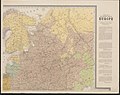
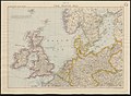
 Bacon's large-print map of Northern Europe (5008136).jpg 5,000 × 3,766; 3.3 MB
-
 Bacon's large-scale map of the British Battle Front, 1917 (5008116).jpg 3,337 × 5,000; 2.96 MB
-
 Bacon's large-scale map of the British Battle Front, 1918 (5008111).jpg 3,376 × 5,000; 3.18 MB
-
 Bacon's large-scale map of the Franco-American battle front (5008101).jpg 3,241 × 5,000; 3.38 MB
-
 Bacon's large-scale map of the French battle front (Peronne to Verdun) (5008091).jpg 5,000 × 3,219; 3.28 MB
-
 Bacon's large-scale map of the French battle front (Peronne to Verdun), 1917 (5008096).jpg 5,000 × 3,236; 3.31 MB
-
 Bacon's large-scale map of the French battle front, 1916 (5008126).jpg 3,236 × 5,000; 3.2 MB
-
 Bacon's large-scale map of the Salonika battle front (5008151).jpg 5,000 × 3,358; 3.07 MB
-
 Bacon's map of the seat of war in North Sea, Belgium and Eastern France (5008141).jpg 3,525 × 5,000; 3.71 MB
-
 Bacon's new chart of the world Mercator's projection (5008614).jpg 5,000 × 3,961; 4.93 MB
-
 Bacon's new war map Paris to Berlin (5008106).jpg 5,000 × 4,398; 5.16 MB
-
 Bacon's picture-map of the war area (5008058).jpg 5,000 × 4,142; 2.42 MB
-
 Bacon's picture-map of the Western war area (5008053).jpg 3,564 × 5,000; 2.37 MB
-
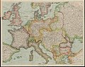
 Bacon's war map of Europe (5008061).jpg 5,000 × 3,981; 4.7 MB
-
 Bacon's war map of Mesopotamia (5008076).jpg 5,000 × 3,334; 2.56 MB
-
 Bacon's war map of Mesopotamia, 1917 (5008081).jpg 5,000 × 3,266; 3.06 MB
-
 Bacon's war map of South-Central Europe (5008086).jpg 3,643 × 5,000; 3.33 MB
-
 Bacon's war map of the Italian and Austrian frontiers (5008071).jpg 5,000 × 4,087; 4.21 MB
-
 Bacon's war-map of Europe embracing all the countries involved (5008146).jpg 5,000 × 4,103; 4.14 MB
-
 Bartholomew's general war map of Europe and the Mediterranean (5007977).jpg 5,000 × 4,022; 3.55 MB
-
 Bartholomew's general war map of Europe and the Mediterranean, 1919 (5008457).jpg 5,000 × 4,028; 3.47 MB
-
 Bartholomew's map of Asia Minor, Egypt, Mesopotamia and Persia (5007987).jpg 5,000 × 3,222; 2.59 MB
-
 Bartholomew's map of North-Eastern France, Belgium and the Rhine (5008556).jpg 5,000 × 3,761; 3.51 MB
-

-
 Bartholomew's war map of Central Europe 1914 (5008447).jpg 3,241 × 5,000; 3.86 MB
-
 Bartholomew's war map of Italy and the Balkan States (5008442).jpg 5,000 × 3,756; 4.16 MB
-

-

-
 Birmingham Gazette war map (5003767).jpg 5,000 × 4,093; 2.52 MB
-
 Black Cat war map of Europe (5003775).jpg 5,000 × 3,352; 2.61 MB
-

-
 British battles during 1918 (8th Aug to 11th Nov 1918) (5003773).jpg 3,952 × 5,000; 2.11 MB
-
 British defences of Hill 70, Vimy Ridge & Arras previous to March 1918 (5003772).jpg 3,803 × 5,000; 2.91 MB
-
 Central Europe Map (5003796a).jpg 5,000 × 4,005; 3.29 MB
-
 Central Europe Map (5003796b).jpg 5,000 × 4,028; 3.18 MB
-
 Central Europe Map (5003796c).jpg 5,000 × 4,005; 2.9 MB
-
 Central Europe Map (5003796d).jpg 5,000 × 4,014; 2.33 MB
-
 Central Europe Map (5003796e).jpg 5,000 × 3,995; 2.75 MB
-

-
 Daily Mail general war map of Europe (5008000).jpg 5,000 × 3,061; 3.04 MB
-
 Daily Mail war map (5008005).jpg 5,000 × 3,232; 3.14 MB
-
 Daily Mail world map of war and commerce (5008015).jpg 5,000 × 3,751; 3.49 MB
-
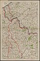
 Eastern frontier of Germany (5003803).jpg 4,666 × 5,000; 3.45 MB
-
 El Imperio que Alemania ha perdido en Africa (5003881).jpg 5,000 × 3,329; 1.47 MB
-
 Embassy of Ukraine in Greece 1919.jpg 1,500 × 2,000; 1.13 MB
-
 Ethnographical map of Central & South Eastern Europe (5003851).jpg 3,908 × 5,000; 1.93 MB
-
 Europe embracing all the countries involved (5008156).jpg 5,000 × 3,979; 4.36 MB
-
 France (5003852).jpg 3,746 × 5,000; 2.98 MB
-
 Gall & Inglis' map of Central Europe showing the war area (5003847).jpg 5,000 × 3,506; 3 MB
-
 General map showing European frontiers (5007996).jpg 5,000 × 3,946; 3.34 MB
-
 General map showing European frontiers, 1914 (5008452).jpg 5,000 × 3,286; 4.17 MB
-
 Gill 's war map with commercial references (5009178).jpg 5,000 × 3,204; 2.93 MB
-
 Large scale map of the Dardanelles (5008161).jpg 5,000 × 3,339; 2.58 MB
-

-
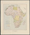
 Map of Africa to illustrate the progress of surveys and explorations (5003885).jpg 4,379 × 4,992; 2.3 MB
-
 Map of central and South Africa (5008566).jpg 3,767 × 5,000; 3.49 MB
-
 Map of the Balkan Peninsula (5008561).jpg 3,825 × 5,000; 2.98 MB
-
 Map of the country around Vladivostok (5003771).jpg 5,000 × 4,817; 3.45 MB
-
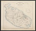 Map of the Island of Malta (5003843).jpg 5,000 × 4,246; 2.34 MB
-
 Map of the North Sea (5003813).jpg 5,000 × 3,675; 2.92 MB
-
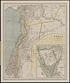 Modern Palestine and Syria (5008479).jpg 4,240 × 5,000; 2.9 MB
-
 New hand-map of Europe to illustrate territorial changes since 1914 (5003866).jpg 5,000 × 3,966; 3.24 MB
-
 Philips' 2 miles to an inch strategical map of the British Front (5008295).jpg 5,000 × 4,225; 5.17 MB
-
 Philips' contoured map of the European battle fronts showing the new Europe (5008467).jpg 5,000 × 4,065; 5.23 MB
-
 Philips' large scale battle front map of Europe showing the allies' iron ring (5008353).jpg 5,000 × 4,382; 5.09 MB
-
 Philips' large scale contoured map of the Anglo-French front (5008303).jpg 5,000 × 4,021; 5.7 MB
-
 Philips' large scale strategical war map of Europe (5008307).jpg 5,000 × 3,945; 5.76 MB
-
 Philips' large scale strategical war map of Europe (5008393).jpg 5,000 × 3,943; 5.71 MB
-
 Philips' large scale strategical war map of Europe Balkans area (5008299).jpg 3,931 × 5,000; 4.8 MB
-

-
 Philips' map of Central Europe (5003842).jpg 5,000 × 4,251; 4.51 MB
-
 Philips' photo-relief model war map of Central Europe (5008462).jpg 5,000 × 2,802; 2.21 MB
-
 Philips' strategical map of Mesopotamia & Asia Minor (5008429).jpg 5,000 × 3,788; 3.49 MB
-
 Philips' strategical map of Palestine, Syria and the Sinai Peninsula (5008433).jpg 3,743 × 5,000; 3.38 MB
-
 Political map of Africa showing international boundaries and railways (5003768).jpg 4,249 × 5,000; 1.99 MB
-
 Sea of Marmara - The theatre of war in Western Asia Minor (5003809) (cropped).jpg 2,402 × 1,006; 390 KB
-

-
 Skeleton map of Western Europe (5003814a).jpg 5,000 × 3,865; 1.78 MB
-
 Skeleton map of Western Europe (5003814b).jpg 5,000 × 3,862; 1.91 MB
-
 Skeleton map of Western Europe (5003814c).jpg 5,000 × 3,826; 1.57 MB
-
 Skeleton map of Western Europe (5003814d).jpg 5,000 × 3,853; 1.65 MB
-
 Skeleton map of Western Europe (5003814e).jpg 5,000 × 3,913; 1.6 MB
-
 Skeleton map of Western Europe (5003814f).jpg 5,000 × 3,855; 1.43 MB
-
 Stanford's half-inch map of the battle front between the Somme and Soissons (5003806).jpg 5,000 × 4,102; 2.92 MB
-
 Stanford's half-inch map of the battle front east of Soissons (5003848).jpg 5,000 × 3,632; 2.86 MB
-
 Stanford's half-inch map of the battle front Mons, Brussels, Louvain (5003850).jpg 5,000 × 3,622; 3.57 MB
-

-
 Stanford's half-inch map of the battle front Ostend, Zeebrugge, Bruges (5003849).jpg 5,000 × 4,087; 2.98 MB
-
 Stanford's half-inch map of the battle front Valenciennes, Maubeuge, Avesnes (5003807).jpg 5,000 × 3,687; 3.28 MB
-
 Stanford's half-inch map of the British front in France and Flanders (5003855).jpg 2,985 × 5,000; 2.86 MB
-

-
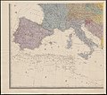
 Stanford's map of Europe, Africa, & Western Asia (5003802).jpg 3,611 × 5,000; 2.5 MB
-
 Stanford's map of the German Empire (5003872a).jpg 3,555 × 5,000; 3.06 MB
-
 Stanford's map of the German Empire (5003872b).jpg 3,573 × 5,000; 2.74 MB
-
 Stanford's map of the Kingdom of Italy (5003857).jpg 4,635 × 5,000; 3.22 MB
-
 Stanford's shilling map of the Austro-Italian frontier (5007991).jpg 5,000 × 3,710; 3.83 MB
-
 Straits of Gibraltar (5003774).jpg 4,819 × 5,000; 2.82 MB
-
 Strategical map of the North Sea and adjacent countries (5003853).jpg 5,000 × 4,505; 2.07 MB
-
 Strategical record map of the western front 1914-1918 (5008554).jpg 5,000 × 4,110; 4.7 MB
-
 Subject nationalities of the German Alliance (5003884).jpg 5,000 × 3,700; 2.16 MB
-
 The allies' gains on the western front 1914-1917 (5008520).jpg 5,000 × 4,118; 5.07 MB
-
 The Allies' map of the Western Front (5008474).jpg 5,000 × 3,994; 6.25 MB
-
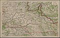
 The Austro-German and Russian frontiers (5003831).jpg 5,000 × 3,362; 3.05 MB
-
 The Balkans - The Graphic war map (5003846) (cropped).jpg 2,421 × 1,583; 943 KB
-

-
 The Daily Express large print map (5003844).jpg 5,000 × 4,020; 2.74 MB
-
 The downfall of Germany's world-empire (5003869).jpg 5,000 × 4,307; 1.74 MB
-
 The European war, 1914 map illustrating the Western campaign (5008291).jpg 5,000 × 3,740; 3.76 MB
-
 The Franco-Belgian and German frontiers (5003828).jpg 5,000 × 3,370; 3.3 MB
-
 The Franco-German frontier and Western Germany (5003878).jpg 5,000 × 3,661; 3.21 MB
-
 The Graphic war map (5003846).jpg 5,000 × 3,714; 3.09 MB
-
 The National Review map of the western front (5008437).jpg 5,000 × 3,929; 4.46 MB
-
 The naval war in the North Sea (5003839a).jpg 5,000 × 3,418; 2.83 MB
-
 The naval war in the North Sea (5003839b).jpg 5,000 × 3,434; 3.32 MB
-
 The Netherlands and Belgium (5003879).jpg 5,000 × 3,675; 3.14 MB
-
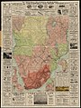
 The railway map map of South Africa (5008579).jpg 4,560 × 5,000; 4.37 MB
-
 The Russian battle front in Europe (5003804).jpg 3,875 × 5,000; 3.01 MB
-
 The satisfactory position of out relations with neutrals (5003883).jpg 5,000 × 3,149; 1.27 MB
-
 The seat of the war in Belgium (5003812).jpg 5,000 × 3,848; 4.5 MB
-
 The seat of war in Eastern Europe (5003811).jpg 3,466 × 5,000; 2.97 MB
-
 The seat of war in the Dardanelles and the Bosporus (5003810).jpg 5,000 × 4,326; 3.28 MB
-
 The seat of war on the Austro-Italian frontier (5003808).jpg 5,000 × 3,288; 3.56 MB
-
 The states & provinces of the Balkan Peninsula (5003770).jpg 3,777 × 5,000; 2.52 MB
-
 The Strand coloured detail map of the Balkan states (5003785).jpg 4,101 × 5,000; 3.8 MB
-
 The Strand coloured detail map of the Dardanelles, Constantinople (5003782).jpg 5,000 × 4,185; 2.74 MB
-
 The theatre of war in Eastern Europe (5003858).jpg 3,703 × 5,000; 4.77 MB
-
 The theatre of war in the Balkan Peninsula (5003856).jpg 5,000 × 3,532; 3.3 MB
-
 The theatre of war in Western Asia Minor (5003809).jpg 5,000 × 3,403; 2.34 MB
-
 The western war area the Seine Basin, Belgium, and the Rhine Lands (5003823a).jpg 5,000 × 3,876; 3.09 MB
-
 The western war area the Seine Basin, Belgium, and the Rhine Lands (5003823b).jpg 5,000 × 3,880; 3.49 MB
-
 The western war area the Seine Basin, Belgium, and the Rhine Lands (5003823c).jpg 5,000 × 3,860; 3.26 MB
-
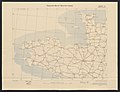
 Trench map showing German positions around the town of Beerst (5028175).jpg 5,000 × 3,002; 2.41 MB
-

-
 W & A K Johnston's war map of Belgium and North-East France (5008049).jpg 5,000 × 4,017; 4 MB
-
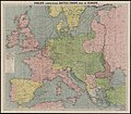
 W & A K Johnston's war map of Europe 1914-1916 (5008287).jpg 5,000 × 3,729; 3.74 MB
-
 W & A K Johnston's war map of Palestine (5008037).jpg 4,137 × 5,000; 2.87 MB
-
 W & A K Johnston's war map of the Balkan States (5008033).jpg 4,003 × 5,000; 3.14 MB
-
 W & A K Johnston's war map of the Dardanelles & Bosporus (5008041).jpg 5,000 × 4,007; 2.23 MB
-
 W & A K Johnston's war map of the Middle East (5008045).jpg 5,000 × 3,271; 3.12 MB
-
 W & A K Johnston's war map of the Western Front (5008029).jpg 3,979 × 5,000; 3.11 MB
-
 War map of Central Europe (5003788).jpg 5,000 × 3,357; 2.89 MB
-
 Western Theatre of war (5003886).jpg 5,000 × 4,875; 3.82 MB
-
 What Germany wants (5003887).jpg 5,000 × 3,449; 1.78 MB
-
 İstanbul - The theatre of war in Western Asia Minor (5003809) (cropped).jpg 2,006 × 1,769; 718 KB
_(5003791).jpg)
_(5003791b).jpg)
_(5003791c).jpg)
_(5003791d).jpg)
.jpg)
.jpg)
.jpg)
.jpg)
.jpg)
_(5008091).jpg)
,_1917_(5008096).jpg)
.jpg)
.jpg)
.jpg)
.jpg)
.jpg)
.jpg)
.jpg)
.jpg)
.jpg)
.jpg)
.jpg)
.jpg)
.jpg)
.jpg)
.jpg)
.jpg)
.jpg)
.jpg)
.jpg)
.jpg)
_(cropped).jpg)
_(cropped).jpg)
.jpg)
.jpg)
_(cropped).jpg)
_(5003773).jpg)
.jpg)
.jpg)
.jpg)
.jpg)
.jpg)
.jpg)
.jpg)
.jpg)
.jpg)
.jpg)
.jpg)
.jpg)

.jpg)
.jpg)
.jpg)
.jpg)
.jpg)
.jpg)
.jpg)
.jpg)
.jpg)
.jpg)
.jpg)
.jpg)
.jpg)
.jpg)
.jpg)
.jpg)
.jpg)
.jpg)
.jpg)
.jpg)
.jpg)
.jpg)
.jpg)
.jpg)
.jpg)
.jpg)
.jpg)
.jpg)
.jpg)
.jpg)
_(cropped).jpg)
_(cropped).jpg)
.jpg)
.jpg)
.jpg)
.jpg)
.jpg)
.jpg)
.jpg)
.jpg)
.jpg)
.jpg)
.jpg)
.jpg)
.jpg)
.jpg)
.jpg)
.jpg)
.jpg)
.jpg)
.jpg)
.jpg)
.jpg)
.jpg)
.jpg)
.jpg)
.jpg)
.jpg)
_(cropped).jpg)
_(cropped).jpg)
.jpg)
.jpg)
.jpg)
.jpg)
.jpg)
.jpg)
.jpg)
.jpg)
.jpg)
.jpg)
.jpg)
.jpg)
.jpg)
.jpg)
.jpg)
.jpg)
.jpg)
.jpg)
.jpg)
.jpg)
.jpg)
.jpg)
.jpg)
.jpg)
.jpg)
.jpg)
.jpg)
_(cropped).jpg)
.jpg)
.jpg)
.jpg)
.jpg)
.jpg)
.jpg)
.jpg)
.jpg)
.jpg)
.jpg)
_(cropped).jpg)