Category:Wroxton
Jump to navigation
Jump to search
village and civil parish in Cherwell district, Oxfordshire, England  | |||||
| Upload media | |||||
| Instance of | |||||
|---|---|---|---|---|---|
| Location | Cherwell, Oxfordshire, South East England, England | ||||
| Population |
| ||||
| Area |
| ||||
| official website | |||||
 | |||||
Subcategories
This category has the following 10 subcategories, out of 10 total.
A
- All Saints' Church, Wroxton (39 F)
H
- Wroxton House Hotel (5 F)
N
- North Arms, Wroxton (7 F)
O
- Oxfordshire Ironstone Railway (14 F)
V
- Wroxton Village Hall (2 F)
W
- White Horse, Wroxton (5 F)
- Wroxton Abbey (13 F)
- Wroxton guide post (6 F)
Media in category "Wroxton"
The following 147 files are in this category, out of 147 total.
-
 Wroxton village flag.png 1,033 × 620; 40 KB
-
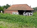 "Iron Gates" - geograph.org.uk - 4995622.jpg 640 × 480; 328 KB
-
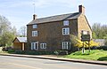 'Black Swan House', Stratford Road - geograph.org.uk - 5353467.jpg 1,024 × 668; 164 KB
-
 CS p3.098 - Wroxton Abbey, Oxfordshire - Morris's County Seats, 1879.jpg 2,768 × 1,965; 1.17 MB
-
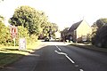
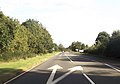
 A422 (Stratford Road) approaching Wroxton - geograph.org.uk - 4916690.jpg 1,024 × 683; 246 KB
-
 A422 (Stratford Road) heading towards Drayton - geograph.org.uk - 4916708.jpg 1,024 × 683; 197 KB
-
 A422 through Wroxton - geograph.org.uk - 3152656.jpg 640 × 426; 81 KB
-
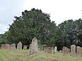 All Saints, Wroxton, churchyard (i) - geograph.org.uk - 5098745.jpg 640 × 480; 78 KB
-
 All Saints, Wroxton, churchyard (ii) - geograph.org.uk - 5098747.jpg 640 × 480; 82 KB
-
 All Saints, Wroxton, churchyard (iii) - geograph.org.uk - 5098748.jpg 640 × 480; 115 KB
-
 Approaching Wroxton - geograph.org.uk - 2061761.jpg 640 × 480; 65 KB
-
 Balscote and the Butchers' Arms - geograph.org.uk - 5537383.jpg 640 × 360; 55 KB
-

-
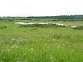 Balscote Quarry Nature Reserve - geograph.org.uk - 4995627.jpg 640 × 480; 258 KB
-
 Balscote Quarry Nature Reserve - geograph.org.uk - 4995629.jpg 640 × 480; 291 KB
-

-
 Balscote-The Butcher's Arms - geograph.org.uk - 4967291.jpg 1,600 × 1,200; 403 KB
-
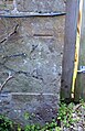 Benchmark on 'Black Swan House', Stratford Road - geograph.org.uk - 5353452.jpg 662 × 1,024; 238 KB
-

-
 Buildings at Priory Farm - geograph.org.uk - 5747767.jpg 640 × 427; 172 KB
-
 Chapel Lane, Balscote - geograph.org.uk - 4995624.jpg 640 × 480; 257 KB
-
 Clear footpath - geograph.org.uk - 2694640.jpg 640 × 480; 85 KB
-
 Cottage off Church Street, Wroxton - geograph.org.uk - 2431134.jpg 640 × 480; 106 KB
-

-
 Cross roads and turnoff for Quarries - geograph.org.uk - 3152647.jpg 640 × 449; 74 KB
-
 Disused garage in Balscote - geograph.org.uk - 4995604.jpg 640 × 480; 256 KB
-
 Dugouts by Wroxton football pitch - geograph.org.uk - 3467766.jpg 640 × 480; 304 KB
-
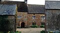
 Farmhouse beside A422 (Stratford Road) - geograph.org.uk - 5353545.jpg 1,024 × 683; 166 KB
-
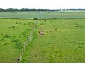
 Field of barley near Balscote - geograph.org.uk - 4995608.jpg 640 × 480; 278 KB
-
 Field of barley near Balscote - geograph.org.uk - 4995609.jpg 640 × 480; 287 KB
-
 Fields of wheat near Langley House Farm - geograph.org.uk - 4995698.jpg 640 × 480; 266 KB
-
-
 Final resting place - geograph.org.uk - 2746343.jpg 3,456 × 2,592; 3.6 MB
-
 Wroxton village flag.svg 1,200 × 720; 17 KB
-
 From Balscote churchyard - geograph.org.uk - 5537371.jpg 640 × 360; 71 KB
-
 From Balscote village green - geograph.org.uk - 5537342.jpg 640 × 360; 110 KB
-
 Houses in Wroxton - geograph.org.uk - 5098939.jpg 640 × 480; 55 KB
-
 Houses on Shutford Road, Balscote - geograph.org.uk - 5537361.jpg 640 × 360; 84 KB
-
 Inside All Saints, Wroxton (i) - geograph.org.uk - 5098767.jpg 640 × 480; 44 KB
-
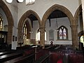 Inside All Saints, Wroxton (ii) - geograph.org.uk - 5098769.jpg 640 × 480; 60 KB
-
 Inside All Saints, Wroxton (iii) - geograph.org.uk - 5098772.jpg 640 × 480; 81 KB
-
 Inside All Saints, Wroxton (iv) - geograph.org.uk - 5098774.jpg 640 × 480; 47 KB
-
 Inside All Saints, Wroxton (ix) - geograph.org.uk - 5098837.jpg 480 × 640; 48 KB
-
 Inside All Saints, Wroxton (v) - geograph.org.uk - 5098778.jpg 640 × 480; 55 KB
-
 Inside All Saints, Wroxton (vi) - geograph.org.uk - 5098780.jpg 640 × 480; 70 KB
-
 Inside All Saints, Wroxton (vii) - geograph.org.uk - 5098782.jpg 640 × 480; 62 KB
-
 Inside All Saints, Wroxton (viii) - geograph.org.uk - 5098834.jpg 480 × 640; 56 KB
-
 Inside All Saints, Wroxton (x) - geograph.org.uk - 5098838.jpg 640 × 480; 63 KB
-
 Inside All Saints, Wroxton (xi) - geograph.org.uk - 5098883.jpg 480 × 640; 35 KB
-
 Inside All Saints, Wroxton (xii) - geograph.org.uk - 5098884.jpg 640 × 480; 107 KB
-
 Inside All Saints, Wroxton (xiii) - geograph.org.uk - 5098891.jpg 480 × 640; 57 KB
-
 Inside All Saints, Wroxton (xiv) - geograph.org.uk - 5098898.jpg 480 × 640; 69 KB
-

-

-

-

-
 Iron country - geograph.org.uk - 5193376.jpg 640 × 480; 139 KB
-
 Ironstone Lane - geograph.org.uk - 5193382.jpg 640 × 480; 236 KB
-
 Ironstone Lane - geograph.org.uk - 5737367.jpg 640 × 427; 225 KB
-
 Jenny's Sanctuary at Heath Farm - geograph.org.uk - 4995613.jpg 640 × 480; 275 KB
-
 Junction near Horley - geograph.org.uk - 2947947.jpg 640 × 480; 48 KB
-
 Lane at Ragnell Farm - geograph.org.uk - 5737366.jpg 640 × 427; 227 KB
-
 Lane to North Newington - geograph.org.uk - 5737369.jpg 640 × 427; 193 KB
-
 Lane towards A422 - geograph.org.uk - 5193358.jpg 640 × 480; 220 KB
-
 Lane towards Hornton - geograph.org.uk - 5193401.jpg 640 × 480; 283 KB
-
 Looking down Chapel Lane, Balscote - geograph.org.uk - 5537353.jpg 640 × 360; 70 KB
-
 Main Street, Wroxton - geograph.org.uk - 2431173.jpg 640 × 480; 81 KB
-
 Main Street, Wroxton - geograph.org.uk - 3467790.jpg 640 × 480; 293 KB
-
 Manor Farm Lane, Balscote - geograph.org.uk - 5537305.jpg 640 × 360; 49 KB
-
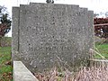
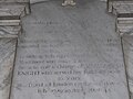
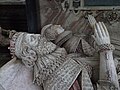 Memorial effigies in Wroxton church - geograph.org.uk - 5798044.jpg 1,024 × 768; 195 KB
-
 Middle Lane, Balscote - geograph.org.uk - 4995623.jpg 640 × 480; 325 KB
-
 Milestone in verge of A422 Stratford Road - geograph.org.uk - 4915727.jpg 1,024 × 683; 250 KB
-
 Milestone on north side of the A422 (geograph 4915723).jpg 683 × 1,024; 336 KB
-
 Milestone, Stratford Road, Wroxton - geograph.org.uk - 2431184.jpg 640 × 480; 141 KB
-
 The North Arms, Wroxton - geograph.org.uk - 553103.jpg 640 × 480; 61 KB
-
 Minor road, Horley, Oxfordshire - geograph.org.uk - 3691411.jpg 1,600 × 1,045; 503 KB
-
 Muddy Road South of Hornton - geograph.org.uk - 5734689.jpg 640 × 427; 258 KB
-
 Newly Sown Field at Horley - geograph.org.uk - 3174875.jpg 640 × 480; 86 KB
-
 Newly Sown Fields at Wroxton - geograph.org.uk - 3174879.jpg 640 × 480; 81 KB
-

-
 Old rectory, Balscote - geograph.org.uk - 5537331.jpg 640 × 360; 74 KB
-
 Plantation south of Horley - geograph.org.uk - 5193643.jpg 640 × 428; 132 KB
-
 Priory Farm, Balscote - geograph.org.uk - 5537311.jpg 640 × 360; 84 KB
-
 Pub in Balscote - geograph.org.uk - 5624902.jpg 640 × 480; 48 KB
-
 Ragnell Barn - geograph.org.uk - 5193391.jpg 640 × 428; 147 KB
-
 Road From Balscote to Shutford - geograph.org.uk - 5747740.jpg 640 × 444; 187 KB
-
 Rush hour in Wroxton - geograph.org.uk - 5098741.jpg 480 × 640; 51 KB
-
 Sharp bend in the A422 - geograph.org.uk - 2050875.jpg 640 × 480; 66 KB
-
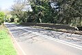 South parapet of bridge for A422 over Sor Brook - geograph.org.uk - 4916532.jpg 1,024 × 683; 259 KB
-
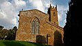 St Mary Magdalene, Balscote - geograph.org.uk - 5537369.jpg 640 × 360; 60 KB
-
 St Mary Magdalene, Balscote - geograph.org.uk - 5537389.jpg 640 × 360; 57 KB
-

-

-
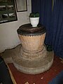 St Mary Magdalene, Balscote, font - geograph.org.uk - 5624913.jpg 480 × 640; 48 KB
-

-

-

-
 St Mary Magdalene, Balscote, pulpit - geograph.org.uk - 5624932.jpg 480 × 640; 53 KB
-
 St Mary Magdalene, Balscote, rear - geograph.org.uk - 5624909.jpg 640 × 480; 67 KB
-
 St Mary Magdalene, Balscote, tower - geograph.org.uk - 5624942.jpg 480 × 640; 87 KB
-
 Straight and nameless lane - geograph.org.uk - 5193617.jpg 640 × 480; 249 KB
-
 Stratford Road passing Heath Farm - geograph.org.uk - 4505482.jpg 1,500 × 999; 188 KB
-
 Stratford Road towards Edgehill - geograph.org.uk - 4505467.jpg 1,500 × 999; 150 KB
-
 Stratford Road towards Edgehill - geograph.org.uk - 4505475.jpg 1,500 × 999; 155 KB
-
 T-junction on the Wroxton to Horley Road - geograph.org.uk - 1771710.jpg 3,072 × 2,304; 3.46 MB
-
 T-junction south of Horley - geograph.org.uk - 1865804.jpg 640 × 480; 94 KB
-

-
 The effects of quarrying - geograph.org.uk - 3467816.jpg 640 × 480; 257 KB
-
 The heart of Balscote - geograph.org.uk - 5537377.jpg 640 × 360; 72 KB
-
 The Indian Queen, Alkerton - geograph.org.uk - 5800524.jpg 2,014 × 1,490; 1.24 MB
-
 The Old Post Office, Wroxton - geograph.org.uk - 3467797.jpg 640 × 480; 272 KB
-
 The road from North Newington to Wroxton - geograph.org.uk - 5593718.jpg 4,000 × 3,000; 4.4 MB
-
 The Stratford Rd in Wroxton - geograph.org.uk - 5737368.jpg 640 × 427; 205 KB
-
 The W O Bentley Memorial Building - geograph.org.uk - 3467841.jpg 640 × 480; 244 KB
-
 Turning for Balscott - geograph.org.uk - 3152641.jpg 640 × 501; 104 KB
-
 Victorian house on Stratford Road, Wroxton - geograph.org.uk - 5800522.jpg 2,048 × 1,536; 1.42 MB
-

-
 Village Pond, Wroxton - geograph.org.uk - 553106.jpg 640 × 480; 88 KB
-
 Woxton-Banbury Mineral line 2.JPG 3,497 × 2,392; 5.85 MB
-

-
 Wroxton Abbey grounds - geograph.org.uk - 553111.jpg 640 × 480; 71 KB
-
 Wroxton Cemetery - geograph.org.uk - 197996.jpg 640 × 480; 78 KB
-
 Wroxton College (Formerly Abbey) - geograph.org.uk - 4322023.jpg 1,600 × 1,200; 619 KB
-
 Wroxton Cricket Club - geograph.org.uk - 3467759.jpg 640 × 480; 242 KB
-
 Wroxton from the west - geograph.org.uk - 3152653.jpg 640 × 407; 75 KB
-
 Wroxton Heath crossroads - geograph.org.uk - 3152637.jpg 640 × 423; 85 KB
-
 Wroxton iron mine 1.jpg 864 × 605; 480 KB
-
 Wroxton Mill - geograph.org.uk - 197426.jpg 640 × 480; 58 KB
-
 Wroxton millennium marker - geograph.org.uk - 441146.jpg 640 × 480; 120 KB
-
 Wroxton OIR P-hut.JPG 1,676 × 1,172; 1.84 MB
-
 Wroxton OIR tool shed.JPG 3,437 × 1,160; 3.28 MB
-
 Wroxton qarry a1.png 873 × 584; 906 KB
-
 Wroxton qarry ruins.JPG 3,485 × 2,380; 6.83 MB
-
 Wroxton's Millennium Stone - geograph.org.uk - 5098942.jpg 640 × 480; 56 KB
-
 Wroxton, thatched cottages - geograph.org.uk - 2831075.jpg 1,024 × 761; 174 KB
-
 Wroxton, The Old Post Office - geograph.org.uk - 2831199.jpg 1,024 × 768; 181 KB
-
 Wroxton, village pond - geograph.org.uk - 2831185.jpg 1,024 × 768; 266 KB
-
 Balscott in the Snow (February 2007) - geograph.org.uk - 485940.jpg 640 × 427; 111 KB
-
 Broughton Grounds Farm - geograph.org.uk - 236914.jpg 640 × 480; 45 KB
-
 Claydon Hill - geograph.org.uk - 202603.jpg 640 × 480; 66 KB
-
 Desirable thatched residence - geograph.org.uk - 188261.jpg 640 × 480; 139 KB
-
 French's Buildings - geograph.org.uk - 202604.jpg 640 × 480; 47 KB
-
 Gardens of Wroxton Abbey - geograph.org.uk - 553109.jpg 640 × 480; 64 KB
-
 Golf course at Wroxton Mill - geograph.org.uk - 198019.jpg 640 × 480; 49 KB
-
 In the grounds of Wroxton College - geograph.org.uk - 42012.jpg 640 × 480; 186 KB
-
 Shutford Bridge - geograph.org.uk - 238433.jpg 640 × 480; 95 KB
-
 Skyline trees catch the evening sun - geograph.org.uk - 485934.jpg 493 × 640; 122 KB


_approaching_Wroxton_-_geograph.org.uk_-_4916690.jpg)
_heading_towards_Drayton_-_geograph.org.uk_-_4916708.jpg)

_-_geograph.org.uk_-_5098745.jpg)
_-_geograph.org.uk_-_5098747.jpg)
_-_geograph.org.uk_-_5098748.jpg)


_-_geograph.org.uk_-_5353545.jpg)


_-_geograph.org.uk_-_5098767.jpg)
_-_geograph.org.uk_-_5098769.jpg)
_-_geograph.org.uk_-_5098772.jpg)
_-_geograph.org.uk_-_5098774.jpg)
_-_geograph.org.uk_-_5098837.jpg)
_-_geograph.org.uk_-_5098778.jpg)
_-_geograph.org.uk_-_5098780.jpg)
_-_geograph.org.uk_-_5098782.jpg)
_-_geograph.org.uk_-_5098834.jpg)
_-_geograph.org.uk_-_5098838.jpg)
_-_geograph.org.uk_-_5098883.jpg)
_-_geograph.org.uk_-_5098884.jpg)
_-_geograph.org.uk_-_5098891.jpg)
_-_geograph.org.uk_-_5098898.jpg)

_-_geograph.org.uk_-_5624936.jpg)
_-_geograph.org.uk_-_5624937.jpg)
_-_geograph.org.uk_-_5624939.jpg)


.jpg)


_-_geograph.org.uk_-_5624927.jpg)
_-_geograph.org.uk_-_5624929.jpg)


_-_geograph.org.uk_-_4322023.jpg)


_-_geograph.org.uk_-_485940.jpg)


