Category:Zieleniewski forge in Kraków
Jump to navigation
Jump to search
| Object location | | View all coordinates using: OpenStreetMap |
|---|
 | |||||
| Upload media | |||||
| Instance of | |||||
|---|---|---|---|---|---|
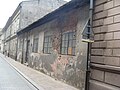
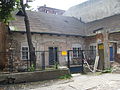
| Location | Kraków, Lesser Poland Voivodeship, Poland | ||||
| Street address |
| ||||
| Heritage designation |
| ||||
| Inception |
| ||||
 | |||||
| Address |
|
Media in category "Zieleniewski forge in Kraków"
The following 4 files are in this category, out of 4 total.
-
 Kuznia Zieleniewskich.JPG 3,264 × 2,448; 1.97 MB
-
 Kuznia Zieleniewskich2.JPG 3,264 × 2,448; 2.01 MB
-
 Kuznia Zieleniewskich3.JPG 3,264 × 2,448; 2 MB
-
 KuźniaZieleniewskich-UlicaŚw.Krzyża16-POL, Kraków.jpg 3,672 × 3,632; 3.3 MB


