Category:Zuckerfabrik Aarberg
Jump to navigation
Jump to search
| Object location | | View all coordinates using: OpenStreetMap |
|---|
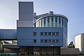
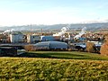
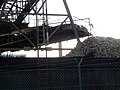
old building of the sugar factory in Aarberg in the canton of Bern, Switzerland  | |||||
| Upload media | |||||
| Instance of | |||||
|---|---|---|---|---|---|
| Part of | |||||
| Location | Aarberg, Seeland administrative district, Seeland administrative region, Bern, Switzerland | ||||
| Street address |
| ||||
| Heritage designation | |||||
| Inception |
| ||||
| Elevation above sea level |
| ||||
 | |||||
Media in category "Zuckerfabrik Aarberg"
The following 16 files are in this category, out of 16 total.
-
 Aarberg Zuckerfabrik.jpg 5,064 × 3,376; 10.97 MB
-
 Aarberg-Zuckerfabrik.jpg 1,200 × 800; 1.02 MB
-
 ETH-BIB-Aarberg mit Zuckermühle-LBS H1-012253.tif 6,629 × 4,580; 87.01 MB
-
 Logo Zuckerfabriken Sucreries Aarberg + Frauenfeld AG ZAF.jpeg 300 × 217; 10 KB
-
 Packaged Sugar Suisse 1.jpg 1,629 × 1,254; 342 KB
-
 Packaged Sugar Suisse 2.jpg 2,184 × 1,509; 408 KB
-
 Packaged Sugar Suisse 3.jpg 2,421 × 1,965; 1.89 MB
-
 Swiss field ration - commonwealth nz808j21v.jpg 4,050 × 3,252; 827 KB
-
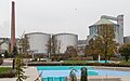 Zuckerfabrik Aarberg (und Schwimmbad Aarberg).jpg 4,000 × 2,500; 6.06 MB
-
 Zuckerfabrik Aarberg 01.jpg 4,608 × 3,456; 6.09 MB
-
 Zuckerfabrik Aarberg 02.jpg 4,608 × 3,456; 6.04 MB
-
 Zuckerfabrik Aarberg 03.jpg 4,608 × 3,456; 5.6 MB
-
 Zuckerfabrik Aarberg 04.jpg 4,608 × 3,456; 4.77 MB
-
 Zuckerfabrik Aarberg 1899.jpg 1,685 × 2,745; 1.11 MB
-
 Zuckerfabrik Aarberg mit Gleisanschluss.jpg 4,200 × 2,363; 7.09 MB
-
 Zuckerfabrik Aarberg von der Gleisseite.jpg 4,200 × 2,800; 6.78 MB


.jpg)


