namn ID
inom det administrativa området plats geografiska koordinater bild
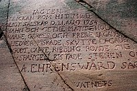
Abborrfors (historisk plats
1163
. Kymmene älv Lovisa
60°29′39″N 26°27′00″E / 60.494167°N 26.45°E / 60.494167; 26.45 Upload an image of this heritage site
Aleksis Kiven Palojoki (historiskt hus/museum
1501
. . Nurmijärvi
60°25′02″N 24°51′53″E / 60.417200345°N 24.864761135°E / 60.417200345; 24.864761135 Upload an image of this heritage site
Alexandersgatan (gata )
4654
. Gloet Helsingfors
60°10′08″N 24°56′56″E / 60.16898°N 24.948771°E / 60.16898; 24.948771
Alphyddans kyrka (kyrka )
5158
. Alphyddan . Helsingfors
60°11′29″N 24°56′28″E / 60.1914°N 24.9411°E / 60.1914; 24.9411 60°11′29″N 24°56′27″E / 60.1915185°N 24.9407777°E / 60.1915185; 24.9407777
Alvar Aalto's home and studio building (kulturlandskap
4665
. Gamla Munksnäs . Helsingfors
60°11′48″N 24°52′35″E / 60.19673789°N 24.87643271°E / 60.19673789; 24.87643271
Arabias fabriker (industriminne
4657
. Arabiastranden . Helsingfors
60°12′31″N 24°58′36″E / 60.208582°N 24.976705°E / 60.208582; 24.976705
Backas (jordbruksmiljö
4836
. . Vanda
Upload an image of this heritage site
Barösund (sund by
3975
. . Ingå
59°58′34″N 23°52′41″E / 59.976°N 23.878°E / 59.976; 23.878
Berghälls kyrka (kyrka )
1586
2Castrénsgatan Östra Prästgatan . Linjerna . Helsingfors Berghäll
60°11′03″N 24°56′57″E / 60.184166666667°N 24.949166666667°E / 60.184166666667; 24.949166666667 60°11′03″N 24°56′58″E / 60.18415437°N 24.94935954°E / 60.18415437; 24.94935954 60°11′03″N 24°56′58″E / 60.184235°N 24.949349°E / 60.184235; 24.949349 60°11′03″N 24°56′58″E / 60.1842278°N 24.9493341°E / 60.1842278; 24.9493341
Björkholmin luotsiasema (water traffic site
626
. . Borgå
60°20′15″N 25°37′18″E / 60.337399142°N 25.621581936°E / 60.337399142; 25.621581936 Upload an image of this heritage site
Borgå järnvägsstation (järnvägsstation )
1538
. . Borgå
60°23′47″N 25°38′53″E / 60.3964°N 25.6481°E / 60.3964; 25.6481
Bromarv kyrkby (kyrkby
4833
. Bromarv Raseborg
Upload an image of this heritage site
Brunnsparken (stadsdel i Helsingfors del av Helsingfors administrativa indelning
1553
. . Ulrikasborgs distrikt
60°09′25″N 24°57′25″E / 60.15694444°N 24.95694444°E / 60.15694444; 24.95694444
Brändö Villastad (trädgårdsstad
1563
. Brändö Helsingfors
60°10′59″N 25°00′36″E / 60.18293805555555°N 25.01000305555555°E / 60.18293805555555; 25.01000305555555 Upload an image of this heritage site
Campus d'Otaniemi (utbildningsinstitution
1360
. Otnäs Esbo
Upload an image of this heritage site
Colline de l'église de Pohja et ses environs (kyrkplats
1060
. . Raseborg
Upload an image of this heritage site
Dagmarkällan (kulturlandskap
4025
. Ekenäs . Raseborg
59°56′36″N 23°22′38″E / 59.94325°N 23.37717°E / 59.94325; 23.37717
Degerby (by kyrkby
4977
. Degerby Ingå
60°05′04″N 24°10′40″E / 60.084443888889°N 24.177778055556°E / 60.084443888889; 24.177778055556 Upload an image of this heritage site
Dickursby järnvägsstation (järnvägsstation stationsbyggnad
5059
. Ånäs Dickursby Vanda
60°17′38″N 25°02′42″E / 60.293889°N 25.045°E / 60.293889; 25.045
Domarby gård (gårdsmiljö herrgårdshus
55
7 Domarbyvägen . Domargård . Helsingfors
60°15′19″N 24°58′13″E / 60.255181°N 24.970324°E / 60.255181; 24.970324 60°15′19″N 24°58′14″E / 60.2552106°N 24.9704465°E / 60.2552106; 24.9704465
Dragsvik kaserner (historisk militärbas
1202
. Dragsvik . Raseborg
59°59′02″N 23°28′49″E / 59.983785533°N 23.480336791°E / 59.983785533; 23.480336791 Upload an image of this heritage site
Drumsö kyrka (kyrka )
5159
. Kvarnberget Helsingfors
60°09′32″N 24°52′09″E / 60.1589°N 24.8692°E / 60.1589; 24.8692 60°09′31″N 24°52′10″E / 60.15851221°N 24.86938335°E / 60.15851221; 24.86938335 60°09′31″N 24°52′09″E / 60.1585264°N 24.8691756°E / 60.1585264; 24.8691756
Drägsbyn kartano (gårdsmiljö
128
. . Borgå
60°22′21″N 25°33′40″E / 60.372627°N 25.561204°E / 60.372627; 25.561204 Upload an image of this heritage site
Eastern Spa Park (villaområde stadslandskap )
1186
. . Hangö
59°49′27″N 22°58′47″E / 59.824047°N 22.979851°E / 59.824047; 22.979851
Ekenäs gamla stan och hamn (stadslandskap )
1197
. . Raseborg
Upload an image of this heritage site
Elias Lönnrotin Sammatti (kulturlandskap
1353
. . Lojo
Upload an image of this heritage site
Eläintarhan huvilat ja yleishyödylliset laitokset (villaområde
3976
. . Helsingfors
Empire-Porvoon puutalokorttelit ja julkiset rakennukset (stadslandskap )
1531
. . Borgå
Upload an image of this heritage site
Esbo gård (herrgårdshus herrgård
33
. . Esbo
60°11′56″N 24°34′57″E / 60.1989°N 24.5825°E / 60.1989; 24.5825
Esplanaden (gata )
1520
. . Lovisa
Upload an image of this heritage site
Esplanadi-Bulevardi (stadslandskap )
4630
. . Helsingfors
Upload an image of this heritage site
Espoon kirkonmäki (kyrkplats
1358
. . Esbo
Upload an image of this heritage site
Fagervik bruk (industriminne
887
. Fagervik . Ingå
60°01′20″N 23°49′06″E / 60.0221°N 23.8184°E / 60.0221; 23.8184
Fasarby (by
2209
. . Lovisa
60°22′37″N 25°59′17″E / 60.377059459°N 25.988071961°E / 60.377059459; 25.988071961 Upload an image of this heritage site
Finlandia-talo, Kaupunginteatteri and Kulttuuritalo (stadslandskap )
4664
. . Helsingfors
Upload an image of this heritage site
Finlands Bank, Riksarkivet och Ständerhuset (stadslandskap )
4634
. . Helsingfors
Upload an image of this heritage site
Folkparkerna Högholmen och Fölisön (stadslandskap )
1574
. . Helsingfors
Upload an image of this heritage site
Former wool mill and factory (industriminne fabrik kontorsbyggnad
4023
. . Hyvinge
60°38′00″N 24°52′09″E / 60.633442°N 24.869303°E / 60.633442; 24.869303
Forsby ironworks (bruk
889
. . Lovisa
60°29′57″N 25°56′41″E / 60.499266°N 25.944695°E / 60.499266; 25.944695 Upload an image of this heritage site
Q5475485 (fästning
1517
. . Lovisa
60°27′44″N 26°14′17″E / 60.462222°N 26.238056°E / 60.462222; 26.238056
Frugårdin kartano ja viljelymaisema (gårdsmiljö
100
. . Mäntsälä
Upload an image of this heritage site
Främre Tölö (stadsdel i Helsingfors del av Helsingfors administrativa indelning
1561
. . Kampmalmens distrikt
60°10′26″N 24°54′30″E / 60.1739401467°N 24.9083881592°E / 60.1739401467; 24.9083881592
Gamla Borgå (stadslandskap kommundel i Finland
1530
. . Borgå
60°23′51″N 25°39′28″E / 60.39741°N 25.657818°E / 60.39741; 25.657818
Gamlas kyrka (kyrka )
4673
. Gamlas . Helsingfors
60°14′39″N 24°52′59″E / 60.24403387°N 24.88297695°E / 60.24403387; 24.88297695 60°14′38″N 24°52′59″E / 60.2439893°N 24.8831904°E / 60.2439893; 24.8831904
Gammelstaden (stadsdel i Helsingfors historiskt stadscentrum del av Helsingfors administrativa indelning
1577
. . Gammelstadens distrikt
60°12′58″N 24°58′44″E / 60.21611111°N 24.97888889°E / 60.21611111; 24.97888889 60°12′50″N 24°58′44″E / 60.2139928571°N 24.9789900113°E / 60.2139928571; 24.9789900113
Gardeskasernen och manegen (kasern kvarter )
5184
. Gardesstaden Helsingfors
60°09′53″N 24°56′56″E / 60.16461809°N 24.94885969°E / 60.16461809; 24.94885969 60°09′53″N 24°56′56″E / 60.1646199°N 24.9490021°E / 60.1646199; 24.9490021
Gerknäs gård (gårdsmiljö herrgårdshus
90
. . Lojo
60°10′36″N 23°55′34″E / 60.17666666666667°N 23.926111111111112°E / 60.17666666666667; 23.926111111111112
Grabbacka slott (fornborg slott )
2095
. . Raseborg
60°03′11″N 23°41′57″E / 60.05291713°N 23.69923347°E / 60.05291713; 23.69923347 Upload an image of this heritage site
Grankulla järnvägsstation (järnvägsstation stationsbyggnad
5055
. . Grankulla
60°12′42″N 24°43′50″E / 60.21171072°N 24.73055015°E / 60.21171072; 24.73055015
Gullön kartano (gårdsmiljö
3934
. . Raseborg
59°56′51″N 23°25′09″E / 59.947515°N 23.419204°E / 59.947515; 23.419204 Upload an image of this heritage site
Gäddtarmen (arkeologisk lokal sund
1187
. . Hangö
59°48′20″N 22°54′25″E / 59.805559°N 22.906818°E / 59.805559; 22.906818
Hagalund (Esbo distrikt
1359
. Stor-Hagalund Esbo
60°10′32″N 24°48′09″E / 60.175555555556°N 24.8025°E / 60.175555555556; 24.8025
Hagenin ja Ramsholmenin puistoalue (stadslandskap )
4010
. . Raseborg
Upload an image of this heritage site
Hamarin asuntoalue ja Porvoon höyrysahan paikka (industriminne
4253
. . Borgå
60°21′38″N 25°38′31″E / 60.36060674°N 25.641957685°E / 60.36060674; 25.641957685 Upload an image of this heritage site
Hangon Keksin teollisuusrakennukset (industriminne
4974
. . Hangö
59°49′54″N 22°59′26″E / 59.831531713°N 22.990640058°E / 59.831531713; 22.990640058
Hangö järnvägsstation (järnvägsstation bangård
2083
. . Hangö
59°49′38″N 22°58′06″E / 59.82722222°N 22.96833333°E / 59.82722222; 22.96833333
Hangö Östra hamnen (naturhamn
1185
. . Hangö
59°49′13″N 22°57′55″E / 59.820208462°N 22.965240326°E / 59.820208462; 22.965240326
Hanko West Harbour (naturhamn
1188
. . Hangö
59°49′16″N 22°57′09″E / 59.820993454°N 22.95246888°E / 59.820993454; 22.95246888 Upload an image of this heritage site
Hankoniemen sotahistorian kohteet (militär anläggning )
1196
. . Raseborg Hangö
Upload an image of this heritage site
Helsinge kyrkoby (stadsdel i Vanda stad
1506
. . Vanda
60°16′59″N 24°59′09″E / 60.28305556°N 24.98583333°E / 60.28305556; 24.98583333
Helsingfors Sjukhus Nickby (sjukhus mentalsjukhus tidigare sjukhus
1542
. Nickby . Sibbo
60°22′17″N 25°16′36″E / 60.37147361°N 25.276694944°E / 60.37147361; 25.276694944
Helsingfors salutorg med omgivande byggnader (kulturminnesplats
4631
. Kronohagen Helsingfors
Helsingfors synagoga (synagoga byggnad
1601
26 Malmgatan . Kampen Helsingfors
60°10′03″N 24°55′43″E / 60.16756248°N 24.92849223°E / 60.16756248; 24.92849223 60°10′03″N 24°55′43″E / 60.16759°N 24.928569°E / 60.16759; 24.928569
Helsingfors universitets centrumcampus (campus
4633
. . Helsingfors
60°10′13″N 24°57′02″E / 60.170347°N 24.950498°E / 60.170347; 24.950498
Helsingfors-Malm flygplats (flygfält
1560
. Malms flygfält Malm Helsingfors
60°15′14″N 25°02′39″E / 60.253888888889°N 25.044166666667°E / 60.253888888889; 25.044166666667
Helsingin suomenkielinen työväenopisto (byggnad
5208
. . Helsingfors
Upload an image of this heritage site
Q5710538 (anstalt byggnad
939
6Gallergatan Sörnäsgatan Hermanstadsbacken . Helsingfors
60°11′41″N 24°58′10″E / 60.19472222°N 24.96944444°E / 60.19472222; 24.96944444
Hertonäs gård (herrgårdshus byggnad
52
12 Borgbyggarvägen Hertonäs gård . Hertonäs strand . Helsingfors
60°11′25″N 25°02′31″E / 60.1902°N 25.042°E / 60.1902; 25.042 60°11′24″N 25°02′30″E / 60.190108°N 25.041789°E / 60.190108; 25.041789 60°11′24″N 25°02′31″E / 60.190105°N 25.0418187°E / 60.190105; 25.0418187
Herttoniemen ja Kumpulan siirtolapuutarhat (kulturlandskap
4086
. . Helsingfors
Upload an image of this heritage site
Hietaniemi cemeteries (begravningsplats )
1556
. Lappviken . Helsingfors
Upload an image of this heritage site
Hilding Ekelundin arkkitehtuuri Karjaalla (kulturlandskap
4501
. . Raseborg
60°04′17″N 23°40′38″E / 60.071336967°N 23.677215564°E / 60.071336967; 23.677215564 Upload an image of this heritage site
Hindsby (by
1541
. . Sibbo
60°20′22″N 25°14′40″E / 60.339440899°N 25.24457573°E / 60.339440899; 25.24457573
Hinthaara railway station (järnvägsstation )
4241
. Hindhår Borgå
60°24′03″N 25°28′51″E / 60.4008°N 25.4808°E / 60.4008; 25.4808
Hoplax järnvägsstation (järnvägsstation station i markplan junction station
5052
. Södra Haga Haga Helsingfors
60°13′05″N 24°53′38″E / 60.2180822155692°N 24.8937623530615°E / 60.2180822155692; 24.8937623530615
Horslök (by
2207
. . Lovisa
60°16′38″N 25°56′40″E / 60.27724°N 25.94455°E / 60.27724; 25.94455 Upload an image of this heritage site
Husholmenin keskiaikainen linnasaari ympäröivine maisemineen (linnaympäristö
2203
. . Borgå
Upload an image of this heritage site
Hvitträsk (artist's home artist's-home museum main house museum condominium
948
. . Kyrkslätt
60°10′53″N 24°31′11″E / 60.18133347°N 24.51974524°E / 60.18133347; 24.51974524 60°10′53″N 24°31′11″E / 60.1813115°N 24.5197198°E / 60.1813115; 24.5197198
Hyvinkään kirkko ja seurakuntakeskus (kyrkplats
1476
. . Hyvinge
60°38′03″N 24°51′48″E / 60.634037°N 24.863216°E / 60.634037; 24.863216 Upload an image of this heritage site
Hyvinkään rautatieasemat (railway environment
3962
. . Hyvinge
Upload an image of this heritage site
Härpe (by
4247
. . Lovisa
60°18′14″N 25°58′03″E / 60.303808017°N 25.967497615°E / 60.303808017; 25.967497615 Upload an image of this heritage site
Q28721611 (bruk industriminne
926
. . Högfors
60°32′01″N 24°11′59″E / 60.533549°N 24.199743°E / 60.533549; 24.199743
Höghusområdet i Bortre Tölö (bostadsområde )
2001
. Bortre Tölö Helsingfors
Ingå kyrka och prästgård (kyrkplats
1220
. . Ingå
60°02′43″N 24°00′06″E / 60.0453°N 24.0017°E / 60.0453; 24.0017 Upload an image of this heritage site
Jackarby gård (gårdsmiljö
129
. Jackarby Borgå
60°24′40″N 25°53′11″E / 60.411°N 25.886388888889°E / 60.411; 25.886388888889
Johanneskyrkans omgivning (kyrkplats
1550
. . Helsingfors
Upload an image of this heritage site
Jokela industrial area (industriminne
4835
. . Tusby
Upload an image of this heritage site
Jokiniemi research estate (kulturminnesplats forskningsinstitut
1017
. . Ånäs Vanda
Upload an image of this heritage site
Junkarsborg (borg ö fornborg
2096
. . Karis Raseborg
60°09′12″N 23°47′10″E / 60.153344°N 23.786004°E / 60.153344; 23.786004
Jussarö (ö )
1208
. . Ekenäs Raseborg
59°49′36″N 23°34′06″E / 59.826666666667°N 23.568333333333°E / 59.826666666667; 23.568333333333
Järnvägstorget (torg öppen plats
4629
. Gloet Helsingfors
60°10′16″N 24°56′39″E / 60.17111111°N 24.94402778°E / 60.17111111; 24.94402778
Kabanovin tykkitie (historisk väg
3937
. . Kyrkslätt Sjundeå
Upload an image of this heritage site
Kaisaniemi Park and the Botanical Gardens (stadslandskap )
4655
. Gloet Helsingfors
Upload an image of this heritage site
Kallbådan ja Rönnskärin majakat (water traffic site
1470
. . Kyrkslätt
Upload an image of this heritage site
Karislojo kyrkby (kyrkby tätort i Finland
4823
. Karislojo Lojo
60°14′30″N 23°43′12″E / 60.24166666666667°N 23.72°E / 60.24166666666667; 23.72 Upload an image of this heritage site
Karjaan rautatieasema ympäristöineen (railway environment
1324
. . Raseborg
Upload an image of this heritage site
Kauniaisten huvilakaupunki (villaområde
4089
. . Grankulla
Upload an image of this heritage site
Kela hållplats (järnvägsstation )
5057
. . Sjundeå
60°06′47″N 24°19′28″E / 60.1131°N 24.3244°E / 60.1131; 24.3244 Upload an image of this heritage site
Kerava prison (anstalt )
935
. . Kervo
60°25′28″N 25°08′02″E / 60.42433333°N 25.13383333°E / 60.42433333; 25.13383333 Upload an image of this heritage site
Kervo järnvägsstation (järnvägsstation bangård
2072
. . Kervo
60°24′12″N 25°06′20″E / 60.403333°N 25.105556°E / 60.403333; 25.105556
Kirurgiska sjukhuset (sjukhus byggnad
4995
11Kaserngatan Observatoriegatan . Ulrikasborg Helsingfors
60°09′42″N 24°56′56″E / 60.161666944444°N 24.948833055556°E / 60.161666944444; 24.948833055556 60°09′42″N 24°56′57″E / 60.161689°N 24.949093°E / 60.161689; 24.949093 60°09′42″N 24°57′00″E / 60.161693°N 24.949899°E / 60.161693; 24.949899
Konsumentkooperationernas och industrins Sörnäs (industriminne
4999
. . Helsingfors
Upload an image of this heritage site
Korso järnvägsstation (järnvägsstation bangård station i markplan
5058
. . Vanda
60°21′03″N 25°04′41″E / 60.350833°N 25.078056°E / 60.350833; 25.078056
Kottby trädhusområden (byggd kulturmiljö av riksintresse
1566
. Kottby Helsingfors
Upload an image of this heritage site
Kudeneule Oy:n tehdasalue (industriminne
1192
. . Hangö
59°50′48″N 22°59′22″E / 59.846659768°N 22.989371969°E / 59.846659768; 22.989371969 Upload an image of this heritage site
Kullaan kartanomaisema (gårdsmiljö
5012
. . Lovisa
60°26′59″N 26°24′15″E / 60.449608276°N 26.404237888°E / 60.449608276; 26.404237888 Upload an image of this heritage site
Kulloon kartano (gårdsmiljö
4932
. . Borgå
60°20′16″N 25°30′33″E / 60.337687152°N 25.509121424°E / 60.337687152; 25.509121424 Upload an image of this heritage site
Kytäjä kyrka (kyrka )
4821
. . Hyvinge
60°36′06″N 24°40′54″E / 60.60166667°N 24.68166667°E / 60.60166667; 24.68166667 60°36′06″N 24°40′54″E / 60.60167426°N 24.68173083°E / 60.60167426; 24.68173083 60°36′06″N 24°40′55″E / 60.6016501°N 24.6818326°E / 60.6016501; 24.6818326
Kärkelä bruk (industriminne
4985
. . Lojo
60°15′40″N 23°36′47″E / 60.261°N 23.613°E / 60.261; 23.613 Upload an image of this heritage site
Köklax järnvägsstation (järnvägsstation station i markplan busstation
5051
. Köklax Esbo
60°11′13″N 24°35′41″E / 60.186944°N 24.594722°E / 60.186944; 24.594722
Lappträsk Kapellby (kyrkby
1515
. . Lappträsk
60°37′25″N 26°11′50″E / 60.62361111°N 26.19722222°E / 60.62361111; 26.19722222
Lappvikens sjukhus (sjukhus tidigare sjukhus byggnad
415
6Lappviksstigen Lappviksvägen . Lappviken . Helsingfors
60°10′04″N 24°54′44″E / 60.167771°N 24.912355°E / 60.167771; 24.912355
Lindö herrgårdshus (kulturminnesplats herrgårdshus herrgård
4011
. Tenala Raseborg
60°01′57″N 23°13′00″E / 60.0325°N 23.216666666666665°E / 60.0325; 23.216666666666665 Upload an image of this heritage site
Lojo kyrka med omgivningar (kyrkplats
1348
. . Lojo
Upload an image of this heritage site
Loviisan alakaupunki (stadslandskap )
1519
. . Lovisa
60°26′59″N 26°13′58″E / 60.449746354°N 26.232760689°E / 60.449746354; 26.232760689 Upload an image of this heritage site
Länsi-Herttoniemen pientaloalue (bostadsområde )
5190
. . Helsingfors
Upload an image of this heritage site
Löparön kartano (gårdsmiljö
1545
. . Sibbo
Upload an image of this heritage site
Malmgård (herrgårdshus
117
. . Lovisa
60°32′35″N 25°55′43″E / 60.543056°N 25.928611°E / 60.543056; 25.928611
Malms begravningsplats (begravningsplats )
1557
. Nedre Malm . Helsingfors
60°14′10″N 25°01′38″E / 60.236125°N 25.027283333333°E / 60.236125; 25.027283333333
Malms järnvägsstation (järnvägsstation stationsbyggnad upphöjd station )
5053
. Nedre Malm Malm Helsingfors
60°15′07″N 25°00′44″E / 60.251944°N 25.012222°E / 60.251944; 25.012222
Marieforsin ruukki ja Kellokosken sairaala (hälsovårdsbyggnad industriminne
903
. Mariefors . Tusby
Upload an image of this heritage site
Meilahden kirkko ja koulu (kyrkplats
4663
. . Helsingfors
Upload an image of this heritage site
Meilahti Villa Area (villaområde
1606
. . Helsingfors
Upload an image of this heritage site
Q30690613 (sjukhus )
4656
. Mejlans Helsingfors
60°11′18″N 24°54′29″E / 60.18828°N 24.90807°E / 60.18828; 24.90807
Michelspiltom järnvägsstation (railway environment järnvägsstation stationsbyggnad
4240
. . Lovisa
60°36′56″N 26°01′49″E / 60.6154403°N 26.03021009°E / 60.6154403; 26.03021009 Upload an image of this heritage site
Myllymäki torp (jordbruksmiljö torp )
959
. . Lojo
Upload an image of this heritage site
Myrskylän kirkonmäki (kyrkplats
1521
. . Mörskom
Upload an image of this heritage site
Mäntsälä kyrka (kyrka )
3955
. . Mäntsälä
60°38′10″N 25°19′10″E / 60.6361°N 25.3194°E / 60.6361; 25.3194 60°37′56″N 25°19′34″E / 60.63229284°N 25.32602105°E / 60.63229284; 25.32602105 60°37′56″N 25°19′33″E / 60.6323528°N 25.3258606°E / 60.6323528; 25.3258606
Månsas (område del av Helsingfors administrativa indelning
1567
. . Helsingfors
60°13′51″N 24°55′58″E / 60.2306980249°N 24.9326673298°E / 60.2306980249; 24.9326673298 Upload an image of this heritage site
Nummijärven kylä ja kulttuurimaisema (by
4824
. . Lojo
60°16′10″N 23°39′52″E / 60.269336191°N 23.664521132°E / 60.269336191; 23.664521132 Upload an image of this heritage site
Nummis kyrkoby (kyrkby by i Finland
4828
. . Lojo
60°23′34″N 23°53′08″E / 60.392719444444445°N 23.885538888888888°E / 60.392719444444445; 23.885538888888888 Upload an image of this heritage site
Nurmijärven kirkonmäki (kyrkplats
4830
. . Nurmijärvi
60°27′30″N 24°48′41″E / 60.458299196°N 24.811466023°E / 60.458299196; 24.811466023 Upload an image of this heritage site
Q19886730 (begravningsplats )
2205
. . Borgå
60°23′36″N 25°38′56″E / 60.39333333°N 25.64888889°E / 60.39333333; 25.64888889
Oitbacka gård (herrgårdshus
77
. Oitbacka . Kyrkslätt
60°12′18″N 24°30′35″E / 60.204966°N 24.5096463°E / 60.204966; 24.5096463 Upload an image of this heritage site
Ojamon rautakaivos ja kartano (gårdsmiljö
1350
. . Lojo
Upload an image of this heritage site
Olsbölen kartano (gårdsmiljö
3987
. . Raseborg
Upload an image of this heritage site
Orrengrund (ö )
3974
. . Lovisa
60°16′28″N 26°26′22″E / 60.27444444°N 26.43944444°E / 60.27444444; 26.43944444
Otalampi railway station (railway environment järnvägsstation )
5060
. . Vichtis
Upload an image of this heritage site
Q98140654 (trafikplats
5060
. . Vichtis
60°24′20″N 24°29′36″E / 60.4055°N 24.493333333333332°E / 60.4055; 24.493333333333332 Upload an image of this heritage site
Oy Forcit Ab fabriksområde (industriminne
1190
. . Hangö
59°51′58″N 23°03′10″E / 59.866030792°N 23.052861692°E / 59.866030792; 23.052861692 Upload an image of this heritage site
Q30506400 (railway environment bangård radiellt lokstall
1578
. Mellersta Böle Helsingfors
60°11′46″N 24°55′56″E / 60.1960573°N 24.9322968°E / 60.1960573; 24.9322968
Pernajan kirkko ja pappila (kyrkplats
1523
. . Lovisa
Upload an image of this heritage site
Pickala gård (gårdsmiljö herrgårdshus
1339
. . Sjundeå
60°05′50″N 24°18′07″E / 60.09714°N 24.30197°E / 60.09714; 24.30197
Pirkkolan omakotialue ja rintamamiestalot (bostadsområde )
1564
. Britas . Helsingfors
Pohjankurun rautatieasema ja satama (railway environment
5056
. . Raseborg
Upload an image of this heritage site
Pojo bruksort (industrilandskap
888
. . Raseborg
Upload an image of this heritage site
Porvoon läntisen saariston luotsi-, majakka- ja kalastusyhdyskunnat (water traffic site
4056
. . Borgå
Upload an image of this heritage site
Porvoon saaristokylät (rural environment
4661
. . Borgå
Upload an image of this heritage site
Porvoonjokilaakson kartano- ja kylämaisema (gårdsmiljö
4931
. . Borgå
Upload an image of this heritage site
Postbacken (museum )
1535
. . Borgå
60°27′19″N 25°45′18″E / 60.45527778°N 25.755°E / 60.45527778; 25.755 60°27′20″N 25°45′21″E / 60.455662°N 25.755719°E / 60.455662; 25.755719
Prästkullan kartano (gårdsmiljö
1210
. . Raseborg
Upload an image of this heritage site
Puolustusvoimien 1930-luvun arkkitehtuuri Helsingissä (stadslandskap )
4667
. . Helsingfors
Upload an image of this heritage site
Rajamäen tehdasyhdyskunta, kirkko ja rautatieasema (industriminne
1500
. . Nurmijärvi
Upload an image of this heritage site
Raseborgs slott (borg )
1203
. Snappertuna Raseborg
59°59′30″N 23°39′04″E / 59.991666666667°N 23.651111111111°E / 59.991666666667; 23.651111111111
Rilax gård (herrgårdshus herrgård
1216
. Bromarv Bromarv Tenala Ekenäs Raseborg
59°57′26″N 23°03′34″E / 59.957222°N 23.059444°E / 59.957222; 23.059444
Rönnbacka (del av Helsingfors administrativa indelning
1568
. . Helsingfors Ladugården distrikt
60°14′10″N 25°00′39″E / 60.2361451272°N 25.0107338094°E / 60.2361451272; 25.0107338094 Upload an image of this heritage site
Saari Manor in Mäntsälä (herrgårdshus
101
. . Mäntsälä
60°44′04″N 25°25′19″E / 60.734388888889°N 25.421972222222°E / 60.734388888889; 25.421972222222 60°44′04″N 25°25′19″E / 60.7343965°N 25.4218785°E / 60.7343965; 25.4218785
Sandhamn (ö stadsdel i Helsingfors del av Helsingfors administrativa indelning
1571
. . Helsingfors Degerö distrikt
60°08′23″N 25°04′09″E / 60.1397150618°N 25.069229503°E / 60.1397150618; 25.069229503
Sarvilahden kartano ympäristöineen (gårdsmiljö
118
. . Lovisa
Upload an image of this heritage site
Selin rautatievahtitupa (railway environment
5061
. . Vichtis
60°26′05″N 24°31′11″E / 60.434728953°N 24.519726132°E / 60.434728953; 24.519726132 Upload an image of this heritage site
Senate Square with surroundings (stadslandskap )
4628
. . Helsingfors
Upload an image of this heritage site
Sibbesborgin keskiaikainen linnasaari ja Sipoonjokilaakson viljelymaisema (jordbruksmiljö
4142
. . Sibbo
Upload an image of this heritage site
Sjundby (gårdsmiljö
1338
. . Sjundeå
60°08′28″N 24°15′55″E / 60.14109255°N 24.265289578°E / 60.14109255; 24.265289578
Sjögårdin kartano (gårdsmiljö
2213
. . Lovisa
Upload an image of this heritage site
Sjökulla herrgård (herrgårdshus
1516
. . Lappträsk
60°37′22″N 26°09′29″E / 60.622778°N 26.158056°E / 60.622778; 26.158056 Upload an image of this heritage site
Skatuddens gamla del (kulturminnesplats stadslandskap )
1549
. Skatudden Helsingfors
Upload an image of this heritage site
Skogbyn masuuni ja sahan alue (industriminne
916
. Skogby Raseborg
Upload an image of this heritage site
Snappertuna kyrkoby (kyrkby
1204
. Snappertuna Raseborg
Upload an image of this heritage site
Snettans-Rödskogin kylä- ja viljelymaisema (by
4818
. . Esbo
60°17′26″N 24°42′06″E / 60.290561476°N 24.701568485°E / 60.290561476; 24.701568485 Upload an image of this heritage site
Sockenbacka järnvägsstation (järnvägsstation )
5054
. Sockenbacka företagsområde Sockenbacka Helsingfors
60°13′24″N 24°51′35″E / 60.223333333333°N 24.859722222222°E / 60.223333333333; 24.859722222222
Sotungin kylä ja Håkansböle (by
1509
. . Vanda
Upload an image of this heritage site
Stadsdelen Eira, kvarteren kring Villagatan och Mikael Agricola-kyrkan (stadslandskap )
1551
. . Helsingfors
Upload an image of this heritage site
Struves meridianbåge (meridianbåge byggnadskomplex anläggning
4255
. . Lappträsk
52°17′22″N 25°38′58″E / 52.28944444444444°N 25.649444444444445°E / 52.28944444444444; 25.649444444444445
Strömfors Ironworks (industriminne
918
. Strömfors Lovisa
60°31′23″N 26°28′16″E / 60.523°N 26.471°E / 60.523; 26.471 Upload an image of this heritage site
Suitia manor and Siuntio church (gårdsmiljö
1337
. . Sjundeå
Upload an image of this heritage site
Sundholmens industriområde (industriminne
1581
. Sundholmen . Helsingfors
Suontaan viljelysmaisema (jordbruksmiljö
4838
. . Vichtis
Upload an image of this heritage site
Svartholm (borg borgholme )
1518
. . Lovisa
60°22′46″N 26°17′56″E / 60.3794°N 26.2989°E / 60.3794; 26.2989 60°22′46″N 26°17′59″E / 60.379401°N 26.299689°E / 60.379401; 26.299689
Svartå bruksområde (industriminne
906
. Svartå Raseborg
Upload an image of this heritage site
Sveaborg (fästning sjöfästning borgholme )
1569
. Sveaborg . Helsingfors
60°08′37″N 24°59′04″E / 60.143611111111°N 24.984444444444°E / 60.143611111111; 24.984444444444
Särkijärven kylä- ja kartanomaisema (gårdsmiljö
4934
. Särkijärvi Askola
60°31′26″N 25°42′22″E / 60.524°N 25.706°E / 60.524; 25.706
Sääksjärven parantolat ja Kiljavan opisto (utbildningsinstitution
4155
. . Nurmijärvi
Upload an image of this heritage site
Södervik (industriminne
1579
. Fiskehamnen Helsingfors
60°11′11″N 24°58′20″E / 60.186388888889°N 24.972222222222°E / 60.186388888889; 24.972222222222
Tammisaaren rautatieasema-alue (railway environment
4009
. . Raseborg
Upload an image of this heritage site
Tammisaaren seminaari ja koulukorttelit (stadslandskap )
1199
. . Raseborg
Upload an image of this heritage site
Tammisaaren ulkosaariston kalastajatilat (fiskeläge
2103
. . Raseborg
Upload an image of this heritage site
Tarvaspää (artist's-home museum ateljé )
1361
. Bredvik Esbo
60°12′23″N 24°50′18″E / 60.206388888889°N 24.838333333333°E / 60.206388888889; 24.838333333333
Tervik (gårdsmiljö
120
. . Lovisa
60°27′30″N 25°56′51″E / 60.4584°N 25.9476°E / 60.4584; 25.9476
Tjusterby herrgård (herrgårdshus
121
. . Lovisa
60°25′54″N 25°59′20″E / 60.431625°N 25.989015°E / 60.431625; 25.989015
Torkelsbacken (område del av Helsingfors administrativa indelning
4088
. Berghäll Helsingfors
60°11′10″N 24°57′22″E / 60.186°N 24.956°E / 60.186; 24.956 60°11′07″N 24°57′23″E / 60.1851921898°N 24.9565204952°E / 60.1851921898; 24.9565204952
Träskända gård (herrgårdshus
35
. Träskända Esbo
60°14′13″N 24°42′32″E / 60.23694444°N 24.70888889°E / 60.23694444; 24.70888889
Träskända kyrka (kyrka )
4627
. . Keskus Träskända
60°28′03″N 25°05′22″E / 60.46757033°N 25.08953217°E / 60.46757033; 25.08953217 60°28′03″N 25°05′22″E / 60.4675147°N 25.0895383°E / 60.4675147; 25.0895383
Tuusula coastal road (historisk väg kulturlandskap
1477
. . Träskända Tusby
Upload an image of this heritage site
Tuusulan reservikomppania (historisk militärbas
2012
. . Träskända
60°30′34″N 25°05′26″E / 60.509514821°N 25.090490937°E / 60.509514821; 25.090490937 Upload an image of this heritage site
Tähtitorninmäen observatorio ja puisto (stadslandskap )
4632
. . Helsingfors
Upload an image of this heritage site
Täkter (by
4975
. . Ingå
60°05′17″N 24°01′31″E / 60.08801°N 24.02534°E / 60.08801; 24.02534 Upload an image of this heritage site
Vakkola (by
4935
. . Askola
60°31′04″N 25°35′13″E / 60.5178°N 25.5869°E / 60.5178; 25.5869 Upload an image of this heritage site
Vakuutusyhtiö Pohjan talo, Lasipalatsi and Rautatalo (stadslandskap )
4666
. . Helsingfors
Upload an image of this heritage site
Vallilan asuinalueet (bostadsområde )
2000
. Vallgård . Helsingfors
Upload an image of this heritage site
Vanjärvi village (by
1511
. . Vichtis
60°28′00″N 24°15′00″E / 60.46666718°N 24.25°E / 60.46666718; 24.25 Upload an image of this heritage site
Vantaa river mouth water and sewage plants (industrilandskap
4658
. Gammelstaden Helsingfors
60°13′06″N 24°58′48″E / 60.218368°N 24.98004°E / 60.218368; 24.98004 Upload an image of this heritage site
Vichtis kyrkby (kyrkby tätort i Finland
4034
. . Vichtis
60°24′57″N 24°19′36″E / 60.41583333333333°N 24.326666666666668°E / 60.41583333333333; 24.326666666666668
Viks försöksgård (utbildningsinstitution gård
4998
. . Helsingfors Vik
60°13′20″N 25°01′00″E / 60.2223353°N 25.0167237°E / 60.2223353; 25.0167237 Upload an image of this heritage site
Virkkalan kalkkitehdas ja yhdyskunta (industriminne
4988
. . Lojo
Upload an image of this heritage site
Vuorela skolhem (utbildningsinstitution Särskilda ungdomshem skolbyggnad
1018
. . Vichtis
60°20′46″N 24°16′15″E / 60.346050481°N 24.270850339°E / 60.346050481; 24.270850339 Upload an image of this heritage site
Västankärr herrgård (herrgårdshus kulturminnesplats
4059
. . Raseborg
Upload an image of this heritage site
World War I fortifications in the Helsinki area (stadslandskap )
1570
. . Helsingfors Vanda Esbo
Upload an image of this heritage site
Yliken kylä (by
1536
. . Borgå
60°23′04″N 25°51′56″E / 60.384503223°N 25.86551732°E / 60.384503223; 25.86551732 Upload an image of this heritage site
landscaping of Sipoo church (kyrkplats
1404
. . Sibbo
Upload an image of this heritage site
museibro ()
4845
. . Nurmijärvi
summer residences around Helsinki steam boat routes (villaområde
1573
. . Helsingfors Esbo
Upload an image of this heritage site
Église et presbytère de Karjaa (kyrkplats
1320
. . Raseborg
Upload an image of this heritage site
Église et presbytère de Tenhola (kyrkplats
1209
. . Raseborg
Upload an image of this heritage site
Österkullabäckens by- och jordbrukslandskap (rural environment
4976
. . Ingå
60°02′58″N 24°03′42″E / 60.0495°N 24.0617°E / 60.0495; 24.0617 Upload an image of this heritage site
Östersundoms herrgård, kapell och Björkuddens villa (kulturminnesplats
1544
. . Helsingfors Östersundom
60°15′31″N 25°11′35″E / 60.258611111111°N 25.193111111111°E / 60.258611111111; 25.193111111111 Upload an image of this heritage site 


