Commons:Wiki Loves Monuments in Switzerland/Valais/T-Z
Jump to navigation
Jump to search
Termen
| Location | Upload | Photo | Object | Cat. | Coordinates | KGS-Nr | |
|---|---|---|---|---|---|---|---|
| Termen | 
|
Haus Trigon | B | 14954 | |||
Törbel
| Location | Upload | Photo | Object | Cat. | Coordinates | KGS-Nr | |
|---|---|---|---|---|---|---|---|
| Törbel | 
|
Mühle, Walke | A | 46°14′21″N 7°50′34″E / 46.23922°N 7.84281°E | 7134 | ||
| Törbel | 
|
Schutzengelkapelle | B | 46°13′56″N 7°51′05″E / 46.23226°N 7.85136°E | 7130 | ||
| Törbel | 
|
Kirche St. Theodor (Altäre) | B | 46°14′13″N 7°51′10″E / 46.23692°N 7.85266°E | 7133 | ||
| Törbel | 
|
Burgen | ISOS | 46°14′49″N 7°51′56″E / 46.2469°N 7.86549°E | |||
| Törbel | 
|
Feld | ISOS | 46°13′58″N 7°51′03″E / 46.23267°N 7.8507°E | |||
| Törbel | 
|
Törbel | ISOS | 46°14′18″N 7°51′05″E / 46.2382°N 7.8514°E | |||
Trient
| Location | Upload | Photo | Object | Cat. | Coordinates | KGS-Nr | |
|---|---|---|---|---|---|---|---|
| Trient | 
|
Alpage des Herbagères | B | 46°01′47″N 6°58′37″E / 46.02971°N 6.97706°E | 13924 | ||
| Trient | 
|
église St-Bernard et environs | B | 46°03′22″N 6°59′41″E / 46.05607°N 6.99473°E | 7137 | ||
Troistorrents
| Location | Upload | Photo | Object | Cat. | Coordinates | KGS-Nr | |
|---|---|---|---|---|---|---|---|
| Troistorrents | 
|
Chemex, chapelle des Rois-Mages (autel) | B | 46°14′43″N 6°55′53″E / 46.24523°N 6.93141°E | 7138 | ||
| Troistorrents | 
|
église Ste-Marie-Madeleine (autels) | B | 46°13′47″N 6°55′08″E / 46.2297°N 6.91899°E | 7139 | ||
| Troistorrents | 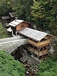
|
Moulins de la Tine | B | 46°13′51″N 6°55′05″E / 46.23085°N 6.91801°E | 7142 | ||
| Troistorrents | 
|
Pont sur le Fayot | B | 46°13′07″N 6°54′12″E / 46.21851°N 6.90342°E | 7140 | ||
| Troistorrents | 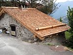
|
Propéra, grenier et four à pain | B | 46°14′54″N 6°55′54″E / 46.24847°N 6.93174°E | 7141 | ||
Turtmann-Unterems
| Location | Upload | Photo | Object | Cat. | Coordinates | KGS-Nr | |
|---|---|---|---|---|---|---|---|
| Turtmann-Unterems | 
|
Fünf Steinhäuser mit Treppenhaus-Vorbauten | B | 46°18′01″N 7°42′12″E / 46.30039°N 7.7034°E | 7144 | ||
| Turtmann-Unterems | 
|
Kirche St. Josef | B | 46°18′05″N 7°42′10″E / 46.30128°N 7.70269°E | 7145 | ||
| Turtmann-Unterems | 
|
Meiden, Kapelle Hl. Familie | B | 46°12′39″N 7°42′19″E / 46.2107°N 7.70531°E | 7146 | ||
| Turtmann-Unterems | 
|
Ruinen der Sust von Stockalper | B | 46°18′01″N 7°42′06″E / 46.30038°N 7.70158°E | 7147 | ||
| Turtmann-Unterems | 
|
Wäbihüs | B | 46°18′00″N 7°42′00″E / 46.30011°N 7.70005°E | 7148 | ||
| Turtmann-Unterems | 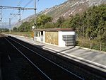
|
Tourtemagne | ISOS | 46°18′07″N 7°42′14″E / 46.301943°N 7.703883°E | |||
Unterbäch
| Location | Upload | Photo | Object | Cat. | Coordinates | KGS-Nr | |
|---|---|---|---|---|---|---|---|
| Unterbäch | 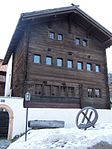
|
Altes Gemeindehaus | B | 46°17′06″N 7°47′55″E / 46.28489°N 7.79861°E | 7153 | ||
| Unterbäch | 
|
Burgruine Steinhaus und sogenanntes Zwingherrenschloss | B | 46°17′25″N 7°47′46″E / 46.29025°N 7.79614°E | 7154 | ||
| Unterbäch | 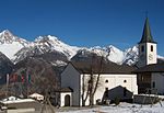
|
Kirche Hl. Dreifaltigkeit | B | 46°17′06″N 7°48′00″E / 46.28492°N 7.80012°E | 7156 | ||
Val-d'Illiez
| Location | Upload | Photo | Object | Cat. | Coordinates | KGS-Nr | |
|---|---|---|---|---|---|---|---|
| Val-d'Illiez | 
|
Maison d'habitation | A | 46°11′51″N 6°53′20″E / 46.1974°N 6.88885°E | 10368 | ||
| Val-d'Illiez | 
|
Cure (1711, ancien prieuré) | B | 46°12′15″N 6°53′35″E / 46.20419°N 6.89315°E | 7158 | ||
| Val-d'Illiez | 
|
église St-Maurice et clocher | B | 46°12′17″N 6°53′35″E / 46.2046°N 6.89299°E | 7159 | ||
Venthône
| Location | Upload | Photo | Object | Cat. | Coordinates | KGS-Nr | |
|---|---|---|---|---|---|---|---|
| Venthône | 
|
Tour | A | 46°18′28″N 7°31′56″E / 46.3077°N 7.5321°E | 7163 | ||
| Venthône | 
|
Château des Anchettes, avec greniers, raccards et chapelle (ensemble) | B | 46°18′11″N 7°31′37″E / 46.30292°N 7.52689°E | 7160 | ||
| Venthône | 
|
Cure (ancienne Tour Vareilli) | B | 46°18′28″N 7°31′52″E / 46.30778°N 7.53118°E | 7161 | ||
| Venthône | 
|
église St-Sébastien | B | 46°18′28″N 7°31′55″E / 46.30782°N 7.532°E | 7162 | ||
| Venthône | 
|
Venthône | ISOS | 46°18′00″N 7°32′00″E / 46.3°N 7.533333333°E | |||
Vernayaz
| Location | Upload | Photo | Object | Cat. | Coordinates | KGS-Nr | |
|---|---|---|---|---|---|---|---|
| Vernayaz | 
|
Grand Hôtel | B | 46°07′55″N 7°02′35″E / 46.13187°N 7.04304°E | 7166 | ||
| Vernayaz | 
|
Gueuroz, Pont sur le Trient | B | 46°07′44″N 7°02′24″E / 46.12897°N 7.04003°E | 7167 | ||
| Vernayaz | 
|
Miéville | ISOS | 46°08′51″N 7°02′29″E / 46.1476°N 7.0415°E | |||
Vérossaz
| Location | Upload | Photo | Object | Cat. | Coordinates | KGS-Nr | |
|---|---|---|---|---|---|---|---|
| Vérossaz | 
|
Chavanne, ensemble moulin, foulon, scierie | B | 46°13′01″N 6°58′49″E / 46.21685°N 6.98041°E | 7168 | ||
| Vérossaz | 
|
église Ste-Marguerite (site archéologique) | B | 46°12′38″N 6°59′18″E / 46.21058°N 6.9884°E | 7169 | ||
Vétroz
| Location | Upload | Photo | Object | Cat. | Coordinates | KGS-Nr | |
|---|---|---|---|---|---|---|---|
| Vétroz | 
|
église Ste-Marie-Madeleine (autels) | B | 46°13′38″N 7°16′54″E / 46.22725°N 7.28165°E | 7170 | ||
Vex
| Location | Upload | Photo | Object | Cat. | Coordinates | KGS-Nr | |
|---|---|---|---|---|---|---|---|
| Vex | 
|
ancienne église St-Sylve | B | 46°12′57″N 7°24′10″E / 46.21575°N 7.40268°E | 7171 | ||
| Vex | 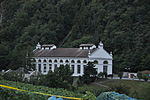
|
Bramois, usine hydroélectrique | B | 46°13′32″N 7°24′20″E / 46.22553°N 7.40565°E | 7172 | ||
| Vex | 
|
Chalet sur la place (magasin Coop) | B | 46°12′41″N 7°23′52″E / 46.21146°N 7.39781°E | 7173 | ||
| Vex | 
|
Riva, pont de pierre | B | 46°11′31″N 7°24′47″E / 46.19194°N 7.41311°E | 7174 | ||
| Vex | 
|
Tour Tavelli (13e s.) et site archéologique | B | 46°12′15″N 7°24′29″E / 46.20409°N 7.40819°E | 7175 | ||
Veyras
| Location | Upload | Photo | Object | Cat. | Coordinates | KGS-Nr | |
|---|---|---|---|---|---|---|---|
| Veyras | 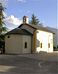
|
chapelle St-François | B | 46°18′09″N 7°32′13″E / 46.30237°N 7.53685°E | 7176 | ||
| Veyras | 
|
Musot, chapelle Ste-Marie | B | 46°18′26″N 7°32′23″E / 46.30715°N 7.53976°E | 7177 | ||
| Veyras | 
|
Musot, tour médiévale (Rilke) | B | 46°18′23″N 7°32′25″E / 46.30642°N 7.54017°E | 7178 | ||
Vionnaz
| Location | Upload | Photo | Object | Cat. | Coordinates | KGS-Nr | |
|---|---|---|---|---|---|---|---|
| Vionnaz | 
|
Ancien clocher | B | 46°18′33″N 6°53′57″E / 46.30919°N 6.89914°E | 7179 | ||
| Vionnaz | 
|
Digue avec inscription et armoiries | B | 46°18′26″N 6°53′51″E / 46.30719°N 6.8976°E | 7180 | ||
| Vionnaz | 
|
Maison forte Barberini | B | 46°18′35″N 6°54′00″E / 46.30967°N 6.89993°E | 7181 | ||
| Vionnaz | 
|
Vionnaz | ISOS | 46°19′00″N 6°54′00″E / 46.316666666°N 6.9°E | |||
Visp
Visperterminen
| Location | Upload | Photo | Object | Cat. | Coordinates | KGS-Nr | |
|---|---|---|---|---|---|---|---|
| Visperterminen | 
|
Oberstalden, bronzezeitliche / mittelalterliche Siedlung | A | 46°16′19″N 7°53′43″E / 46.2719°N 7.89525°E | 9705 | ||
| Visperterminen | 
|
Altäre der Kirche St. Theodul | B | 46°15′29″N 7°54′03″E / 46.2581°N 7.90083°E | 7197 | ||
| Visperterminen | 
|
Waldkapelle (1652) mit Kapellenweg | B | 46°15′23″N 7°54′44″E / 46.25635°N 7.91215°E | 7203 | ||
| Visperterminen | 
|
Niederhäusern | ISOS | 46°15′37″N 7°53′43″E / 46.2602°N 7.89537°E | |||
| Visperterminen | 
|
Unterstalden | ISOS | 46°16′23″N 7°53′33″E / 46.2731°N 7.8925°E | |||
| Visperterminen | 
|
Oberstalden | ISOS | 46°16′25″N 7°53′33″E / 46.27358°N 7.89259°E | |||
Vollèges
| Location | Upload | Photo | Object | Cat. | Coordinates | KGS-Nr | |
|---|---|---|---|---|---|---|---|
| Vollèges | 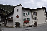
|
Deux maisons avec tour d'escalier en façade | B | 46°05′17″N 7°10′04″E / 46.08816°N 7.16783°E | 7209 | ||
| Vollèges | 
|
église St-Martin | B | 46°05′14″N 7°10′08″E / 46.08733°N 7.16897°E | 7210 | ||
| Vollèges | 
|
Vens | ISOS | 46°05′17″N 7°07′48″E / 46.0881°N 7.1301°E | |||
| Vollèges | 
|
Vollèges | ISOS | 46°05′00″N 7°10′00″E / 46.083333333°N 7.166666666°E | |||
Vouvry
| Location | Upload | Photo | Object | Cat. | Coordinates | KGS-Nr | |
|---|---|---|---|---|---|---|---|
| Vouvry | 
|
Musée historique du Chablais | B | 46°20′57″N 6°53′15″E / 46.349175°N 6.887601°E | 10677 | ||
| Vouvry | 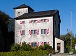
|
château de la Porte du Scex | B | 46°20′56″N 6°53′13″E / 46.34888°N 6.88692°E | 7213 | ||
| Vouvry | 
|
église St-Hippolyte et clocher | B | 46°20′07″N 6°53′09″E / 46.33538°N 6.88589°E | 7214 | ||
| Vouvry | 
|
Hôtel de Ville | B | 46°20′09″N 6°53′20″E / 46.33579°N 6.889°E | 7215 | ||
| Vouvry | 
|
Maison de la Tour | B | 46°20′10″N 6°53′20″E / 46.33617°N 6.88889°E | 7216 | ||
| Vouvry | 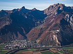
|
Vouvry | ISOS | 46°20′00″N 6°53′00″E / 46.333333333°N 6.883333333°E | |||
Wiler
| Location | Upload | Photo | Object | Cat. | Coordinates | KGS-Nr | |
|---|---|---|---|---|---|---|---|
| Wiler | 
|
Friedhof | B | 46°24′15″N 7°47′00″E / 46.40409°N 7.78333°E | 7218 | ||
| Wiler | 
|
Zwei Wüstungen im Giätrich (abgegangene Weiler) | B | 46°24′08″N 7°47′38″E / 46.40225°N 7.79402°E | 7219 | ||
Zeneggen
| Location | Upload | Photo | Object | Cat. | Coordinates | KGS-Nr | |
|---|---|---|---|---|---|---|---|
| Zeneggen | 
|
Kastel, bronzezeitliche Höhensiedlung | B | 46°16′19″N 7°51′28″E / 46.27205°N 7.85764°E | 7220 | ||
| Zeneggen | 
|
Nothelferkapelle auf dem Biel | B | 46°16′25″N 7°51′50″E / 46.27371°N 7.86395°E | 7221 | ||
Zermatt
| Location | Upload | Photo | Object | Cat. | Coordinates | KGS-Nr | |
|---|---|---|---|---|---|---|---|
| Zermatt | 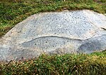
|
Hubelwäng, Felszeichnungen / prähistorische Schalensteine | A | 46°00′42″N 7°43′45″E / 46.01158°N 7.72912°E | 9706 | ||
| Zermatt | 
|
Kapelle St. Jakob | B | 46°00′40″N 7°45′55″E / 46.01118°N 7.76528°E | 7223 | ||
| Zermatt | 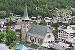
|
Kirche St. Mauritius (Altäre mit Taufstein) | B | 46°01′10″N 7°44′48″E / 46.01947°N 7.74657°E | 7225 | ||
| Zermatt | 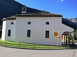
|
Winkelmatten, Kapelle der Hl. Familie | B | 46°00′47″N 7°44′43″E / 46.01308°N 7.74529°E | 7226 | ||
Zwischbergen
| Location | Upload | Photo | Object | Cat. | Coordinates | KGS-Nr | |
|---|---|---|---|---|---|---|---|
| Zwischbergen | 
|
Siedlungsruinen des Goldbergwerks Gondo | A | 46°11′16″N 8°08′24″E / 46.18789°N 8.14°E | 7229 | ||
| Zwischbergen | 
|
Gondo, Kirche St. Markus | B | 46°11′45″N 8°08′27″E / 46.19571°N 8.14086°E | 7230 | ||
| Zwischbergen | 
|
Gondo, Sust von Stockalper | B | 46°11′45″N 8°08′25″E / 46.19585°N 8.14036°E | 7231 | ||


