Commons:Wiki Loves Monuments in Switzerland/Vaud/A-E
Jump to navigation
Jump to search
Agiez
| Location | Upload | Photo | Object | Cat. | Coordinates | KGS-Nr | |
|---|---|---|---|---|---|---|---|
| Agiez | 
|
Le Chenau. Maison forte et rurale | B | 46°43′15″N 6°30′24″E / 46.72086°N 6.50668°E | 5888 | ||
| Agiez | 
|
Agiez | ISOS | 46°43′00″N 6°30′00″E / 46.716666666°N 6.5°E | |||
Aigle
Allaman
| Location | Upload | Photo | Object | Cat. | Coordinates | KGS-Nr | |
|---|---|---|---|---|---|---|---|
| Allaman | 
|
château d'Allaman | A | 46°28′17″N 6°23′52″E / 46.47132°N 6.39784°E | 5898 | ||
| Allaman | 
|
Château de Rochefort | B | 46°28′15″N 6°23′45″E / 46.470877°N 6.395728°E | 5899 | ||
| Allaman | 
|
église réformée Saint-Jean-Baptiste | B | 46°28′15″N 6°23′44″E / 46.470821°N 6.3954425°E | 14550 | ||
Apples
| Location | Upload | Photo | Object | Cat. | Coordinates | KGS-Nr | |
|---|---|---|---|---|---|---|---|
| Apples | 
|
Bois de Duin, pierres à cupule | B | 46°33′36″N 6°24′24″E / 46.56013°N 6.40664°E | 14551 | ||
Arnex-sur-Orbe
| Location | Upload | Photo | Object | Cat. | Coordinates | KGS-Nr | |
|---|---|---|---|---|---|---|---|
| Arnex-sur-Orbe | 
|
Arnex-sur-Orbe | ISOS | 46°42′00″N 6°31′00″E / 46.7°N 6.516666666°E | |||
Arzier-Le Muids
| Location | Upload | Photo | Object | Cat. | Coordinates | KGS-Nr | |
|---|---|---|---|---|---|---|---|
| Arzier-Le Muids | 
|
chartreuse d'Oujon | A | 46°27′52″N 6°10′55″E / 46.4644°N 6.18207°E | 9687 | ||
Assens
| Location | Upload | Photo | Object | Cat. | Coordinates | KGS-Nr | |
|---|---|---|---|---|---|---|---|
| Assens | 
|
Musée de l'histoire estudiantine Assens | B | 46°36′47″N 6°37′33″E / 46.612965°N 6.6258565°E | 14552 | ||
| Assens | 
|
église catholique St-Germain | B | 46°36′42″N 6°37′27″E / 46.61158°N 6.62407°E | 5904 | ||
| Assens | 
|
église paritaire St-Germain | B | 46°36′45″N 6°37′21″E / 46.61259°N 6.62259°E | 5903 | ||
| Assens | 
|
tumulus d'Assens | B | 46°36′41″N 6°38′00″E / 46.61144°N 6.63321°E | 5902 | ||
Aubonne
| Location | Upload | Photo | Object | Cat. | Coordinates | KGS-Nr | |
|---|---|---|---|---|---|---|---|
| Aubonne | 
|
poudrerie d'Aubonne | A+ISOS | 46°29′13″N 6°24′12″E / 46.486866°N 6.403319°E | 10315 | ||
| Aubonne | 
|
Archives communales d'Aubonne | B | 46°29′43″N 6°23′29″E / 46.495406°N 6.391308°E | 14554 | ||
| Aubonne | 
|
Musée du bois | B | 46°30′40″N 6°22′01″E / 46.511147°N 6.366858°E | 14668 | ||
| Aubonne | 
|
château d'Aubonne | A | 46°29′48″N 6°23′29″E / 46.49672°N 6.39127°E | 5905 | ||
| Aubonne | 
|
église réformée Saint-Étienne | B | 46°29′48″N 6°23′31″E / 46.4967°N 6.39208°E | 5912 | ||
| Aubonne | 
|
Fontaine | B | 46°29′47″N 6°23′27″E / 46.496319°N 6.3907825°E | 14553 | ||
| Aubonne | 
|
Maison | B | 46°29′45″N 6°23′31″E / 46.4959°N 6.39191°E | 5909 | ||
| Aubonne | 
|
hôtel de ville d'Aubonne | A | 46°29′44″N 6°23′28″E / 46.49549°N 6.39109°E | 5908 | ||
| Aubonne | 
|
maison d'Aspre | A | 46°29′40″N 6°23′31″E / 46.49446°N 6.39202°E | 5910 | ||
| Aubonne | 
|
manoir de Bougy | A | 46°29′35″N 6°22′54″E / 46.49306°N 6.38166°E | 5911 | ||
| Aubonne | 
|
Aubonne | ISOS | 46°30′00″N 6°23′00″E / 46.5°N 6.383333333°E | |||
Avenches
Ballaigues
| Location | Upload | Photo | Object | Cat. | Coordinates | KGS-Nr | |
|---|---|---|---|---|---|---|---|
| Ballaigues | 
|
Ferme | B | 46°44′24″N 6°24′24″E / 46.74004°N 6.406534°E | 10316 | ||
Bassins
| Location | Upload | Photo | Object | Cat. | Coordinates | KGS-Nr | |
|---|---|---|---|---|---|---|---|
| Bassins | 
|
église réformée Notre-Dame | B | 46°27′44″N 6°13′53″E / 46.46209°N 6.23143°E | 5926 | ||
Baulmes
| Location | Upload | Photo | Object | Cat. | Coordinates | KGS-Nr | |
|---|---|---|---|---|---|---|---|
| Baulmes | 
|
Baulmes | ISOS | 46°47′25″N 6°31′22″E / 46.79031°N 6.52279°E | |||
| Baulmes | 
|
abri de la Cure | A | 46°47′34″N 6°31′04″E / 46.79265°N 6.51786°E | 5927 | ||
| Baulmes | 
|
beffroi de Baulmes | A | 46°47′27″N 6°31′17″E / 46.79081°N 6.52146°E | 11687 | ||
| Baulmes | 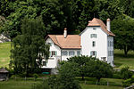
|
Cure et ancien monastère du 1er millénaire | B | 46°47′32″N 6°31′07″E / 46.7922°N 6.51851°E | 5928 | ||
| Baulmes | 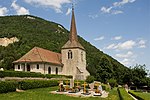
|
église réformée Saint-Pierre | B | 46°47′27″N 6°31′06″E / 46.79093°N 6.51826°E | 5929 | ||
| Baulmes | 
|
Forel, pointes de Forel. Sites fortifiés préhistorique et romain, ermitage médiéval. | B | 46°47′20″N 6°30′11″E / 46.78902°N 6.50312°E | 14794 | ||
Bavois
| Location | Upload | Photo | Object | Cat. | Coordinates | KGS-Nr | |
|---|---|---|---|---|---|---|---|
| Bavois | 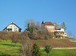
|
Château | B | 46°40′42″N 6°34′01″E / 46.678407°N 6.567007°E | 5932 | ||
| Bavois | 
|
église réformée Saint-Léger | B | 46°41′08″N 6°33′56″E / 46.68542°N 6.56544°E | 5933 | ||
Begnins
| Location | Upload | Photo | Object | Cat. | Coordinates | KGS-Nr | |
|---|---|---|---|---|---|---|---|
| Begnins | 
|
Begnins | ISOS | 46°26′29″N 6°14′51″E / 46.44152°N 6.24762°E | |||
| Begnins | 
|
Château du Martheray | B | 46°26′25″N 6°15′02″E / 46.4403°N 6.25055°E | 5934 | ||
| Begnins | 
|
église réformée Notre-Dame | B | 46°26′27″N 6°15′05″E / 46.44081°N 6.25137°E | 5936 | ||
| Begnins | 
|
Manoir de Rochefort et ses dépendances | B | 46°26′24″N 6°15′08″E / 46.43995°N 6.25212°E | 5935 | ||
Belmont-sur-Yverdon
| Location | Upload | Photo | Object | Cat. | Coordinates | KGS-Nr | |
|---|---|---|---|---|---|---|---|
| Belmont-sur-Yverdon | 
|
Site de l'ancien château, habitat préhistorique et médiéval. | B | 46°44′46″N 6°37′12″E / 46.7462°N 6.62008°E | 5941 | ||
Bercher
| Location | Upload | Photo | Object | Cat. | Coordinates | KGS-Nr | |
|---|---|---|---|---|---|---|---|
| Bercher | 
|
Château | B | 5942 | |||
| Bercher | 
|
Cure | B | 46°41′50″N 6°42′53″E / 46.697146°N 6.714609°E | 14561 | ||
| Bercher | 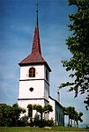
|
église réformée Saint-Michel | B | 46°41′49″N 6°42′51″E / 46.697044°N 6.714126°E | 14560 | ||
| Bercher | 
|
Grenier | B | 46°41′35″N 6°42′04″E / 46.693039°N 6.701237°E | 5943 | ||
Bettens
| Location | Upload | Photo | Object | Cat. | Coordinates | KGS-Nr | |
|---|---|---|---|---|---|---|---|
| Bettens | 
|
Château | B | 46°41′49″N 6°42′51″E / 46.696908°N 6.71405°E | 5944 | ||
Bex
| Location | Upload | Photo | Object | Cat. | Coordinates | KGS-Nr | |
|---|---|---|---|---|---|---|---|
| Bex | 
|
clocher du Temple de Bex | A | 46°15′04″N 7°00′44″E / 46.25124°N 7.01234°E | 5946 | ||
| Bex | 
|
Jardin alpin de Pont de Nant «La Thomasia» | B | 46°15′03″N 7°06′38″E / 46.25096°N 7.11066°E | 10572 | ||
| Bex | 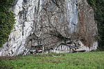
|
Abri sous-roche des Mûriers, occupation du Néolithique, de l'âge du Bronze et de l'époque romaine | B | 46°14′21″N 7°00′22″E / 46.239249°N 7.006149°E | 14567 | ||
| Bex | 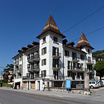
|
Ancien Hôtel des Bains | B | 46°15′08″N 7°00′41″E / 46.252241°N 7.011258°E | 5947 | ||
| Bex | 
|
Ancien Hôtel des Bains | B | 14562 | |||
| Bex | 
|
Ancien Hôtel des Bains | B | 14563 | |||
| Bex | 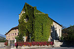
|
ancienne église libre | B | 46°15′00″N 7°00′44″E / 46.249969°N 7.012235°E | 14569 | ||
| Bex | 
|
Château Feuillet et son parc | B | 46°15′01″N 7°00′48″E / 46.250252°N 7.0132965°E | 14571 | ||
| Bex | Château Grenier, sa dépendance et son parc | Château Grenier, sa dépendance et son parc | B | 46°15′01″N 7°01′18″E / 46.250211°N 7.0217775°E | 14572 | ||
| Bex | 
|
église catholique | B | 46°14′52″N 7°00′47″E / 46.247741°N 7.012979°E | 14570 | ||
| Bex | 
|
Gare CFF | B | 46°15′05″N 7°00′03″E / 46.25144°N 7.00076°E | 5949 | ||
| Bex | [[File:|150x150px|Hôtel de Ville]] | Hôtel de Ville | B | 46°15′04″N 7°00′49″E / 46.251171°N 7.013743°E | 5950 | ||
| Bex | 
|
Les Dévens, « maison grise » du naturaliste Emmanuel Thomas | B | 46°16′10″N 7°01′03″E / 46.269491°N 7.017557°E | 14564 | ||
| Bex | 
|
Les Dévens, « maison rouge » des naturalistes Abraham et Emmanuel Thomas | B | 46°16′10″N 7°01′02″E / 46.26958°N 7.017323°E | 14565 | ||
| Bex | 
|
Les Dévens, ancienne maison du directeur des salines | B | 46°16′12″N 7°01′02″E / 46.270102°N 7.017319°E | 5951 | ||
| Bex | 
|
Maison (ancienne saline des Dévens) | B | 46°16′11″N 7°00′57″E / 46.269737°N 7.015817°E | 14568 | ||
| Bex | Musée de la mine de sel de Bex | Musée de la mine de sel de Bex | B | 46°16′40″N 7°01′36″E / 46.277855°N 7.026613°E | 10671 | ||
| Bex | 
|
Fortification de l'Arzillier | A | 46°13′32″N 7°00′26″E / 46.2256°N 7.00729°E | 5948 | ||
| Bex | 
|
pont sur le Rhône | A | 46°13′25″N 7°00′13″E / 46.22353°N 7.0036°E | 10365 | ||
| Bex | 
|
Tour de Duin | B | 46°14′29″N 7°01′16″E / 46.24131°N 7.02105°E | 14566 | ||
| Bex | 
|
Bex | ISOS | 46°15′01″N 7°00′47″E / 46.2503°N 7.013°E | |||
| Bex | 
|
Les Posses | ISOS | 46°16′17″N 7°02′50″E / 46.2713°N 7.0473°E | |||
| Bex | 
|
Le Bévieux | ISOS | 46°15′37″N 7°01′47″E / 46.2603°N 7.0298°E | |||
| Bex | 
|
saline de Bex | A | 46°16′40″N 7°01′35″E / 46.27771°N 7.02652°E | 5945 | ||
Bière
| Location | Upload | Photo | Object | Cat. | Coordinates | KGS-Nr | |
|---|---|---|---|---|---|---|---|
| Bière | 
|
École | B | 46°32′14″N 6°19′59″E / 46.537217°N 6.332979°E | 14573 | ||
| Bière | 
|
Pavillon des officiers | B | 46°31′50″N 6°20′05″E / 46.530576°N 6.334614°E | 5952 | ||
Bioley-Magnoux
| Location | Upload | Photo | Object | Cat. | Coordinates | KGS-Nr | |
|---|---|---|---|---|---|---|---|
| Bioley-Magnoux | 
|
Château | B | 46°43′28″N 6°42′31″E / 46.72444°N 6.7086°E | 5954 | ||
Bioley-Orjulaz
| Location | Upload | Photo | Object | Cat. | Coordinates | KGS-Nr | |
|---|---|---|---|---|---|---|---|
| Bioley-Orjulaz | 
|
Grenier en pierre | B | 46°37′14″N 6°35′52″E / 46.620579215°N 6.597905407°E | 14575 | ||
| Bioley-Orjulaz | 
|
Grenier en pierre | B | 46°37′15″N 6°35′52″E / 46.620883113°N 6.59763954°E | 14574 | ||
| Bioley-Orjulaz | 
|
Grenier en pierre | B | 46°37′15″N 6°35′51″E / 46.620746933°N 6.597471928°E | 14799 | ||
Blonay
| Location | Upload | Photo | Object | Cat. | Coordinates | KGS-Nr | |
|---|---|---|---|---|---|---|---|
| Blonay | 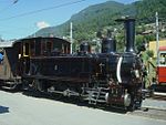
|
Chemin de fer-Musée Blonay-Chamby | B | 46°27′16″N 6°54′44″E / 46.45449°N 6.912198°E | 10683 | ||
| Blonay | 
|
chemin de fer-musée Blonay-Chamby | B | 46°27′56″N 6°53′45″E / 46.46563°N 6.895804°E | 14669 | ||
| Blonay | 
|
château de Blonay | A | 46°28′10″N 6°53′24″E / 46.469444444°N 6.89°E | 5956 | ||
Bofflens
| Location | Upload | Photo | Object | Cat. | Coordinates | KGS-Nr | |
|---|---|---|---|---|---|---|---|
| Bofflens | 
|
Bofflens | ISOS | 46°42′N 6°30′E / 46.7°N 6.5°E | |||
Bogis-Bossey
| Location | Upload | Photo | Object | Cat. | Coordinates | KGS-Nr | |
|---|---|---|---|---|---|---|---|
| Bogis-Bossey | 
|
Carré de fermes avec volière et fontaine | B | 46°20′49″N 6°11′30″E / 46.347018°N 6.191532°E | 5957 | ||
Bonvillars
| Location | Upload | Photo | Object | Cat. | Coordinates | KGS-Nr | |
|---|---|---|---|---|---|---|---|
| Bonvillars | 
|
église réformée Saint-Nicolas | B | 46°50′24″N 6°40′21″E / 46.84002°N 6.672371°E | 5958 | ||
| Bonvillars | 
|
Morbey, station palafittique | B | 46°49′45″N 6°41′15″E / 46.82915°N 6.68748°E | 14576 | ||
| Bonvillars | 
|
Bonvillars | ISOS | 46°50′16″N 6°40′17″E / 46.8378°N 6.6713°E | |||
Bottens
| Location | Upload | Photo | Object | Cat. | Coordinates | KGS-Nr | |
|---|---|---|---|---|---|---|---|
| Bottens | 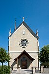
|
église catholique St-Étienne avec son cimetière | B | 46°37′14″N 6°39′34″E / 46.6205°N 6.65948°E | 5959 | ||
Boudry
| Location | Upload | Photo | Object | Cat. | Coordinates | KGS-Nr | |
|---|---|---|---|---|---|---|---|
| Boudry | 
|
Areuse | ISOS | 46°57′09″N 6°51′12″E / 46.9524°N 6.8532°E | |||
Bougy-Villars
| Location | Upload | Photo | Object | Cat. | Coordinates | KGS-Nr | |
|---|---|---|---|---|---|---|---|
| Bougy-Villars | 
|
Pavillon du Signal de Bougy | B | 46°29′06″N 6°21′23″E / 46.48499°N 6.35625°E | 5960 | ||
| Bougy-Villars | 
|
Bougy-Villars | ISOS | 46°29′00″N 6°21′00″E / 46.483333333°N 6.35°E | |||
Boulens
| Location | Upload | Photo | Object | Cat. | Coordinates | KGS-Nr | |
|---|---|---|---|---|---|---|---|
| Boulens | 
|
Grenier | B | 46°40′57″N 6°43′15″E / 46.682431°N 6.72078°E | 10317 | ||
Bourg-en-Lavaux
Bournens
| Location | Upload | Photo | Object | Cat. | Coordinates | KGS-Nr | |
|---|---|---|---|---|---|---|---|
| Bournens | 
|
Château | B | 46°36′13″N 6°33′48″E / 46.603495°N 6.56323°E | 5961 | ||
Bretonnières
| Location | Upload | Photo | Object | Cat. | Coordinates | KGS-Nr | |
|---|---|---|---|---|---|---|---|
| Bretonnières | 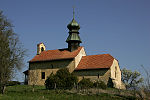
|
église réformée | B | 46°42′44″N 6°28′31″E / 46.71209°N 6.47522°E | 5962 | ||
Bullet
| Location | Upload | Photo | Object | Cat. | Coordinates | KGS-Nr | |
|---|---|---|---|---|---|---|---|
| Bullet | 
|
Chasseron. Sanctuaire romain | B | 46°51′01″N 6°32′17″E / 46.850311°N 6.538153°E | 14795 | ||
Bursinel
| Location | Upload | Photo | Object | Cat. | Coordinates | KGS-Nr | |
|---|---|---|---|---|---|---|---|
| Bursinel | 
|
Château | B | 46°26′26″N 6°18′24″E / 46.44061°N 6.3068°E | 5963 | ||
| Bursinel | 
|
villa Choisi | A | 46°26′23″N 6°18′59″E / 46.43984°N 6.31641°E | 5964 | ||
Bursins
| Location | Upload | Photo | Object | Cat. | Coordinates | KGS-Nr | |
|---|---|---|---|---|---|---|---|
| Bursins | 
|
Bursins | ISOS | 46°27′10″N 6°17′29″E / 46.45276°N 6.29139°E | |||
| Bursins | 
|
Château du Rosey | B | 46°27′15″N 6°17′19″E / 46.45419°N 6.28865°E | 5966 | ||
| Bursins | 
|
Ferme | B | 46°27′06″N 6°17′23″E / 46.451682°N 6.289845°E | 10318 | ||
| Bursins | 
|
Maison du syndic (maison Jules Rossier) | B | 46°27′10″N 6°17′23″E / 46.45276°N 6.28986°E | 5967 | ||
| Bursins | 
|
temple de Bursins | A | 46°27′11″N 6°17′23″E / 46.45315°N 6.28977°E | 5968 | ||
| Bursins | Tuilerie de Vinzel | Tuilerie de Vinzel | A | 46°26′51″N 6°17′02″E / 46.44761°N 6.28392°E | 11665 | ||
Burtigny
| Location | Upload | Photo | Object | Cat. | Coordinates | KGS-Nr | |
|---|---|---|---|---|---|---|---|
| Burtigny | 
|
Burtigny | ISOS | 46°28′03″N 6°15′25″E / 46.46754°N 6.25706°E | |||
| Burtigny | 
|
Forêt des Grandes-Tattes, pierres à cupules | B | 46°28′34″N 6°16′48″E / 46.476142°N 6.279989°E | 14578 | ||
| Burtigny | 
|
Forêt des Grandes-Tattes, pierres à cupules | B | 46°28′10″N 6°16′40″E / 46.469417°N 6.277789°E | 14579 | ||
| Burtigny | 
|
Forêt des Grandes-Tattes, pierres à cupules | B | 46°28′18″N 6°16′35″E / 46.471562°N 6.276441°E | 14577 | ||
| Burtigny | 
|
Forêt des Grandes-Tattes, pierres à cupules | B | 46°28′23″N 6°16′32″E / 46.473083°N 6.275562°E | 5969 | ||
Champagne
| Location | Upload | Photo | Object | Cat. | Coordinates | KGS-Nr | |
|---|---|---|---|---|---|---|---|
| Champagne | 
|
Champagne | ISOS | 46°49′00″N 6°39′00″E / 46.816666666°N 6.65°E | |||
Champvent
| Location | Upload | Photo | Object | Cat. | Coordinates | KGS-Nr | |
|---|---|---|---|---|---|---|---|
| Champvent | 
|
château de Champvent (Suisse) | A | 46°46′44″N 6°34′17″E / 46.77894°N 6.57138°E | 5970 | ||
| Champvent | 
|
manoir de Saint-Christophe | A | 46°46′23″N 6°32′57″E / 46.77293°N 6.54912°E | 5971 | ||
| Champvent | 
|
Saint-Christophe | ISOS | 46°46′22″N 6°32′54″E / 46.7729°N 6.5483°E | |||
| Champvent | 
|
Champvent | ISOS | 46°46′58″N 6°34′19″E / 46.7829°N 6.57188°E | |||
Chardonne
| Location | Upload | Photo | Object | Cat. | Coordinates | KGS-Nr | |
|---|---|---|---|---|---|---|---|
| Chardonne | 
|
Château | B | 46°28′39″N 6°49′47″E / 46.47754°N 6.82975°E | 5973 | ||
| Chardonne | 
|
église réformée Saint-Jean-Baptiste | B | 46°28′36″N 6°49′37″E / 46.47678°N 6.82692°E | 14581 | ||
Château-d'Œx
| Location | Upload | Photo | Object | Cat. | Coordinates | KGS-Nr | |
|---|---|---|---|---|---|---|---|
| Château-d'Œx | 
|
L'Étivaz | ISOS | 46°25′28″N 7°08′48″E / 46.4244°N 7.1468°E | |||
| Château-d'Œx | 
|
Château-d'Œx | ISOS | 46°28′26″N 7°07′46″E / 46.474°N 7.1295°E | |||
| Château-d'Œx | 
|
Cure | B | 46°28′27″N 7°07′47″E / 46.474254°N 7.129841°E | 14583 | ||
| Château-d'Œx | 
|
église réformée Saint-Donat (sur le site d'un château médiéval) | B | 46°28′21″N 7°07′46″E / 46.47262°N 7.12939°E | 5977 | ||
| Château-d'Œx | 
|
L'Étivaz, cure | B | 46°25′28″N 7°08′50″E / 46.424483°N 7.147217°E | 14582 | ||
| Château-d'Œx | 
|
L'Étivaz, temple | B | 46°25′30″N 7°08′56″E / 46.424955°N 7.148893°E | 5975 | ||
| Château-d'Œx | 
|
Musée du Vieux Pays d'Enhaut | B | 46°28′34″N 7°08′07″E / 46.47617°N 7.13539°E | 5976 | ||
| Château-d'Œx | 
|
Les Ciernes-Picat | A | 46°30′19″N 7°10′13″E / 46.5053°N 7.1704°E | 9689 | ||
Chavannes-le-Chêne
| Location | Upload | Photo | Object | Cat. | Coordinates | KGS-Nr | |
|---|---|---|---|---|---|---|---|
| Chavannes-le-Chêne | 
|
Hôtel de Ville avec tour | B | 46°46′36″N 6°46′41″E / 46.776792°N 6.778103°E | 5980 | ||
| Chavannes-le-Chêne | 
|
Vallon des Vaux | A | 46°46′30″N 6°46′01″E / 46.77505°N 6.76695°E | 10509 | ||
Chavannes-le-Veyron
| Location | Upload | Photo | Object | Cat. | Coordinates | KGS-Nr | |
|---|---|---|---|---|---|---|---|
| Chavannes-le-Veyron | 
|
La Motte, site archéologique médiéval. Tumulus Hallstatt | B | 46°36′28″N 6°26′36″E / 46.60782°N 6.44347°E | 5982 | ||
| Chavannes-le-Veyron | 
|
Scierie de Chavannes-le-Veyron | A | 46°36′13″N 6°27′01″E / 46.60356°N 6.45034°E | 10319 | ||
Chavannes-près-Renens
| Location | Upload | Photo | Object | Cat. | Coordinates | KGS-Nr | |
|---|---|---|---|---|---|---|---|
| Chavannes-près-Renens | 
|
Archives cantonales vaudoises | A | 46°31′33″N 6°34′42″E / 46.5257°N 6.5782°E | 8792 | ||
| Chavannes-près-Renens | 
|
Archives cantonales vaudoises (bâtiment) | B | 46°31′32″N 6°34′40″E / 46.525483048°N 6.577800003°E | 5983 | ||
| Chavannes-près-Renens | 
|
Bibliothèque des Archives cantonales vaudoises | B | 46°31′32″N 6°34′42″E / 46.5256°N 6.5783°E | 9367 | ||
| Chavannes-près-Renens | 
|
Musée Encre & plomb | B | 46°32′03″N 6°34′38″E / 46.534143°N 6.577297°E | 14584 | ||
Chavannes-sur-Moudon
| Location | Upload | Photo | Object | Cat. | Coordinates | KGS-Nr | |
|---|---|---|---|---|---|---|---|
| Chavannes-sur-Moudon | 
|
Chavannes-sur-Moudon | ISOS | 46°39′N 6°48′E / 46.65°N 6.8°E | |||
Chavornay
| Location | Upload | Photo | Object | Cat. | Coordinates | KGS-Nr | |
|---|---|---|---|---|---|---|---|
| Chavornay | 
|
temple de Chavornay | A | 46°42′06″N 6°34′13″E / 46.70156°N 6.57036°E | 5984 | ||
Chêne-Pâquier
| Location | Upload | Photo | Object | Cat. | Coordinates | KGS-Nr | |
|---|---|---|---|---|---|---|---|
| Chêne-Pâquier | 
|
temple de Chêne-Pâquier | A | 46°46′14″N 6°45′50″E / 46.770452777°N 6.763836111°E | 5985 | ||
| Chêne-Pâquier | 
|
Chêne-Pâquier | ISOS | 46°46′17″N 6°46′10″E / 46.77149°N 6.76937°E | |||
Cheseaux-Noréaz
| Location | Upload | Photo | Object | Cat. | Coordinates | KGS-Nr | |
|---|---|---|---|---|---|---|---|
| Cheseaux-Noréaz | 
|
château de Champittet | A | 46°47′01″N 6°39′57″E / 46.783625°N 6.665866666°E | 5990 | ||
| Cheseaux-Noréaz | 
|
Châble-Perron, 2 stations lacustres | B | 5989 | |||
| Cheseaux-Noréaz | 
|
Stations lacustres devant le village et vers Yverdon | B | 5991 | |||
Cheseaux-sur-Lausanne
| Location | Upload | Photo | Object | Cat. | Coordinates | KGS-Nr | |
|---|---|---|---|---|---|---|---|
| Cheseaux-sur-Lausanne | 
|
Château avec dépendances | B | 46°35′01″N 6°36′11″E / 46.58361°N 6.60298°E | 5992 | ||
Chéserex
| Location | Upload | Photo | Object | Cat. | Coordinates | KGS-Nr | |
|---|---|---|---|---|---|---|---|
| Chéserex | 
|
Château avec dépendances (ancienne abbaye de Bonmont) | B | 46°24′09″N 6°08′54″E / 46.40254°N 6.14843°E | 14586 | ||
| Chéserex | 
|
église abbatiale de Bonmont | A | 46°24′10″N 6°08′57″E / 46.40287°N 6.14915°E | 5993 | ||
Chessel
| Location | Upload | Photo | Object | Cat. | Coordinates | KGS-Nr | |
|---|---|---|---|---|---|---|---|
| Chessel | 
|
église réformée Saint-Nicolas | B | 46°20′59″N 6°53′39″E / 46.349612°N 6.894248°E | 5994 | ||
Chevilly
| Location | Upload | Photo | Object | Cat. | Coordinates | KGS-Nr | |
|---|---|---|---|---|---|---|---|
| Chevilly | 
|
Moulin de Veyron | B | 46°38′38″N 6°29′04″E / 46.64388°N 6.48435°E | 10320 | ||
Chevroux
| Location | Upload | Photo | Object | Cat. | Coordinates | KGS-Nr | |
|---|---|---|---|---|---|---|---|
| Chevroux | 
|
Stations lacustres néolithiques et de l'âge de bronze | B | 46°53′34″N 6°54′02″E / 46.89269°N 6.90063°E | 5995 | ||
Chexbres
| Location | Upload | Photo | Object | Cat. | Coordinates | KGS-Nr | |
|---|---|---|---|---|---|---|---|
| Chexbres | 
|
La Grande-Maison avec dépendance et fontaine | B | 46°28′53″N 6°46′39″E / 46.481402°N 6.777595°E | 5996 | ||
| Chexbres | 
|
Maison de Crousaz | B | 46°28′58″N 6°46′44″E / 46.482741°N 6.778829°E | 5997 | ||
Clarens
| Location | Upload | Photo | Object | Cat. | Coordinates | KGS-Nr | |
|---|---|---|---|---|---|---|---|
| Clarens | 
|
villa Karma | A | 46°26′44″N 6°52′42″E / 46.44561°N 6.87845°E | 6241 | ||
Coinsins
| Location | Upload | Photo | Object | Cat. | Coordinates | KGS-Nr | |
|---|---|---|---|---|---|---|---|
| Coinsins | 
|
Château | B | 46°25′26″N 6°14′22″E / 46.42399°N 6.23954°E | 5999 | ||
Colombier
| Location | Upload | Photo | Object | Cat. | Coordinates | KGS-Nr | |
|---|---|---|---|---|---|---|---|
| Colombier | 
|
Areuse | ISOS | 46°57′09″N 6°51′12″E / 46.9524°N 6.8532°E | |||
Commugny
| Location | Upload | Photo | Object | Cat. | Coordinates | KGS-Nr | |
|---|---|---|---|---|---|---|---|
| Commugny | 
|
Cure | B | 46°19′12″N 6°10′48″E / 46.31991°N 6.18013°E | 14590 | ||
| Commugny | 
|
église réformée Saint-Christophe | B | 46°19′13″N 6°10′50″E / 46.320158°N 6.180566°E | 6004 | ||
| Commugny | 
|
Maison gothique (maison Jean-Pierre Steffen) | B | 46°19′15″N 6°10′46″E / 46.320767°N 6.179487°E | 6003 | ||
| Commugny | 
|
Villa gallo-romaine | B | 46°19′14″N 6°10′51″E / 46.320519°N 6.180726°E | 14796 | ||
Concise
| Location | Upload | Photo | Object | Cat. | Coordinates | KGS-Nr | |
|---|---|---|---|---|---|---|---|
| Concise | 
|
carrière de la Raisse | A | 46°51′41″N 6°44′42″E / 46.86127°N 6.74489°E | 6006 | ||
| Concise | 
|
chartreuse de La Lance | A | 46°51′32″N 6°44′14″E / 46.85896°N 6.73724°E | 6005 | ||
| Concise | 
|
église réformée Saint-Jean-Baptiste | B | 46°51′00″N 6°43′12″E / 46.84987°N 6.71998°E | 6008 | ||
| Concise | 
|
La Lance, station lacustre | B+ISOS | 46°51′28″N 6°44′27″E / 46.85791°N 6.74072°E | 6007 | ||
| Concise | 
|
Concise-sous-Colachoz | A+UNESCO | 46°50′50″N 6°43′03″E / 46.8472°N 6.71754°E | 9690 | ||
| Concise | 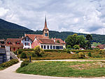
|
Concise | ISOS | 46°51′04″N 6°43′14″E / 46.851°N 6.7205°E | |||
Coppet
| Location | Upload | Photo | Object | Cat. | Coordinates | KGS-Nr | |
|---|---|---|---|---|---|---|---|
| Coppet | 
|
Institut européen de l'Université de Genève, Centre d'archives européennes | A | 9174 | |||
| Coppet | 
|
château de Coppet | A | 46°19′01″N 6°11′31″E / 46.31706°N 6.19194°E | 6010 | ||
| Coppet | 
|
Maison de Mézières | B | 46°18′58″N 6°11′38″E / 46.31618°N 6.19397°E | 6012 | ||
| Coppet | 
|
Musée de Coppet-Maison Michel | B | 46°18′59″N 6°11′35″E / 46.316356°N 6.193119°E | 14591 | ||
| Coppet | 
|
Musée du château | B | 46°19′01″N 6°11′30″E / 46.31701°N 6.19165°E | 10673 | ||
| Coppet | 
|
temple de Coppet | A | 46°18′57″N 6°11′35″E / 46.31584°N 6.19312°E | 6013 | ||
| Coppet | 
|
Coppet | ISOS | 46°19′17″N 6°11′21″E / 46.32135°N 6.18907°E | |||
Corcelles-le-Jorat
| Location | Upload | Photo | Object | Cat. | Coordinates | KGS-Nr | |
|---|---|---|---|---|---|---|---|
| Corcelles-le-Jorat | 
|
Château | B | 46°36′18″N 6°44′33″E / 46.60493°N 6.74248°E | 6014 | ||
Corcelles-près-Concise
| Location | Upload | Photo | Object | Cat. | Coordinates | KGS-Nr | |
|---|---|---|---|---|---|---|---|
| Corcelles-près-Concise | 
|
menhirs de Corcelles | B | 46°51′00″N 6°42′08″E / 46.85012°N 6.70221°E | 6015 | ||
| Corcelles-près-Concise | 
|
Château | B | 46°50′45″N 6°42′26″E / 46.84581°N 6.70711°E | 6016 | ||
| Corcelles-près-Concise | 
|
Station lacustre des Grèves, dite d'Onnens | B | 46°50′12″N 6°42′16″E / 46.83673°N 6.70455°E | 6017 | ||
| Corcelles-près-Concise | 
|
Corcelles-près-Concise | ISOS | 46°50′00″N 6°42′00″E / 46.833333333°N 6.7°E | |||
Corcelles-près-Payerne
| Location | Upload | Photo | Object | Cat. | Coordinates | KGS-Nr | |
|---|---|---|---|---|---|---|---|
| Corcelles-près-Payerne | 
|
église réformée Saint-Nicolas | B | 46°49′54″N 6°57′40″E / 46.83165°N 6.96107°E | 6019 | ||
| Corcelles-près-Payerne | 
|
Greniers en pierre(1647) et four | B | 46°50′01″N 6°57′40″E / 46.83359°N 6.96105°E | 6018 | ||
Corseaux
| Location | Upload | Photo | Object | Cat. | Coordinates | KGS-Nr | |
|---|---|---|---|---|---|---|---|
| Corseaux | 
|
villa Le Lac | A+UNESCO | 46°28′06″N 6°49′46″E / 46.46841°N 6.82945°E | 6020 | ||
| Corseaux | 
|
Villa Sartoris | B | 46°28′13″N 6°50′15″E / 46.47032°N 6.837623°E | 14593 | ||
Corsier-sur-Vevey
| Location | Upload | Photo | Object | Cat. | Coordinates | KGS-Nr | |
|---|---|---|---|---|---|---|---|
| Corsier-sur-Vevey | 
|
temple de Corsier-sur-Vevey | B | 46°28′13″N 6°50′30″E / 46.470234°N 6.841686°E | 6024 | ||
| Corsier-sur-Vevey | 
|
café de la Place | A | 46°28′14″N 6°50′30″E / 46.47053°N 6.84155°E | 6021 | ||
| Corsier-sur-Vevey | 
|
Cure | B | 46°28′13″N 6°50′28″E / 46.47015°N 6.841232°E | 14596 | ||
| Corsier-sur-Vevey | 
|
Maison | B | 46°28′12″N 6°50′32″E / 46.470075°N 6.842248°E | 6023 | ||
| Corsier-sur-Vevey | 
|
Maison de maître | B | 46°28′13″N 6°50′43″E / 46.470162°N 6.845229°E | 14595 | ||
| Corsier-sur-Vevey | 
|
Maison de maître | B | 46°28′12″N 6°50′34″E / 46.470059°N 6.842652°E | 14594 | ||
| Corsier-sur-Vevey | 
|
Maison de maître | B | 46°28′14″N 6°50′31″E / 46.470496°N 6.842009°E | 14598 | ||
| Corsier-sur-Vevey | 
|
Maison vigneronne | B | 46°28′14″N 6°50′29″E / 46.470628°N 6.841461°E | 14597 | ||
| Corsier-sur-Vevey | 
|
manoir de Ban | A | 46°28′32″N 6°51′05″E / 46.47544°N 6.85143°E | 6022 | ||
| Corsier-sur-Vevey | 
|
Corsier-sur-Vevey | ISOS | 46°28′00″N 6°51′00″E / 46.466666666°N 6.85°E | |||
Cossonay
| Location | Upload | Photo | Object | Cat. | Coordinates | KGS-Nr | |
|---|---|---|---|---|---|---|---|
| Cossonay | 
|
Archives communales de Cossonay | B | 46°36′50″N 6°30′26″E / 46.613854°N 6.507161°E | 14599 | ||
| Cossonay | 
|
Maison Sartoris avec archives | B | 46°36′51″N 6°30′27″E / 46.61421°N 6.50745°E | 14772 | ||
| Cossonay | 
|
château de Cossonay | B | 46°36′49″N 6°30′36″E / 46.613743°N 6.510126°E | 6027 | ||
| Cossonay | 
|
Ancien Hôtel du Cerf | B | 46°36′51″N 6°30′32″E / 46.61411°N 6.508775°E | 6026 | ||
| Cossonay | 
|
Maison Sartoris | B | 46°36′51″N 6°30′27″E / 46.614208°N 6.50752°E | 6028 | ||
| Cossonay | 
|
Tuilerie | B | 46°37′05″N 6°29′43″E / 46.618065°N 6.495311°E | 10321 | ||
| Cossonay | 
|
temple de Cossonay | A | 46°36′51″N 6°30′33″E / 46.61421°N 6.50916°E | 6029 | ||
| Cossonay | 
|
La Chaux | ISOS | 46°49′52″N 6°28′46″E / 46.8312°N 6.4794°E | |||
| Cossonay | 
|
Cossonay | ISOS | 46°36′52″N 6°30′23″E / 46.61443°N 6.50631°E | |||
Crans-près-Céligny
| Location | Upload | Photo | Object | Cat. | Coordinates | KGS-Nr | |
|---|---|---|---|---|---|---|---|
| Crans-près-Céligny | 
|
château de Crans | A | 46°21′28″N 6°12′32″E / 46.35774°N 6.20877°E | 6031 | ||
Crissier
| Location | Upload | Photo | Object | Cat. | Coordinates | KGS-Nr | |
|---|---|---|---|---|---|---|---|
| Crissier | 
|
Cinémathèque Jean-Marie Boursicot S.A. | B | 46°33′15″N 6°34′48″E / 46.55418°N 6.57992°E | 14600 | ||
Cronay
| Location | Upload | Photo | Object | Cat. | Coordinates | KGS-Nr | |
|---|---|---|---|---|---|---|---|
| Cronay | 
|
Cronay | ISOS | 46°45′N 6°42′E / 46.75°N 6.7°E | |||
Cuarnens
| Location | Upload | Photo | Object | Cat. | Coordinates | KGS-Nr | |
|---|---|---|---|---|---|---|---|
| Cuarnens | 
|
Scierie et moulin sur la Venoge | B | 46°37′35″N 6°25′55″E / 46.62639°N 6.43189°E | 6032 | ||
| Cuarnens | 
|
Cuarnens | ISOS | 46°38′00″N 6°26′00″E / 46.633333333°N 6.433333333°E | |||
Cudrefin
| Location | Upload | Photo | Object | Cat. | Coordinates | KGS-Nr | |
|---|---|---|---|---|---|---|---|
| Cudrefin | 
|
Cure | B | 46°56′58″N 7°01′39″E / 46.949452°N 7.027377°E | 14601 | ||
| Cudrefin | 
|
Montet, Église réformée Saint-Théodule | B | 46°56′58″N 7°01′41″E / 46.949427°N 7.0279945°E | 6035 | ||
| Cudrefin | 
|
Station lacustre de Chavannes | B | 46°57′14″N 7°00′42″E / 46.95388°N 7.01168°E | 6036 | ||
| Cudrefin | 
|
Tour des remparts | B | 46°57′19″N 7°01′10″E / 46.95521°N 7.0195°E | 6037 | ||
| Cudrefin | 
|
Fontaine de la Justice | A | 46°57′19″N 7°01′07″E / 46.95523°N 7.01854°E | 6034 | ||
Curtilles
| Location | Upload | Photo | Object | Cat. | Coordinates | KGS-Nr | |
|---|---|---|---|---|---|---|---|
| Curtilles | 
|
château de Curtilles | A | 46°41′54″N 6°50′54″E / 46.6983°N 6.84824°E | 6045 | ||
| Curtilles | 
|
église réformée Notre-Dame | B | 46°42′10″N 6°50′51″E / 46.70271°N 6.8476°E | 6046 | ||
Daillens
| Location | Upload | Photo | Object | Cat. | Coordinates | KGS-Nr | |
|---|---|---|---|---|---|---|---|
| Daillens | 
|
clocher du temple de Daillens | A | 46°37′14″N 6°32′56″E / 46.62048°N 6.54879°E | 6047 | ||
| Daillens | 
|
Cure | B | 46°37′11″N 6°32′55″E / 46.619611°N 6.548646°E | 14604 | ||
| Daillens | 
|
église réformée Notre-Dame (nef) | B | 46°37′14″N 6°32′55″E / 46.620466°N 6.54871°E | 14603 | ||
Démoret
| Location | Upload | Photo | Object | Cat. | Coordinates | KGS-Nr | |
|---|---|---|---|---|---|---|---|
| Démoret | 
|
église réformée Saint-Maurice | B | 46°44′51″N 6°45′23″E / 46.747411°N 6.7564°E | 6048 | ||
| Démoret | 
|
Démoret | ISOS | 46°45′N 6°45′E / 46.75°N 6.75°E | |||
Denens
| Location | Upload | Photo | Object | Cat. | Coordinates | KGS-Nr | |
|---|---|---|---|---|---|---|---|
| Denens | 
|
Château | B | 46°31′03″N 6°27′31″E / 46.517545°N 6.458685°E | 6049 | ||
| Denens | 
|
Habitation et rural | B | 46°31′05″N 6°27′32″E / 46.518131°N 6.458805°E | 14605 | ||
Donneloye
| Location | Upload | Photo | Object | Cat. | Coordinates | KGS-Nr | |
|---|---|---|---|---|---|---|---|
| Donneloye | Manoir avec tour-colombier | Manoir avec tour-colombier | B | 46°44′41″N 6°42′58″E / 46.74484°N 6.71607°E | 6052 | ||
| Donneloye | 
|
Prahins | ISOS | 46°44′05″N 6°44′25″E / 46.7347°N 6.7403°E | |||
Duillier
| Location | Upload | Photo | Object | Cat. | Coordinates | KGS-Nr | |
|---|---|---|---|---|---|---|---|
| Duillier | 
|
château de Duillier | A | 46°24′25″N 6°14′03″E / 46.40682°N 6.23424°E | 6053 | ||
| Duillier | 
|
Grange des Dîmes | A | 46°24′30″N 6°13′59″E / 46.40845°N 6.23292°E | 6054 | ||
Dully
| Location | Upload | Photo | Object | Cat. | Coordinates | KGS-Nr | |
|---|---|---|---|---|---|---|---|
| Dully | 
|
château de Dully | A | 46°25′46″N 6°17′42″E / 46.42944°N 6.29499°E | 6055 | ||
Échallens
| Location | Upload | Photo | Object | Cat. | Coordinates | KGS-Nr | |
|---|---|---|---|---|---|---|---|
| Échallens | 
|
Maison du blé et du pain | B | 46°38′31″N 6°37′57″E / 46.641988°N 6.632512°E | 14606 | ||
| Échallens | 
|
château d'Échallens | B | 46°38′30″N 6°37′49″E / 46.641622°N 6.630349°E | 6056 | ||
| Échallens | 
|
Hôtel de Ville | B | 46°38′30″N 6°37′56″E / 46.641662°N 6.632112°E | 6057 | ||
| Échallens | 
|
Hôtel des Balances | B | 46°38′32″N 6°38′05″E / 46.642257°N 6.63482°E | 6058 | ||
| Échallens | 
|
Maison Bezançon | B | 46°38′29″N 6°37′58″E / 46.641369°N 6.632639°E | 6059 | ||
| Échallens | 
|
Temple | B | 46°38′27″N 6°38′03″E / 46.64081°N 6.63407°E | 6060 | ||
Échandens
| Location | Upload | Photo | Object | Cat. | Coordinates | KGS-Nr | |
|---|---|---|---|---|---|---|---|
| Échandens | 
|
Château | B | 46°32′09″N 6°32′32″E / 46.53575°N 6.54231°E | 6061 | ||
Échichens
| Location | Upload | Photo | Object | Cat. | Coordinates | KGS-Nr | |
|---|---|---|---|---|---|---|---|
| Échichens | 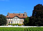
|
château de Mestral | A | 46°32′43″N 6°29′15″E / 46.54536°N 6.48757°E | 6492 | ||
| Échichens | 
|
Château et sa dépendance | B | 46°33′24″N 6°28′31″E / 46.556597°N 6.475322°E | 6000 | ||
| Échichens | 
|
église réformée Saint-Jean-Baptiste | B | 46°33′24″N 6°28′31″E / 46.556552°N 6.475323°E | 6001 | ||
| Échichens | 
|
Fontaine | B | 46°33′20″N 6°28′19″E / 46.555434°N 6.471848°E | 14588 | ||
| Échichens | 
|
Maison de Commune | B | 46°33′22″N 6°28′22″E / 46.556061°N 6.472658°E | 14589 | ||
| Échichens | 
|
Petit château | B | 46°33′21″N 6°28′20″E / 46.555886°N 6.472101°E | 14587 | ||
| Échichens | 
|
Saint-Saphorin-sur-Morges | ISOS | 46°32′45″N 6°29′15″E / 46.5459°N 6.4874°E | |||
| Échichens | Colombier | ISOS | 46°33′25″N 6°28′21″E / 46.5569°N 6.4725°E | ||||
Éclépens
| Location | Upload | Photo | Object | Cat. | Coordinates | KGS-Nr | |
|---|---|---|---|---|---|---|---|
| Éclépens | 
|
canal d'Entreroches | A | 46°39′42″N 6°33′10″E / 46.661583333°N 6.552777777°E | 6063 | ||
| Éclépens | 
|
Mormont | A | 46°39′19″N 6°32′01″E / 46.65514°N 6.53367°E | 11776 | ||
| Éclépens | 
|
Château d'En-Haut avec dépendance et parc | B | 46°39′11″N 6°31′28″E / 46.65308°N 6.52455°E | 6064 | ||
| Éclépens | 
|
Éclépens | ISOS | 46°39′00″N 6°32′00″E / 46.65°N 6.533333333°E | |||
Écublens
| Location | Upload | Photo | Object | Cat. | Coordinates | KGS-Nr | |
|---|---|---|---|---|---|---|---|
| Écublens | 
|
Archives communales d'Écublens | B | 46°31′58″N 6°33′54″E / 46.53279°N 6.56504°E | 8886 | ||
| Écublens | 
|
Bibliothèque de l'EPFL | B | 46°31′05″N 6°34′05″E / 46.518148°N 6.567947°E | 14628 | ||
| Écublens | 
|
Archives de la construction moderne | A | 46°31′15″N 6°33′50″E / 46.52095°N 6.56393°E | 10596 | ||
| Écublens | 
|
Bibliothèque cantonale et universitaire de Lausanne, Département des manuscrits | A | 46°31′22″N 6°34′46″E / 46.52269°N 6.57951°E | 8933 | ||
| Écublens | 
|
Bibliothèque cantonale et universitaire, Centre de recherches sur les lettres romandes | B | 46°31′22″N 6°34′46″E / 46.522689°N 6.579513°E | 14626 | ||
| Écublens | 
|
Bibliothèque cantonale et universitaire, Institut Benjamin Constant | B | 46°31′22″N 6°34′46″E / 46.522671°N 6.579487°E | 14625 | ||
| Écublens | 
|
Château de la Motte | B | 46°32′17″N 6°34′01″E / 46.538086°N 6.56704°E | 6066 | ||
| Écublens | 
|
Fondation Jean-Monnet pour l'Europe | A | 46°31′26″N 6°34′57″E / 46.52399°N 6.58237°E | 9159 | ||
| Écublens | 
|
musée Bolo | B | 46°31′08″N 6°33′50″E / 46.518818°N 6.563857°E | 14627 | ||
| Écublens | 
|
Cantonal and University Library of Lausanne (collection) | A | 46°31′22″N 6°34′47″E / 46.52276°N 6.57966°E | 9348 | ||
| Écublens | 
|
Bibliothèque cantonale et universitaire de Lausanne | A | 46°31′22″N 6°34′46″E / 46.5228°N 6.5795°E | 14624 | ||
Épalinges
| Location | Upload | Photo | Object | Cat. | Coordinates | KGS-Nr | |
|---|---|---|---|---|---|---|---|
| Épalinges | 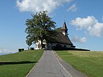
|
Temple des Croisettes | B | 46°32′45″N 6°40′26″E / 46.54596°N 6.67377°E | 6067 | ||
Essertines-sur-Rolle
| Location | Upload | Photo | Object | Cat. | Coordinates | KGS-Nr | |
|---|---|---|---|---|---|---|---|
| Essertines-sur-Rolle | 
|
Ruines du château de Mont-Le-Vieux | B | 46°28′31″N 6°18′58″E / 46.47533°N 6.3162°E | 14629 | ||
| Essertines-sur-Rolle | 
|
Essertines-sur-Rolle | ISOS | 46°28′24″N 6°19′08″E / 46.4732°N 6.3189°E | |||
| Essertines-sur-Rolle | 
|
Tartegnin | ISOS | 46°28′00″N 6°18′57″E / 46.4668°N 6.3157°E | |||
Essertines-sur-Yverdon
| Location | Upload | Photo | Object | Cat. | Coordinates | KGS-Nr | |
|---|---|---|---|---|---|---|---|
| Essertines-sur-Yverdon | 
|
Essertines-sur-Yverdon | ISOS | 46°43′00″N 6°38′00″E / 46.716666666°N 6.633333333°E | |||
Étoy
| Location | Upload | Photo | Object | Cat. | Coordinates | KGS-Nr | |
|---|---|---|---|---|---|---|---|
| Étoy | 
|
Château (ancien prieuré) | B | 46°29′09″N 6°25′16″E / 46.48595°N 6.42116°E | 6068 | ||
| Étoy | 
|
église réformée Saint-Nicolas | B | 46°29′10″N 6°25′15″E / 46.48616°N 6.42084°E | 6070 | ||
| Étoy | 
|
Maison aux arcades | B | 46°29′09″N 6°25′13″E / 46.48572°N 6.42018°E | 6069 | ||
| Étoy | 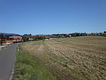
|
Étoy | ISOS | 46°29′00″N 6°25′00″E / 46.483333333°N 6.416666666°E | |||
