File:Mecklenburg-Vorpommern Flughäfen und Landeplätze.png
Jump to navigation
Jump to search
Size of this preview: 800 × 549 pixels. Other resolutions: 320 × 220 pixels | 640 × 439 pixels | 1,024 × 702 pixels | 1,280 × 878 pixels | 1,500 × 1,029 pixels.
Original file (1,500 × 1,029 pixels, file size: 388 KB, MIME type: image/png)
Captions
Captions
Add a one-line explanation of what this file represents
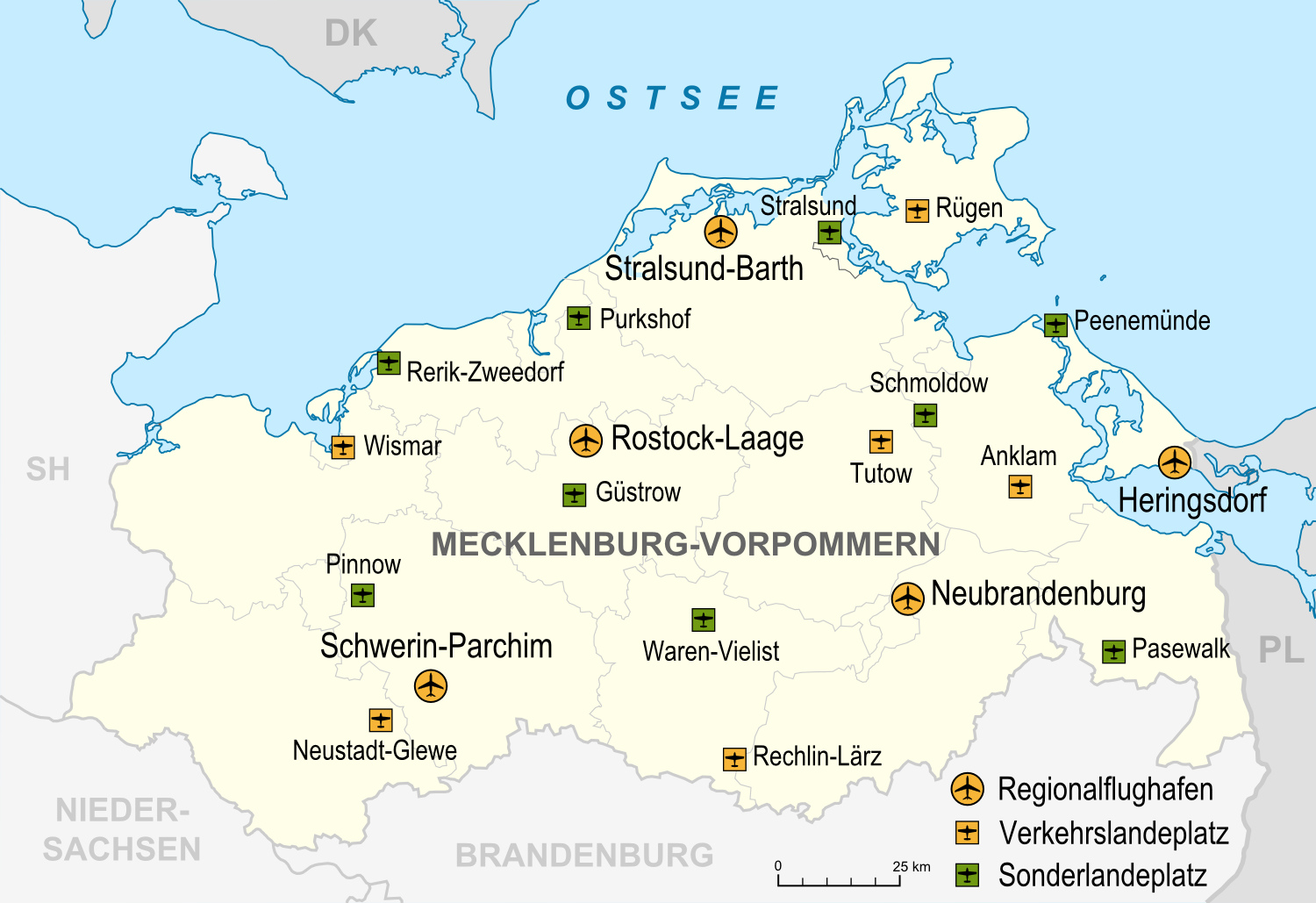
| Description | Flughäfen, Verkehrslandeplätze, Sonderlandeplätze und Wasserlandeplätze in Mecklenburg-Vorpommern, Stand 2007 |
| Date | |
| Source |
own work, used: |
| Author | Lencer |
This file is licensed under the Creative Commons Attribution-Share Alike 3.0 Unported license.
- You are free:
- to share – to copy, distribute and transmit the work
- to remix – to adapt the work
- Under the following conditions:
- attribution – You must give appropriate credit, provide a link to the license, and indicate if changes were made. You may do so in any reasonable manner, but not in any way that suggests the licensor endorses you or your use.
- share alike – If you remix, transform, or build upon the material, you must distribute your contributions under the same or compatible license as the original.

|
This map has been made or improved in the German Kartenwerkstatt (Map Lab). You can propose maps to improve as well.
|
File history
Click on a date/time to view the file as it appeared at that time.
| Date/Time | Thumbnail | Dimensions | User | Comment | |
|---|---|---|---|---|---|
| current | 12:11, 15 March 2009 | | 1,500 × 1,029 (388 KB) | Lencer (talk | contribs) | + Maßstabsleiste |
| 20:26, 13 March 2009 |  | 1,500 × 1,029 (386 KB) | Lencer (talk | contribs) | {{Information| |Description=Flughäfen, Verkehrslandeplätze, Sonderlandeplätze und Wasserlandeplätze in Mecklenburg-Vorpommern, Stand 2007 |Source=own work, used: * [[:de:Liste der Verkehrs- und Sonderlandeplätze in Deutschland|Liste der Verkehrs- und |
You cannot overwrite this file.
File usage on Commons
There are no pages that use this file.
File usage on other wikis
The following other wikis use this file:
- Usage on de.wikipedia.org
- Usage on en.wikipedia.org
- Usage on mk.wikipedia.org