File:Геометрична нивелация.pdf
Jump to navigation
Jump to search

Size of this JPG preview of this PDF file: 423 × 599 pixels. Other resolutions: 169 × 240 pixels | 339 × 480 pixels | 542 × 768 pixels | 1,239 × 1,754 pixels.

Original file (1,239 × 1,754 pixels, file size: 61 KB, MIME type: application/pdf, 2 pages)
Captions
Captions
Add a one-line explanation of what this file represents
Summary
[edit]| Description |
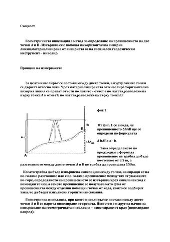
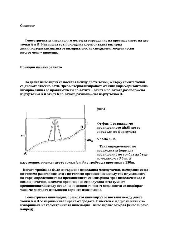
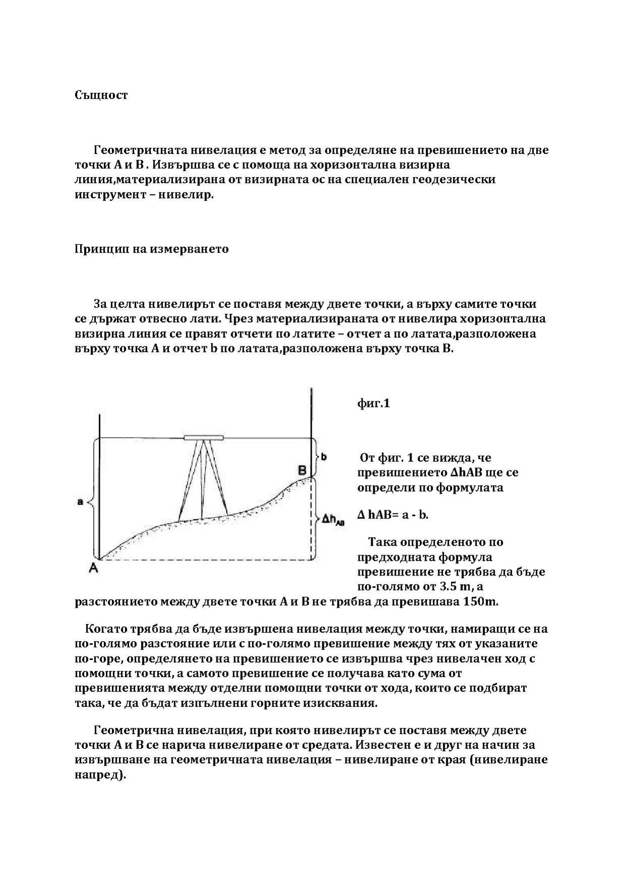
English: geometric leveling is a way of measuring the excess of two points A and B
Български: геометрична нивелация е способ за измерване на превишението на две точки А и Б |
| Date | between 1991 and 2012 |
| Source | Ръководство за упражнения по геодезия, Издателство "Техника", София, 1991 |
| Author | Паско Бакалов, Радка Янева, Димитър Тонков,Светлана Бакъшева, Евгени Кръстанов |
Licensing
[edit]This file is licensed under the Creative Commons Attribution 3.0 Unported license.
- You are free:
- to share – to copy, distribute and transmit the work
- to remix – to adapt the work
- Under the following conditions:
- attribution – You must give appropriate credit, provide a link to the license, and indicate if changes were made. You may do so in any reasonable manner, but not in any way that suggests the licensor endorses you or your use.
File history
Click on a date/time to view the file as it appeared at that time.
| Date/Time | Thumbnail | Dimensions | User | Comment | |
|---|---|---|---|---|---|
| current | 17:37, 18 March 2012 |  | 1,239 × 1,754, 2 pages (61 KB) | Rosictsa Hadzhiyska (talk | contribs) | {{Information |Description ={{en|1=geometric leveling is a way of measuring the excess of two points A and B}} {{bg|1=геометрична нивелация е способ за измерване на превишението на две точ... |
You cannot overwrite this file.
File usage on Commons
There are no pages that use this file.