File:20120816 ACM-brug Reitdiep Groningen NL.jpg
(Redirected from File:120816 ACM-brug Reitdiep Groningen NL.jpg)

Size of this preview: 800 × 400 pixels. Other resolutions: 320 × 160 pixels | 640 × 320 pixels | 1,024 × 512 pixels | 1,280 × 640 pixels | 2,560 × 1,280 pixels | 5,200 × 2,600 pixels.
Original file (5,200 × 2,600 pixels, file size: 4.14 MB, MIME type: image/jpeg)
Captions
Captions
Add a one-line explanation of what this file represents
| Description |
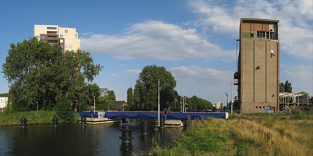
English: The ACM-brug, a pedestrian and bicycle bridge in the Dutch city of Groningen. Frysk: De ACM-brêge oer it Reitdjip yn Grins, sjoen út it westen wei. De brêge waard ûntwurpen troch Yushi Uehara en is yn 2009 iepene. Links it flatgebou Marquant, rjochts in part fan it kompleks fan de eardere Aankoop Centrale Meppel (ACM), dêr't de brêge nei neamd is. Oer de brêge rint it Donghornsterpad, in fytspaad dat Vinkhuizen mei de Oranjebuurt en Paddepoel ferbynt. Nederlands: De ACM-brug (Yushi Uehara, 2009) over het Reitdiep in de stad Groningen. Links het flatgebouw Marquant, rechts een deel van het complex van de voormalige Aankoop Centrale Meppel (ACM), waarnaar de brug is genoemd. Over de brug loopt het Donghornsterpad, een fietspad dat de wijk Vinkhuizen met de Oranjebuurt en Paddepoel verbindt. |
| Date | |
| Source | Own work |
| Author | Wutsje |
| Permission (Reusing this file) |
This file is licensed under the Creative Commons Attribution-Share Alike 3.0 Unported license.
|
| Attribution (required by the license) | Wutsje / Wikimedia Commons / |
| Camera location | | View this and other nearby images on: OpenStreetMap |
|---|
File history
Click on a date/time to view the file as it appeared at that time.
| Date/Time | Thumbnail | Dimensions | User | Comment | |
|---|---|---|---|---|---|
| current | 00:34, 18 August 2012 | | 5,200 × 2,600 (4.14 MB) | Wutsje (talk | contribs) | {{Information |Description = {{Multilingual description |en=The ''ACM-brug'', a pedestrian and bicycle bridge in the Dutch city of Groningen. |fy=De ''ACM-brêge'' oer it Reitdjip yn [[:Category... |
You cannot overwrite this file.
File usage on Commons
The following 2 pages use this file:
File usage on other wikis
The following other wikis use this file:
- Usage on nl.wikipedia.org
- Usage on www.wikidata.org