File:1780 Bonne Map of Arabia, Egypt ^ Ethiopia - Geographicus - Arabia-bonne-1780.jpg
Jump to navigation
Jump to search

Size of this preview: 800 × 529 pixels. Other resolutions: 320 × 212 pixels | 640 × 423 pixels | 1,024 × 677 pixels | 1,280 × 847 pixels | 2,500 × 1,654 pixels.
Original file (2,500 × 1,654 pixels, file size: 1.11 MB, MIME type: image/jpeg)
Captions
Captions
Add a one-line explanation of what this file represents
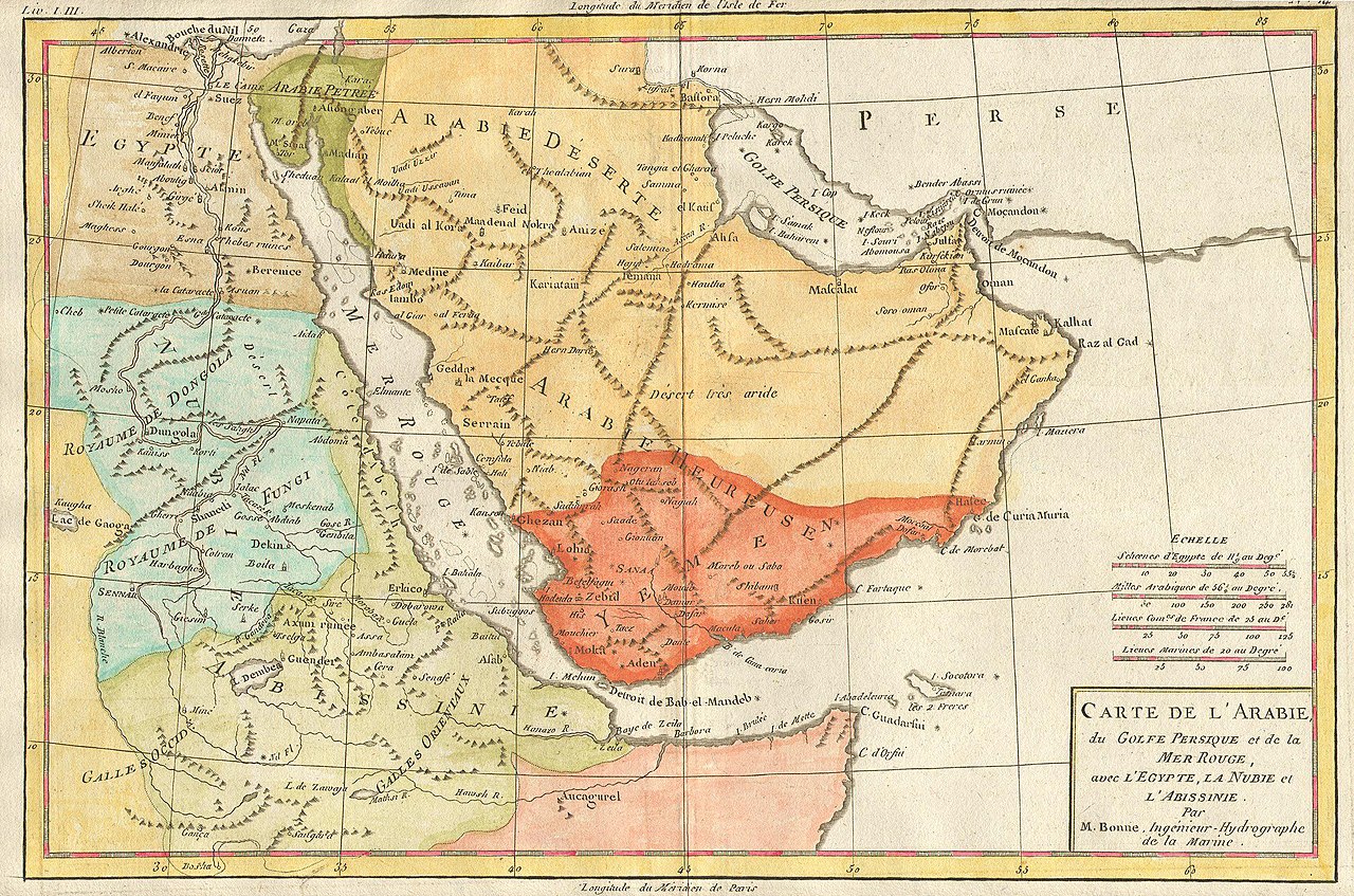
| Rigobert Bonne: Carte de L'Arabie, du Golfe Persique et de lat Mer Rouge, avec L'Egypte, La Nubie et L'Abissinie.
( |
|||||||||||||||||||||||
|---|---|---|---|---|---|---|---|---|---|---|---|---|---|---|---|---|---|---|---|---|---|---|---|
| Artist |
|
||||||||||||||||||||||
| Title |
Carte de L'Arabie, du Golfe Persique et de lat Mer Rouge, avec L'Egypte, La Nubie et L'Abissinie. |
||||||||||||||||||||||
| Description |
English: This is an attractive map of Arabia, northwestern Africa, Ethiopia (Absynnia) and the Red Sea by the mapmaker Rigobert Bonne, c. 1780. Towns, churches, cities and mountains are depicted as miniature representations of themselves. This map is highly detailed and beautifully crafted. |
||||||||||||||||||||||
| Date | 1780 | ||||||||||||||||||||||
| Dimensions | height: 8.5 in (21.5 cm); width: 12 in (30.4 cm) | ||||||||||||||||||||||
| Accession number |
Geographicus link: Arabia-bonne-1780 |
||||||||||||||||||||||
| Source/Photographer |
|
||||||||||||||||||||||
| Permission (Reusing this file) |
|
||||||||||||||||||||||
File history
Click on a date/time to view the file as it appeared at that time.
| Date/Time | Thumbnail | Dimensions | User | Comment | |
|---|---|---|---|---|---|
| current | 12:57, 12 March 2011 | | 2,500 × 1,654 (1.11 MB) | BotMultichill (talk | contribs) | {{subst:User:Multichill/Geographicus |link=http://www.geographicus.com/P/AntiqueMap/Arabia-bonne-1780 |product_name=1780 Bonne Map of Arabia, Egypt & Ethiopia |map_title=Carte de L'Arabie, du Golfe Persique et de lat Mer Rouge, avec L'Egypte, La Nubie et |
You cannot overwrite this file.
File usage on Commons
The following page uses this file:
File usage on other wikis
The following other wikis use this file:
- Usage on ru.wikipedia.org
- Usage on uk.wikipedia.org