File:1799 Clement Cruttwell Map of France in Provinces - Geographicus - FranceProvinces-cruttwell-1799.jpg
Jump to navigation
Jump to search
Size of this preview: 682 × 599 pixels. Other resolutions: 273 × 240 pixels | 546 × 480 pixels | 874 × 768 pixels | 1,165 × 1,024 pixels | 2,330 × 2,048 pixels | 3,500 × 3,076 pixels.
Original file (3,500 × 3,076 pixels, file size: 3.05 MB, MIME type: image/jpeg)
Captions
Captions
Add a one-line explanation of what this file represents
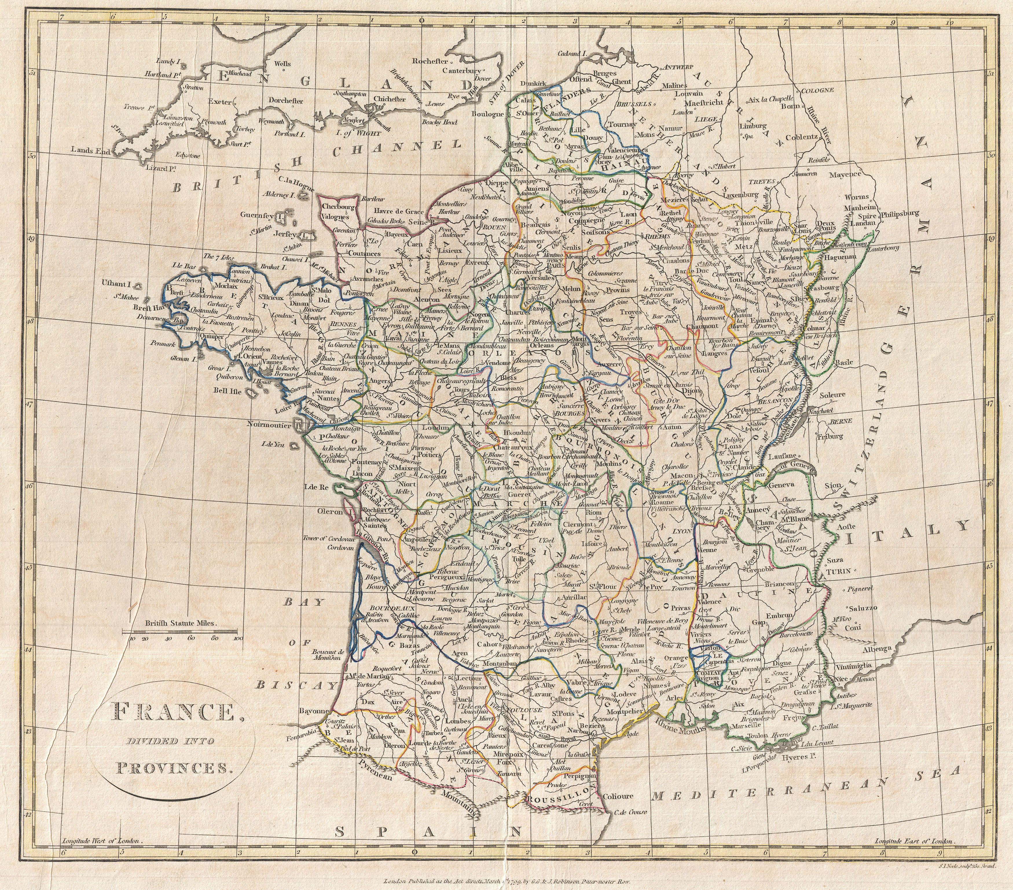
| France, Divided into Provinces. | ||||||
|---|---|---|---|---|---|---|
| Artist | ||||||
| Title |
France, Divided into Provinces. |
|||||
| Description |
English: A fine 1799 map of France Divided into Provinces by the English map publisher Clement Cruttwell. France was organized into provinces until March 4, 1790, when the establishment of the department system superseded provinces. The change was an attempt to eradicate local loyalties based on feudal ownership of land and focus all loyalty on the central government in Paris. There were roughly 40 provinces in France before they were abolished. Maps displays all provinces, including the province of Île-de-France, the center of power during most of French history. Many atlas produced during this period thus included two maps of France, one in Provinces, and one in Departments. Includes parts adjacent Austrian Netherlands, Switzerland, Germany, Italy, and Spain. Includes rivers, political boundaries, important cities, ports and gulfs. Mountains and other topographical features shown by profile. Outline color and fine copper plate engraving in the minimalist English style prevalent in the late 18th and early 19th centuries. Drawn by Clement Cruttwell and published in the 1799 Atlas to Cruttwell's Gazetteer. |
|||||
| Date | 1799 (dated) | |||||
| Dimensions | height: 14 in (35.5 cm); width: 16 in (40.6 cm) | |||||
| Accession number |
Geographicus link: FranceProvinces-cruttwell-1799 |
|||||
| Source/Photographer |
Cruttwell, C., Atlas to Cruttwell's Gazetteer, 1799.
|
|||||
| Permission (Reusing this file) |
|
|||||
File history
Click on a date/time to view the file as it appeared at that time.
| Date/Time | Thumbnail | Dimensions | User | Comment | |
|---|---|---|---|---|---|
| current | 13:59, 24 March 2011 | | 3,500 × 3,076 (3.05 MB) | BotMultichillT (talk | contribs) | {{subst:User:Multichill/Geographicus |link=http://www.geographicus.com/P/AntiqueMap/FranceProvinces-cruttwell-1799 |product_name=1799 Clement Cruttwell Map of France in Provinces |map_title=France, Divided into Provinces. |description=A fine 1799 map of F |
You cannot overwrite this file.
File usage on Commons
The following page uses this file: