File:1815 Thomson Map of Spain and Portugal - Geographicus - Spain-t-15.jpg
Jump to navigation
Jump to search

Size of this preview: 715 × 599 pixels. Other resolutions: 286 × 240 pixels | 573 × 480 pixels | 916 × 768 pixels | 1,222 × 1,024 pixels | 2,443 × 2,048 pixels | 3,000 × 2,515 pixels.
Original file (3,000 × 2,515 pixels, file size: 2.05 MB, MIME type: image/jpeg)
Captions
Captions
Add a one-line explanation of what this file represents
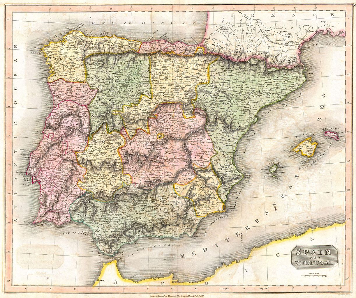
| John Thomson: Spain and Portugal.
( |
||||||||||||||
|---|---|---|---|---|---|---|---|---|---|---|---|---|---|---|
| Artist |
|
|||||||||||||
| Title |
Spain and Portugal. |
|||||||||||||
| Description |
English: This fascinating hand colored 1815 map by Edinburgh cartographer John Thomson depicts southern Spain and Portugal or the Iberian Peninsula. Color coded according to region. This is the finest 19th century representation of Spain and Portugal we’ve seen. |
|||||||||||||
| Date | 1815 | |||||||||||||
| Dimensions | height: 20 in (50.8 cm); width: 25 in (63.5 cm) | |||||||||||||
| Accession number |
Geographicus link: Spain-t-15 |
|||||||||||||
| Source/Photographer |
|
|||||||||||||
| Permission (Reusing this file) |
|
|||||||||||||
File history
Click on a date/time to view the file as it appeared at that time.
| Date/Time | Thumbnail | Dimensions | User | Comment | |
|---|---|---|---|---|---|
| current | 23:36, 24 March 2011 | | 3,000 × 2,515 (2.05 MB) | BotMultichillT (talk | contribs) | {{subst:User:Multichill/Geographicus |link=http://www.geographicus.com/P/AntiqueMap/Spain-t-15 |product_name=1815 Thomson Map of Spain and Portugal |map_title=Spain and Portugal. |description=This fascinating hand colored 1815 map by Edinburgh cartograp |
You cannot overwrite this file.
File usage on Commons
The following page uses this file: