File:1839 map of the countries lying between Turkey & Birmah by James Wyld.tif
Jump to navigation
Jump to search

Size of this JPG preview of this TIF file: 800 × 584 pixels. Other resolutions: 320 × 234 pixels | 640 × 468 pixels | 1,024 × 748 pixels | 1,280 × 935 pixels | 2,560 × 1,870 pixels | 25,922 × 18,936 pixels.
Original file (25,922 × 18,936 pixels, file size: 1.37 GB, MIME type: image/tiff)
Captions
Captions
Add a one-line explanation of what this file represents
Summary[edit]
| Warning | The original file is very high-resolution. It might not load properly or could cause your browser to freeze when opened at full size. |
|---|
| Description |
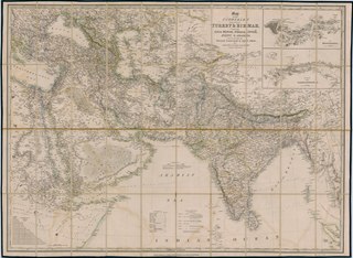
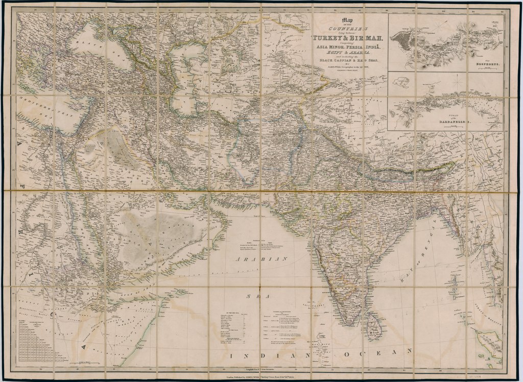
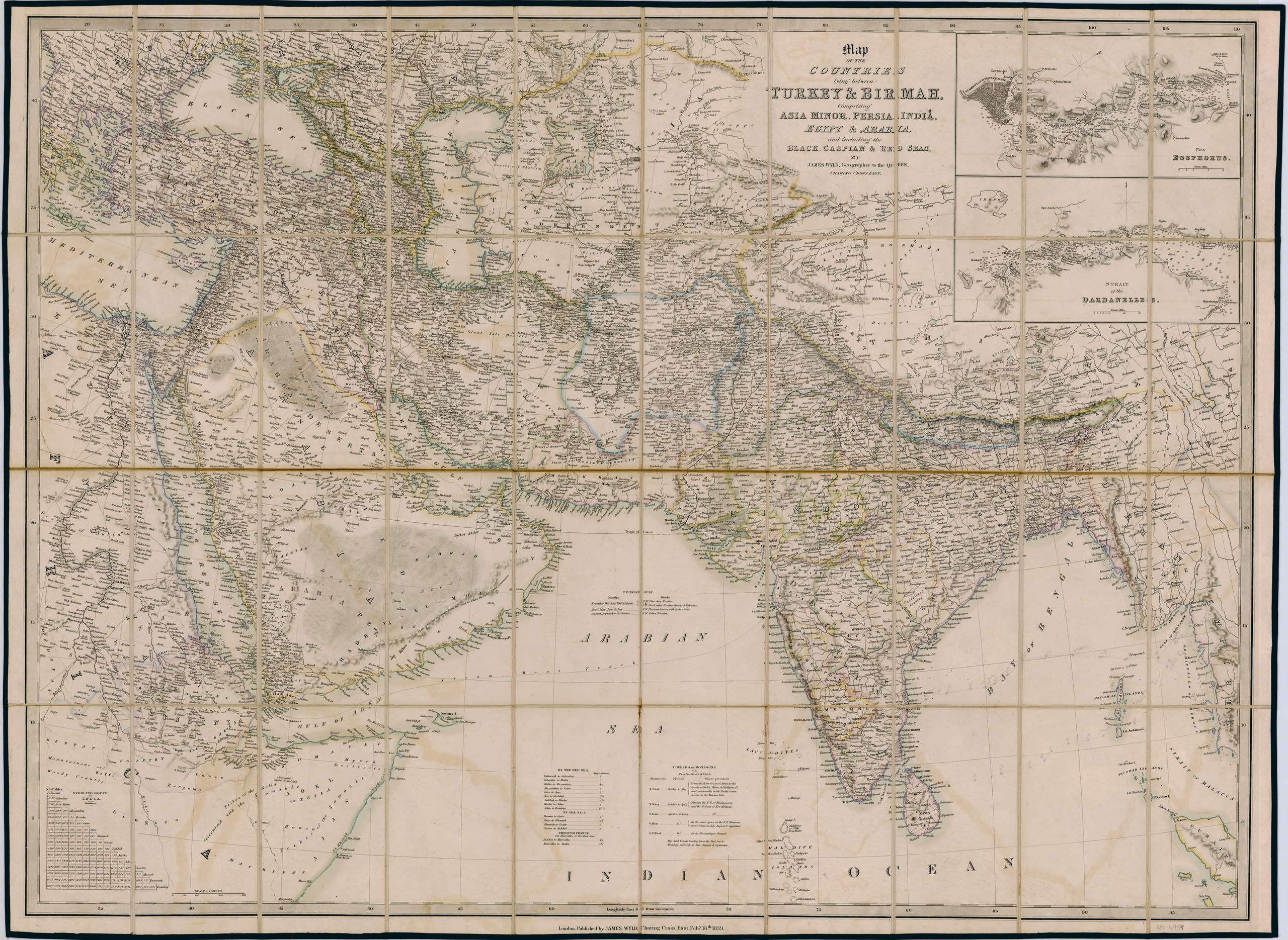
English: Map of the countries lying between Turkey & Birmah, |
|||||||||||||||||||||||
| Date | ||||||||||||||||||||||||
| Source | https://nla.gov.au/nla.obj-534790861/view | |||||||||||||||||||||||
| Author |
|
|||||||||||||||||||||||

Licensing[edit]
|
This work is in the public domain in its country of origin and other countries and areas where the copyright term is the author's life plus 70 years or fewer. This work is in the public domain in the United States because it was published (or registered with the U.S. Copyright Office) before January 1, 1929. | |
| This file has been identified as being free of known restrictions under copyright law, including all related and neighboring rights. | |
File history
Click on a date/time to view the file as it appeared at that time.
| Date/Time | Thumbnail | Dimensions | User | Comment | |
|---|---|---|---|---|---|
| current | 07:48, 29 April 2020 |  | 25,922 × 18,936 (1.37 GB) | Balkanique (talk | contribs) | Uploaded a work by Wyld, James (1812-1887) from https://nla.gov.au/nla.obj-534790861/view with UploadWizard |
You cannot overwrite this file.
File usage on Commons
There are no pages that use this file.