File:1846 Emmons Agricultural Map of New York State - Geographicus - NewYork-emmons-1846.jpg

Original file (4,000 × 3,108 pixels, file size: 3.34 MB, MIME type: image/jpeg)
Captions
Captions
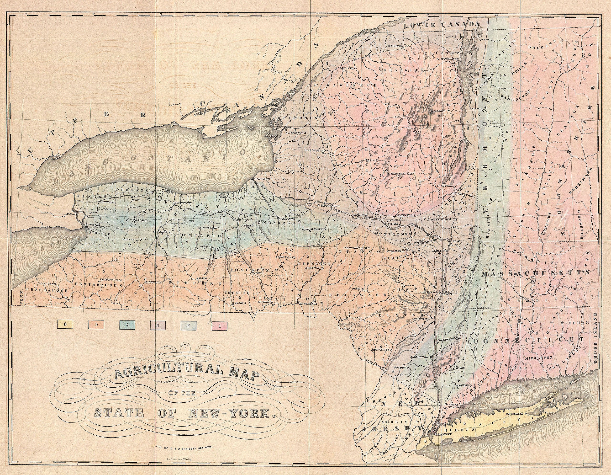
| Agricultural Map of the State of New-York. | ||||||
|---|---|---|---|---|---|---|
| Artist | ||||||
| Title |
Agricultural Map of the State of New-York. |
|||||
| Description |
English: This is a rarely seen 1846 thematic of New York by E. Emmons and G. & W. Endicott. Divides the state of New York, as well as neighboring states of Connecticut, Massachusetts, New Hampshire and Vermont, into six distinct agricultural zones. It is interesting to note that even at this early date Emmons identifies the Adirondacks as an independent agricultural zone clearly definable from other nearby mountain regions. Published in 1846 to illustrated volume one of E. Emmons’ Agriculture of New York . |
|||||
| Date | 1846 (undated) | |||||
| Dimensions | height: 18.5 in (46.9 cm); width: 24 in (60.9 cm) | |||||
| Accession number |
Geographicus link: NewYork-emmons-1846 |
|||||
| Source/Photographer |
Emmons, E., Agriculture of New York comprising an Account of the Classification Composition and Distribution of the Soils and Rocks and the Natural Waters of the different Geological Formations together with a condensed View of the Climate and the Agricultural Productions of the State, Vol 1, 1846 New York edition.
|
|||||
| Permission (Reusing this file) |
|
|||||
File history
Click on a date/time to view the file as it appeared at that time.
| Date/Time | Thumbnail | Dimensions | User | Comment | |
|---|---|---|---|---|---|
| current | 18:00, 22 March 2011 | | 4,000 × 3,108 (3.34 MB) | BotMultichillT (talk | contribs) | {{subst:User:Multichill/Geographicus |link=http://www.geographicus.com/P/AntiqueMap/NewYork-emmons-1846 |product_name=1846 Emmons Agricultural Map of New York State |map_title=Agricultural Map of the State of New-York. |description=This is a rarely seen 1 |
You cannot overwrite this file.
File usage on Commons
The following page uses this file:
File usage on other wikis
The following other wikis use this file:
- Usage on en.wikipedia.org
- Usage on es.wikipedia.org
- Usage on fr.wikipedia.org