File:1850 Mitchell Map of Spain and Portugal - Geographicus - SpainPortugal-mitchell-1850.jpg
Jump to navigation
Jump to search
Size of this preview: 742 × 599 pixels. Other resolutions: 297 × 240 pixels | 594 × 480 pixels | 951 × 768 pixels | 1,268 × 1,024 pixels | 2,536 × 2,048 pixels | 3,000 × 2,423 pixels.
Original file (3,000 × 2,423 pixels, file size: 1.68 MB, MIME type: image/jpeg)
Captions
Captions
Add a one-line explanation of what this file represents
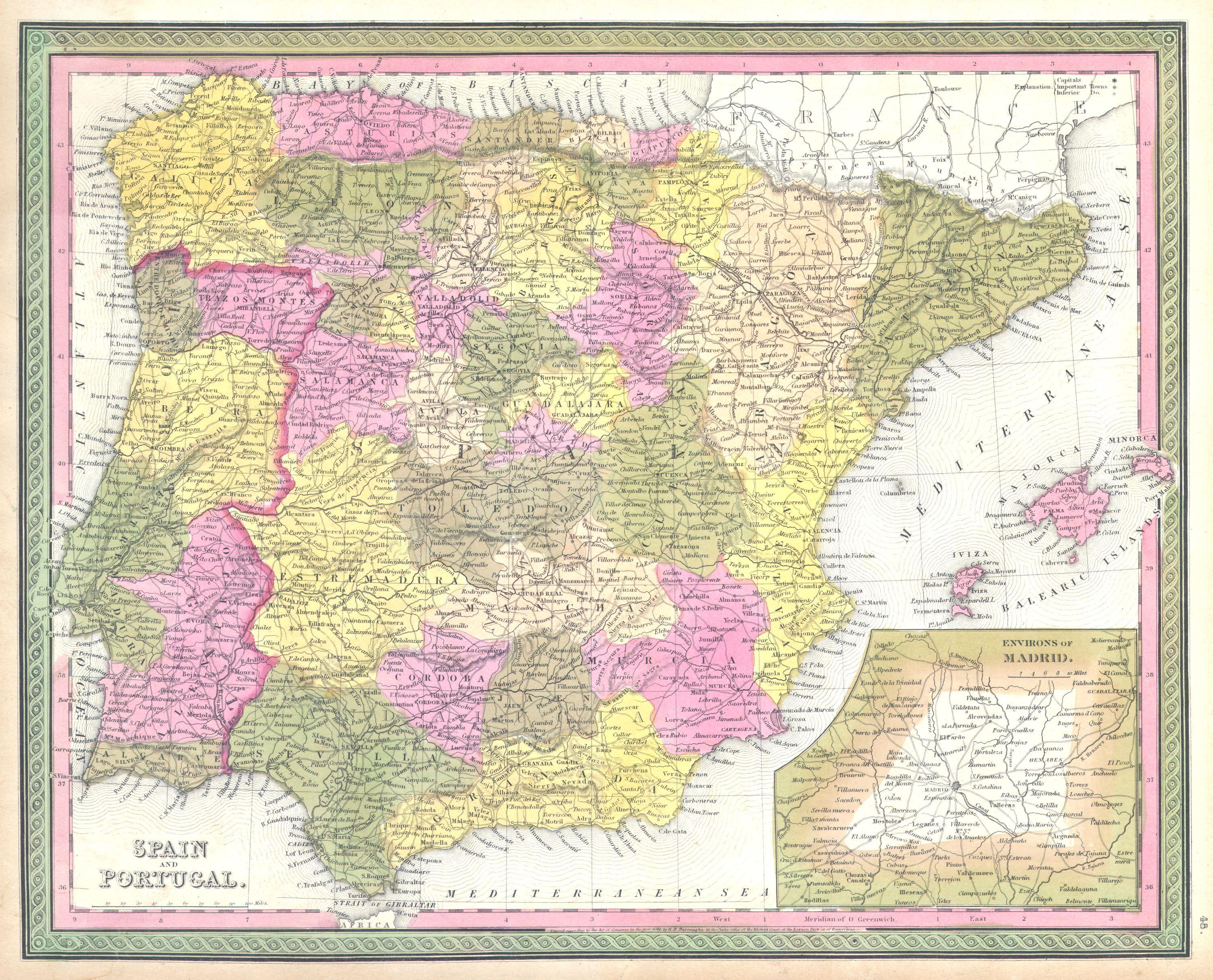
| Samuel Augustus Mitchell: Spain and Portugal.
( |
||||||||||||||||||||
|---|---|---|---|---|---|---|---|---|---|---|---|---|---|---|---|---|---|---|---|---|
| Artist |
|
|||||||||||||||||||
| Title |
Spain and Portugal. |
|||||||||||||||||||
| Description |
English: This hand colored map is a copper plate engraving, dating to 1850, by the legendary American mapmaker S. A. Mitchell, the elder. It represents Spain and Portugal. Includes the Balearic Islands of Ibiza, Majorca, and Minorca. Lower right quadrant features inset map of environs of Madrid. Prepared by H.N. Burroughs for the 1850 edition of Mitchell's New General Atlas . Dated and copyrighted: Entered according to Act of Congress in the year 1846 by H.N. Burroughs, in the Clerk's office of the District Court of the Eastern District of Pennsylvania. |
|||||||||||||||||||
| Date | 1850 | |||||||||||||||||||
| Dimensions | height: 13 in (33 cm); width: 16 in (40.6 cm) | |||||||||||||||||||
| Accession number |
Geographicus link: SpainPortugal-mitchell-1850 |
|||||||||||||||||||
| Source/Photographer |
|
|||||||||||||||||||
| Permission (Reusing this file) |
|
|||||||||||||||||||
| Other versions | ||||||||||||||||||||
.jpg)
File history
Click on a date/time to view the file as it appeared at that time.
| Date/Time | Thumbnail | Dimensions | User | Comment | |
|---|---|---|---|---|---|
| current | 07:14, 16 March 2011 | | 3,000 × 2,423 (1.68 MB) | BotMultichill (talk | contribs) | {{subst:User:Multichill/Geographicus |link=http://www.geographicus.com/P/AntiqueMap/SpainPortugal-mitchell-1850 |product_name=1850 Mitchell Map of Spain and Portugal |map_title=Spain and Portugal. |description=This hand colored map is a copper plate engra |
You cannot overwrite this file.
File usage on Commons
The following 2 pages use this file: