File:1856 Colton Map of Prussia and Saxony, Germany - Geographicus - Prussia-colton-1856.jpg
Jump to navigation
Jump to search

Size of this preview: 730 × 599 pixels. Other resolutions: 292 × 240 pixels | 585 × 480 pixels | 936 × 768 pixels | 1,247 × 1,024 pixels | 2,495 × 2,048 pixels | 4,000 × 3,284 pixels.
Original file (4,000 × 3,284 pixels, file size: 4.33 MB, MIME type: image/jpeg)
Captions
Captions
Add a one-line explanation of what this file represents
Summary[edit]
| J. H. Colton: Prussia and Saxony.
( |
|||||||||||||||||||||
|---|---|---|---|---|---|---|---|---|---|---|---|---|---|---|---|---|---|---|---|---|---|
| Artist |
|
||||||||||||||||||||
| Title |
Prussia and Saxony. |
||||||||||||||||||||
| Description |
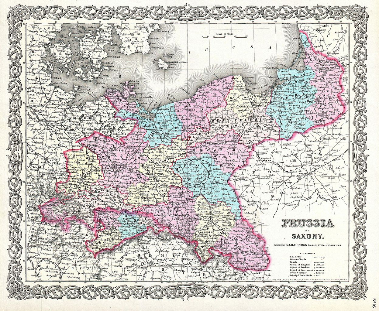
English: This is the very rare 1856 issue of J. H. Colton’s map of Prussia and Saxony. Covers what is today northwestern Germany. Divided and color coded according to district. Shows major roadways and railroads as well as geological features such as lakes and rivers. Like most Colton maps this map is dated 1855, but most likely was issued in the 1856 issue of Colton’s Atlas . Dated and copyrighted: “Entered according to the Act of Congress in the Year of 1855 by J. H. Colton & Co. in the Clerk’s Office of the District Court of the United States for the Southern District of New York.” Published from Colton’s 172 William Street Office in New York City, NY. |
||||||||||||||||||||
| Date | 1855 (dated) | ||||||||||||||||||||
| Dimensions | height: 13 in (33 cm); width: 15.5 in (39.3 cm) | ||||||||||||||||||||
| Accession number |
Geographicus link: Prussia-colton-1856 |
||||||||||||||||||||
| Source/Photographer |
Colton, G.W., Colton's Atlas Of The World, Illustrating Physical And Political Geography., (1856 single volume editon).
|
||||||||||||||||||||
| Permission (Reusing this file) |
|
||||||||||||||||||||

File history
Click on a date/time to view the file as it appeared at that time.
| Date/Time | Thumbnail | Dimensions | User | Comment | |
|---|---|---|---|---|---|
| current | 16:17, 22 March 2011 | | 4,000 × 3,284 (4.33 MB) | BotMultichillT (talk | contribs) | {{subst:User:Multichill/Geographicus |link=http://www.geographicus.com/P/AntiqueMap/Prussia-colton-1856 |product_name=1856 Colton Map of Prussia and Saxony, Germany |map_title=Prussia and Saxony. |description=This is the very rare 1856 issue of J. H. Colt |
You cannot overwrite this file.
File usage on Commons
The following page uses this file:
File usage on other wikis
The following other wikis use this file:
- Usage on hy.wikipedia.org