File:1861 Johnson Map of China - Geographicus - China-johnson-1861.jpg
Jump to navigation
Jump to search

Size of this preview: 722 × 600 pixels. Other resolutions: 289 × 240 pixels | 578 × 480 pixels | 925 × 768 pixels | 1,233 × 1,024 pixels | 2,466 × 2,048 pixels | 4,000 × 3,322 pixels.
Original file (4,000 × 3,322 pixels, file size: 4.89 MB, MIME type: image/jpeg)
Captions
Captions
Add a one-line explanation of what this file represents
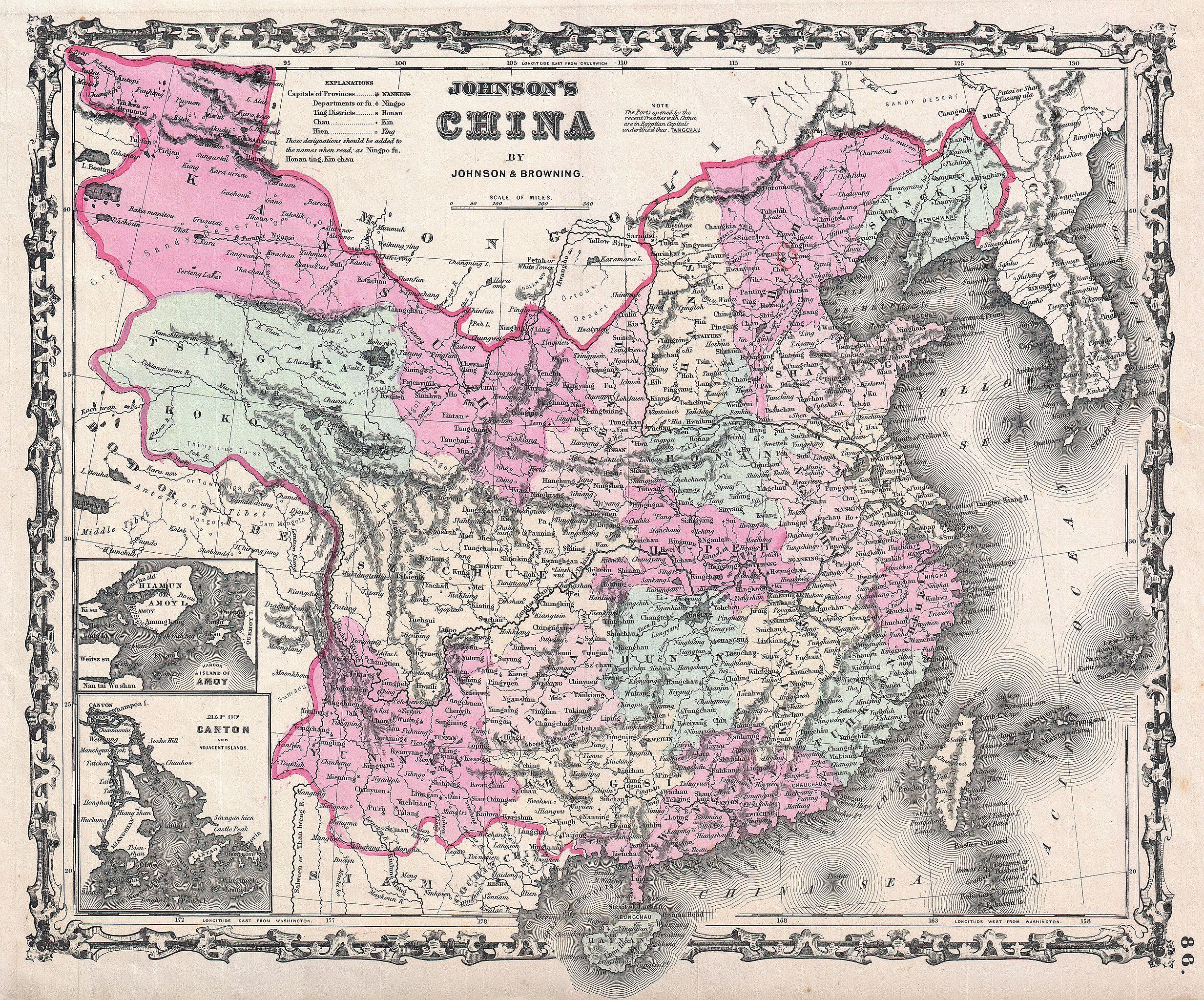
| Alvin Jewett Johnson: Johnson's China.
( |
|||||||||||||||||||||||
|---|---|---|---|---|---|---|---|---|---|---|---|---|---|---|---|---|---|---|---|---|---|---|---|
| Artist |
|
||||||||||||||||||||||
| Title |
Johnson's China. |
||||||||||||||||||||||
| Description |
English: This is Johnson and Browning’s 1861 map of China, first edition. Covers the region with particular attention to cities and waterways. China at the time this map was made was mostly closed country, however, a few ports were opened to western trade, these few are noted in capital letters and include Tanchau, Kaifung, Waingan, Shanghai, Canton and Nanking (Nanjing) among others. Insets detail the “Island of Amoy” and Canton (Hong Kong). Features the ribbon style border common to Johnson’s atlas work from 1860 to 1862. Steel plate engraving prepared by A. J. Johnson for publication as plate no. 86 in the 1861 edition of his New Illustrated Atlas… This is the last edition of the Johnson’s Atlas to exclusively bear the Johnson and Browning imprint. |
||||||||||||||||||||||
| Date | 1861 (undated) | ||||||||||||||||||||||
| Dimensions | height: 12.5 in (31.7 cm); width: 15.5 in (39.3 cm) | ||||||||||||||||||||||
| Accession number |
Geographicus link: China-johnson-1861 |
||||||||||||||||||||||
| Source/Photographer |
Johnson's New Illustrated (Steel Plate) Family Atlas, (1861 Johnson and Browning edition).
|
||||||||||||||||||||||
| Permission (Reusing this file) |
|
||||||||||||||||||||||
File history
Click on a date/time to view the file as it appeared at that time.
| Date/Time | Thumbnail | Dimensions | User | Comment | |
|---|---|---|---|---|---|
| current | 07:31, 18 March 2011 | | 4,000 × 3,322 (4.89 MB) | BotMultichill (talk | contribs) | {{subst:User:Multichill/Geographicus |link=http://www.geographicus.com/P/AntiqueMap/China-johnson-1861 |product_name=1861 Johnson Map of China |map_title=Johnson's China. |description=This is Johnson and Browning’s 1861 map of China, first edition. Cov |
You cannot overwrite this file.
File usage on Commons
The following page uses this file:
File usage on other wikis
The following other wikis use this file:
- Usage on en.wikipedia.org
- Usage on fr.wikipedia.org
- Usage on it.wikipedia.org
- Usage on uk.wikipedia.org