File:1874 Mitchell Map of Florida w- Mobile, Alabama inset - Geographicus - FL-m-1874.jpg
Jump to navigation
Jump to search
Size of this preview: 754 × 600 pixels. Other resolutions: 302 × 240 pixels | 604 × 480 pixels | 966 × 768 pixels | 1,280 × 1,018 pixels | 2,560 × 2,036 pixels | 3,000 × 2,386 pixels.
Original file (3,000 × 2,386 pixels, file size: 2.34 MB, MIME type: image/jpeg)
Captions
Captions
Add a one-line explanation of what this file represents
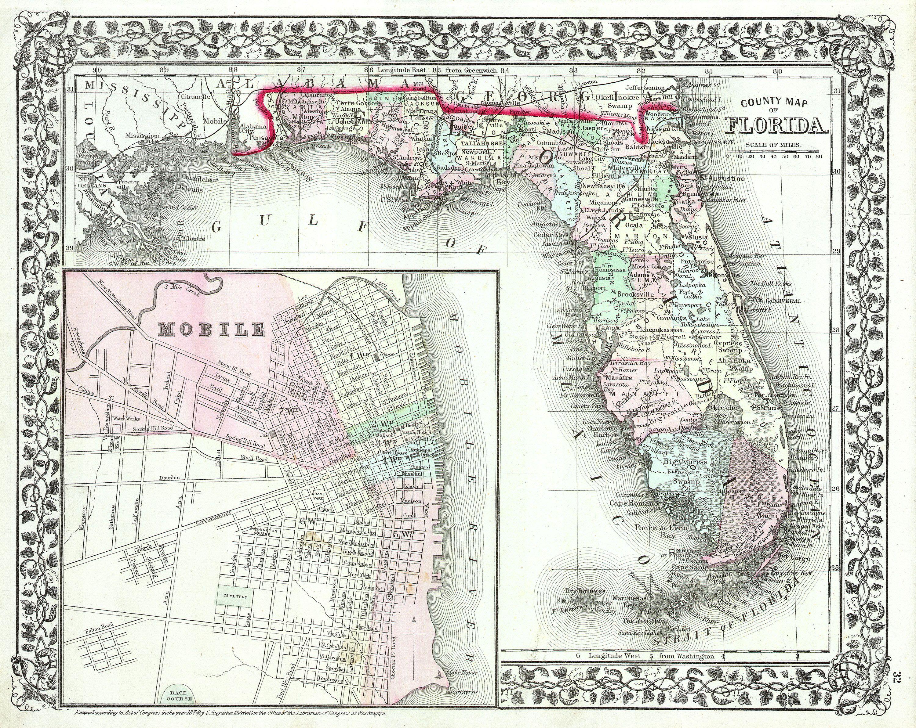
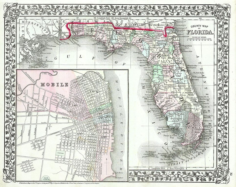
| Samuel Augustus Mitchell: County Map of Florida.
( |
||||||||||||||||||||
|---|---|---|---|---|---|---|---|---|---|---|---|---|---|---|---|---|---|---|---|---|
| Artist |
|
|||||||||||||||||||
| Title |
County Map of Florida. |
|||||||||||||||||||
| Description |
English: This hand colored antique map of Florida is a lithographic engraving dating to 1874 by the important American map publisher Samuel Augustus Mitchell, the younger. Map features a large inset of Mobile Alabama, indicating streets and important buildings. Florida itself is shown in considerable detail with interesting references such as “Indian Hunting Grounds” and “Mangrove Woods”. Prepared for inclusion in the 1874 issue of Mitchell's New General Atlas . Dated and copyrighted, Entered according to Act of Congress in the year of 1874 by S. Augustus Mitchell in the office of the Librarian of Congress at Washington. |
|||||||||||||||||||
| Date | 1874 | |||||||||||||||||||
| Dimensions | height: 12 in (30.4 cm); width: 14 in (35.5 cm) | |||||||||||||||||||
| Accession number |
Geographicus link: FL-m-1874 |
|||||||||||||||||||
| Source/Photographer |
|
|||||||||||||||||||
| Permission (Reusing this file) |
|
|||||||||||||||||||
File history
Click on a date/time to view the file as it appeared at that time.
| Date/Time | Thumbnail | Dimensions | User | Comment | |
|---|---|---|---|---|---|
| current | 07:16, 16 March 2011 | | 3,000 × 2,386 (2.34 MB) | BotMultichill (talk | contribs) | {{subst:User:Multichill/Geographicus |link=http://www.geographicus.com/P/AntiqueMap/FL-m-1874 |product_name=1874 Mitchell Map of Florida w- Mobile, Alabama inset |map_title=County Map of Florida. |description=This hand colored antique map of Florida is a |
You cannot overwrite this file.
File usage on Commons
The following page uses this file: