File:1890 Hachette Map of Antarctica - Geographicus - Antarctica-hachette-1890.jpg
Jump to navigation
Jump to search
Size of this preview: 774 × 600 pixels. Other resolutions: 310 × 240 pixels | 620 × 480 pixels | 992 × 768 pixels | 1,280 × 991 pixels | 2,560 × 1,983 pixels | 3,500 × 2,711 pixels.
Original file (3,500 × 2,711 pixels, file size: 2.61 MB, MIME type: image/jpeg)
Captions
Captions
Add a one-line explanation of what this file represents
Summary[edit]
| Region Antarctique. | |||
|---|---|---|---|
| Artist | |||
| Title |
Region Antarctique. |
||
| Description |
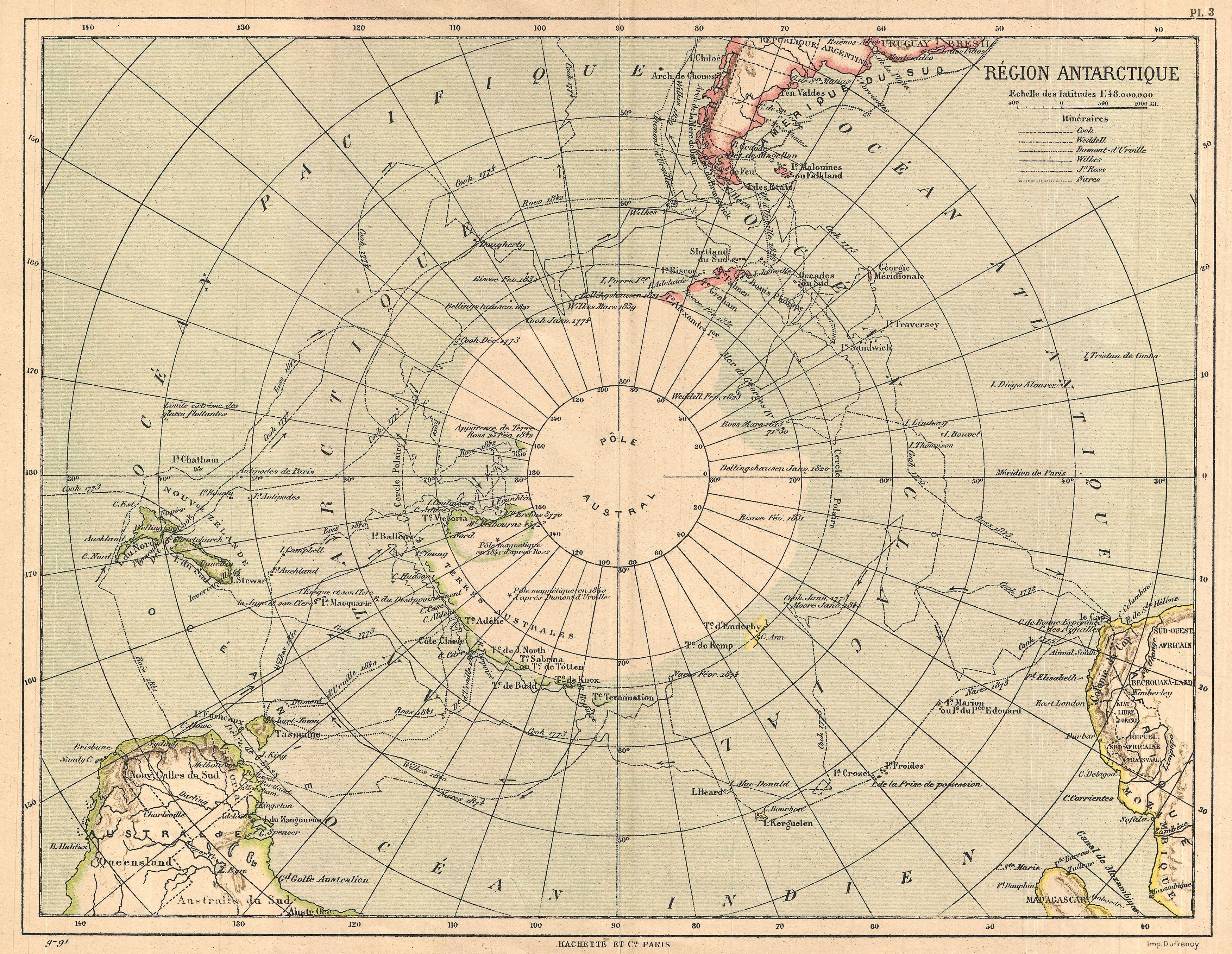
English: An uncommon color map of the Antarctic region. Published by the Hachette firm, circa 1890. Reflects a relatively primitive state of exploration in the region though a number of exploratory routes mapped out. A key in the upper left quadrant lists the explorers who explored the Antarctic: Cook, Weddell, Dumont-d’Urville, Wilkes, Ross, and Nares. Countries and territories labeled, along with rivers and other minimal topographical detail. Published from Hachette & Company’s 79 Boulevard Saint Germain office in Paris, France. |
||
| Date | 1890 (undated) | ||
| Dimensions | height: 10.5 in (26.6 cm); width: 14 in (35.5 cm) | ||
| Accession number |
Geographicus link: Antarctica-hachette-1890 |
||
| Source/Photographer |
|
||
Licensing[edit]
|
This is a faithful photographic reproduction of a two-dimensional, public domain work of art. The work of art itself is in the public domain for the following reason:
The official position taken by the Wikimedia Foundation is that "faithful reproductions of two-dimensional public domain works of art are public domain".
This photographic reproduction is therefore also considered to be in the public domain in the United States. In other jurisdictions, re-use of this content may be restricted; see Reuse of PD-Art photographs for details. | ||||
File history
Click on a date/time to view the file as it appeared at that time.
| Date/Time | Thumbnail | Dimensions | User | Comment | |
|---|---|---|---|---|---|
| current | 19:03, 24 March 2011 | | 3,500 × 2,711 (2.61 MB) | BotMultichillT (talk | contribs) | {{subst:User:Multichill/Geographicus |link=http://www.geographicus.com/P/AntiqueMap/Antarctica-hachette-1890 |product_name=1890 Hachette Map of Antarctica |map_title=Region Antarctique. |description=An uncommon color map of the Antarctic region. Published |
You cannot overwrite this file.
File usage on Commons
The following page uses this file: