File:1900 Bacon Pocket Map of London, England - Geographicus - London-bacon-1900.jpg
Jump to navigation
Jump to search
Size of this preview: 673 × 600 pixels. Other resolutions: 269 × 240 pixels | 539 × 480 pixels | 862 × 768 pixels | 1,150 × 1,024 pixels | 2,299 × 2,048 pixels | 5,000 × 4,454 pixels.
Original file (5,000 × 4,454 pixels, file size: 8.05 MB, MIME type: image/jpeg)
Captions
Captions
Add a one-line explanation of what this file represents
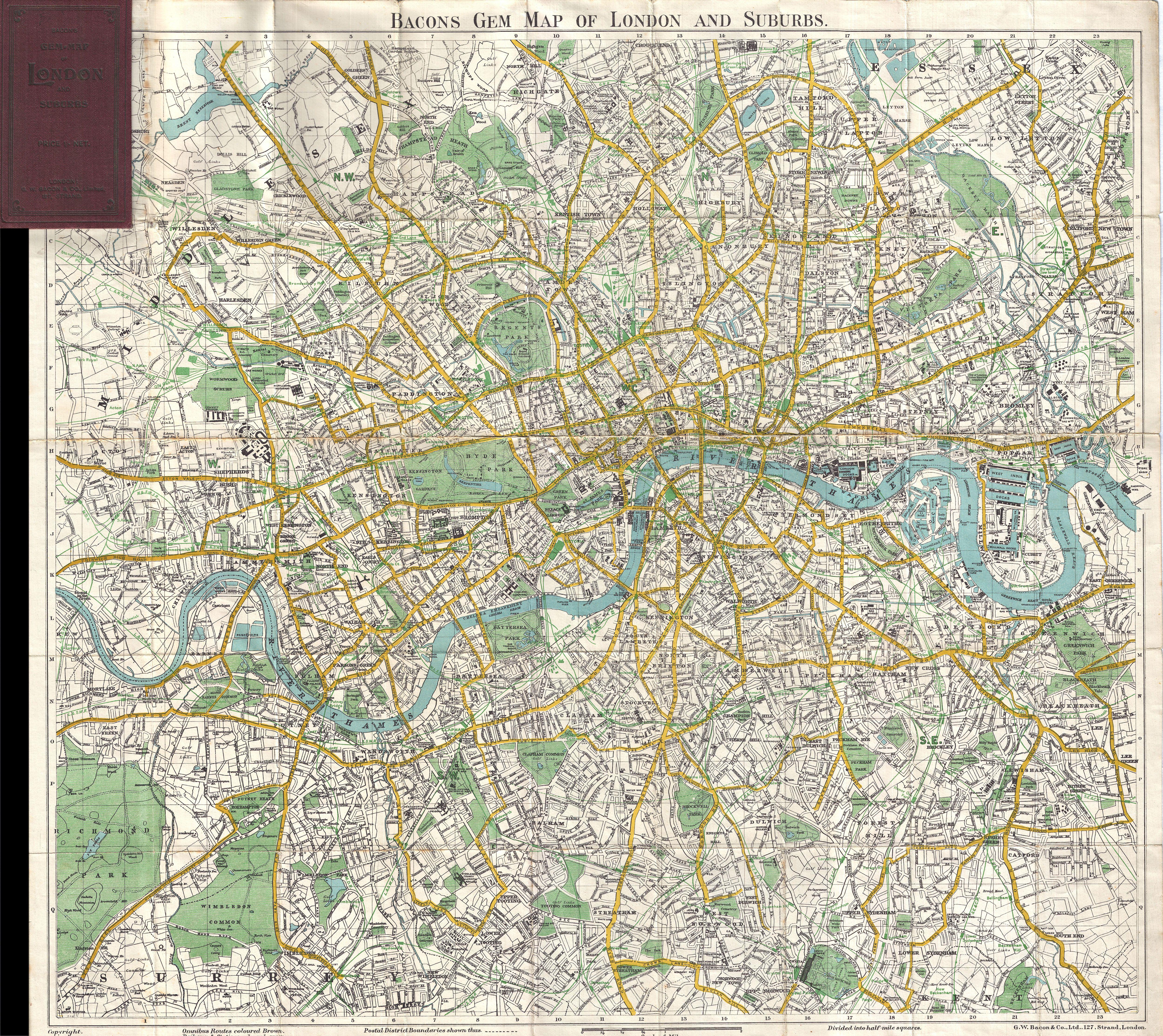
| George Washington Bacon: Bacons Gem Map of London and Suburbs
( |
|||||||||||||||||
|---|---|---|---|---|---|---|---|---|---|---|---|---|---|---|---|---|---|
| Artist |
|
||||||||||||||||
| Title |
Bacons Gem Map of London and Suburbs |
||||||||||||||||
| Description |
English: This Bacon's uncommon c. 1900 map of London, England. Covers London from Mortlake and Richmond Park to the East India Docks and Greenwich Park. Names all streets, parks, railways, and numerous important buildings. Folds into its original maroon binder. |
||||||||||||||||
| Date | 1900 (undated) | ||||||||||||||||
| Dimensions | height: 22 in (55.8 cm); width: 24 in (60.9 cm) | ||||||||||||||||
| Accession number |
Geographicus link: London-bacon-1900 |
||||||||||||||||
| Source/Photographer |
|
||||||||||||||||
| Permission (Reusing this file) |
|
||||||||||||||||
File history
Click on a date/time to view the file as it appeared at that time.
| Date/Time | Thumbnail | Dimensions | User | Comment | |
|---|---|---|---|---|---|
| current | 04:41, 23 March 2011 | | 5,000 × 4,454 (8.05 MB) | BotMultichillT (talk | contribs) | {{subst:User:Multichill/Geographicus |link=http://www.geographicus.com/P/AntiqueMap/London-bacon-1900 |product_name=1900 Bacon Pocket Map of London, England |map_title=Bacons Gem Map of London and Suburbs |description=This Bacon's uncommon c. 1900 map of |
You cannot overwrite this file.
File usage on Commons
The following page uses this file: