File:21 near Petrolia.png
Jump to navigation
Jump to search

Size of this preview: 724 × 600 pixels. Other resolutions: 290 × 240 pixels | 580 × 480 pixels | 915 × 758 pixels.
Original file (915 × 758 pixels, file size: 1.99 MB, MIME type: image/png)
Captions
Captions
Add a one-line explanation of what this file represents
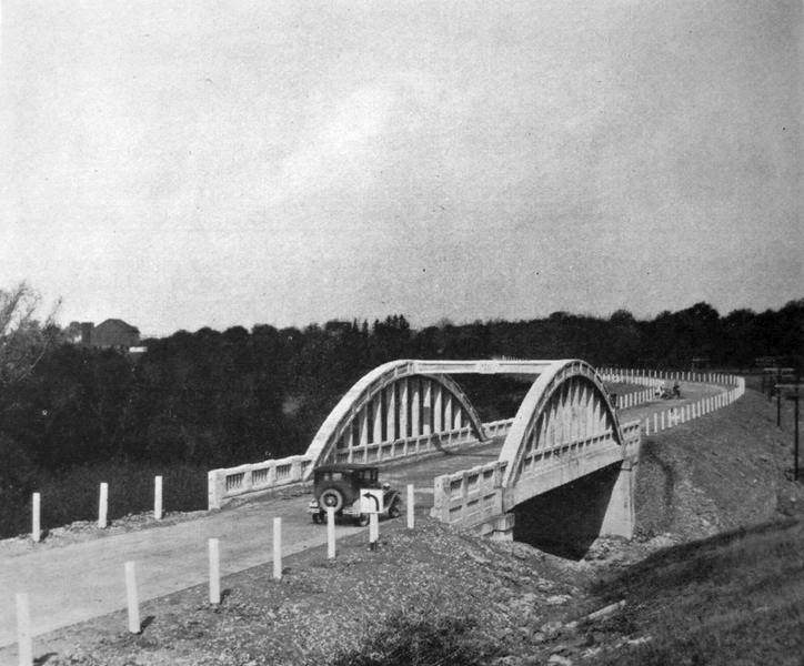
| Description | Highway 21 crossing a new bridge near Petrolia, Ontario, shortly after the highway was assumed by the Department of Highways | |||
| Date | circa 1930 | |||
| Source | 1928 / 1929 Annual Report, Department of Highways | |||
| Author | Department of Highways, Ontario | |||
| Permission (Reusing this file) |
|

File history
Click on a date/time to view the file as it appeared at that time.
| Date/Time | Thumbnail | Dimensions | User | Comment | |
|---|---|---|---|---|---|
| current | 01:30, 15 August 2011 | | 915 × 758 (1.99 MB) | Floydian (talk | contribs) | contrast / brightness improvements |
| 01:28, 15 August 2011 |  | 915 × 758 (1.99 MB) | Floydian (talk | contribs) | {{Information |Description=Highway 21 crossing a new bridge near Petrolia, Ontario, shortly after the highway was assumed by the Department of Highways |Source=1928 / 1929 Annual Report, Department of Highways |Date=c. 1930 |Author=Department of Highways |
You cannot overwrite this file.
File usage on Commons
The following page uses this file:
File usage on other wikis
The following other wikis use this file:
- Usage on en.wikipedia.org
- Usage on www.wikidata.org