File:7 subway extension and hudson yards.svg
Jump to navigation
Jump to search

Size of this PNG preview of this SVG file: 700 × 400 pixels. Other resolutions: 320 × 183 pixels | 640 × 366 pixels | 1,024 × 585 pixels | 1,280 × 731 pixels | 2,560 × 1,463 pixels.
Original file (SVG file, nominally 700 × 400 pixels, file size: 100 KB)
Captions
Captions
Add a one-line explanation of what this file represents
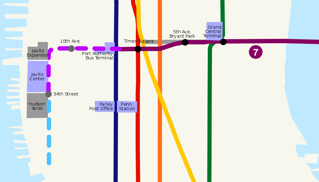
| Description | Route map of New York City Subway 7 Subway Extension, including planned station stops and hudson yards development. | ||
| Date | |||
| Source | self-made, based on Image:NYCS map 7.svg, Image:NYCS-bull-trans-7.svg and USGS topographical map | ||
| Author | ChrisRuvolo | ||
| Permission (Reusing this file) |
|
File history
Click on a date/time to view the file as it appeared at that time.
| Date/Time | Thumbnail | Dimensions | User | Comment | |
|---|---|---|---|---|---|
| current | 18:32, 14 July 2008 | | 700 × 400 (100 KB) | ChrisRuvolo (talk | contribs) | add 7 line bullet |
| 02:59, 7 July 2008 |  | 700 × 400 (100 KB) | ChrisRuvolo (talk | contribs) | change coloration to match line map | |
| 19:43, 21 January 2008 |  | 700 × 400 (99 KB) | ChrisRuvolo (talk | contribs) | fix stations | |
| 19:37, 21 January 2008 |  | 700 × 400 (99 KB) | ChrisRuvolo (talk | contribs) | {{Information |Description=Route map of New York City Subway en:7 Subway Extension, including planned station stops and hudson yards development. |Source=self-made, based on Image:NYCS map 7.svg and USGS topographical map |Date=2007-01-21 |Auth |
You cannot overwrite this file.
File usage on Commons
The following 3 pages use this file:
File usage on other wikis
The following other wikis use this file:
- Usage on de.wikipedia.org
- Usage on en.wikipedia.org
- Usage on es.wikipedia.org
- Usage on it.wikipedia.org
- Usage on ja.wikipedia.org
- Usage on www.wikidata.org
- Usage on zh.wikipedia.org