File:AMH-5634-KB Map of Arabia.jpg
Jump to navigation
Jump to search
Size of this preview: 744 × 600 pixels. Other resolutions: 298 × 240 pixels | 595 × 480 pixels | 953 × 768 pixels | 1,270 × 1,024 pixels | 2,400 × 1,935 pixels.
Original file (2,400 × 1,935 pixels, file size: 648 KB, MIME type: image/jpeg)
Captions
Captions
Add a one-line explanation of what this file represents
Summary[edit]
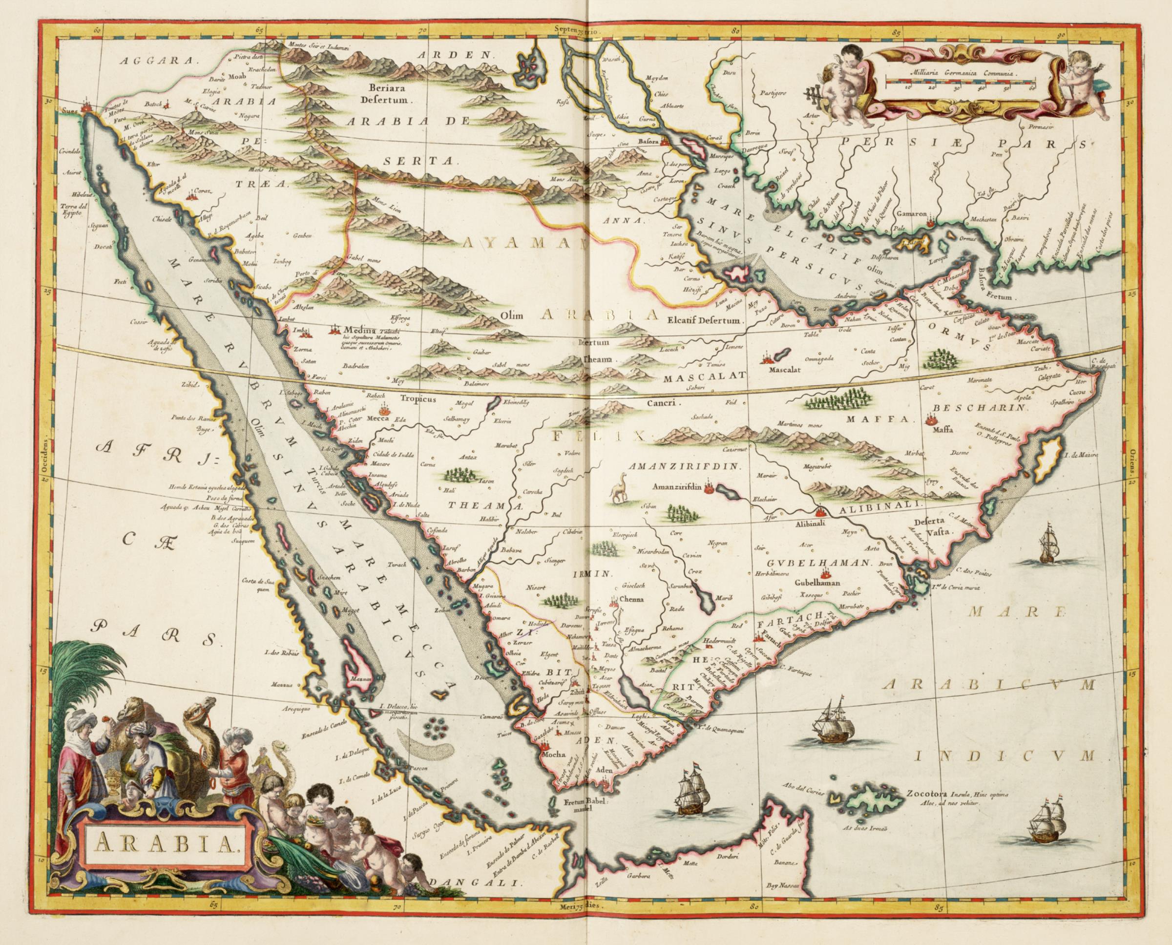
Nederlands: Kaart van Arabië
English: Map of Arabia( |
|||||||||||||||||||||||||||
|---|---|---|---|---|---|---|---|---|---|---|---|---|---|---|---|---|---|---|---|---|---|---|---|---|---|---|---|
| Author |
Nederlands: Joan Blaeu sr. (uitgever)
English: Joan Blaeu sr. (publisher) |
||||||||||||||||||||||||||
| Title |
Nederlands: Kaart van Arabië
English: Map of Arabia |
||||||||||||||||||||||||||
| Description |
Nederlands: Kaart van Arabië uit de Atlas van der Hagen, Koninklijke Bibliotheek, Den Haag Deel 4.
Deze kaart van Arabië werd in 1662 gepubliceerd in de Atlas Maior van Joan Blaeu (1598-1673). Hoewel de kaart speciaal voor deze uitgave werd gegraveerd, komt de inhoud overeen met de eerdere kaart van het schiereiland die Willem Jansz. Blaeu (1571-1638) al in 1608 had uitgegeven.
English: Map of Arabia from the Atlas van der Hagen, Koninklijke Bibliotheek, The Hague, Part 4.
This map of Arabia was published in 1662 in the Atlas Maior of Joan Blaeu (1598-1673). Although the map was engraved specially for this edition, the content is the same as that of an earlier map of the peninsula published by Willem Jansz. Blaeu (1571-1638) in 1608. |
||||||||||||||||||||||||||
| Date | 1662 | ||||||||||||||||||||||||||
| Medium |
Nederlands: koperdruk op papier
English: copperplate printing on paper |
||||||||||||||||||||||||||
| Dimensions | height: 52 cm (20.4 in); width: 42 cm (16.5 in) | ||||||||||||||||||||||||||
| Collection |
|
||||||||||||||||||||||||||
| Accession number |
1049B13_012 |
||||||||||||||||||||||||||
| Inscriptions |
ARABIA
|
||||||||||||||||||||||||||
| Notes |
English: Subjects: Person, chart / map / plan, banderole / cartouche / ornamentation
Nederlands: Onderwerpen: Persoon, plattegrond / kaart, banderol / cartouche / versiering |
||||||||||||||||||||||||||
| Source/Photographer |
|
||||||||||||||||||||||||||
| Permission (Reusing this file) |
|
||||||||||||||||||||||||||
.jpg)

File history
Click on a date/time to view the file as it appeared at that time.
| Date/Time | Thumbnail | Dimensions | User | Comment | |
|---|---|---|---|---|---|
| current | 10:58, 10 June 2014 | | 2,400 × 1,935 (648 KB) | HuskyBot (talk | contribs) | == {{int:filedesc}} == {{Artwork |title = {{nl|1=Kaart van Arabië}} {{en|1=Map of Arabia}} |description = {{nl|1=Kaart van Arabië uit de Atlas van der Hagen, Koninklijke Bibliotheek, Den Haag Deel 4. Deze ka... |
You cannot overwrite this file.
File usage on Commons
The following page uses this file:
File usage on other wikis
The following other wikis use this file:
- Usage on nl.wikipedia.org