File:A chart shewing the relative situation of Milford Haven with all the principal ports of the European seas with their distances from that port. RMG K1093.jpg

Original file (1,280 × 1,043 pixels, file size: 1.05 MB, MIME type: image/jpeg)
Captions
Captions
Summary[edit]
| Author |
|
||||||||||||||||||||
| Description |
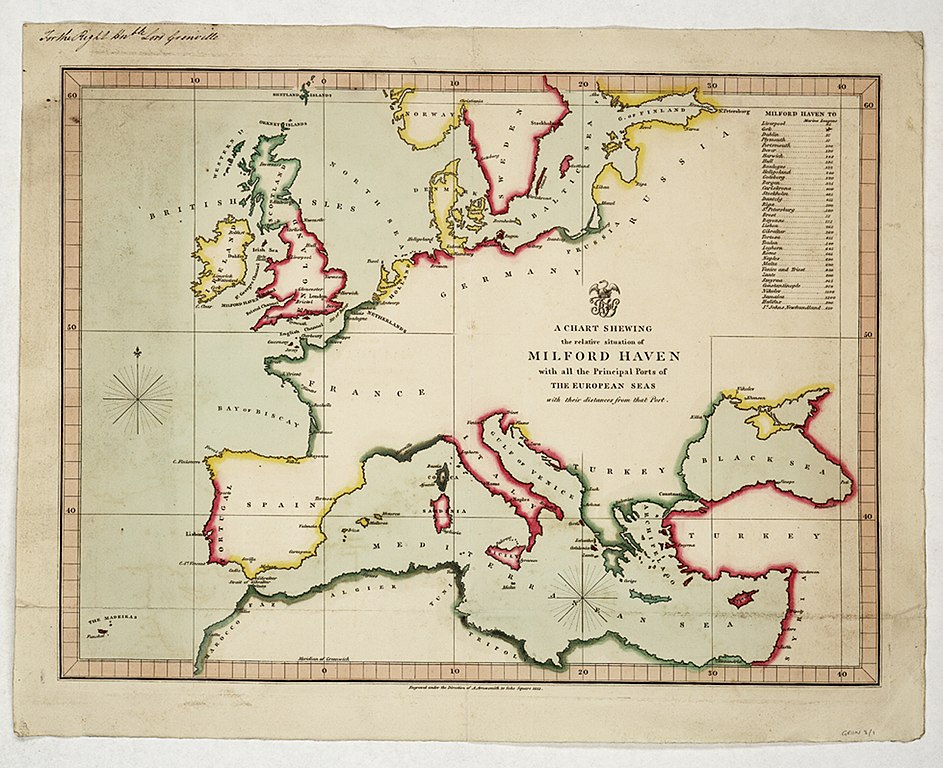
English: A chart shewing the relative situation of Milford Haven with all the principal ports of the European seas with their distances from that port.Single sheet. Hand col. engr. Physical description Note: Outline colour. Scale: [ca. 1:12 000 000]. Cartographic Note: Graduated. Meridian through Greenwich. Additional Places: Europe. Contents Note: Contains a list of distances in marine leagues from Milford Haven to 35 other ports. Gren3/1 A chart shewing the relative situation of Milford Haven with all the principal ports of the European seas with their distances from that port. |
||||||||||||||||||||
| Date | 1813 | ||||||||||||||||||||
| Dimensions | height: 34 cm (13.3 in); width: 43 cm (16.9 in) | ||||||||||||||||||||
| Notes | For an analysis of the bias towards geographical coverage when looking at the contents of the collection see tables from the printed (complete) biography of Grenville. This is kept with the red binders as part of the Grenville collection binder (in SOG). | ||||||||||||||||||||
| Source/Photographer | http://collections.rmg.co.uk/collections/objects/541978 | ||||||||||||||||||||
| Permission (Reusing this file) |
The original artefact or artwork has been assessed as public domain by age, and faithful reproductions of the two dimensional work are also public domain. No permission is required for reuse for any purpose. The text of this image record has been derived from the Royal Museums Greenwich catalogue and image metadata. Individual data and facts such as date, author and title are not copyrightable, but reuse of longer descriptive text from the catalogue may not be considered fair use. Reuse of the text must be attributed to the "National Maritime Museum, Greenwich, London" and a Creative Commons CC-BY-NC-SA-3.0 license may apply if not rewritten. Refer to Royal Museums Greenwich copyright. |
||||||||||||||||||||
| Identifier | id number: GREN3/1 | ||||||||||||||||||||
| Collection | Charts and maps | ||||||||||||||||||||

Licensing[edit]
|
This is a faithful photographic reproduction of a two-dimensional, public domain work of art. The work of art itself is in the public domain for the following reason:
The official position taken by the Wikimedia Foundation is that "faithful reproductions of two-dimensional public domain works of art are public domain".
This photographic reproduction is therefore also considered to be in the public domain in the United States. In other jurisdictions, re-use of this content may be restricted; see Reuse of PD-Art photographs for details. | ||||
File history
Click on a date/time to view the file as it appeared at that time.
| Date/Time | Thumbnail | Dimensions | User | Comment | |
|---|---|---|---|---|---|
| current | 10:35, 1 September 2017 | | 1,280 × 1,043 (1.05 MB) | Fæ (talk | contribs) | Royal Museums Greenwich Charts and maps, http://collections.rmg.co.uk/collections/objects/541978 |
You cannot overwrite this file.
File usage on Commons
The following page uses this file: