File:Abu Volcano Group.jpg
Jump to navigation
Jump to search
Size of this preview: 799 × 600 pixels. Other resolutions: 320 × 240 pixels | 640 × 480 pixels | 1,023 × 768 pixels | 1,280 × 961 pixels | 1,387 × 1,041 pixels.
Original file (1,387 × 1,041 pixels, file size: 917 KB, MIME type: image/jpeg)
Captions
Captions
Add a one-line explanation of what this file represents
Summary[edit]
| Description |
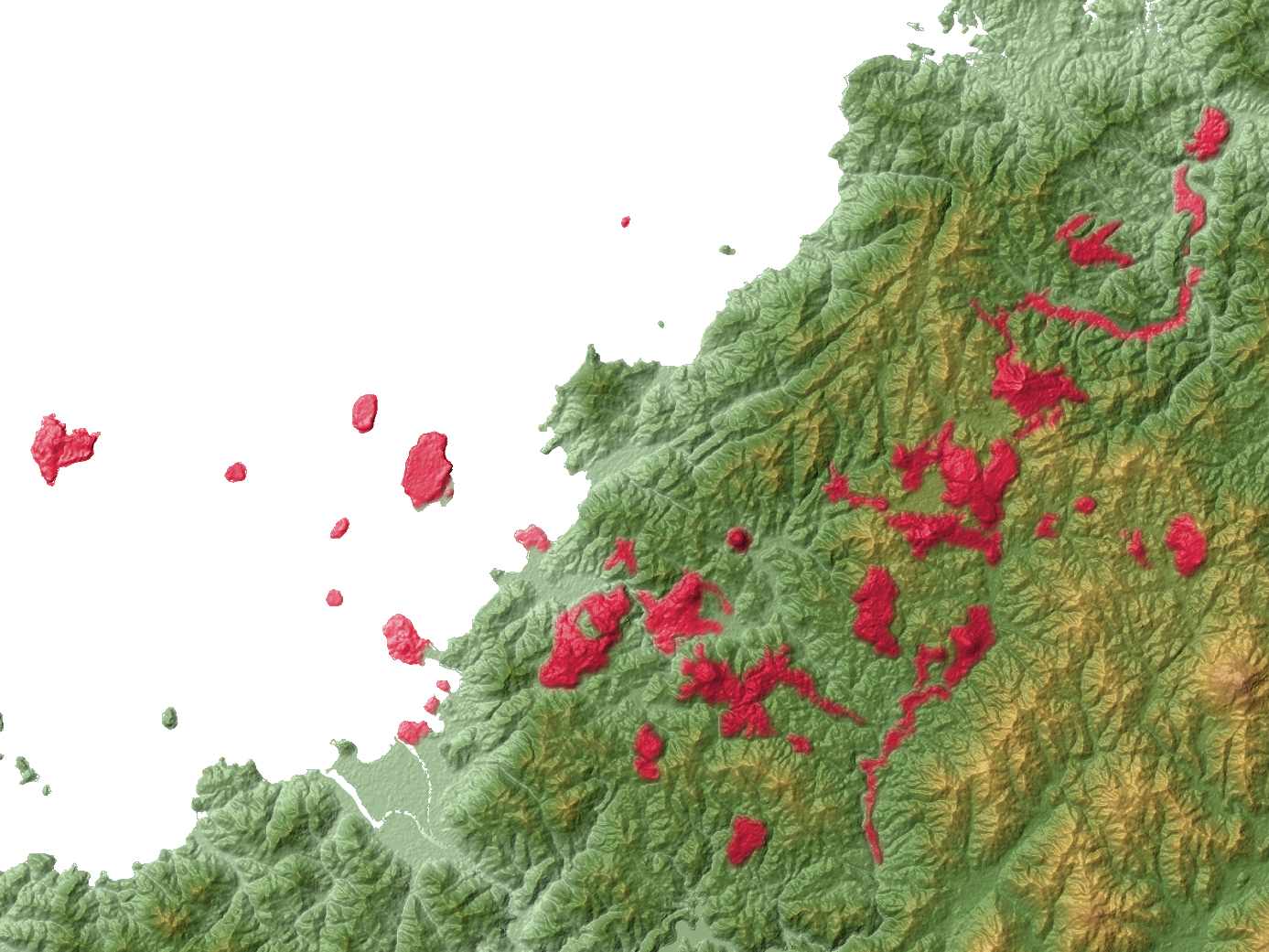
日本語: 山口県萩市にある阿武火山群の溶岩の分布図。
Source: 阿武単成火山群のK-Ar年代とマグマ活動史 - 角縁進 永尾隆志 長尾敬介 (2000) Source: K-Ar ages and magmatic history of Abu Monogenetic Volcano Group, southwest Japan - Susumu KAKUBUCHI, Takashi NAGAO, Keisuke NAGAO (2000) |
| Date | |
| Source |
Topographic data: NASA's SRTM-1 30m Mesh (ver.3 2014) |
| Author | Batholith |
| Other versions |
 |
| Object location | | View this and other nearby images on: OpenStreetMap |
|---|
Licensing[edit]
| I, the copyright holder of this work, release this work into the public domain. This applies worldwide. In some countries this may not be legally possible; if so: I grant anyone the right to use this work for any purpose, without any conditions, unless such conditions are required by law. |
This image uses high-resolution digital topography data from NASA's Shuttle Radar Topography Mission (SRTM) at JPL-Caltech [1]. It is in the public domain in the United States.
|
 | |
File history
Click on a date/time to view the file as it appeared at that time.
| Date/Time | Thumbnail | Dimensions | User | Comment | |
|---|---|---|---|---|---|
| current | 10:24, 14 April 2016 | | 1,387 × 1,041 (917 KB) | Batholith (talk | contribs) | {{Information |Description= {{en|Distribution map of '''Abu Volcano Group''', Yamaguchi prefecture, Japan.Data from "SRTM-1 (30m Mesh) Ver.3 2014... |
You cannot overwrite this file.
File usage on Commons
The following 3 pages use this file:
File usage on other wikis
The following other wikis use this file:
- Usage on ar.wikipedia.org
- Usage on ca.wikipedia.org
- Usage on de.wikipedia.org
- Usage on en.wikipedia.org
- Usage on eu.wikipedia.org
- Usage on hy.wikipedia.org
- Usage on ja.wikipedia.org
- Usage on pt.wikipedia.org
- Usage on ru.wikipedia.org
- Usage on sk.wikipedia.org
- Usage on uk.wikipedia.org
- Usage on uz.wikipedia.org
- Usage on www.wikidata.org
- Usage on zh.wikipedia.org