File:Admiralty Chart No 3110 Cromarty Firth, Published 1900.jpg
Jump to navigation
Jump to search

Size of this preview: 800 × 543 pixels. Other resolutions: 320 × 217 pixels | 640 × 434 pixels | 1,024 × 695 pixels | 1,280 × 869 pixels | 2,560 × 1,738 pixels | 9,942 × 6,749 pixels.
Original file (9,942 × 6,749 pixels, file size: 34.67 MB, MIME type: image/jpeg)
Captions
Captions
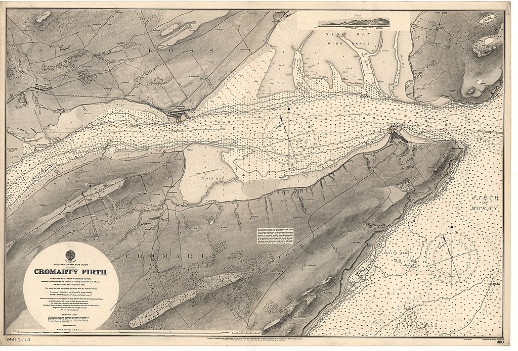
Nautical chart of the Cromarty Firth
Summary[edit]
| Description |
English: Nautical chart of the Cromarty Firth. Surveyed by Captain W. Usborne Morre assisted bt Lieutenants J.C. Tancred, E.C. Hardy, C.P. Buckie and J.R. Lay, H.M. Surveying Ship Research 1898. Not current - not to be used for navigation! |
||||||||||
| Date | |||||||||||
| Source | https://maps.nls.uk/view/74412460 | ||||||||||
| Creator |
|
||||||||||
| Georeferencing | |||||||||||
Licensing[edit]
Original chart:
This work created by the United Kingdom Government is in the public domain.
This is because it is one of the following:
HMSO has declared that the expiry of Crown Copyrights applies worldwide (ref: HMSO Email Reply)
|
 |
Any derivative rights in the digital version have been released by the National Library of Scotland under the following license:
This file is licensed under the Creative Commons Attribution 4.0 International license.
- You are free:
- to share – to copy, distribute and transmit the work
- to remix – to adapt the work
- Under the following conditions:
- attribution – You must give appropriate credit, provide a link to the license, and indicate if changes were made. You may do so in any reasonable manner, but not in any way that suggests the licensor endorses you or your use.
File history
Click on a date/time to view the file as it appeared at that time.
| Date/Time | Thumbnail | Dimensions | User | Comment | |
|---|---|---|---|---|---|
| current | 10:33, 25 September 2021 | | 9,942 × 6,749 (34.67 MB) | Kognos (talk | contribs) | Uploaded a work by W.J.L. Wharton from https://maps.nls.uk/view/74412460 with UploadWizard |
You cannot overwrite this file.
File usage on Commons
There are no pages that use this file.