File:Admiralty Chart No 833 Rangooon River and appproaches, Published 1923.jpg
Jump to navigation
Jump to search

Size of this preview: 414 × 599 pixels. Other resolutions: 166 × 240 pixels | 331 × 480 pixels | 530 × 768 pixels | 707 × 1,024 pixels | 1,414 × 2,048 pixels | 11,298 × 16,360 pixels.
Original file (11,298 × 16,360 pixels, file size: 66.53 MB, MIME type: image/jpeg)
Captions
Captions
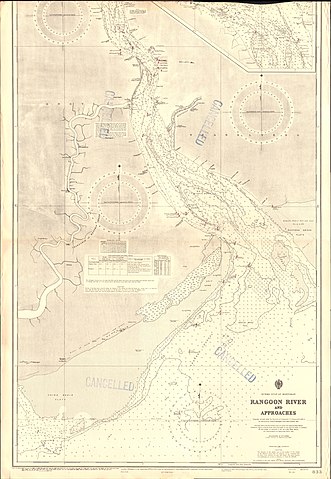
Nautical chart of the Rangooon River and appproaches
Summary[edit]
| Warning | The original file is very high-resolution. It might not load properly or could cause your browser to freeze when opened at full size. |
|---|
| Description |
English: Nautical chart of the Rangooon River and appproaches, at a scale of 1:53,470. Originally surveyed under the direction of Commander L,S. Dawson, 1883-4. Re-surveyed by Commdr. A.M. Hughes, H.M.S. Chinthe 1945. Not current - not to be used for navigation! Note thta the top section of this chart is missing. |
||||||||||
| Date | |||||||||||
| Source | Scan of original Admiralty Chart | ||||||||||
| Creator |
|
||||||||||
| Geotemporal data | |||||||||||
| Scale | 1:53,470 | ||||||||||
| Bounding box |
|
||||||||||
| Georeferencing | |||||||||||
Licensing[edit]
This work created by the United Kingdom Government is in the public domain.
This is because it is one of the following:
HMSO has declared that the expiry of Crown Copyrights applies worldwide (ref: HMSO Email Reply)
|
 |
File history
Click on a date/time to view the file as it appeared at that time.
| Date/Time | Thumbnail | Dimensions | User | Comment | |
|---|---|---|---|---|---|
| current | 14:42, 28 October 2020 | | 11,298 × 16,360 (66.53 MB) | Kognos (talk | contribs) | Uploaded a work by Fredk. C. Learmonth from Scan of original Admiralty Chart with UploadWizard |
You cannot overwrite this file.
File usage on Commons
The following 2 pages use this file: