File:Admiralty Chart No 938 East Cape to Cape Nelson with the d'Entrecasteux Islands, Published 1886.jpg
Jump to navigation
Jump to search

Size of this preview: 690 × 599 pixels. Other resolutions: 276 × 240 pixels | 553 × 480 pixels | 884 × 768 pixels | 1,179 × 1,024 pixels | 2,357 × 2,048 pixels | 9,308 × 8,087 pixels.
Original file (9,308 × 8,087 pixels, file size: 12.92 MB, MIME type: image/jpeg)
Captions
Captions
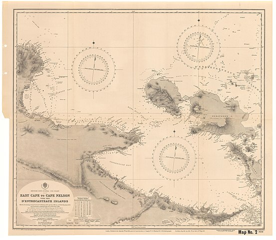
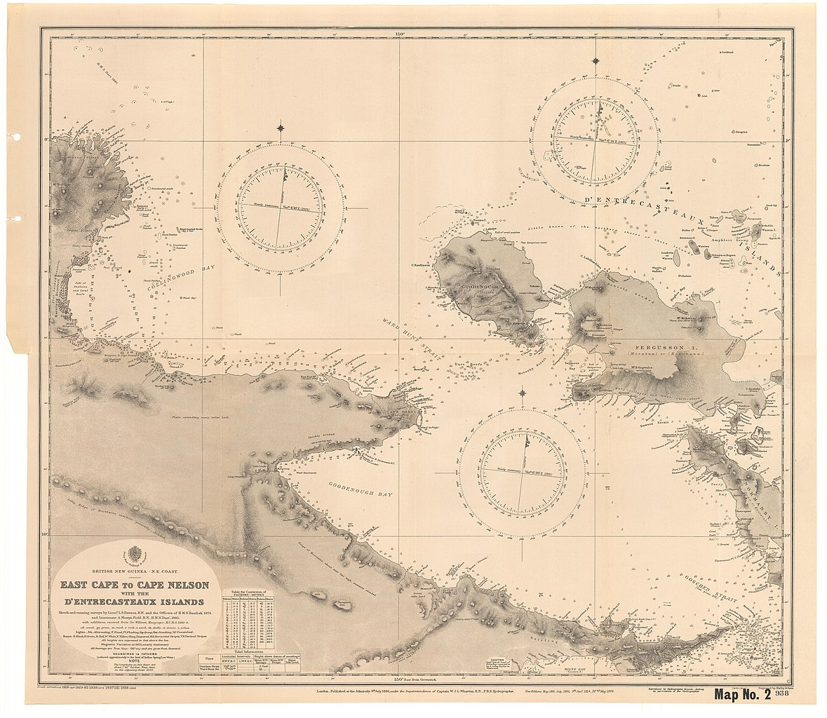
Nautical chart of East Cape to Cape Nelson with the d'Entrecasteux Islands
Summary[edit]
| Description |
English: Nautical chart of East Cape to Cape Nelson with the d'Entrecasteux Islands. Not current - not to be used for navigation! |
||||||||||
| Date | |||||||||||
| Source | https://repository.monash.edu/files/original/370c57dfff6170eeeeba7e09b351658a.jpg | ||||||||||
| Author |
|
||||||||||
Licensing[edit]
This work created by the United Kingdom Government is in the public domain.
This is because it is one of the following:
HMSO has declared that the expiry of Crown Copyrights applies worldwide (ref: HMSO Email Reply)
|
 |
File history
Click on a date/time to view the file as it appeared at that time.
| Date/Time | Thumbnail | Dimensions | User | Comment | |
|---|---|---|---|---|---|
| current | 10:03, 25 August 2020 | | 9,308 × 8,087 (12.92 MB) | Kognos (talk | contribs) | Uploaded a work by W.J.L. Wharton from https://repository.monash.edu/files/original/370c57dfff6170eeeeba7e09b351658a.jpg with UploadWizard |
You cannot overwrite this file.
File usage on Commons
There are no pages that use this file.
Metadata
Categories:
- Admiralty Charts 801-1000
- Admiralty Charts Region O: Western Pacific islands and New Guinea
- Cape Vogel
- Cape Nelson, Papua New Guinea
- D'Entrecasteaux Islands
- Old maps of Papua New Guinea
- Normanby Island
- Dawson Straits
- Dawson Strait Volcanic Group
- Fergusson Island
- Topographic maps of Papua New Guinea
- Maps of volcanoes in Papua New Guinea